Showing posts sorted by date for query Willow River State Park. Sort by relevance Show all posts

Wednesday, October 6, 2021

Fall color trails abound around Milwaukee

Franklin Wirth Park, Brookfield, Wis.
There’s no better way to experience autumn colors around the Milwaukee metro area than a hike.

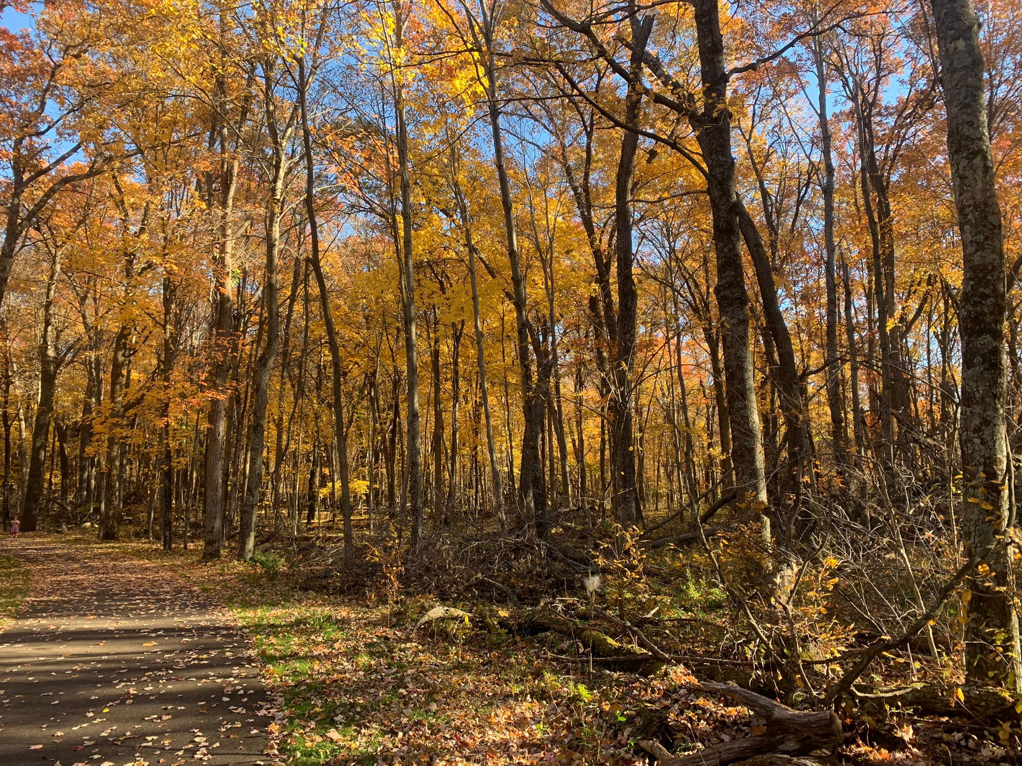
The brilliant yellows, oranges and red of maples to the scarlet and russets of oaks...the crisp, fresh autumn air and the last warm rays of sunlight before winter arrives...the crunch of fallen leaves and acorns beneath your boots...stopping to enjoy a warm mug of apple cider or a caramel apple pulled from your backpack – it all calls for an afternoon on the trail.

Fortunately, there are plenty of great autumn trails around Milwaukee to hike. Some are right out your back door, while some are a day trip that you can do in an afternoon.

Franklin Wirth Park (Brookfield)
Orange-, tan- and russet-leaved oaks await day hikers during an autumn walk
at Franklin Wirth Park in Brookfield. The 135-plus acre parks offers a number of walking paths, including a trailhead to the Greenway Trail System. For a total immersion in the forest, try the 0.4-mile Backwoods Adventure Trail, which loops
in the park’s northwest corner as crossing Underwood Creek. From the junction of Interstate 94 and South Moorland Road, take the latter north. After U.S. Hwy. 18/Bluemound Road, it becomes Pilgrim Parkway. Use the second entry to the park on the left/west.

Homestead Hollow County Park (Germantown)
Leaves of yellow, crimson and tan await hikers during autumn at Homestead Hollow County Park in Germantown. The 105-acre farmstead, converted to a park during the early 1980s, gives off a rural-like vibe as the red barns were converted to shelters while the fields were replanted to prairie. The Blue Trail, with access to it via the Green Trail, runs a mile round trip, and stays in the old farm’s woods most of the way. From the junction of Interstate 41 and Freistadt Road/County Road F, take the latter east. The park’s entry is on the right/south.

Greenfield Park (West Allis)
Day hikers can enjoy autumn colors at Greenfield Park in West Allis. Orange, yellow and russet leaves line a segment of the Oak Leaf Trail, which runs 0.8 miles through a woods between two parking lots. You can extend the hike by continuing on the Root River Parkway to the south or around a willow-shaded pond to the north. From the junction of Interstate 94 and Wis. Hwy. 100, take the latter south. Turn right/west on West Rogers Street. The road enters the park and ends at a parking lot, from which where the trail heads south.

Engel Conservation Area (Muskego)
Woodlands, prairie and wetlands come alive with color each autumn at the Engel Conservation Area in Muskego. A 155-acre site, 29 acres of it are upland woods with the rest as prairie and wetlands. During autumn, the oak leaves turn tan and russet while the prairie grasses glow fiery red and the wetlands grasses shimmer gold in the sunlight. The 0.9 miles of trails directly east of the entry road and parking lot mostly remain in the woodlands. Other trails head through each of the ecosystems. From the junction of Interstate 43 and County Road Y/Racine Avenue, take the latter south. Go right/west onto Henneberry Drive then right/north into the center.

Wehr Nature Center (Franklin)
A walk through a rainbow of harvest hues awaits at the Wehr Nature Center in Franklin. The looping 1-mile Woodland Trail passes sugar maple, aspen and oak lit up in amber, orange, russet and red during fall. From the junction of Interstate 43 and Wis. Hwy. 100/South 108th Street, take the latter south. Turn right/east onto West College Avenue then once in Whitnall Park go right/south onto Nature Center Drive.

Seven Bridges in Grant Park (South Milwaukee South Shore)
Day hikers can traverse a wooded ravine with great views of Lake Michigan at Seven Bridges in Grant Park on Milwaukee's South Shore. The 0.4-mile round trip Seven Bridges Trail, with its stone steps and footbridges, makes for a great autumn hike. Along the way are yellow-leafed American beech and birch, amber-, orange- and red-colored maples, and gold to maroon white ash. From the junction of Interstates 94/41 and College Avenue, take the latter east. Go right/south onto South Lake Drive then left/east onto Grant Park Drive. Park in the spaces off the road at the Seven Bridges Trailhead.

Hoyt Park (Wauwatosa)
Day hikers can amble through a maple-beech forest in the heart of Wisconsin's largest metro area at the Forest Exploration Center in Wauwatosa. During autumn at the 60-acre woods in Hoyt Park, hikers can enjoy the amber, orange and reds of sugar maple and the golden-bronze of beech. This type of forest used to dominate southeast Wisconsin along Lake Michigan. From the junction of Interstate 41 and West North Avenue, take the latter east. Turn right/south onto Menomonee River Parkway, then right/southwest onto Underwood Parkway, and then left/south onto Forest Exploration Drive.

Big Bay Park (Whitefish Bay)
Autumn colors with a view of Lake Michigan awaits at Big Bay Park in Whitefish Bay. A short 0.44-mile round trip path heads along the tree line, atop the bluff, while another heads to the Lake Michigan shore, where there's a concrete pier. In fall, yellow-, olive- and russet-colored leaves brighten the walk. From the intersection of Interstate 43 and West Hampton Road, take the latter east. Turn left/north onto North Lake Drive then right/north onto North Palisades Road. Park on the street.

Schlitz Audubon Nature Center (Milwaukee North Shore)
An observation tower offers great views of Lake Michigan and 185 acres of forest right in the Milwaukee metro area. The 0.26-mile Green Tree Accessible Loop at the Schlitz Audubon Nature Center heads through a woods of beech, sugar maple, basswood and red and white oak. On the loop’s northeast side is a 60-foot high tower that you can go to the top of. From Interstate 43, head east on E. Brown Deer Road. Turn right/south onto E. Bay Road and into the center. Park in the lot at the road’s end. Walk east from the road to the trailhead.

Havenwoods State Forest (Milwaukee)
Day hikers can enjoy autumn leaves at a state forest smack dab in the middle of Wisconsin’s largest urban area. The 1.28-miles round trip self-guided Nature Trail loops through Havenwoods State Forest in Milwaukee. A grove of Norway maple sits at the trail entry. The maple typically turns yellow but some will glow orange-red. Another part of the woods along the trail includes box elder, which turns brilliant gold, elm for a mix of yellow, russet, bronze, orange and wine, white ash to amber and maroon, and hawthorn to hues of purple. From Interstate 43 in Milwaukee, go west on West Silver Spring Drive. Turn right/north onto North Sherman Boulevard then left/west onto West Douglas Avenue. Park in the lot at the nature center.

Kettle Moraine State Forest-Lapham Peak Unit (Delafield)
Hikers can head through a colorful oak woods and to the top of an observation tower on the county’s highest point at Kettle Moraine State Forest-Lapham Peak Unit. The ADA accessible 1.8-mile Plantation Path loops past prairie and through a woods of black, red and white oak, shagbark hickory, red maple, aspen, basswood, paper birch, white pine, and black cherry. A connector trail to the Ice Age National Scenic Trail leads to the observation tower atop Lapham Peak, which rises to an elevation of 1,233 feet. From Delafield, take County Road C south. Turn left/east toward the park office. Park in the Homestead lot.

Lion’s Den Gorge Nature Preserve (Port Washington)
Migrating raptors and fall colors set against the backdrop of beautiful Lake Michigan await at Lion’s Den Gorge Nature Preserve. After passing a wetlands popular with waterfowl, the 2-mile round trip Lion’s Den Trail enters a deep, verdant gorge. Aspen stands and mature white birch with their fluttering yellow leaves abound. The trail then delivers you to a long, secluded beach. From Port Washington, drive south on County Road C/Lake Shore Road. Turn left/east onto High Bluff Drive, which enters the park. When the road becomes a roundabout, park in the first/southern lot.


Tuesday, September 21, 2021

Top fall hikes in southeast Wisconsin, Part I

Petrifying Springs Park
There’s no better way
to experience autumn colors in southeast Wisconsin than a hike.

The brilliant yellows, oranges and red of maples to the
scarlet and russets of oaks...the crisp, fresh autumn air and the last warm rays of sunlight before winter arrives...
the crunch of fallen leaves and acorns beneath your boots...stopping to enjoy a warm mug of apple cider or a caramel apple pulled from your backpack – it all calls for an afternoon on the trail.

Fortunately, there are plenty of great autumn trails across southeast Wisconsin to hike. Some are right out your back door, while some are a day trip that you can do in an afternoon.

Kenosha County
Among the best places to see fall colors are streams, where the leaves reflect beautifully against the blue water or brighten a gray sky. Such is the case at Petrifying Springs Park, where an unnamed trail traverses 2 miles (round trip) through a woods and alongside Pike River in the park’s southwest corner. Be sure to take the side trails with footbridges crossing the river, where you can enjoy orange and yellow leaves on trees and shrubs, some of them falling into the water and slowly gliding downstream. In Kenosha, from Wis. Hwy. 31 exit east onto Berryville Road/7th Street. Take the second right/south. Drive 0.17 miles to the second parking lot. Pick up the hiking trail from the paved sidewalk on the lot’s west side, going southwest into the woods.
***
Hikers can experience the richly colored orange-red leaves of the hawthorn tree that grows along Pike Creek near Kenosha. The 0.4-mile looping Hawthorn Trail runs in the Hawthorn Hollow Nature Sanctuary and Arboretum. Hawthorns grow from 16 to 49 feet tall, and when more shrub than tree-like, their leaves branch out all around the trunk from the ground to its top. A bonus in autumn: The woods is a major stopover for migrating songbirds. From Kenosha, head north on Wis. Hwy. 31. After crossing Somers Road, turn left/west into the nature sanctuary. Park at the nature center; the trail begins west of it.

Milwaukee County
An observation tower offers great views of Lake Michigan and 185 acres of forest right in the Milwaukee metro area. The 0.26-mile Green Tree Accessible Loop at the Schlitz Audubon Nature Center heads through a woods of beech, sugar maple, basswood and red and white oak. On the loop’s northeast side is a 60-foot high tower that you can go to the top of. From Interstate 43, head east on E. Brown Deer Road. Turn right/south onto E. Bay Road and into the center. Park in the lot at the road’s end. Walk east from the road to the trailhead.
***
Day hikers can enjoy autumn leaves at a state forest smack dab in the middle of Wisconsin’s largest urban area. The 1.28-miles round trip self-guided Nature Trail loops through Havenwoods State Forest in Milwaukee. A grove of Norway maple sits at the trail entry. The maple typically turns yellow but some will glow orange-red. Another part of the woods along the trail includes box elder, which turns brilliant gold, elm for a mix of yellow, russet, bronze, orange and wine, white ash to amber and maroon, and hawthorn to hues of purple. From Interstate 43 in Milwaukee, go west on West Silver Spring Drive. Turn right/north onto North Sherman Boulevard then left/west onto West Douglas Avenue. Park in the lot at the nature center.
***
Day hikers can enjoy autumn colors at Greenfield Park in West Allis. Orange, yellow and russet leaves line a segment of the Oak Leaf Trail, which runs 0.8 miles through a woods between two parking lots. You can extend the hike by continuing on the Root River Parkway to the south or around a willow-shaded pond to the north. From the junction of Interstate 94 and Wis. Hwy. 100, take the latter south. Turn right/west on West Rogers Street. The road enters the park and ends at a parking lot, from which where the trail heads south.
***
A walk through a rainbow of harvest hues awaits at the Wehr Nature Center in Franklin. The looping 1-mile Woodland Trail passes sugar maple, aspen and oak lit up in amber, orange, russet and red during fall. From the junction of Interstate 43 and Wis. Hwy. 100/South 108th Street, take the latter south. Turn right/east onto West College Avenue then once in Whitnall Park go right/south onto Nature Center Drive.
***
Day hikers can traverse a wooded ravine with great views of Lake Michigan at Seven Bridges in Grant Park on Milwaukee's South Shore. The 0.4-mile round trip Seven Bridges Trail, with its stone steps and footbridges, makes for a great autumn hike. Along the way are yellow-leafed American beech and birch, amber-, orange- and red-colored maples, and gold to maroon white ash. From the junction of Interstates 94/41 and College Avenue, take the latter east. Go right/south onto South Lake Drive then left/east onto Grant Park Drive. Park in the spaces off the road at the Seven Bridges Trailhead.
***
Day hikers can amble through a maple-beech forest in the heart of Wisconsin's largest metro area at the Forest Exploration Center in Wauwatosa. During autumn at the 60-acre woods in Hoyt Park, hikers can enjoy the amber, orange and reds of sugar maple and the golden-bronze of beech. This type of forest used to dominate southeast Wisconsin along Lake Michigan. From the junction of Interstate 41 and West North Avenue, take the latter east. Turn right/south onto Menomonee River Parkway, then right/southwest onto Underwood Parkway, and then left/south onto Forest Exploration Drive.
***
Autumn colors with a view of Lake Michigan awaits at Big Bay Park in Whitefish Bay. A short 0.44-mile round trip path heads along the tree line, atop the bluff, while another heads to the Lake Michigan shore, where there's a concrete pier. In fall, yellow-, olive- and russet-colored leaves brighten the walk. From the intersection of Interstate 43 and West Hampton Road, take the latter east. Turn left/north onto North Lake Drive then right/north onto North Palisades Road. Park on the street.

Ozaukee County
Migrating raptors and fall colors set against the backdrop of beautiful Lake Michigan await at Lion’s Den Gorge Nature Preserve. After passing a wetlands popular with waterfowl, the 2-mile round trip Lion’s Den Trail enters a deep, verdant gorge. Aspen stands and mature white birch with their fluttering yellow leaves abound. The trail then delivers you to a long, secluded beach. From Port Washington, drive south on County Road C/Lake Shore Road. Turn left/east onto High Bluff Drive, which enters the park. When the road becomes a roundabout, park in the first/southern lot.


Sunday, September 19, 2021

Autumn hikes on Minn.-Wis. border, Part I

Mount Charity, Minnesota
If living in a border county or traveling near the Wisconsin-Minnesota state line, plenty of great autumn trails await.

Southern and central Minnesota’s border with Wisconsin follows the Mississippi River from Prescott, Wis., south to the Iowa border. Maple, basswood, oak, aspen and birch dominate.

Minnesota

Dakota County
Day hikers can enjoy modern sculptures in a forest setting at the Caponi Art Park in Eagan. A variety of pathways head through the 60-acre site that in autumn is made all that more magical by the changing leaves of birch, maple and basswood. Most of the sculptures were created by Italian-born Anthony Caponi, who as an adult adopted Minnesota as his home. From Interstate 35 in Eagan, take Diffley Road east. Turn right/southeast and park in the lot. The art park is on both sides of the highway with an underpass connecting them.

Goodhue County
Hikers can traverse the top and the base of a bluff looming 430 feet above Lake Pepin at Frontenac State Park. The 2.6-mile Bluff Side Loop Trail offers impressive views as it heads up and down the steep bluff with a series of wooden stairs and switchbacks. Fall is a particularly good time to visit with the bird migration through the area at its peak and the leaves resplendent in an array of harvest colors. A couple of picnic spots along the way offer vistas of the lake below with the visible Wisconsin shoreline about two miles away. From the park entrance, go left/northwest on County Road 28; follow the road to its end, where it loops back upon itself and forms a parking lot.

Houston County
Among the most scenic hikes in Minnesota is the Root River State Trail, and that’s especially so in autumn. A range of fall colors line the trail, thanks to the great variety of trees that grow there. Riverside features black ash, willow, box elder, cottonwood and elm while the highlands boast maples, basswood and oaks. A great segment of the trail to hike begins in Houston and runs 2.3 miles west to a picnic area for a 4.6-mile round trip. From Minn. Hwy. 76 in Houston, turn north on Plum Street and park at the Houston Nature Center. The nature center, as well as the International Owl Center just two blocks away, are well worth a visit, and if you have little ones, they’ll love the playground near the trailhead.

Wabasha County
One of the best urban areas in the Midwest to enjoy fall colors in the small town of Wabasha. For seven weeks from September through October, the small town celebrates a harvest festival. You can enjoy the festivities and take a nice stroll on the 0.8-mile round trip riverwalk. The Wisconsin shoreline on the opposite side of the Mississippi River is lit up in golden hues, the perfect match to the streets’ autumn decorations. To reach the riverwalk, park in downtown Wabasha. Finding a spot on Big Jo Alley near Pembroke Avenue is best, as the National Eagle Center is at the corner of those two streets. The riverwalk is behind the center.

Washington County
The fresh scent of pine needles upon the pathway and the gentle rush of water along the river’s rock walls instantly lulls you into a feeling of serenity on the Riverside Trail at William O’Brien State Park. The 1.5-mile trail loops through a floodplain and typically is open during summer and autumn when water levels have gone down. Roughly half of the trail follows the river, mainly through a good mix of hardwoods common to a floodplain forest in this region. During autumn, their leaves turn gold, red, orange and brown. Across the water is Wisconsin, and with the two undeveloped shorelines, tranquility reigns. From Marine on St. Croix, Minn., take Minn. Hwy. 95 north into the park. Turn right/east onto O’Brien Trail North/County Road 33. The road curves south, dead ending in a parking area alongside Lake Alice. The trail begins at the picnic grounds immediately east of the parking lot.

Winona County
A great view of the Mississippi River awaits at the Great River Bluffs State Park on the 2.2-mile round trip Kings Bluff Trail. After heading through a forest of white pine and the yellow to maroon-colored leaves of ash trees, the trail arrives at Kings Bluff, which offers a spectacular vista of the river valley below, a blue ribbon surrounded by the yellows of various birch and aspen. From Interstate 90 at the Minnesota-Wisconsin border, take County Road 3 north. Turn right/east onto Kipp Drive, which becomes Park Road. About two miles in, look for a small parking lot on the left/northwest. The trail heads northwest from the lot.

Wisconsin

Pierce County
Hikers can walk through a rare old growth oak forest on the Purple Trail at Kinnickinnic State Park. The 1.2-mile loop sits near the confluence of the St. Croix and Kinnicknnic rivers. Pioneers and 19th century logging companies cut most of the trees in this part of Wisconsin, but the trail passes through one of the few woodlands to escape the ax. The oaks are majestic, especially when their leaves turn tan, orange and brown in autumn. The trail includes a deck overlooking the confluence where eagles can be spotted. From Prescott, take Wis. Hwy. 29 east then turn left/north County Road F north. Turn left/west onto 820th Avenue then left/south into the park; follow the entry road west all of the way to its end and park in the St. Croix Picnic Area Lot.
***
Amber, orange and crimson leaves surround and reflect off of the blue waters at Nugget Lake County Park east of Ellsworth. The Nook Trail and the Lake Overlook combine for a mile-long round trip that gets you up close to 117-acre Nugget Lake and to a great vista of it. From Ellsworth, take U.S. Hwy. 10 east. Turn left/north onto County Road CC then right/east onto County Road HH, which curves south. The park entry is on the road’s right/west side. Park in the lot where the road runs out.

Pepin County
Day hikers can explore a bluff steeped in majestic white oaks and legend high above Lake Pepin. The Maiden Rock Bluff Trail runs 1.4-miles round trip in west-central Wisconsin overlooking beautiful Lake Pepin. It’s located in the Maiden Rock State Natural Area, which preserves a blufftop prairie that turns golden in autumn. From Stockholm, take County Road J north. Turn left/northwest onto County Road E then go left/west into Long Lane. The road dead ends at a grassy parking lot on the blufftop. A trailhead is a few yards east of the lot and heads north from the road.
***
Day hikers can enjoy a walk alongside a lake and through the woods on the Silver Birch Park Trail. The 0.6-mile round trip trail runs through Silver Birch Park to Holden Park Campground. As if it were a mirror, Silver Birch Lake impressively reflects the blue sky and clouds on days when the wind is low. The reflection seems to stretch forever – not surprisingly as the lake’s surface area covers 145 acres. A tree canopy covers the walking path, which makes for a nice autumn stroll when leaves change color. From Durand, head west on Wis. Hwy. 25 then turn left/south onto County Road P. Go left/south onto Silver Birch Road. At County Road NN/Round Hill Road, turn right/west. The next left/south is the park entry road.

Buffalo County
Day hikers can see ancient fossils on a spectacular vista that one time sat at the bottom of the sea. The 0.22-miles round trip Buena Vista Overlook Trail marks a must-see for anyone traveling the Wisconsin side of the Mississippi River. Located in Alma’s Buena Vista County Park, it’s an easy walk and a spectacular one in autumn. From the vista, a rainbow of leaf colors lead downhill to large swaths of gold around the Mississippi River. From Wis. Hwy. 35 in Alma, turn east onto County Road E; known as North Street in town, it curves and becomes Second Street then curls again as ascending the bluff. Near the top, turn left/north onto Buena Vista Road. The road dead ends at the park entrance.

Trempealeau County
Great views of the Mississippi River await at Perrot State Park. The 2.4-miles round trip Brady’s Bluff West and East trails are particularly impressive in autumn. Start up Brady’s Bluff West Trail and pause at the hill’s summit, which offers impressive views of the Mississippi River Valley, a brilliant blue ribbon through a forest of golden leaves. Descending the summit via the Brady’s Bluff East Trail heads through a woods of russet-leaved oaks. From Wis. Hwy. 35 in Trempealeau, take 10th Street west. Turn right/north onto Park Road, which becomes South Park Road. Park in the lot before the boat launch; the trailhead is on the opposite side of the road.

La Crosse County
Hikers can head through an oak woodland to the top of a bluff at Wisconsin’s Hixon Forest Nature Center. The 3-mile round-trip Lookout Trail, reached via a segment of the Sumac Trail, sits at the edge of the La Crosse metro area. The trail is exceptional during autumn when acorns and leaves cover the trail beneath a harvest-hued canopy. Fall leaves in their expansive canopy range from brown and wine-red to orange-red on the white oaks and the golden leaves, which are far richer than the yellows of the sugar maple, of the shagbark hickory. Also look for the hickory’s fragrant, edible nut; it has a sweet flavor. From U.S. Hwy. 53 in La Crosse, go east on La Crosse Street. Turn left/north onto Wis. Hwy. 16/Losey Boulevard North then right/east onto Bluff Pass Road and right/south onto Milson Court. The road ends at a gravel parking lot.
***
Autumn colors and great views await in the Greens Coulee-Savanna Oaks site in Onalaska. The Mississippi River Valley Conservancy's 81 acres includes a scenic bluff that rises 400 feet above the valley floor adjacent to the city’s Greens Coulee Park. A 1.4-mile lollipop-plus route heads to the bluff's peak, where reds, oranges and yellows fill much of the fall canopy along the way. From the intersection of U.S. Hwy. 53 and East Main Street in Onalaska, take the latter east. Turn left/northeast onto Green Coulee Road then right onto Clifford Drive. Look for the kiosk at the of the cul-de-sac, where parking is available.
***
Hikers can walk alongside and cross a stream via five different bridges on the Halfway Creek Trail. The 3.4-mile trail connects Holmen to the Great River State Trail in Midway. Maple, aspen, oak and the occasional pine line the creek, making for a colorful autumn walk. Start at Halfway Creek Park in Holmen; the trailhead is on the park’s southwest side. One good turnaround spot to avoid crossing under U.S. Hwy. 53 is the connector trail to Judith Court for a 1.13-mile round trip and three bridge crossings.

Vernon County
Hikers can step back in time and walk through the woods as in the days of old at Wildcat Mountain State Park. The rugged 2.5-mile Old Settlers’ Trail includes 390-feet of elevation change as heading through a forest of sugar maple, basswood and oak, all very colorful in autumn. An additional 0.8-mile round trip spur goes to the Taylor Hollow Overlook, which offers a fantastic view of the village of Ontario in the coulee below. From Westby, take Wis. Hwy. 27 north. In Cashton, turn right/east onto Wis. Hwy. 33. Once in the park, go left/east past the park office and at the split turn left/northwest to the Upper Picnic Area. Park there; a connector trail goes north to the Old Settlers’ Trail.


Saturday, September 11, 2021

Fall colors abound at Wisconsin waterfalls

Willow Falls, near Hudson, Wis.
Among the most
beautiful scenes in autumn is a waterfall wreathed in autumn colors. Fortunately for those living in or visiting Wisconsin, there are plenty of great waterfalls that fit he bill and can be easily reached via a day hike.

Ashland County
Hikers can tour Wisconsin’s geological history in some of the most breathtaking scenery this side of the Mississippi on Doughboys’ Nature Trail at Copper Falls State Park. The trail follows the Bad River and Tyler Forks past Copper and Brownstone waterfalls and a series of cascades. From Mellen, take State Hwy. 169 north. Upon passing Loon Lake, enter the park by turning left onto Copper Falls Road. The road leads to a parking lot near the pet area. From there, head northwest to the picnic area. Doughboys’ Nature Trail starts near the concession building.

Douglas County
Just a few miles south of Superior flows the highest waterfall in the Upper Midwest. Short overlook trails in Pattison State Park provide a variety of scenic views of Big Manitou Falls. Summer marks the most comfortable time to visit the falls, but each season delivers a unique experience. Winter offers mist rising off the falls, spring brings thundering water flows, and autumn unveils the fantastic ancient rocks forming the gorge below. To reach the trailhead, take Wis. Hwy. 35 south about 13 miles from Superior. The entrance and parking lot is on the left. Walk to the southwest corner of the parking lot and take the pathway through the park’s grassy picnic area past the nature center toward Interfalls Lake.

Florence County
Yellow-leaved birch and evergreen cedar and pine line a waterfall at the end of the LaSalle Falls Trail. The 1.9-miles round trip partially heads along the Pine River to the 20-foot high waterfalls, which slides down a long rock ledge. LaSalle Falls is the highest waterfall in this part of the state. From Florence, take County Road N south. Turn right/west on County Road C then right/north onto LaSalle Falls Road. After crossing Halls Creek, park in the lot on the right/north side of the road. Leashed dogs are allowed on the trail.

Iron County
An impressive waterfalls surrounded by a gorge of fall colors awaits on the Potato River Falls Trails. Three paths for a combined 0.5-mile round trip heads to a series of cascades and falls that drop about 90 feet over the Potato River. One trail heads to the 40-foot drop over the Upper Falls, a second trail to the-50 foot Lower Falls, and another to a lookout. Red, yellow and orange leaves line the gorge below the falls, and fallen leaves float and swirl upon the flowing river. From Hurley, take U.S. Hwy. 2 west. Turn left/south on Wis. Hwy. 169. Go right/west on Falls Road. The trail leaves from the Potato River Falls Campground.

Iowa County
Fall colors light up the trail to picturesque Stephens Falls in Governor Dodge State Park. The 0.5-mile round trip Stephens Falls Trail passes beneath a canopy of hardwoods before arriving at the waterfalls, which spills 20 feet over a moss-covered sandstone into a splash pool below. The hike can be extended by continuing past the falls on the Lost Canyon Trail. From Dodgeville, take U.S. Hwy. 23 north. The park entry road is on the right/east. Follow the entry road north to the Stephens Falls parking area on the right/east. Leashed dogs are allowed on the trail.

St. Croix County
A waterfall that many say is among Wisconsin’s best awaits day hikers on the Willow Falls Hill (Gray) Trail. The trail runs about 0.85-miles round trip on Willow Falls State Park’s eastern side. Trees line the top of 200-foot walls and the base of the 45-foot high falls. Take Exit 4 from Interstate 94, heading north on U.S. Hwy. 12 for about 1.6 miles. Follow County Road U for 0.3 miles to County Road A. Drive north, continuing past the main park entrance for about 0.4 miles. Park in the Willow Falls Parking Lot on the road’s left/west side. The trailhead leaves from the lot’s northwest corner


Friday, September 13, 2019

Fall color hikes abound in Winona MN area

Great River Bluffs State Park
There’s no better way
to experience autumn colors in the Winona, Minnesota, area than
a hike.

The brilliant yellows, oranges and red of maples to the scarlet
and russets of oaks...
the crisp, fresh autumn air and the last warm
rays of sunlight before winter arrives...the crunch of fallen leaves and acorns beneath your boots...stopping to enjoy a warm mug of apple cider or a caramel apple pulled from your backpack – it all calls for an afternoon on the trail.

Fortunately, there are plenty of great autumn trails around Winona to hike. Some are right out your back door, while some are a day trip that you can do in an afternoon.

Great River Bluffs State Park (Winona)
A great view of the Mississippi River awaits at the Great River Bluffs State Park on the 2.2-mile round trip Kings Bluff Trail. After heading through a forest of white pine and the yellow to maroon-colored leaves of ash trees, the trail arrives at Kings Bluff, which offers a spectacular vista of the Mississippi River valley below, a blue ribbon surrounded by the yellows of various birch and aspen. From Interstate 90 near the Minnesota-Wisconsin border, take County Road 3 north. Turn right/east onto Kipp Drive, which becomes Park Road. About two miles in, look for a small parking lot on the left/northwest. The trail heads northwest from the lot.

John A. Latsch State Park (Winona)

A beautiful view of the Mississippi River resplendent in fall colors awaits each autumn at John A. Latsch State Park. The 1-mile round trip Riverview Trail heads to the top of Mount Charity, a bluff alongside Ol’ Man River. The trail consists of nearly 600 steps that head up a deep ravine in the bluff. During the autumn, the bluffside brims with color: the yellows of birch, ironwood, black walnut, and elm; the oranges and scarlets of oaks; the golds, oranges and reds of maples; and the olive of basswood. Evergreen cedar accents the harvest hues. From Winona, take U.S. Hwy. 61 north. In about 10 miles, turn left/southwest into the park. There’s no entry fee, and the parking lot is wedged between the highway and the bluff. The trail heads south from the lot.

Perrot State Park (Trempealeau, Wis.)
Great views of the Mississippi River await at Perrot State Park. The 2.4-miles round trip Brady’s Bluff West and East trails are particularly impressive in autumn. Start up Brady’s Bluff West Trail and pause at the hill’s summit, which offers impressive views of the Mississippi River Valley, a brilliant blue ribbon through a forest of golden leaves. Descending the summit via the Brady’s Bluff East Trail heads through a woods of russet-leaved oaks. From Wis. Hwy. 35 in Trempealeau, take 10th Street west. Turn right/north onto Park Road, which becomes South Park Road. Park in the lot before the boat launch; the trailhead is on the opposite side of the road.

Whitewater State Park (Elba)
Hikers can head through and below a maple and oak forest at Whitewater State Park. The 4.5-mile round trip Dakota Trail crosses the ridge above the Whitewater River, where you walk beneath the harvest-hued canopy, then descends to the waterway for a great view of the gold, orange, scarlet and tan trees covering the hill. From Winona, take U.S. Hwy. 14 west. In St. Charles, turn right/north onto Minn. Hwy. 74. Use the Nature Store parking lot.

Great River State Trail (Midway, Wis.)
Hikers can walk alongside and cross a stream via five different bridges on the Halfway Creek Trail. The 3.4-mile trail connects Holmen to the Great River State Trail in Midway. Maple, aspen, oak and the occasional pine line the creek, making for a colorful autumn walk. Start at Halfway Creek Park in Holmen; the trailhead is on the park’s southwest side. One good turnaround spot to avoid crossing under U.S. Hwy. 53 is the connector trail to Judith Court for a 1.13-mile round trip and three bridge crossings.

Root River State Trail (Houston)
Among the most scenic hikes in Minnesota is the Root River State Trail, and that’s especially so in autumn. A range of fall colors line the trail, thanks to the great variety of trees that grow here. Riverside features black ash, willow, box elder, cottonwood and elm while the highlands boast maples, basswood and oaks. A great segment of the trail to hike begins in Houston and runs 2.3 miles west to a picnic area for a 4.6-mile round trip. From Minn. Hwy. 76 in Houston, turn north on Plum Street and park at the Houston Nature Center. The nature center as well as the International Owl Center just two blocks away are well worth a visit, and if you have little ones, they’ll love the playground near the trailhead.

Wabasha Riverwalk (Wabasha)
One of the best urban areas in the Midwest to enjoy fall colors in the small town of Wabasha. For seven weeks from September through October, the small town celebrates a harvest festival. You can enjoy the festivities and take a nice stroll on the 0.8-mile round trip riverwalk. The Wisconsin shoreline on the opposite side of the Mississippi River is lit up in golden hues, the perfect match to the streets’ autumn decorations. To reach the riverwalk, park in downtown Wabasha. Finding a spot on Big Jo Alley near Pembroke Avenue is best, as the National Eagle Center is at the corner of those two streets. The riverwalk is behind the center.


Tuesday, October 23, 2018

Fall color hikes abound in Red Wing MN area

Barn Bluff in Red Wing, Minn.
There’s no better way
to experience autumn colors in the Red Wing area than a hike.

The brilliant yellows, oranges and red of maples to the scarlet
and russets of oaks
...the crisp, fresh
autumn air and the last warm rays of sunlight before winter arrives...
the crunch of fallen leaves and acorns beneath your boots...stopping to enjoy a warm mug of apple cider or a caramel apple pulled from your backpack – it all calls for an afternoon on the trail.

Fortunately, there are plenty of great autumn trails around Red Wing to hike. Some are right out your back door, while some are a day trip that you can do in an afternoon.

Barn Bluff (Red Wing)
Yellow, orange and red maples with tan and russet oaks await hikers on Barn Bluff, a Red Wing icon. The 1.66-mile round trip South Trail heads through the wooded portion of the sandstone bluff and via the Kiwanis Stairway takes you to the top. The East Scenic Overlook offers a view of the surrounding river valley from 30 stories up. From U.S. Hwy. 61 in downtown Red Wing, go southeast onto Plum Street. Next, head left/northeast onto Fifth Street. When the road crosses under Hwy. 61, find a parking spot along the street. The trailhead is on the road’s left/northwest side.

Frontenac State Park (Frontenac)
Hikers can traverse the top and the base of a bluff looming 430 feet above Lake Pepin at Frontenac State Park. The 2.6-mile Bluff Side Loop Trail offers impressive views as it heads up and down the steep bluff with a series of wooden stairs and switchbacks. Fall is a particularly good time to visit with the bird migration through the area at its peak and the leaves resplendent in an array of harvest colors. The trees change with the elevation; the trail at the top of the bluff is a mix of aspen, basswood, elm, maple and oak while cottonwood, maple and willow dominate the trail along the bluff’s bottom. Fall colors usually peak in late September to mid-October. From the park entrance, go left/northwest on County Road 28; follow the road to its end, where it loops back upon itself and forms a parking lot.

Lake Byllesby Regional Park (Cannon Falls)
A variety of trees and bushes light up Lake Byllesby Regional Park each autumn. Try the five stacked loop trails in the park’s undeveloped northwest corner for the greatest range of leaf colors. On the 2.2-mile round trip hike are alder, red-osier dogwood, willow, sumac, and Amur maple. From Cannon Falls, take County Road 20/Fifth Street north. Turn left/west onto County Road 17, which becomes County Road 88 along the way, then left/south onto Harry Avenue and right/west onto Gerlach Way. The parking lot is on the right/north just before the Echo Point Road intersection.

Miesville Ravine Park (Cannon Falls)
Maple, birch, willow, and box elder brighten the deep, narrow gorge at Miesville Ravine Park in harvest hues. A 1.54-mile round trip trail runs through the ravine alongside Trout Brook, a tributary of the Cannon River. The ravine is thickly wooded and almost entirely shaded. From Cannon Falls, take Minn. Hwy. 20 north. Turn right/east onto 280th Street. Once in the park after crossing the stream, go left/north onto a dirt road that leads to a parking lot.

Cairns Woods Park (Ellsworth)
Autumn colors can be enjoyed at Cairns Woods Park in Ellsworth. The 0.74-mile Orange Trail loops on an old logging trail through the 34-acre site, which was donated to the city in 1949. In Ellsworth, take Wis. Hwy. 65 north and turn left/west onto Cairns Street.

Maiden Rock State Natural Area (Stockholm)
Day hikers can explore a bluff steeped in majestic white oaks and legend high above Lake Pepin. The Maiden Rock Bluff Trail runs 1.4-miles round trip. It’s located in the Maiden Rock State Natural Area, which preserves a blufftop prairie that turns golden in autumn. Beyond the giant oaks, sunlight sparkles off the blue lake, as if diamonds had been tossed across a turquoise cloth. From Stockholm, take County Road J north. Turn left/northwest onto County Road E then go left/west into Long Lane. The road dead ends at a grassy parking lot on the blufftop. A trailhead is a few yards east of the lot and heads north from the road.

Nerstrand Big Woods State Park (Cannon Falls)
A picturesque waterfall awaits hikers at Nerstrand Big Woods State Park. The 1-mile round trip walk via Hidden Falls Trail is especially beautiful in autumn with yellow, orange, red sugar maple and ironwood, bronze-colored basswood, and russet-leaved oak lining the path. Hidden Falls sits in a glade amid this northern hardwoods forest, and boasts a 12-foot drop over a 90-foot wide ledge. From Cannon Falls, take County Road 24 Boulevard south. Turn right/west onto County Road 9 Boulevard, left/south onto Minn. Hwy. 246, then right/west onto County Road 40. Nerstrand Big Woods’ entrance is on the right/north and heads straight to the parking area. From there, walk east on the White Oak Trail to the Hidden Falls Trail.

Spring Lake Park Reserve (Hastings)
Maple and ash trees along with some quite large oaks await hikers at Spring Lake Park Reserve. A 3-mile trail loops through a woods atop a bluff on the Mississippi River. Moss-covered rocks and birch accent the mostly maple forest. From Hastings, take Second Street west. When the street splits, go right/northwest onto Niniger Road, which naturally becomes 132nd Street East. Turn right/north onto Idell Avenue, which becomes 127th Street East when it curves west. Head right/north onto the park entry road and leave your vehicle in the lot for the playground. The connector trail heads east from the parking lot.


Friday, October 12, 2018

Top fall color hikes around North Branch MN

Wild River State Park, North Branch, Minnesota
There’s no better way
to experience autumn colors in the North Branch area than a
hike.

The brilliant yellows, oranges and red of maples to the scarlet
and russets of oaks...
the crisp, fresh autumn air and the last warm rays of sunlight before winter arrives...the crunch of fallen leaves and acorns beneath your boots...stopping to enjoy a warm mug of apple cider or a caramel apple pulled from your backpack – it all calls for an afternoon on the trail.

Fortunately, there are plenty of great autumn trails around North Branch to hike. Some are right out your back door, while some are a day trip that you can do in an afternoon.

Wild River State Park (North Branch)
Silver maple and basswood flourish along the St. Croix River at Wild River State Park. The 1.5-mile River Terrace Loop and its stem trail circles through a bottomland forest in this popular park. Originally called St. Croix Wild River State Park – and it still appears on various maps that way – it’s now just Wild River State Park. From North Branch, take Minn. Hwy. 95 to County Road 12. Drive County Road 12 to the park entrance, and follow the main park road to a parking lot near the picnic area.
***
Autumn colors abound in the floodplain forest at Wild River State Park. The 4.6-mile Sunrise Loop in the park’s north side is little used and so offers lots of solitude as it runs along the St. Croix River. Silver maple, ash, black willow and cottonwood all thrive there. From North Branch, take Minn. Hwy. 95 east/south. Turn left/north on County Road 9, taking it into the hamlet of Sunrise; from there, turn right/north on Ferry Road into the park. When the road runs out, use the parking lot on the left/west. Hike Ferry Road south to the trailhead and cross Ferry Road (which leads to the boat landing) then over the Sunrise River footbridge. On the other side of the bridge, the loop begins.

Minnesota Interstate State Park (Taylors Falls)
The southernmost section of Minnesota Interstate State Park offers a number of great day hiking trails to explore the Dalles of the St. Croix. To reach the area, from U.S. Hwy. 8 in Taylors Falls, turn east onto Milltown Road. A parking lot is at the end of the entry road. Along the parking lot’s northwest side are three trailheads. The Sandstone Bluff Trail heads northwest under Hwy. 8 to a nice vista of the valley and river gorge below. A 1-mile lollipop trail, it’s spectacular in autumn with a mix of colors from the orange maples, red sumac and brilliant yellow oaks.

Swedish Immigrant Trail (Shafer)
Hikers can follow some of the same footpaths and rail lines that the region’s first Swedish immigrants used to settle Chisago County and Minnesota on the Swedish Immigrant Trail. During the late 1800s, many Swedish immigrants took the ferry across the St. Croix River and then footpaths to their destinations. A spur off the St. Paul-Duluth rail route to Wyoming opened during 1880, helping speed the immigration inland. Perhaps the best of the trail’s completed portions is the Shafer Segment, which runs roughly west of the hamlet through wooded areas and past bucolic landscapes. Birch trees dominate in some sections, but the trail is mainly lined by mixed hardwoods that leave the path and its grass shoulders covered in an array of colorful leaves during autumn. Park on the street in downtown Shafer, off of Redwing Avenue near 303rd Street. The trailhead is near 303rd and heads for about two miles east of Redwing. Look for the white signs with the trail logo in the blue and yellow colors of Sweden’s flag.

Wisconsin Interstate State Park (St. Croix Falls, Wis.)
The splendor of fall colors combines with a vista of the St. Croix River and fascinating rock formations on the Summit Rock Trail at Wisconsin Interstate State Park. The 1-mile round trip trail heads to a bluff’s highest point. Moss and autumn leaves cover the surrounding rock and ground while maples, basswood and eastern white pines line the trail. At the top, prickly pear cactus can be spotted amid the outcroppings. The highlight of the hike without question is the incredible view of the riverway from the summit. Looking north, the Old Man of the Dalles rock formation is visible. From St. Croix Falls, take Wis. Hwy. 35 south. Turn right/west into the park and follow the entry road to the parking lot across from the Lake O’ the Dalles.

St. Croix National Scenic Riverway (Osceola, Wis.)

Fantastic river views beneath a colorful forest canopy await hikers on the this pair of trails near Osceola. Not to be confused with Ridgeview Trail at the adjacent Osceola Bedrock Glades State Natural Area, this pair of trails actually are two loops that only locals really know about. They run through the St. Croix National Scenic Riverway and the Osceola State Fish Hatchery on a bluff overlooking a St. Croix River back channel. The oranges and reds of maples dominate here with the occasional pine grove.

Big Marine Park Reserve (Forest Lake)
Hikers can enjoy a walk through a woodlands and on long pier at Big Marine Park Reserve. The unnamed trail in the Washington County park runs 0.75 miles round-trip. The turf trail leaves from the park’s western side, entering a deciduous forest, which makes for a colorful walk among yellow, orange, red, russet and olive leaves in autumn. From Forest Lake, take Minn. Hwy. 97 east. Turn left/south onto County Road 15/Morning Trail North. The park entry road (aka Lomond Trail North) is on the left/east. When the entry road splits, go straight/west, following it to the last/northernmost parking lot (the road loops back onto itself at the lot).


Friday, September 14, 2018

Fall color hikes abound in Hastings MN area

Spring Lake Park Reserve
There’s no better way to experience autumn colors in the Hastings area
than a hike.

The brilliant yellows, oranges and
red of maples to the scarlet and russets of oaks...the crisp, fresh autumn air and the last warm rays of sunlight before winter arrives...the crunch of fallen leaves and acorns beneath your boots...stopping to enjoy a warm
 mug of apple cider or a caramel apple pulled from your backpack – it all calls for an afternoon on the trail.

Fortunately, there are plenty of great autumn trails around Hastings to hike. Some are right out your back door,
while some are a day trip that you can do in an afternoon.

Spring Lake Park Reserve (Hastings)
Maple and ash trees along with some quite large oaks await hikers at Spring Lake Park Reserve. A 3-mile trail loops through a woods atop a bluff on the Mississippi River. Moss-covered rocks and birch accent the mostly maple forest. From Hastings, take Second Street west. When the street splits, go right/northwest onto Niniger Road, which naturally becomes 132nd Street East. Turn right/north onto Idell Avenue, which becomes 127th Street East when it curves west. Head right/north onto the park entry road and leave your vehicle in the lot for the playground. The connector trail heads east from the parking lot.

Carpenter St. Croix Valley Nature Center (Hastings)
Day hikers can enjoy a walk down a bluff to the St. Croix River shrouded in colorful hardwoods and then through an apple orchard at the Carpenter St. Croix Valley Nature Center. The South River Bluff Trail and a paved trail connecting it to the visitor center runs about 0.95-miles round trip to the shores of the St. Croix. Thirteen types of apples grow at the center; you’ll be able to purchase most of them in mid-September. From U.S. Hwy. 10 between Hastings and Prescott, take Minn. Hwy. 21 (aka as St. Croix Trail) north and watch for the signs; the center is on the right/east in about two miles. Once on the center entry road, park in the northern lot.

Kinnickinnic State Park (Prescott, Wis.)
Hikers can walk through a rare old growth oak forest on the Purple Trail at Kinnickinnic State Park. The 1.2-mile loop sits near the confluence of the St. Croix and Kinnickinnic rivers. Pioneers and 19th century logging companies cut most of the trees in this part of Wisconsin, but the trail passes through one of the few woodlands to escape the ax. The oaks are majestic, especially when their leaves turn tan, orange and brown in autumn. The trail includes a deck overlooking the confluence where eagles can be spotted. From Prescott, take Wis. Hwy. 29 east then turn left/north County Road F north. Turn left/west onto 820th Avenue then left/south into the park; follow the entry road west all of the way to its end and park in the St. Croix Picnic Area Lot.

Cottage Grove Ravine Regional Park (Cottage Grove)
Day hikers can explore wooded gorges that run near the Mississippi River in Cottage Grove Ravine Regional Park. Because of the varied hardwood trees – ash, aspen, birch and maple – the 2-mile packed turf Ravine Trail makes for a pretty autumn walk. From U.S. Hwy. 61 in Cottage Grove, go northeast on County Road 19 then right/southeast onto E. Point Douglas Road. The park service road is a left/northeast turn. Head to the second parking lot located where the entry road loops back on itself then walk northeast on the far-right trail.

Vermillion Highlands Wildlife Management Area (Rosemount)
Gold aspen and russet oak leaves await hikers at Vermillion Highlands Wildlife Management Area. The 4.6-mile Wetland and Pine Loop largely stays in the woods while circling a wetlands that drains into the Vermillion River. The wildlife area covers more than 2800 acres. From County Road 42 and Minn. Hwy. 3 in Rosemount, take the latter south. Turn left/east onto County Road 46 then right/south onto Clayton Avenue. A parking lot for the trailhead is on the right/west.

Fort Snelling State Park (St. Paul)
Two rivers reflect fall colors as you pass beneath a harvest-hued canopy at Fort Snelling State Park. The 3-mile Pike Island Trail loops around the isle at the confluence of the Mississippi and Minnesota rivers with historic Fort Snelling on the bluff above. Cottonwood, silver maple, ash, and willow trees all thrive on the island. From the junction of Minn. Hwy. 5 and Post Road near Minneapolis-St. Paul International Airport, take the latter southeast. Turn left/northeast onto Snelling Lake Road. Park in the lot when the road runs out. Head northeast on Snelling Lake Trail and at the first junction go right/southeast onto Pike Island Trail.

Barn Bluff (Red Wing)
Yellow, orange and red maples with tan and russet oaks await hikers on Barn Bluff, a Red Wing icon. The 1.66-mile round trip South Trail heads through the wooded portion of the sandstone bluff and via the Kiwanis Stairway takes you to the top. The East Scenic Overlook offers a view of the surrounding river valley from 30 stories up. From U.S. Hwy. 61 in downtown Red Wing, go southeast onto Plum Street. Next, head left/northeast onto Fifth Street. When the road crosses under Hwy. 61, find a parking spot along the street. The trailhead is on the road’s left/northwest side.


Sunday, May 20, 2018

Cordwalk crosses Lake Michigan sand dune

A cordwalk parallels Lake Michigan over sand dunes near Sheboygan, Wis.
Kohler Dunes Cordwalk map.
Click for larger version.
Day hikers can walk the length of a sand dune as paralleling Lake Michigan on the Kohler Dunes Cordwalk.

The 2.5-mile round trip hike in Wisconsin's Kohler-Andrade State Park runs entirely on cordwalk – boards tied together with steel cables. This ensures your feet don't sink into the sand and keeps you on the trail so fragile dune grasses aren't trampled.

The trail also passes the Sanderling Nature Center, which provides exhibits on dunes, and offers spurs to an interdunal pond and an overlook of the lake.

To reach the trailhead, from Sheboygan take Interstate 43 south. Exit onto County Road V and take it left/east to the park entrance. After passing through the entrance station, turn left/east. Park in the lot at the road's end.

Spurs to beach
Two spurs head off the cordwalk to the beach; the northernmost one, just 150 feet in from the trailhead, offers a nice overlook of Lake Michigan. Gulls flit about the shore, as sounds of waves crash on the beach. Sailing boats and fishing craft often can be seen in the distance.

Unlike boards nailed together on cement poured into the ground, the cordwalk is ideal for the dunes. Wind and rain constantly shifts the sand’s location, and the more flexible cordwalk can better adapt to the changes.

About 0.2 miles from the trailhead, the cordwalk reaches a roundabout with a depression in the middle. You can go either way, though staying left keeps you closer to the beach than going right. Blowing wind hollowed the depression. Scotch pines growing on the depression’s southwest side were planted as a wind break.

Upon reaching Sandering Lane and the Sanderling Nature Center, cross the road and continue left/southeast through the parking lot and along the trail. The cordwalk here briefly shares a segment with the Creeping Juniper Nature Trail Loop.

Desert vs. beach dunes
While desert dunes tend to be barren, dune grass covers those at Kohler-Andrade. Thanks to the grass, these dunes are more rounded than those in deserts, which rise into ridges with sharp drops. The grass diminishes erosion and even allows wildflowers to flourish.

Another difference with desert dunes is the way they are created. Many desert dunes tend to be sand blowing off a dry lake beds. Kohler-Andrade’s are barrier dunes, created when beach sand is blown inland during storms. Though the prevailing winds come out of the west, during storms the wind direction can switch direction and rise out of the east.

Thanks to the dunes, the Black River is unable to flow into Lake Michigan here. Instead, a wetlands from the river sits west of the dunes, and the river flows north about five miles before emptying into the lake.

At the next trail junction, go left/southwest, continuing on the cordwalk. You’ll pass a spur trail going right/west to an interdunal pond and after that a grove of wind-swept birch.

Along the cordwalk you can see a variety of plants that usually don't appear together. Among them are birch, aspen, the endangered dune thistle (found in only three other Wisconsin counties), goldenrod, milkweed, mullein, white pine wheat-grass, and willow. Beyond the barrier dune, juniper, white pine, and birch grows.

Dune wildlife
There’s a lot of wildlife here as well. You’ll likely see whitetail deer, definitely will spot gulls, and probably will cross pawprints for skunks that come here at night. During summer, watch for monarch butterflies fluttering about the milkweed.

Next the cordwalk passes a spur heading to the right/west. This leads to the group camp area.

The trail reaches its end at Old Park Road; a parking lot sits at the intersection. Once at the pet beach area, retrace your steps back to the trailhead.

As walking on the bare sand can damage the dunes’ fragile (and sometimes threatened) plants, always stay on the cordwalk or designated trail. If you brought Fido or Queenie with you, there is a pet beach area north of Sanderling Nature Center; on the cordwalk, pets must be leashed and stay on the trail.


Sunday, September 25, 2016

Day hikes abound in central St. Croix Co.

Trail leading to bridge crossing Paperjack Creek in New Richmond, Wis.
Several great day hiking trails – ranging from primitive, grass paths near rookeries to paved, wide routes alongside urban lakes – can be found in the central portion of Wisconsin’s St. Croix County.

The trails generally are located in or close to the four communities making up the region. Trails by community include:

Baldwin-Hammond
• Casey Lake Trail – Day hikers can sight great blue herons on the 0.2 miles-round trip Casey Lake Trail in the Casey Lake Wildlife Management Area. From 130th Avenue east of U.S. Hwy. 63 north, look for a gravel parking lot on the left/south side of the road between 200th and 190th streets.
• Wintergreen Park trails – Several unnamed walking paths wind through the 32-acre pine and hardwood forest on the town’s southwest side. Use the lot in the park’s northwest corner off of 60th Avenue west of U.S. Hwy. 63.

New Richmond
• Doar Park Trail – About 0.7 miles of trails ramble about the 14.6-acre park, which is being restored to native prairie grasses. The trailhead is on a private road east of 115th Street, just south of Sixth Street West.
• Doughboy Trail – The 0.33-mile paved trail runs from the Mill Pond Walk along the Willow River to North Pierce Street south of High Street. Park in the lot west of the New Richmond depot off of High Street.
• ELC Trail – The 0.2-mile paved trail links East Sixth Street to Paperjack Elementary School. Park at the northwest end of the elementary school, off of East 11th Street on weekends or during school vacations.
• Richmond Way Trail – The 1.7-mile trail parallels East Richmond Way and briefly West Richmond Way from 140th Street west to County Road A with connector trails. Park along the street.
• Freedom Park Trail Loop – Formerly the Hatfield Lake Trail Loop, the 2.4-mile trail circles the park with a long side hugging the shore of Hatfield Lake. Park then pick up the trail at the end of Liberty Drive north of Industrial Boulevard.
• Hatfield Lake Trail – The 1-mile trail runs along the south side of Hatfield Lake into Hatfield Park with a spur heading southeast to North Knowles Avenue and Johnson Drive. Parking is in the southeast corner of the Hatfield Park lot.
• Mary Park Trail – Day hikers can enjoy a 0.6-mile round trip walk alongside a placid lake in Mary Park at the southwest end of Mary Park Lake. To reach the trailhead, on Wis. Hwy. 65 in downtown turn east onto County Road K/East First Street; next, turn left/north onto North Green Avenue.
• Mill Pond Trail – The 0.1-mile trail runs across the Willow River dam then partially alongside the small reservoir. Access the trail from West First Street just west of South Knowles Avenue.
• Monette Park Trail – A 0.1-mile paved path sits in the neighborhood park and connects to Marshall Road. Park and start the trail at the end of Fifth Street South just west of South Washington Street.
• Nature Center Trail – A 0.5-mile trail rambles through woodlands at the 16.5-acre nature along the Willow River. The park is at the corner of Wis. Hwy. 64 and County Road A.
• New Richmond Heritage Center and Paperjack Creek Trail – Hikers can combine a walk near a stream with a loop through a historical village and farm that show what life was like in western Wisconsin decades ago; they combine for a roughly mile-long stroll. The trailhead is on Heritage Drive east of Wis. Hwy. 64; when the drive curves south, turn left/east into the Heritage Center’s parking lot.
• North Shore Trail – The 0.3-mile trail links two ends of North Shore Drive. Use street parking.
• Rail Bridge Trail – This 1.7-mile paved trail runs between West Richmond Way and West Sixth Street. Four short connectors link the trail to residential areas and to Wisconsin Indianhead Technical College.
• Somerset Road Trail – The paved 0.5-mile trail runs between Nature Center Park and Victoria Park. The regional hospital is along the trail between the parks.
• Willowind Trail – The paved 0.4-mile trail runs alongside West Eighth Street next to the hospital and then south with spurs. A connector trail links it to Somerset Road Trail.
• Woodland Creek Trail – The 0.5-mile trail heads from County Road A north of Woodland Creek Park to the street Pinewood Trail. The trail is in a residential area.

Roberts
• Clapp Waterfowl Production Area – A 0.36-mile round trip grass path crosses part of the production area to a woodline. A parking lot and the trailhead sit off Kinney Road south of Highlander Trail.
• Kinnickinnic Headwaters Fish and Wildlife Area and Trumpeter Swan Preserve walkabout – Day hikers with a taste for bushwhacking can explore the headwaters of a Class 1 trout stream at the Kinnickinnic Headwaters Fish and Wildlife Area and Trumpeter Swan Preserve. From 70th Avenue, go right/south onto 150th Street; a parking lot is on the road's right/west side.
• Kinnickinnic River State Fishery Area Trail – A 0.3-mile round trip path runs to the center of the fishery. On 140th Street, once south of 70th Avenue, take the first gravel road heading west; look for the fishery area sign and turn left/south.

Star Prairie/Deer Park
• Prairie Flats North Waterfowl Area – For a primitive hiking experience, grass paths leave from the parking lot toward and around a pond and the surrounding wetlands. Park in the gravel lot on the north side of County Road H between 90th Street and Thrush Drive.
• Stanton County Forest trails – Trails stacked in two columns run through the 40-acre forest east of South Prairie. Park in the lot off of 185th Street about a mile north of the County Roads H and T intersection.

Learn more about nearby day hiking trails in my Day Hiking Trails of St. Croix County guidebook.


Wednesday, September 21, 2016

Hiking trails abound in central St. Croix Co.

New Richmond Heritage Center
Rising out of the St. Croix River Valley is the largely flat farmland of the county’s central area. There are fewer trails here – while pretty countryside, the lack of variety in terrain and the nearness of excellent trails and outdoors recreation at Willow River State Park and around Somerset have squelched interest in marking out walking paths. That's changing, though.

The city of New Richmond in particular has developed a variety of parks and trails to create an outdoors-friendly community. Both the Heritage Center and Paperjack Creek Trail and the Mary Park Trail are a couple of great options for day hikes.

Conservation efforts to preserve the Kinnickinnic River has led to the Kinnickinnic Headwaters Trail near Roberts and preservation of native flora and fauna, especially of wetlands such as the Cylon State Wildlife Area Trail east of Deer Park and the Casey Lake Trail outside of Baldwin also have provided some hiking paths.

Learn about trail guidebooks available in the Hittin’ the Trail series.


Wednesday, September 14, 2016

Great trails run through west St. Croix Co.

Willow River on the Trout Brook (Purple) Trail
Among the most scenic areas of St. Croix County is the Great River Road region. Here the St. Croix River forms the county’s eastern boundary with three tributaries – the Apple, the Willow and the Kinnickinnic rivers – flowing to it. The region is so named because Wis. Hwy. 35 – the Great River Road – parallels the St. Croix and connects its three main cities – River Falls, Hudson and Somerset, each of which sport several great trails.

Hudson and Willow Falls State Park sit on the St. Croix at the region’s center. Among the great trails here are the 45-foot high and 100-foot wide Willow Falls on the Willow Falls Hill (Gray) Trail. A restored prairie can be explored on the Knapweed (Orange) Trail and the Willow River, a popular trout stream, via the Trout Brook (Purple) Trail.

River Falls sits south of Hudson and spreads into neighboring Pierce County. A great hike here is the Glen Park Trail, which cuts over 500 million-year-old rock on the Kinnickinnic; note that the trail is in Pierce County just across the county line.

Somerset is to the north of Hudson. One great trail there is the Parnell Prairie Reserve Loop, which traipses through an area being restored to its mid-1800s appearance.

Learn more about nearby day hiking trails in my Day Hiking Trails of St. Croix County guidebook.


Wednesday, September 7, 2016

3 Great Day Hiking Trails in St. Croix County

Willow Falls at Willow River State Park
St. Croix County’s hiking trails largely can be divided into three geographical areas, each with great hiking trails.

The Great River Road region is a rapidly urbanizing area paralleling the St. Croix River. It makes up the western third of the county and includes the communities of Hudson, Somerset and River Falls. The region’s best sight is 45-foot-high Willow Falls, which sits in a 200-foot-high gorge.

The Central region mainly is farm country, but the cities here – New Richmond, Roberts, Hammond and Baldwin – also are growing at a faster rate than most communities across Wisconsin. Among the many great hikes here is the New Richmond Heritage Center and Paperjack Creek Trail, which gives a good sense of the area’s history while also getting back to nature.

The Eastern region still is largely untouched by the growth of the Twin Cities and remains primarily farmland and woods. A good hike that passes both pastoral scenes and forests is the Wildwood Trail, a former rail line that connects the villages of Woodville and Spring Valley.

Learn more about nearby day hiking trails in my Day Hiking Trails of St. Croix County.


Wednesday, August 31, 2016

Great hikes near major St. Croix Co. roads

Wildwood Trail
Several major highways offer access to Wisconsin’s St. Croix County, which is chock full of great hiking trails.

From the Minneapolis-St. Paul area, take Interstate 94 east across the St. Croix River. Visitors from southern Minnesota and Iowa can drive Interstate 35 north to I-94 while those in northern Minnesota can take I-35 south to I-94. Once in St. Croix County, most of the hiking trails are only a few miles north or south of the freeway. One easy hiking area to reach is Willow River State Park and its 45-foot waterfall, which is just a couple of miles off I-94.

From western Wisconsin take either Wis. Hwy. 35 or U.S. Hwy. 63 to I-94. Hwy. 35 runs through River Falls, past Hudson’s downtown pier and riverway, and to Somerset. Hwy. 63 meets I-94 in Baldwin, which boasts the Casey Lake Wildlife Management Area.

From eastern Wisconsin and Michigan’s Upper Peninsula, head west on Wis. Hwy. 64, Wis. Hwy. 29 or I-94. Hwy. 64 runs through New Richmond and Somerset, passing the latter’s La Grandeur Natural Area. Hwy. 29 links to I-94 in Eau Claire or can be taken directly to Spring Valley with its Eau Galle Recreation Area and Crystal Cave. I-94 passes Woodville and offers access to the Glen Hills.

From southern Wisconsin, take I-94 north into the county. The freeway offers access to each St. Croix County community.

Learn more about nearby day hiking trails in my Day Hiking Trails of St. Croix County.