 |
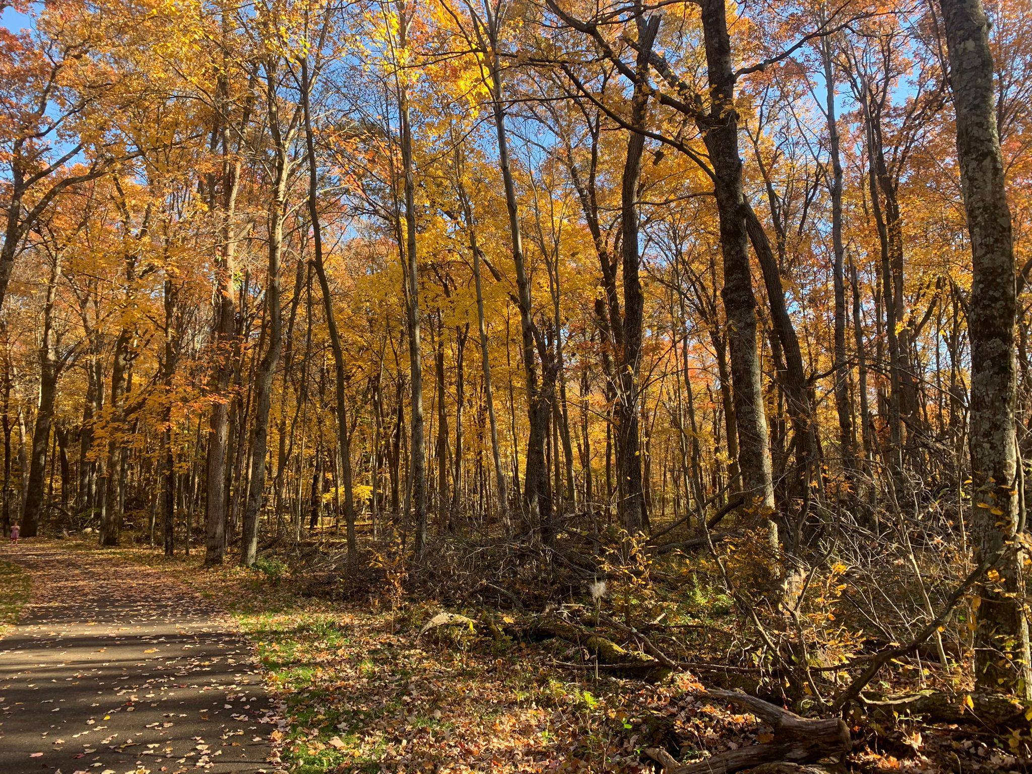
| Wild River State Park, North Branch, Minnesota |
There’s no better way
to experience autumn colors in the North Branch area than a
hike.
The brilliant yellows, oranges and red of maples to the scarlet
and russets of oaks...
the crisp, fresh autumn air and the last warm rays of sunlight before winter arrives...the crunch of fallen leaves and acorns beneath your boots...stopping to enjoy a warm mug of apple cider or a caramel apple pulled from your backpack – it all calls for an afternoon on the trail.
Fortunately, there are plenty of great autumn trails around North Branch to hike. Some are right out your back door, while some are a day trip that you can do in an afternoon.
Wild River State Park (North Branch)
Silver maple and basswood flourish along the St. Croix River at Wild River State Park. The 1.5-mile River Terrace Loop and its stem trail circles through a bottomland forest in this popular park. Originally called St. Croix Wild River State Park – and it still appears on various maps that way – it’s now just Wild River State Park. From North Branch, take Minn. Hwy. 95 to County Road 12. Drive County Road 12 to the park entrance, and follow the main park road to a parking lot near the picnic area.
Minnesota Interstate State Park (Taylors Falls)
The southernmost section of Minnesota Interstate State Park offers a number of great day hiking trails to explore the Dalles of the St. Croix. To reach the area, from U.S. Hwy. 8 in Taylors Falls, turn east onto Milltown Road. A parking lot is at the end of the entry road. Along the parking lot’s northwest side are three trailheads. The Sandstone Bluff Trail heads northwest under Hwy. 8 to a nice vista of the valley and river gorge below. A 1-mile lollipop trail, it’s spectacular in autumn with a mix of colors from the orange maples, red sumac and brilliant yellow oaks.
Swedish Immigrant Trail (Shafer)
Hikers can follow some of the same footpaths and rail lines that the region’s first Swedish immigrants used to settle Chisago County and Minnesota on the Swedish Immigrant Trail. During the late 1800s, many Swedish immigrants took the ferry across the St. Croix River and then footpaths to their destinations. A spur off the St. Paul-Duluth rail route to Wyoming opened during 1880, helping speed the immigration inland. Perhaps the best of the trail’s completed portions is the Shafer Segment, which runs roughly west of the hamlet through wooded areas and past bucolic landscapes. Birch trees dominate in some sections, but the trail is mainly lined by mixed hardwoods that leave the path and its grass shoulders covered in an array of colorful leaves during autumn. Park on the street in downtown Shafer, off of Redwing Avenue near 303rd Street. The trailhead is near 303rd and heads for about two miles east of Redwing. Look for the white signs with the trail logo in the blue and yellow colors of Sweden’s flag.
Wisconsin Interstate State Park (St. Croix Falls, Wis.)
The splendor of fall colors combines with a vista of the St. Croix River and fascinating rock formations on the Summit Rock Trail at Wisconsin Interstate State Park. The 1-mile round trip trail heads to a bluff’s highest point. Moss and autumn leaves cover the surrounding rock and ground while maples, basswood and eastern white pines line the trail. At the top, prickly pear cactus can be spotted amid the outcroppings. The highlight of the hike without question is the incredible view of the riverway from the summit. Looking north, the Old Man of the Dalles rock formation is visible. From St. Croix Falls, take Wis. Hwy. 35 south. Turn right/west into the park and follow the entry road to the parking lot across from the Lake O’ the Dalles.
St. Croix National Scenic Riverway (Osceola, Wis.)
Fantastic river views beneath a colorful forest canopy await hikers on the this pair of trails near Osceola. Not to be confused with Ridgeview Trail at the adjacent Osceola Bedrock Glades State Natural Area, this pair of trails actually are two loops that only locals really know about. They run through the St. Croix National Scenic Riverway and the Osceola State Fish Hatchery on a bluff overlooking a St. Croix River back channel. The oranges and reds of maples dominate here with the occasional pine grove.
Big Marine Park Reserve (Forest Lake)
Hikers can enjoy a walk through a woodlands and on long pier at Big Marine Park Reserve. The unnamed trail in the Washington County park runs 0.75 miles round-trip. The turf trail leaves from the park’s western side, entering a deciduous forest, which makes for a colorful walk among yellow, orange, red, russet and olive leaves in autumn. From Forest Lake, take Minn. Hwy. 97 east. Turn left/south onto County Road 15/Morning Trail North. The park entry road (aka Lomond Trail North) is on the left/east. When the entry road splits, go straight/west, following it to the last/northernmost parking lot (the road loops back onto itself at the lot).

Fortunately, there are plenty of great autumn trails around North Branch to hike. Some are right out your back door, while some are a day trip that you can do in an afternoon.
Wild River State Park (North Branch)
Silver maple and basswood flourish along the St. Croix River at Wild River State Park. The 1.5-mile River Terrace Loop and its stem trail circles through a bottomland forest in this popular park. Originally called St. Croix Wild River State Park – and it still appears on various maps that way – it’s now just Wild River State Park. From North Branch, take Minn. Hwy. 95 to County Road 12. Drive County Road 12 to the park entrance, and follow the main park road to a parking lot near the picnic area.
***
Autumn colors abound in the floodplain forest at Wild River State Park. The 4.6-mile Sunrise Loop in the park’s north side is little used and so offers lots of solitude as it runs along the St. Croix River. Silver maple, ash, black willow and cottonwood all thrive there. From North Branch, take Minn. Hwy. 95 east/south. Turn left/north on County Road 9, taking it into the hamlet of Sunrise; from there, turn right/north on Ferry Road into the park. When the road runs out, use the parking lot on the left/west. Hike Ferry Road south to the trailhead and cross Ferry Road (which leads to the boat landing) then over the Sunrise River footbridge. On the other side of the bridge, the loop begins.Minnesota Interstate State Park (Taylors Falls)
The southernmost section of Minnesota Interstate State Park offers a number of great day hiking trails to explore the Dalles of the St. Croix. To reach the area, from U.S. Hwy. 8 in Taylors Falls, turn east onto Milltown Road. A parking lot is at the end of the entry road. Along the parking lot’s northwest side are three trailheads. The Sandstone Bluff Trail heads northwest under Hwy. 8 to a nice vista of the valley and river gorge below. A 1-mile lollipop trail, it’s spectacular in autumn with a mix of colors from the orange maples, red sumac and brilliant yellow oaks.
Swedish Immigrant Trail (Shafer)
Hikers can follow some of the same footpaths and rail lines that the region’s first Swedish immigrants used to settle Chisago County and Minnesota on the Swedish Immigrant Trail. During the late 1800s, many Swedish immigrants took the ferry across the St. Croix River and then footpaths to their destinations. A spur off the St. Paul-Duluth rail route to Wyoming opened during 1880, helping speed the immigration inland. Perhaps the best of the trail’s completed portions is the Shafer Segment, which runs roughly west of the hamlet through wooded areas and past bucolic landscapes. Birch trees dominate in some sections, but the trail is mainly lined by mixed hardwoods that leave the path and its grass shoulders covered in an array of colorful leaves during autumn. Park on the street in downtown Shafer, off of Redwing Avenue near 303rd Street. The trailhead is near 303rd and heads for about two miles east of Redwing. Look for the white signs with the trail logo in the blue and yellow colors of Sweden’s flag.
Wisconsin Interstate State Park (St. Croix Falls, Wis.)
The splendor of fall colors combines with a vista of the St. Croix River and fascinating rock formations on the Summit Rock Trail at Wisconsin Interstate State Park. The 1-mile round trip trail heads to a bluff’s highest point. Moss and autumn leaves cover the surrounding rock and ground while maples, basswood and eastern white pines line the trail. At the top, prickly pear cactus can be spotted amid the outcroppings. The highlight of the hike without question is the incredible view of the riverway from the summit. Looking north, the Old Man of the Dalles rock formation is visible. From St. Croix Falls, take Wis. Hwy. 35 south. Turn right/west into the park and follow the entry road to the parking lot across from the Lake O’ the Dalles.
St. Croix National Scenic Riverway (Osceola, Wis.)
Fantastic river views beneath a colorful forest canopy await hikers on the this pair of trails near Osceola. Not to be confused with Ridgeview Trail at the adjacent Osceola Bedrock Glades State Natural Area, this pair of trails actually are two loops that only locals really know about. They run through the St. Croix National Scenic Riverway and the Osceola State Fish Hatchery on a bluff overlooking a St. Croix River back channel. The oranges and reds of maples dominate here with the occasional pine grove.
Big Marine Park Reserve (Forest Lake)
Hikers can enjoy a walk through a woodlands and on long pier at Big Marine Park Reserve. The unnamed trail in the Washington County park runs 0.75 miles round-trip. The turf trail leaves from the park’s western side, entering a deciduous forest, which makes for a colorful walk among yellow, orange, red, russet and olive leaves in autumn. From Forest Lake, take Minn. Hwy. 97 east. Turn left/south onto County Road 15/Morning Trail North. The park entry road (aka Lomond Trail North) is on the left/east. When the entry road splits, go straight/west, following it to the last/northernmost parking lot (the road loops back onto itself at the lot).


