Showing posts with label St. Croix County. Show all posts

Sunday, April 1, 2018

New guidebook explores St. Croix Co. trails

My newest hiking guidebook, “Day Hiking Trails of St. Croix County,” was released today. The book describes more than 100 day hiking trails in or near the Wisconsin communities of Hudson, New Richmond, River Falls, Somerset, Baldwin, Woodville, Glenwood City and the surrounding area. Among the sights to see on the county’s hikes: a waterfall tumbling through a 20-story canyon; a premier trout stream running past picturesque fields and woodlands; and the Midwest’s largest earthen dam. “Day Hiking Trails of St. Croix County” is my 21st hiking guidebook. It’s available in paperback and on Kindle ebook.

Learn about trail guidebooks available in the Hittin’ the Trail series.


Sunday, December 31, 2017

Trails head through restored prairie in Wis.

Big bluestem grows across a restored prairie at the Carpenter Nature Center
Wisconsin Campus south of Hudson, Wis.
Carpenter Nature Center, Wisconsin
Campus trail map. Click for larger
version.
Ask most any hiker in the Twin Cities metro area where the Carpenter Nature Center is located, and they’ll answer near Hastings, Minn. They wouldn’t be wrong. The long-established pastoral nature center on the St. Croix River is a popular destination for many taking a day hike or just seeking some apples from the orchard there.

The nature center, however, actually has two campuses – the other is located just south of Hudson, Wis., roughly 20 miles north of the Minnesota site. The Wisconsin campus offers a number of great trails that head through remnant and restored prairies.

In all, seven trails loop about the 300-acre Wisconsin campus, making for a little more than 4 miles of hiking.

To reach the Wisconsin campus, from Interstate 94 in Hudson take County Road F (Carmichael Road) south. Once out of town, turn right/west onto East Cove Road. Alternately, from Prescott, Wis., take County Road F north past Kinnickinnic State Park and turn left/west onto East Cove Road. Once on East Cove Road, watch for the nature center’s signs; the buildings and parking are on the right/north.

Northern trails
From the parking lot, walk to the northeast corner of the buildings and follow the jeep trail east. Upon reaching the prairie, you can access the Ridgeline Trail. The 0.63-mile loop heads down a 50-foot hill into a basin, also known as “the bowl,” a remnant prairie habitat that was never farmed. It’s also an awesome trail for birdwatchers, as a number of species nest there.

To extend the hike, you have a couple of options. One is to take the Indigo Trail, a 0.2-mile side trail on the Ridgeline Trail’s northwest side. Pines as well as a variety of prairie plants, most notably blooming indigo, grow around the trail.

Another option is to take the Goldenrod Trail from the Ridgeline Trail’s southwest corner. A council ring – stones large enough to sit on arranged in a circle with no head of table or hierarchy – sits at the trails’ intersection, overlooking the bowl.

Recently added, the idea for a council ring came from the teachings of Jens Jensen, a Danish landmark designer who with Frank Lloyd Wright formed the Prairie School of Landscape Design. Jensen believed the rings symbolized humanity’s bond with nature; such circles can be found in the culture of the ancient Vikings, Native Americans and even legends, such as King Arthur’s Knights of the Round Table.

Middle trails
A connector trail, the 0.25-mile (one way) Goldenrod Trail crosses East Cove Road and joins the Little Bluestem Trail. The Little Bluestem is a quarter-mile loop though the middle of an 80-acre restored prairie.

On the west side of the prairie and sharing a side with the Little Bluestem Trail is the Big Bluestem Trail. A 1.25-mile loop, the trail is named for the bluestem, a common prairie grass that grows between 6- to 8-feet tall. Its leaves range in color from light green/yellow to burgundy.

If interested in only hiking the Little and Big Bluestem trails, parking is available off of South Cove Road. To reach that lot, after turning from County Road F onto East Cove Road, drive past the aforementioned entrance and turn left/south onto Ahrens Road then left/east onto South Cove Road. The gravel lot is the on the road’s left/north side.

Southern trails
Two other trails sit at the campus’s southern corner. To reach them, from Ahrens Road turn right/southwest onto South Cove Road. After going around the curve, look for an entry on the road’s left/east side. Park there.

The Acorn Trail winds 1.2 miles through a deciduous forest. Serveral species of wildlife common to Wisconsin can be found along the trial, including whitetail deer, woodpeckers, owls and squirrels.

To extend the hike, take the Laurie and Al Hein Trail, a side trail off the Acorn. At 0.25 miles, the trail is named for the couple who in the late 1980s donated to Carpenter Nature Center 98 acres of land, the nucleus of the Wisconsin campus. This walk was among their favorites when they owned the property.

The Wisconsin campus is open for hiking every day of the year from sunrise to sunset, though the nature enter buildings are open only on select days.


Wednesday, October 19, 2016

Pierce County offers variety of great trails

Glen Park Trail waterfall beneath the swinging bridge in River Falls, Wis. 
For travelers to Wisconsin’s St. Croix County, several great trails await just across the border in neighboring Pierce County. A river delta, famous trout streams, and even the state’s largest cave are just a few miles from Interstate 94.

Kinnickinnic State Park
Among the trails at the state park (going from east to west):
Red Trail – The 1.6-mile hike heads through prairie alongside a forest’s edge. Among the highlights is the Vulture’s Peak area. Near the park entrance, the set of two loops can be accessed from the park’s first two parking lot.
Blue Trail – The 0.7-mile out-and-back trail (1.4-miles round trip) gives hikers the opportunity to explore gorges and coulees into the Kinnickinnic River Valley. Access the wooded trail from the second parking area past the park entrance. Add the 0.1-mile (0.2-miles round trip) Brown Trail, which serves as a sledding hill in winter, to extend the hike.
Yellow Trail – The 1.2-mile loop edges a forest and prairie area. Watch for deer, pheasants and turkeys along the trail. The Kinni Overlook Lot is a good place to start; the trail can be extended by adding the Green, Orange or Purple trails.
Orange Trail – A wooded out-and-back trail atop the Kinnickinnic River bluffs, it runs for 0.5 miles (1-mile round trip). Park at the Kinni Overlook Lot and access it via the Yellow Trail; add the Purple and Yellow trails for a longer walk.
Green Trail – The trail loops about the outside of a prairie area under restoration and is an excellent place to spot partridge, pheasants and other birds. Access it via the Yellow Trail; from the Kinnic Overlook Lot, go left/north on the Yellow for a 1.6-mile round trip (The Green Trail itself is 1.1-miles long).
Purple Trail The 1.2-mile loop features a vista overlooking the Kinnickinnic’s confluence with the St. Croix River. The Kinnickinnic dumps much sediment in the St. Croix that the latter’s riverway narrows, forming a lake to the north.

River Falls
Glen Park TrailA swinging bridge and a cascades cuts through 500-million-year-old rock await day hikers in River Falls. The 0.25-mile round trip set of trails – christened here after the park they run through – sits close to the University of Wisconsin-River Falls campus.
Manion Wildlife Area walkabout – If you enjoy bushwhacking or primitive trails, try this 158-acre property that includes restored grasslands. A parking lot sits on the south side of County Road FF east of 1130th Street.
Jackson Preserve walkabout – Ditto for the adjacent Jackson Preserve, a 46-acre Kinnickinnic River Land Trust property on the north side of County FF. Use the wildlife area’s parking lot.

Spring Valley
Crystal Cave Tour Day hikers can explore Wisconsin’s longest cave just west of the village. The tour runs about 0.5-miles round trip through 1,300 feet of passageways, heading seven stories underground. Several deeper passages are closed to the public. The cave is a commercial venture, so a fee is charged to be part of a tour.
Sinkhole Nature Trail – The free trail half-mile path on the Crystal Cave property passes two sinkholes, gooseberry brambles, and mossy banks. Trailhead is immediately north of the parking lot.
Wildwood Trail – Among the most accessible and pleasurable parts of the trail runs 1.7 miles round-trip from near downtown alongside a small stream through a pleasant woods. The trailhead is off of Herb Avenue, north of County Road B (N. Second St.).

Learn about trail guidebooks available in the Hittin’ the Trail series.


Sunday, October 16, 2016

Pierce Co. trails a quick drive from freeway

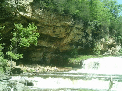
Waterfalls on the Kinnickinnic River below the Glen Park swinging bridge.
For those visiting Wisconsin's St. Croix County, Pierce County offers several great day hikes that explore riverways and pretty woodlands. All are an easy drive from Interstate 94, which cuts through southern St. Croix County.

No trip to Pierce County would be complete without a stop at Kinnickinnic State Park. A number of trails crosscross the diverse park. Most notable among them is the Purple Trail, a 1.2-mile loop with a vista overlooking the Kinnickinnic’s confluence with the St. Croix River.

A swinging bridge and a cascades that cuts through 500-million-year-old rock await day hikers on the Glen Park Trail in River Falls. The 0.25-mile round trip set of trails – christened here after the park they run through – sits close to the University of Wisconsin-River Falls campus.

Day hikers can explore Wisconsin’s longest cave near the village of Spring Valley. The Crystal Cave Tour runs about 0.5-miles round trip through 1,300 feet of passageways, heading seven stories underground. Several deeper passages are closed to the public. The cave is a commercial venture, so a fee is charged to be part of a tour.

Learn about trail guidebooks available in the Hittin’ the Trail series.


Sunday, October 9, 2016

Great hikes await on St. Croix/Dunn border

Bjornson Education-Recreation Center Loop
If you find yourself traveling the stretch between the Twin Cities and Eau Claire, a few great trails in the Dunn and St. Croix county border area mark excellent spots to stretch your legs.

Most of the countryside there is farmland with steep wooded areas set aside by their owners for private hunting, but that means the few public trails that do exist are great spots for spotting the plentiful wildlife.

Listed roughly west to east and then north to south, those hikes include:
Glen Lake West Trail Glen Hills County Park in eastern St. Croix County offers a plethora of trails amid 700 acres of maple, birch and oak hardwoods. This 0.4-mile round trip begins at the north end of the vista overlooking a swimming beach.
Glen Lake East TrailThis 2-mile round trip trail heads from a high vista to a campground. Park in the lot at the end of Thompson Lane, northwest of Rustic Road 4.
Wildwood TrailFormer railroad tracks recently were converted into the pretty Wildwood Trail, which connects the villages of Woodville and Spring Valley. The 7-mile (one-way) trail passes scenic farmland and runs through several small woodlands.
Eau Galle Dam TrailDay hikers can walk across the largest earthen dam in the Midwest on this trail near Spring Valley. The 0.8-mile round trip hike sits in the popular Eau Galle Recreation Area.
Crystal Cave tourDay hikers can explore Wisconsin’s longest cave near the village of Spring Valley. The tour runs about 0.5-miles round trip through 1,300 feet of passageways.
Bolen Creek State Public Hunting Trails – Primitive trails cut through this small wooded area near Connorsville. Do not visit this area during hunting season. Park off of 1270th Street just west of County Road Q.
Knapp School Hill Trail – Generations of kids at the local elementary school used to sled down the school-owned hill during recess each winter. In the 1990s, trees were allowed to overtake the hill, but the trails up the sandstone rise remain. Park in the elementary school lot off of Knapp’s Main Street on weekends or during summer.
Bjornson Education-Recreation Center LoopA good concentration of trails is at the Bjornson Education-Recreation Center. There day hikers can enjoy a pleasant walk through woodlands and past a small, spring-fed creek on a 1.7-mile loop, which is a set of interconnecting trails at the 443-acre school forest owned by the School District of the Menomonie Area. The entrance is on 160th Street southwest of 700th Avenue.
Bjornson Education-Recreation Center Back Trail – A logging road heads down a hillside to a ravine created by an intermittent creek and connects with a trail heading to the center’s main campus. Park in a gravel lot off of 700th Avenue east of County Road Q.
Gilbert Creek Trail – Hikers can walk along bucolic Gilbert Creek, whose banks recently were restored. This is best hiked in spring or in autumn after a hard freeze when grass is low. A small gravel lot sits off of County Road N north of Wis. Hwy. 29.

Learn about trail guidebooks available in the Hittin’ the Trail series.


Sunday, October 2, 2016

Great trails also surround St. Croix County

Cascade Falls in Osceola, Wis.
Wisconsin’s St. Croix County sits at the center of a hiking mecca, neighboring several counties that boast great day trails within a few miles of the border.

To the west on the other side of the St. Croix River, is Washington County, Minnesota. Among its great day hikes are the Kettlekamp Prairie Trail, which runs through a restored prairie at the Belwin Conservancy. Afton State Park’s North River Trail is a tranquil dirt path running next to the St. Croix River’s widest section. In the St. Croix National Scenic Riverway are the four-story Fairy Falls and the historic Boom Site with its sandstone formations, both just north of Stillwater. Hikers can learn about the power of floods on the St. Croix River via the Riverside Trail at William O’Brien State Park.

Polk County, where Wisconsin’s farmland begins to give way to the Northwoods, sits to the north. Some of the best scenery along the St. Croix River can be found there. Nearby hikes include: the Cascade Falls Trail, which heads to a 25-foot waterfall in Osceola; the Stower Seven Lakes State Trail, which runs west of Amery through peaceful woodland, serene ponds, and picturesque farms; and the Clear Lake-Clayton Trail, an old rail line turned hiking trail that connects its namesake cities.

Heading deeper into central Wisconsin is Dunn County, which is similar in terrain and feel to eastern St. Croix County. Mainly farm country, there are a few good trails at the Bjornson Education-Recreation Center, most notably a loop that passes a bubbling creek.

To the south is Pierce County, where the St. Croix River ultimately flows into the Mississippi. The Purple Trail takes hikers to that confluence at Kinnickinnic State Park. A little upstream, the Glen Park Trail heads over 500 million-year-old rock in River Falls. On the county’s east side, hikers can explore Wisconsin’s largest cave via the Crystal Cave Tour.

St. Croix County also shares a tangential boundary with Barron County.

Learn more about nearby day hiking trails in my Day Hiking Trails of St. Croix County guidebook.


Wednesday, September 28, 2016

Great day hikes in eastern St. Croix County

Wildwood Trail in St. Croix County, Wisconsin
St. Croix County’s landscape becomes visibly more hilly as leaving the prairie for Wisconsin's driftless area. This geography in the past led to catastrophic flooding, so during the 20th century dams were constructed and the surrounding region landscaped into a public recreation area.

Two such areas stand out – Glen Hills County Park, which offers the Glen Hills East Trail and the Glen Hills West Trail, and the Eau Galle Recreation Area with its Eau Galle Dam Trail.

In addition, former railroad tracks recently were converted into the rustic Wildwood Trail, which connects the villages of Woodville and Spring Valley. The lengthy trail passes scenic farmland and runs through several small woodlands.

Learn more about nearby day hiking trails in my Day Hiking Trails of St. Croix County guidebook.


Sunday, September 25, 2016

Day hikes abound in central St. Croix Co.

Trail leading to bridge crossing Paperjack Creek in New Richmond, Wis.
Several great day hiking trails – ranging from primitive, grass paths near rookeries to paved, wide routes alongside urban lakes – can be found in the central portion of Wisconsin’s St. Croix County.

The trails generally are located in or close to the four communities making up the region. Trails by community include:

Baldwin-Hammond
Casey Lake Trail – Day hikers can sight great blue herons on the 0.2 miles-round trip Casey Lake Trail in the Casey Lake Wildlife Management Area. From 130th Avenue east of U.S. Hwy. 63 north, look for a gravel parking lot on the left/south side of the road between 200th and 190th streets.
Wintergreen Park trails – Several unnamed walking paths wind through the 32-acre pine and hardwood forest on the town’s southwest side. Use the lot in the park’s northwest corner off of 60th Avenue west of U.S. Hwy. 63.

New Richmond
Doar Park Trail – About 0.7 miles of trails ramble about the 14.6-acre park, which is being restored to native prairie grasses. The trailhead is on a private road east of 115th Street, just south of Sixth Street West.
Doughboy Trail – The 0.33-mile paved trail runs from the Mill Pond Walk along the Willow River to North Pierce Street south of High Street. Park in the lot west of the New Richmond depot off of High Street.
ELC Trail – The 0.2-mile paved trail links East Sixth Street to Paperjack Elementary School. Park at the northwest end of the elementary school, off of East 11th Street on weekends or during school vacations.
Richmond Way Trail – The 1.7-mile trail parallels East Richmond Way and briefly West Richmond Way from 140th Street west to County Road A with connector trails. Park along the street.
Freedom Park Trail Loop – Formerly the Hatfield Lake Trail Loop, the 2.4-mile trail circles the park with a long side hugging the shore of Hatfield Lake. Park then pick up the trail at the end of Liberty Drive north of Industrial Boulevard.
Hatfield Lake Trail – The 1-mile trail runs along the south side of Hatfield Lake into Hatfield Park with a spur heading southeast to North Knowles Avenue and Johnson Drive. Parking is in the southeast corner of the Hatfield Park lot.
Mary Park Trail – Day hikers can enjoy a 0.6-mile round trip walk alongside a placid lake in Mary Park at the southwest end of Mary Park Lake. To reach the trailhead, on Wis. Hwy. 65 in downtown turn east onto County Road K/East First Street; next, turn left/north onto North Green Avenue.
Mill Pond Trail – The 0.1-mile trail runs across the Willow River dam then partially alongside the small reservoir. Access the trail from West First Street just west of South Knowles Avenue.
Monette Park Trail – A 0.1-mile paved path sits in the neighborhood park and connects to Marshall Road. Park and start the trail at the end of Fifth Street South just west of South Washington Street.
Nature Center Trail – A 0.5-mile trail rambles through woodlands at the 16.5-acre nature along the Willow River. The park is at the corner of Wis. Hwy. 64 and County Road A.
New Richmond Heritage Center and Paperjack Creek Trail – Hikers can combine a walk near a stream with a loop through a historical village and farm that show what life was like in western Wisconsin decades ago; they combine for a roughly mile-long stroll. The trailhead is on Heritage Drive east of Wis. Hwy. 64; when the drive curves south, turn left/east into the Heritage Center’s parking lot.
North Shore Trail – The 0.3-mile trail links two ends of North Shore Drive. Use street parking.
Rail Bridge Trail – This 1.7-mile paved trail runs between West Richmond Way and West Sixth Street. Four short connectors link the trail to residential areas and to Wisconsin Indianhead Technical College.
Somerset Road Trail – The paved 0.5-mile trail runs between Nature Center Park and Victoria Park. The regional hospital is along the trail between the parks.
Willowind Trail – The paved 0.4-mile trail runs alongside West Eighth Street next to the hospital and then south with spurs. A connector trail links it to Somerset Road Trail.
Woodland Creek Trail – The 0.5-mile trail heads from County Road A north of Woodland Creek Park to the street Pinewood Trail. The trail is in a residential area.

Roberts
• Clapp Waterfowl Production Area – A 0.36-mile round trip grass path crosses part of the production area to a woodline. A parking lot and the trailhead sit off Kinney Road south of Highlander Trail.
Kinnickinnic Headwaters Fish and Wildlife Area and Trumpeter Swan Preserve walkabout Day hikers with a taste for bushwhacking can explore the headwaters of a Class 1 trout stream at the Kinnickinnic Headwaters Fish and Wildlife Area and Trumpeter Swan Preserve. From 70th Avenue, go right/south onto 150th Street; a parking lot is on the road's right/west side.
Kinnickinnic River State Fishery Area Trail – A 0.3-mile round trip path runs to the center of the fishery. On 140th Street, once south of 70th Avenue, take the first gravel road heading west; look for the fishery area sign and turn left/south.

Star Prairie/Deer Park
• Prairie Flats North Waterfowl Area – For a primitive hiking experience, grass paths leave from the parking lot toward and around a pond and the surrounding wetlands. Park in the gravel lot on the north side of County Road H between 90th Street and Thrush Drive.
Stanton County Forest trails – Trails stacked in two columns run through the 40-acre forest east of South Prairie. Park in the lot off of 185th Street about a mile north of the County Roads H and T intersection.

Learn more about nearby day hiking trails in my Day Hiking Trails of St. Croix County guidebook.


Wednesday, September 21, 2016

Hiking trails abound in central St. Croix Co.

New Richmond Heritage Center
Rising out of the St. Croix River Valley is the largely flat farmland of the county’s central area. There are fewer trails here – while pretty countryside, the lack of variety in terrain and the nearness of excellent trails and outdoors recreation at Willow River State Park and around Somerset have squelched interest in marking out walking paths. That's changing, though.

The city of New Richmond in particular has developed a variety of parks and trails to create an outdoors-friendly community. Both the Heritage Center and Paperjack Creek Trail and the Mary Park Trail are a couple of great options for day hikes.

Conservation efforts to preserve the Kinnickinnic River has led to the Kinnickinnic Headwaters Trail near Roberts and preservation of native flora and fauna, especially of wetlands such as the Cylon State Wildlife Area Trail east of Deer Park and the Casey Lake Trail outside of Baldwin also have provided some hiking paths.

Learn about trail guidebooks available in the Hittin’ the Trail series.


Wednesday, September 14, 2016

Great trails run through west St. Croix Co.

Willow River on the Trout Brook (Purple) Trail
Among the most scenic areas of St. Croix County is the Great River Road region. Here the St. Croix River forms the county’s eastern boundary with three tributaries – the Apple, the Willow and the Kinnickinnic rivers – flowing to it. The region is so named because Wis. Hwy. 35 – the Great River Road – parallels the St. Croix and connects its three main cities – River Falls, Hudson and Somerset, each of which sport several great trails.

Hudson and Willow Falls State Park sit on the St. Croix at the region’s center. Among the great trails here are the 45-foot high and 100-foot wide Willow Falls on the Willow Falls Hill (Gray) Trail. A restored prairie can be explored on the Knapweed (Orange) Trail and the Willow River, a popular trout stream, via the Trout Brook (Purple) Trail.

River Falls sits south of Hudson and spreads into neighboring Pierce County. A great hike here is the Glen Park Trail, which cuts over 500 million-year-old rock on the Kinnickinnic; note that the trail is in Pierce County just across the county line.

Somerset is to the north of Hudson. One great trail there is the Parnell Prairie Reserve Loop, which traipses through an area being restored to its mid-1800s appearance.

Learn more about nearby day hiking trails in my Day Hiking Trails of St. Croix County guidebook.


Wednesday, September 7, 2016

3 Great Day Hiking Trails in St. Croix County

Willow Falls at Willow River State Park
St. Croix County’s hiking trails largely can be divided into three geographical areas, each with great hiking trails.

The Great River Road region is a rapidly urbanizing area paralleling the St. Croix River. It makes up the western third of the county and includes the communities of Hudson, Somerset and River Falls. The region’s best sight is 45-foot-high Willow Falls, which sits in a 200-foot-high gorge.

The Central region mainly is farm country, but the cities here – New Richmond, Roberts, Hammond and Baldwin – also are growing at a faster rate than most communities across Wisconsin. Among the many great hikes here is the New Richmond Heritage Center and Paperjack Creek Trail, which gives a good sense of the area’s history while also getting back to nature.

The Eastern region still is largely untouched by the growth of the Twin Cities and remains primarily farmland and woods. A good hike that passes both pastoral scenes and forests is the Wildwood Trail, a former rail line that connects the villages of Woodville and Spring Valley.

Learn more about nearby day hiking trails in my Day Hiking Trails of St. Croix County.


Wednesday, August 31, 2016

Great hikes near major St. Croix Co. roads

Wildwood Trail
Several major highways offer access to Wisconsin’s St. Croix County, which is chock full of great hiking trails.

From the Minneapolis-St. Paul area, take Interstate 94 east across the St. Croix River. Visitors from southern Minnesota and Iowa can drive Interstate 35 north to I-94 while those in northern Minnesota can take I-35 south to I-94. Once in St. Croix County, most of the hiking trails are only a few miles north or south of the freeway. One easy hiking area to reach is Willow River State Park and its 45-foot waterfall, which is just a couple of miles off I-94.

From western Wisconsin take either Wis. Hwy. 35 or U.S. Hwy. 63 to I-94. Hwy. 35 runs through River Falls, past Hudson’s downtown pier and riverway, and to Somerset. Hwy. 63 meets I-94 in Baldwin, which boasts the Casey Lake Wildlife Management Area.

From eastern Wisconsin and Michigan’s Upper Peninsula, head west on Wis. Hwy. 64, Wis. Hwy. 29 or I-94. Hwy. 64 runs through New Richmond and Somerset, passing the latter’s La Grandeur Natural Area. Hwy. 29 links to I-94 in Eau Claire or can be taken directly to Spring Valley with its Eau Galle Recreation Area and Crystal Cave. I-94 passes Woodville and offers access to the Glen Hills.

From southern Wisconsin, take I-94 north into the county. The freeway offers access to each St. Croix County community.

Learn more about nearby day hiking trails in my Day Hiking Trails of St. Croix County.


Wednesday, August 24, 2016

St. Croix County attractions for hikers

Overlook Trail, Eau Galle Recreation Area.
Four major attractions in Wisconsin’s St. Croix County offer great opportunities for hiking.

The St. Croix National Scenic Riverway – whose 252 miles includes the entire length of the county’s eastern border – is largely urbanized in this region. A pier and riverwalk in downtown Hudson, however, provide for some fun day walks.

To get back to nature, you’ll want to hit any of the three parks centered on reservoirs.

In Hudson, Willow River State Park features a 45-foot waterfall that’s at the bottom of a 20-story canyon. Upstream, the Willow River is dammed to form Little Falls Lake. A dozen trails can be found in the park.

On the county’s east side, Glen Hills County Park sits southeast of Glenwood City. Several trails ramble around 78-acre Glen Lake, a flowage that keeps Beaver Creek from flooding. To the south near Spring Valley, the Eau Galle Recreation Area dams up its namesake river to form Lake George. A number of trails, including an overlook of the dam and reservoir, are located there.

Learn more about nearby day hiking trails in my Day Hiking Trails of St. Croix County.


Thursday, August 18, 2016

Variety of trails found across St. Croix Cnty.

Willow Falls at Willow River State Park.
Wisconsin's St. Croix County consists of several communities with great hiking trails. Most sprung up as agricultural centers, though during the past couple of decades those closest to the Minnesota border increasingly serve as bedroom communities for the Minneapolis-St. Paul metro area. The county’s communities neatly fall into one of three groups based on the level of this transition from farm to bedroom town.

The Great River Road communities sit in the western third of the county, which is rapidly urbanizing. Wis. Hwy. 35, also known as the Great River Road, runs north-south connecting these cities. So also do four major rivers.

The county seat, Hudson, with its neighbor North Hudson, are located where the St. Croix River joins a tributary, the Willow River. Beautiful Willow River State Park sits just east of town; a hike to Willow Falls is a must for any visitor to this part of Wisconsin.

North of Hudson is Somerset, which the Apple River flows through on its way to the St. Croix. The city enjoys a colorful history as a rough logging town and bootleg alcohol production center during the Prohibition. One great Somerset hike is the Parnell Prairie Reserve Trail.

South of Hudson is River Falls. Partially in neighboring Pierce County, the city is home to the University of Wisconsin-River Falls. Hiking trails abound on the Kinnickinnic River, which flows through town en route to the St. Croix. The most scenic part of the Kinnickinnic is just a mile south of the St. Croix-Pierce county line at Glen Park.

The central third of the county is farming country though the population of cities along the Interstate 94 and Wis. Hwy. 64 corridors is growing at a faster rate than most other communities in Wisconsin.

The most populous, New Richmond, sits just east of Somerset in the county’s north. During 1899, an F5 tornado wiped out the community, killing 117 people. Today, the city is a vibrant town with many great local hiking options. Among them is the New Richmond Heritage Center and Paperjack Creek Trail.

Much smaller Star Prairie and Deer Park sit to the north and northeast of New Richmond. Roberts is to the south where Wis. Hwy. 65 and I-94 meets. Hammond and then Baldwin, the latter beginning as a railroad town, are east of Roberts on the I-94 corridor. The Casey Lake Trail near Baldwin offers an opportunity to see great blue heron near their rookery.

The eastern third of the county is farming country with cities no larger than a population of 1500, but quality trails can be here as well. Woodville and Wilson are east of Baldwin off of I-94. Glenwood City is to the north; nearby Glen Hills County Park boasts a number of great hikes. The Wildwood Trail links Woodville to Spring Valley, home of Crystal Cave and the Eau Galle Recreation Area.

Learn more about nearby day hiking trails in my Day Hiking Trails of St. Croix County.


Wednesday, August 10, 2016

Great day hikes await in St. Croix County

Willow Falls at Willow River State Park
Imagine a place where a river plunges 45 feet at the bottom of a 20-story canyon, where premier trout streams run through picturesque fields and charming woodlands, where bald eagles grace the skies and white-tailed deer graze at twilight, where restored prairies look just as the pioneers saw them, and where the Midwest’s largest earthen dam holds back a mighty waterway. The place is real: It’s called St. Croix County, Wisconsin.

Serving as the main gateway for Twin Cities residents entering Wisconsin, St. Croix County is an outdoor recreational mecca. During summers, bicyclists and off-road vehicle enthusiasts ply a number of forested trails while fishermen and canoeists play on waterways and a nationally protected riverway. Come autumn, the roads turn busy with drivers out to enjoy the colorful blaze of autumn leaves. Throughout winter, cross-country skiers, snowshoers and snowmobilists sail across white paths while ice fishing shacks pop up on frozen lakes. And, of course, day and backcountry hikers alike enjoy the county’s dozens of miles of trails rambling through verdant scenery.

Three must-do St. Croix County trails include:
Willow Falls Hill (Gray) TrailThe quickest way to reach beautiful 45-foot Willow Falls at Willow River State Park is this 0.4-mile trail. An initial hill to the waterfalls is steep but paved before turning flat and to dirt while heading alongside the river.
Parnell Prairie Preserve trails Hikers at the Parnell Prairie Preserve west of Somerset can see an ecosystem in the making as a long-abandoned dump is reclaimed. In fact, you might consider repeated trips here during the years ahead to watch the prairie spring alive.
Eau Galle Dam Trail Day hikers can walk across the largest earthen dam in the Midwest on this trail near Spring Valley. The 0.8-mile round trip hike sits in the popular Eau Galle Recreation Area, nestled on the borders of St. Croix and Pierce counties.

Learn more about nearby day hiking trails in my Day Hiking Trails of St. Croix County series.


Wednesday, August 3, 2016

Great day hikes abound in east St. Croix Cty.

Glen Hills West Trail
Though primarily thought of as farm country, Wisconsin’s eastern St. Croix County offers a number of great day hiking trails. Whether a local looking to explore or a traveler on Interstate 94 needing to stretch your legs, there’s probably a trail that’s right for you.

Eastern St. Croix County loosely is centered on three small cities – Glenwood City to the north, Woodville in the center, and Spring Valley in the south (though that farming village technically is in Pierce County).

Here are some of the great trails near those towns:

Glenwood City
Glen Hills East Trail Tucked within Wisconsin’s dairy country is a hilly, wooded region that gives day hikers the chance to get back to nature. Glen Hills County Park in eastern St. Croix County offers a plethora of trails amid 700 acres of maple and oak hardwoods. The 2-mile round trip unnamed trail (christened here for convenience’s sake) heads from a vista to a campground.
Glen Hills West Trail – A pleasant walk through the woods alongside a pretty lake awaits day hikers on the west side of Glen Hills County Park. To reach the trailhead, from U.S. Hwy. 12 west of Wilson, take Wis. Hwy. 128 north. Turn right/east onto Day Use Road then go right/south onto Picnic Point Lane, which dead ends at a parking lot atop a vista.
Glen Hills Southwest Trail – This rustic 1.2-mile round trip route heads through woods as skirting the Glen Lake’s curving, southwest corner at Glen Lake County Park. It runs from the playground on Picnic Point Lane to the campground.

Woodville
Wildwood Trail segment Day hikers can enjoy a bucolic walk on a segment of the Wildwood Trail. The seven-mile hiking, biking and snowmobiling trail runs between the communities of Woodville and Spring Valley in eastern St. Croix County. Among the most accessible and pleasurable parts of the trail runs 2.3-miles round-trip from western Woodville past farm fields.

Spring Valley
• Crystal Cave tour – Day hikers can explore Wisconsin’s longest cave near the village of Spring Valley. The Crystal Cave tour runs about 0.5-miles round trip through 1,300 feet of passageways. Several deeper passages are closed to the public. The cave is a commercial venture, so a fee is charged to be part of a tour. To reach Crystal Cave, from Spring Valley take Wis. Hwy. 29 west. In about a mile after ascending the hill, turn left/south onto the cave entrance road.
• Eau Galle Dam Trail – Day hikers can walk across the largest earthen dam in the Midwest on the Eau Galle Dam Trail. The 0.8-mile round trip hike sits in the popular Eau Galle Recreation Area. To reach the trailhead, from Spring Valley, head west on Wis. Hwy. 29. In about a mile, turn right/north onto Van Buren Road then right/west onto Eau Galle Dam Road.
• Northwest Day Use Loop – The 0.75-mile trail parallels the wooded park road in the Eau Galle Recreational Area. One side runs alongside the scenic Eau Galle River. Park at the lot where Boston Road (east of County Road B) crosses the river.
• Overlook Trail – The 0.76-mile round trip trail heads from an overlook of Lake George (often referred to as the Eau Galle Reservoir) down to a beach then back up again at the Eau Galle Recreational Area. Park at the overlook off of Eau Galle Dam Road.
• Pond Trail – The 0.22-mile loop through a grassy area circles a small L-shaped pond at the Eau Galle Recreational Area. Park at the lot nearest the beach, off of Eau Galle Dam Road.
• West Ridge Trail/Low Land Trail Loop – The two paths can be combined into a 1.14-mile lollipop trail that heads from the beach through woodland at the Eau Galle Recreational Area. Park in the lot closest to the beach.
• Wildwood Trail – Among the most accessible and pleasurable parts of the trail runs 1.7 miles round-trip from near downtown Spring Valley alongside a small stream through a pleasant woods. To reach the trailhead, from Wis. Hwy. 29 in Spring Valley turn north on McKay Avenue then left/west onto County Road B (N. Second St.). In four blocks, turn right/north onto Herb Avenue. As that street curves east, park in the small lot off its left side; the trail heads west from the lot. Note that this trail starts in Pierce County then enters St. Croix County on its way north to Woodville.

Learn more about nearby day hiking trails in my Day Hiking Trails of St. Croix County guidebook.


Friday, June 10, 2016

Day hikes explore St. Croix County history

The Wildwood Trail takes a walk into St. Croix County's history.
Several excellent trails provide hikers the opportunity to explore the rich history of Wisconsin’s St. Croix County.

For centuries, Dakota Indians lived in what is now St. Croix County. Shortly before Europeans arrived in the area, the Ojibwe gained control of the area. Trading between Frenchmen seeking furs and the Ojibwe occurred throughout the 1700s, with France claiming the region as part of its empire. The British pushed out the French in 1763, and following the Revolutionary War 20 years later, the United States took possession of what is now Wisconsin.

Euro-American settlement of St. Croix County began during the 1830s as homesteaders began claiming land. By 1839, steamers began plying the St. Croix River, and a year later the county’s first town – Buena Vista – was laid out. Buena Vista changed its named to Hudson 12 years later.

For the next four decades, the St. Croix River served as a major route for ferrying cut pine from northern Wisconsin to sawmills in Hudson and neighboring Stillwater, Minn. Wheat farming dominated the interior. The county's population doubled between 1860 and 1870. New Richmond’s Paperjack Creek and Heritage Center trails gives a sense of what life was like in the county during that era.

As the 1800s came to a close, the sawmills shut down for the great pineries of the north had been logged off. Railroads crisscrossed the county. Dairying replaced wheat farming; by 1895, the county boasted 14 creameries and seven cheese factories. The Wildwood Trail runs on a former rail line past dairy farms that have been in operation since that period.

During the 20th century, roads and motor vehicles gradually surpassed the railroad as the main form of transportation. The new Interstate highway system of the 1950s ran straight through the county, connecting Minneapolis-St. Paul with Madison and Milwaukee to the south. This opened the way for the county's western portion to become bedroom communities for the Twin Cities. In part to ward off potential overdevelopment of the predominantly rural area, the St. Croix National Scenic Riverway was established in 1968. The Hudson Pier takes day hikers into the middle of the scenic riverway's Lake St. Croix to an island.

As the number of family dairy farms declined at the beginning of the 21st century, the role of commuting – and of tourism – grew in the county. Today, several public areas aimed at preserving natural habitats while offering recreational activities exist throughout the county. Prime examples of this are the Willow Falls Hill (Gray) Trail at Willow River State Park and the Glen Hills West Trail at Glen Hills County Park.

Learn more about nearby day hiking trails in my Day Hiking Trails of St. Croix County.


Wednesday, May 25, 2016

Trails explore St. Croix Cnty.’s geography

Willow Falls on the Burkhardt (Pink) Trail east of Hudson.
A number of great day hiking trails explore St. Croix County’s diverse geography.

The west-central Wisconsin county largely can be broken into three distinct geographical areas: the St. Croix Valley, the central plain, and the western uplands.

The western third of the county consists of a thin slice where the St. Croix River runs while the area overlooking it is moderately hilly as creeks drain into it and the tributaries of the Apple, Willow and Kinnickinnic rivers. Collectively is known as the St. Croix Valley, this area actually stretches south into Pierce and north into Polk counties. Willow River State Park near Hudson offers several excellent trails that are representative of the river valley, including the Whitetail (Red) Trail, the Burkhardt (Pink) Trail, and the Knapweed (Orange) Trail.

The central and eastern thirds of the county are largely a flat plain with slightly rolling hills. This region once was an outwash plain at the end of a previous ice age. With such little change in elevation, much of it today is prime farmland rather, but there are a few trails here, most notably the Wildwood Trail, a former rail line turned into a bicycling/walking path.

A third area consists of high-relief hills and valleys that mark the northwestern edges of Wisconsin’s western uplands. This hilly terrain is particularly noticeable around Glenwood City, east of Wilson, and north of Spring Valley. A day hike that gives a good sense of this landscape is the Glen Lake East Trail at Glen Hills County Park.

Learn more about nearby day hiking trails in my Day Hiking Trails of St. Croix County.


Monday, May 9, 2016

Trails explore St. Croix County WI geology

Rocks forming the cliffs that Willow River cuts through were formed about
half-a-billion years ago.
Hikers can explore the geology of Wisconsin’s St. Croix County via a number of great day trails. Located just east of Minneapolis-St. Paul, the county is easy to reach via Interstate 94.

Underlying the entire county is 1.1 billion year old bedrock, formed when the North American continent began to split in two. From this rift flowed thousands of feet of lava. In the county, these flaws included the area northwest of where the Willow River runs today while the rest of the county mainly contains clastic rock, which is weathered rock that rivers dumped into the rift’s depression.

Fast forward a half-billion years. At that time – the Cambrian and Ordovician periods – the county sat in a sea off the edge of North America. Northern Wisconsin was a high coastal area. As rivers carried sediment off these eroding mountains, the sand and silt settled in the sea for more than 100 million years. As sea life grew more complex near the end of that period, their falling shells settled in the sediment, creating the marine limestone underlying much of the county’s topsoil. Cliffsides of this rock can be seen today at Willow Falls where the Willow River has cut through it; it can be reached via the Willow Falls Hill (Gray) Trail at Willow River State Park.

Two ancient faults during that time offset the rocks layers by as much as 400 feet in the county. One fault runs north of Hudson. The other one, known as the Hudson Fault, sits in the state park on the eastern side of Little Falls Lake. You can walk over the latter fault on the Willow Falls (Blue) Trail at Willow River State Park.

Fast forward nearly another half-billion years. About 2.5 million years ago, the Earth entered a series of ice ages. Much of the landscape seen today in St. Croix County exists as it does because of those glaciers. During one of those glacial periods more than 100,000 years ago, an ice sheet engulfed the entire county.

In the last ice age, which began about 100,000 years ago and ended a mere 8000 years ago, the leading edge of the Superior Lobe of the Laurentide Ice Sheet covered the county’s northwestern corner. It formed moraines – ridges of rock and sediment carried by glaciers – and kettle lakes, where melting ice broken from retreating glacier formed a depression, with the trapped meltwater forming a waterbody. Moraines are visible on the Mound (White) Trail at Willow River State Park and a kettle lake on the Siem Trail, located in the Homestead Parklands on Perch Lake.

Most noticeably, the St. Croix River served as a major drainage for meltwater from retreating glaciers with flashfloods scouring out the St. Croix River Valley. The Hudson Pier, at Lakefront Park in downtown Hudson, runs to the center of the river valley. During the height of the glacial drainage, the pier would have been a few hundred feet under the river.

Learn more about nearby day hiking trails in my Day Hiking Trails of St. Croix County series.


Friday, November 27, 2015

Hiking area being restored as unique prairie

Parnell Prairie Reserve
Aerial map of Parnell Prairie Reserve trails
Hikers at the Parnell Prairie Preserve west of Somerset, Wis., can see an ecosystem in the making as a long-abandoned dump is reclaimed. In fact, you might consider repeated trips here during the years ahead to watch the prairie spring alive.

The preserve is fairly new, opening in 2010 as a park jointly operated by the Township and the Village of Somerset. In all, you’ll walk less than a half-mile on its trails, though there are some side loops that allow you to add a few extra steps if you’re up to it.

As you’re walking across an open meadow, there’s little sun cover; because of this, morning and early evening are best for hiking. Regardless the time of day, though, you’ll definitely want to bring a hat. The preserve is open 5 a.m.-10 p.m. daily.

To reach the preserve, from Somerset head west/south on Wis. Hwy. 64. At the village’s edge, turn left/west onto 180th Avenue. In about 2.5 miles, at 38th Street, 180th Avenue goes right/north. At the T intersection, go right/east onto 44th Street, which curves and becomes 45th Street. As the road straightens, turn right into the parking lot.

Town dump far below your feet
None of the trails are named, and are mainly loops sharing common segments. You’ll find getting lost will be difficult, though; the preserve is an open area and largely bordered by trees.

The trailhead of this recommended hike is at the northeast corner of the parking lot that goes straight east into the prairie. Mowed trails cross rolling terrain.

For 21 years – from 1967-88 – this site served as the Somerset “town dump.” The area previously had been farmed by Albert (Alley) Parnell, whose forefathers were among this region’s original pioneer families. After the dump closed, officials covered the 5.5-acre refuse site with two feet of fine-grained soils and then six inches of topsoil. The land sat vacant for several years, then in 2010, the U.S. Fish and Wildlife Service began restoring the prairie you’re now crossing.

In about 250 feet, the trail comes to a junction. Go left/northeast with the trail curving to the preserve’s north side. As walking, you may notice the dirt beneath the grass is particularly poor for Wisconsin. This medium textured and moderately coarse soil is typical of outwash plains created as the glaciers retreated from this area some 10,000 years ago.

Endangered ecosystem
After about 200 feet, you’ll come to another junction. This time, go right/southeast for 150 feet. The soil and flat terrain make good growing conditions for cool season prairie grasses. The current restoration plan calls for making the entire area look like some of the small prairie remnants along the railroad tracks bordering the preserve’s south side.

At the next junction, go right/south. This takes you to roughly the center of the preserve. After 100 feet, the trail swerves northeast.

The area specifically is a dry mesic prairie, in which tall species such as big bluestem and Indian-grass typically dominate. Herbs also are commonplace. Such prairies used to run all through southern Wisconsin, but most were plowed under decades ago for farmland. Less than 1 percent of the state’s dry mesic prairies remain.

In 400 more feet, you’ll arrive at another junction. You’re now at the preserve’s eastern edge. Turn right/southwest to begin the loop back home.

Birds, butterflies abound
Though the restoration has only begun, you’ll probably spot some of the animals that typically live in a dry mesic area. Butterflies are abundant in summertime. Among the many birds are barn owls, bobolinks, dickcissel, eastern and western meadowlarks, grasshopper sparrow, greater prairie-chicken, Henslow’s sparrow, and the upland sandpiper. Common mammals include Franklin’s ground squirrel, prairie vole, and the white-tailed jackrabbit.

For the next 750 feet or so, the trail meanders as roughly paralleling the preserve’s eastern and southern woodline of pines. At the junction, go left/west (i.e. straight). The trail curves toward the woodline; if a sunny day, you're likely to get some good cover here, and your location gives you a good, broad view of the sweeping meadow.

When the restoration is completed, the prairie likely will appear just as it did in the mid-1800s to Parnell’s ancestors and other pioneers of this area. Indeed, a government survey report from August 1847 reports that the area’s southern edge was void of trees and had second-rate soil.

After another 300 feet, the trail cures north. It’s another 150 feet or so to the parking lot.

Learn more about nearby day hiking trails in my Day Hiking Trails of St. Croix County guidebook.