Showing posts with label St. Croix National Scenic Riverway. Show all posts

Friday, October 12, 2018

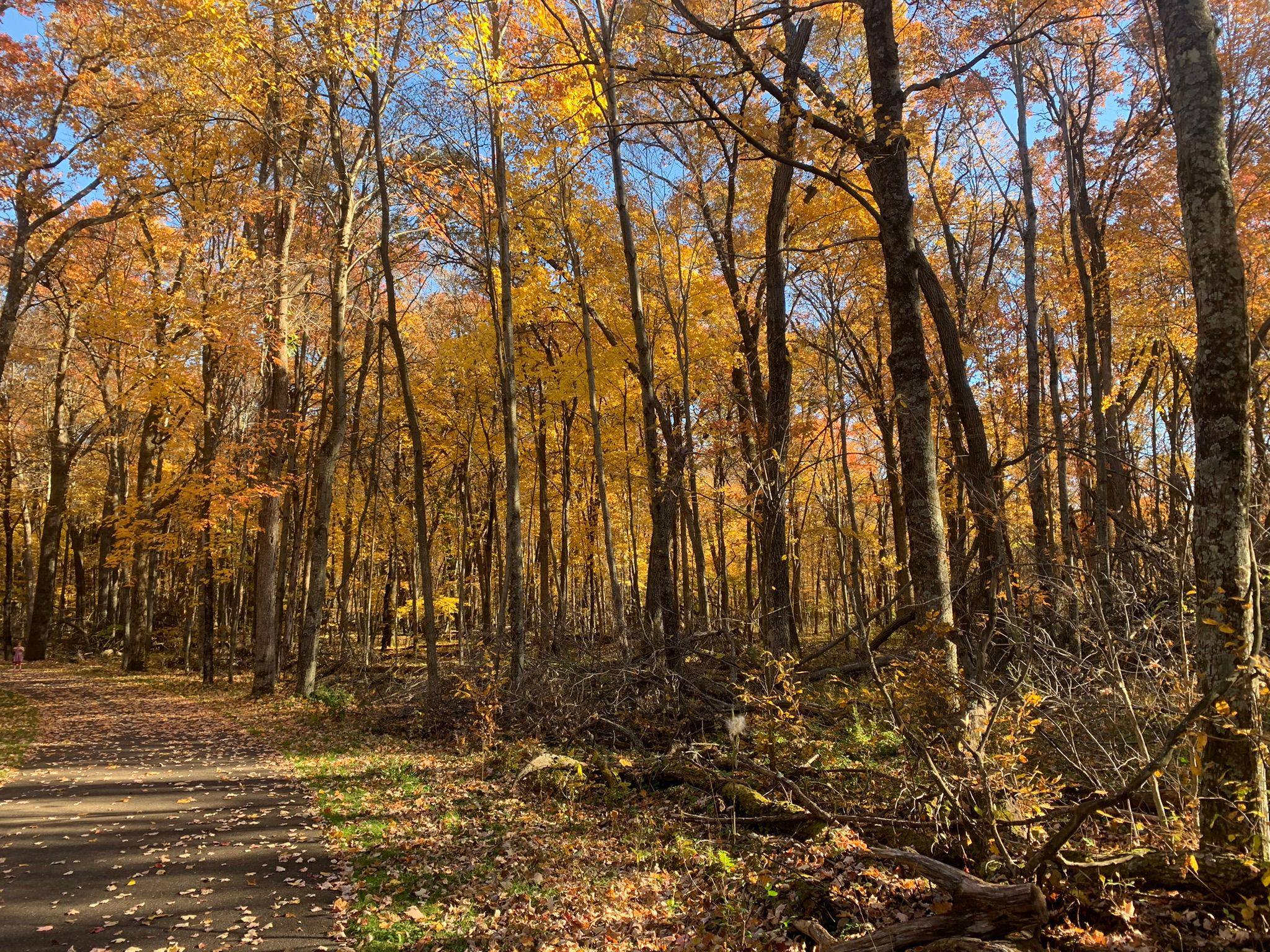
Top fall color hikes around North Branch MN

Wild River State Park, North Branch, Minnesota
There’s no better way
to experience autumn colors in the North Branch area than a
hike.

The brilliant yellows, oranges and red of maples to the scarlet
and russets of oaks...
the crisp, fresh autumn air and the last warm rays of sunlight before winter arrives...the crunch of fallen leaves and acorns beneath your boots...stopping to enjoy a warm mug of apple cider or a caramel apple pulled from your backpack – it all calls for an afternoon on the trail.

Fortunately, there are plenty of great autumn trails around North Branch to hike. Some are right out your back door, while some are a day trip that you can do in an afternoon.

Wild River State Park (North Branch)
Silver maple and basswood flourish along the St. Croix River at Wild River State Park. The 1.5-mile River Terrace Loop and its stem trail circles through a bottomland forest in this popular park. Originally called St. Croix Wild River State Park – and it still appears on various maps that way – it’s now just Wild River State Park. From North Branch, take Minn. Hwy. 95 to County Road 12. Drive County Road 12 to the park entrance, and follow the main park road to a parking lot near the picnic area.
***
Autumn colors abound in the floodplain forest at Wild River State Park. The 4.6-mile Sunrise Loop in the park’s north side is little used and so offers lots of solitude as it runs along the St. Croix River. Silver maple, ash, black willow and cottonwood all thrive there. From North Branch, take Minn. Hwy. 95 east/south. Turn left/north on County Road 9, taking it into the hamlet of Sunrise; from there, turn right/north on Ferry Road into the park. When the road runs out, use the parking lot on the left/west. Hike Ferry Road south to the trailhead and cross Ferry Road (which leads to the boat landing) then over the Sunrise River footbridge. On the other side of the bridge, the loop begins.

Minnesota Interstate State Park (Taylors Falls)
The southernmost section of Minnesota Interstate State Park offers a number of great day hiking trails to explore the Dalles of the St. Croix. To reach the area, from U.S. Hwy. 8 in Taylors Falls, turn east onto Milltown Road. A parking lot is at the end of the entry road. Along the parking lot’s northwest side are three trailheads. The Sandstone Bluff Trail heads northwest under Hwy. 8 to a nice vista of the valley and river gorge below. A 1-mile lollipop trail, it’s spectacular in autumn with a mix of colors from the orange maples, red sumac and brilliant yellow oaks.

Swedish Immigrant Trail (Shafer)
Hikers can follow some of the same footpaths and rail lines that the region’s first Swedish immigrants used to settle Chisago County and Minnesota on the Swedish Immigrant Trail. During the late 1800s, many Swedish immigrants took the ferry across the St. Croix River and then footpaths to their destinations. A spur off the St. Paul-Duluth rail route to Wyoming opened during 1880, helping speed the immigration inland. Perhaps the best of the trail’s completed portions is the Shafer Segment, which runs roughly west of the hamlet through wooded areas and past bucolic landscapes. Birch trees dominate in some sections, but the trail is mainly lined by mixed hardwoods that leave the path and its grass shoulders covered in an array of colorful leaves during autumn. Park on the street in downtown Shafer, off of Redwing Avenue near 303rd Street. The trailhead is near 303rd and heads for about two miles east of Redwing. Look for the white signs with the trail logo in the blue and yellow colors of Sweden’s flag.

Wisconsin Interstate State Park (St. Croix Falls, Wis.)
The splendor of fall colors combines with a vista of the St. Croix River and fascinating rock formations on the Summit Rock Trail at Wisconsin Interstate State Park. The 1-mile round trip trail heads to a bluff’s highest point. Moss and autumn leaves cover the surrounding rock and ground while maples, basswood and eastern white pines line the trail. At the top, prickly pear cactus can be spotted amid the outcroppings. The highlight of the hike without question is the incredible view of the riverway from the summit. Looking north, the Old Man of the Dalles rock formation is visible. From St. Croix Falls, take Wis. Hwy. 35 south. Turn right/west into the park and follow the entry road to the parking lot across from the Lake O’ the Dalles.

St. Croix National Scenic Riverway (Osceola, Wis.)

Fantastic river views beneath a colorful forest canopy await hikers on the this pair of trails near Osceola. Not to be confused with Ridgeview Trail at the adjacent Osceola Bedrock Glades State Natural Area, this pair of trails actually are two loops that only locals really know about. They run through the St. Croix National Scenic Riverway and the Osceola State Fish Hatchery on a bluff overlooking a St. Croix River back channel. The oranges and reds of maples dominate here with the occasional pine grove.

Big Marine Park Reserve (Forest Lake)
Hikers can enjoy a walk through a woodlands and on long pier at Big Marine Park Reserve. The unnamed trail in the Washington County park runs 0.75 miles round-trip. The turf trail leaves from the park’s western side, entering a deciduous forest, which makes for a colorful walk among yellow, orange, red, russet and olive leaves in autumn. From Forest Lake, take Minn. Hwy. 97 east. Turn left/south onto County Road 15/Morning Trail North. The park entry road (aka Lomond Trail North) is on the left/east. When the entry road splits, go straight/west, following it to the last/northernmost parking lot (the road loops back onto itself at the lot).


Wednesday, April 20, 2016

Minn.’s Washington County delivers on trails

Sandstone formations along the St. Croix River at historic Boom Site.
Located along the St. Croix National Scenic Riverway, Minnesota’s Washington County offers a number of great day hiking experiences.

Along the St. Croix River, the county boasts two state parks, including Afton on scenic Lake St. Croix and William O’Brien near Marine on St. Croix. Both parks include river access and trails heading through woodlands and restored prairies.

Also on the river or within viewing distance of it are the Carpenter Nature Center (which boasts apple orchards), St. Croix Bluffs Regional Park, and Belwin Conservancy (which includes a raised platform for watching a small buffalo herd). In the scenic riverway itself is four-story Fairy Falls and the historic Boom Site with its sandstone formations, both just north of Stillwater.

Inland, several county parks deliver impressive hiking opportunities. Most notable among them are Cottage Grove Ravine Regional Park, Lake Elmo Park Reserve, and Big Marine Park Reserve. The latter heads around lakes.

All the parks are within an hour’s drive of most of the Minneapolis-St. Paul metro area and west-central Wisconsin.

Learn more about nearby day hiking trails in my Day Hiking Trails of St. Croix County guidebook.


Friday, December 18, 2015

Hat trick of trails run near Minn. river landing

American bald eagles nest at several sites along the St Croix River near
Stevens Creek Landing in Minnesota.

Stevens Creek routes located in scenic riverway


Primitive trails cutting through riverside woodlands await day hikers on the Stevens Creek Landing Trails northeast of Rush City, Minn.

Three unmarked and unnamed trails generally are maintained near the boat launch. Each path often just consists of mowed grass, so be sure to wear pants, a long-sleeved shirt, and bug spray.

Wide and slow river
The landing is located on the Chisago/Pine County line. To reach it, from Rush City take County Road 5 east; upon entering the St. Croix National Scenic Riverway, the road turns north. Go right/north onto County Road 3 then right/east onto County Road 52 (aka River Road/Macy Lane) to the landing.

Early summer marks a good time to hike the trails, as by then the St. Croix River runs wide and slow with most flooding having receded. From the landing, you’ll spot a series of small series of rapids north of the landing with Stevens Creek spilling into the river to the south.

The landing can be busy at times as the St. Croix River through this stretch sports a sand and gravel bottom, making for excellent smallmouth bass fishing. In addition, there’s a campground south of the site.

Red pines are prominent here, as are bald eagles. Several nesting sites can be found in this section of the river, so keep an eye to the sky for the noble raptors.

Trail options
Three different trails can be found near the landing.

A half-mile round trip trail runs from County Road 52 (aka River Road/Macy Lane) a few hundred feet west of the boat landing’s parking lot. The trail heads through woodland to the river.

Another trail loops north from the landing’s parking lot through and at the edge of woodlands for 0.6 miles.

A third loop heads from the parking lot’s southeast corner, mostly edging a woodland for about 0.4 miles.

Read more about day hiking the scenic riverway in my guidebook Hittin’ the Trail: Day Hiking the St. Croix National Scenic Riverway.


Monday, June 29, 2015

Video of Minnesota’s Boom Site Trail

Day hikers can enjoy fascinating sandstone bluff formations at the St. Croix Boom Site Trail north of Stillwater, Minn.

The St. Croix Boom Site Trail runs a mere 0.4 miles round trip but makes for a scenic afternoon diversion. It’s located in the St. Croix National Scenic Riverway.

The Cambrian-era sandstone formed around 485 million years old when this part of the world sat under a shallow, tropical sea. Flashfloods from melting glaciers swept through the area carved out the cliffs and river valley a mere 10,000 years ago.

Here’s a video of some of the sandstone formations taken along the trail:


To reach the trail, from downtown Stillwater drive north on Minn. Hwy. 95. Watch for the signs; after Pawnee Avenue North, there’s a turnoff for the Boom Site on the right/east. Park in the looping access road. The trailhead is south of the lot’s access road. The Boom Site is a brief 50-foot walk down a staircase to a beach.

Article describing trail
Photo album of trail

Learn about trail guidebooks available in the Hittin’ the Trail series.


Wednesday, May 27, 2015

Great trails await hikers in Washburn County

Wild River Trail north of Minong, Wis.
Located in Wisconsin’s northwest corner, Washburn County is an outdoor recreational paradise. During summers, bicyclists and off-road vehicle enthusiasts ply a number of wooded trails while fishermen and canoeists try their hand at their sport on freshwater lakes and a nationally protected riverway. Come autumn, the roads turn busy with drivers out to enjoy the colorful blaze of autumn leaves. Throughout winter, cross-country skiers, snowshoers and snowmobilers sail across white paths while ice fishing shacks pop up on frozen lakes. And, of course, day and backcountry hikers alike enjoy the county’s hundreds of miles of trails, some routes well-groomed and others primitive, but all rambling through fabulous scenery.

Three major attractions stand out for day and backcountry hikers in Washburn County. Across much of the county’s southern section, the 1200-mile Ice Age National Scenic Trail winds its way toward its western and northern terminus, loosely marking the edge of where glaciers once stood more than 10,000 years ago during the last ice age. Cutting north to south through the county is the Wild River Trail, which follows an abandoned rail line between the city of Rice Lake to the south and the port city of Superior to the north. Finally, splitting the county almost in half, the St. Croix National Scenic Riverway curves from the Namekagon’s headwaters to the northeast toward a meeting with the great St. Croix River to the west.

Among the best day hiking trails in Washburn County to hit include:
St. Croix National Scenic Riverway
Trego Lake Trail
Trego Nature Trail
Ice Age National Scenic Trail
Cumberland segment
Wild River Trail
Spooner segment
Others
Tuscobia State Trail
Bear Trail (Hunt Hill Audubon Sanctuary)

Learn more about these and other nearby trails in Day Hiking Trails of Washburn County.


Wednesday, May 6, 2015

‘Hikes’ author presenting St. Croix River Valley’s best birding trails

Where’s the best place in the St Croix Valley to see eagles soar within a few feet of you? To hear songbirds sing a sweet soundtrack as you walk through the woods? To spot pheasants, turkeys and other game birds?

I’ll tell about those and several other locales during “Best Bird Trails of the St Croix River Valley,” an hour-long presentation on Thursday, May 14, at Chapter2Books in Hudson, Wis.

Each of the trails will be pulled from my bestselling book, Hittin’ the Trail: Day Hiking Trails of the St. Croix National Scenic Riverway, and most are within an hour’s drive of Hudson. Copies of the book and my other hiking titles are available for purchase at Chapter2Books.

The presentation starts at 7 p.m. Chapter2Books is located at 226 Locust St. in historic downtown Hudson.

Learn about trail guidebooks available in the Hittin’ the Trail series.


Wednesday, January 28, 2015

Minnesota trails explore St. Croix riverway

Stevens Creek Landing. Photo courtesy of MN DNR.
Trails near old ferry crossings, through a forest of red and white pines, and along a clean blue river await day hikers in the Rush City, Minn., area.

The small town is easy to reach from Minnesota’s two largest metro areas. Rush City sits off of Interstate 35 about midway between Minneapolis-St. Paul and Duluth-Superior. Only a few miles to the east of Rush City is the St. Croix National Scenic Riverway.

Among the great trails in the Rush City region are:
g Old Railroad Bridge Landing Trail – A short trail runs near this boat landing at river mile marker S82.0, just off of Bridge Trail, east of County Road 5 in the scenic riverway. The trail near the St. Croix River is a great spot for a picnic.
g Stevens Creek Landing Trail – A half-mile round trip trail runs from County Road 52 (aka River Road/Macy Lane) west of the boat landing on the St. Croix River. The trail heads through woodland in the scenic riverway to the St. Croix.
g Sandrock Cliffs Trail – Across the river in Wisconsin’s Governor Knowles State Forest, up to five miles of bluff-top trails can do be done in various combinations. A three-mile loop of the trail heads through a forest of red and white pines while river views wow hikers.
g Wood River Interpretive Trail – The 0.8-mile trail in Governor Knowles State Forest runs from the St. Croix Campground to near the Wood River, a tributary of the St. Croix. Reach the trailhead by taking River Road south of Wis. Hwy. 70 to the campground.

Read more about day hiking Northeast Minnesota in my Headin’ to the Cabin: Day Hiking Trails of Northeast Minnesota guidebook.


Monday, November 24, 2014

Author releases day hiking guidebook to Sawyer County, Wis.

The first in a pair of new hiking guidebooks I’m releasing this holiday season is now available. Day Hiking Trails of Sawyer County describes more than a hundred trails in Sawyer County, which sits in the heart of the Wisconsin Northwoods. A popular tourist destination, Sawyer County is host to the annual American Birkebeiner, the largest cross-country ski race in North America. Trails in the St. Croix National Scenic Riverway, the Chequamegon National Forest, and the Flambeau River State Forest can be found in the volume. The book marks the seventh title in the popular and bestselling “Hittin’ the Trail” hiking guide series. It is available for purchase online.

Learn about trail guidebooks available in the Hittin’ the Trail series.


Tuesday, September 30, 2014

Four-story waterfall awaits day hikers

Silver Creek flows over rim of Fairy Falls.

Short hike heads to historic Fairy Falls near Stillwater


NOTE: Due to COVID-19, Fairy Falls is closed. For updates on the closure and others in the St. Croix National National Scenic Riverway, please visit the National Park service website or call the St. Croix River Visitor Center at 715-483-2274.

Day hikers can enjoy a little-known four-story waterfall in eastern Minnesota on the Fairy Falls Trail.

For years, the short quarter-mile round trip was located on private land but is now operated by National Park Service as part of a 55-acre addition to the St. Croix National Scenic Riverway. The Fairy Falls Day Use Area is open 8 a.m.–8 p.m. daily.

To reach the falls, from downtown Stillwater, take Minn. Hwy. 95 north. Turn left/northwest onto Minn. Hwy. 96 then right/north onto County Road 11/Boom Road. The county road separates from Boom Road and goes left/west and becomes Fairy Falls Road North as heading up a hill. Park along the west side of Orwell Avenue, which is directly across from the day use area. The trailhead is a footpath to the right of the yellow directional sign.
Topo map of Fairy Falls Trail.
Click for larger version.

The footpath heads through a hardwood forest with a number of birch trees. Be careful of not taking narrow sidepaths that meander through the woods away from the falls.

Within about 0.1 miles, the trail reaches the top of the falls, where Silver Creek drops into a deep pool in the gorge below then continues on its way to the St. Croix River. A wooden bridge crosses the creek about a dozen feet from the waterfalls’ rim.

The trail can be followed around the gorge’s rim, but unless late in fall or early in spring when the foliage is light, the glen isn’t visible below. Still, it’s a pleasant walk with a few glacial erratics along the way.

Spur trail to gorge bottom
You can take a spur trail, tucked against one gorge wall, down to the creek bottom. There are no signs indicating the way to go, but it looks more like a washed out draw than a walking path. Still, it’s traversable, though you shouldn’t try it during night, if the ground is wet, or when with young children. The fall is a long way down.

The bluff sits atop sandstone laid here about 500 million years old during the Cambrian. Floodwaters from melting glaciers swept through the river valley some 8000 years ago at the end of the last ice age, carving out the sandstone, which Silver Creek has further eroded back. Today, the thick beds exposed along the river are known as the “St. Croixian series.”

During spring when Silver Creek is higher due to snow melt, those who hike down the bluff’s side can feel mist from the falls. There’s a shallow cave behind the base of the falls, and if you don’t mind getting wet, you can go into it and see the waterfall from the inside.

By early summer, the gorge is thick with greenery. During autumn, look for Jack in the Pulpit; the bright orange berries that lie under the pulpit add another tinge of color to the scene.

Shadow of the falls
During spring and autumn, Silver Creek can be hiked a ways downstream. From the falls, the creek flows about a quarter mile before spilling into the St. Croix.

In days past, the falls flowed heavily through the summer. By the early 1950s, it fell off during late summer, as the lake feeding Silver Creek dried to a wetlands.

The falls and glen – which Native Americans living in the area called Ugua-Wah-to-gi-di-big, or “shadow of the falls” – were popular with local in the 1890s through the early 1900s when hundreds of people would walk there from Stillwater to pick pink crocuses and violets as well as to enjoy picnics. Postcards even were made of the falls.

After the hike, you can add to your day by driving on Hwy. 95 north of County Road 11 to the St. Croix Boom Site Trail, which is a few hundred feet up the highway on the right/east side.

Read more about day hiking the scenic riverway in my guidebook Hittin’ the Trail: Day Hiking the St. Croix National Scenic Riverway.


Friday, August 1, 2014

Five kid-friendly activities in St. Croix NSR

A number of adventures await kids in the
St. Croix National Scenic Riverway.
Photo courtesy of NPS.
Children will love time spent in the St. Croix National Scenic Riverway, where they can participate in a number of cool adventures:
g Become a Junior Ranger – Kids can earn a patch and partake in a swearing-in ceremony after completing an activity booklet and program at the riverway’s visitor centers.
g Complete a geological obstacle course – Clambering over ancient rock, fitting through The Squeeze formation, and gazing into seemingly bottomless potholes await at Minnesota Interstate State Park in Taylors Falls, Minn.
g Take a swim – Swimming beaches abound in the pristine St. Croix River. Afton State Park near Afton, Minn., and Point Douglas Park at Prescott, Wis., are two popular summer beaches.
g Stand in a fire tower – Children can go to the top of an observation tower looming 100 feet above the Kettle River, a tributary of the St. Croix River, at Minnesota’s St Croix State Park.
g Pretend to be a giant – Kids can walk across a large aerial photo of the riverway that covers several yards of the St. Croix River Visitor Center in St. Croix Falls, Wis.

Read more about day hiking the scenic riverway in my guidebook Hittin’ the Trail: Day Hiking the St. Croix National Scenic Riverway.


Thursday, July 3, 2014

Easy to reach St. Croix National Scenic Riverway offers diversity of day hiking trails

St. Croix River shoreline near campsites north of Danbury, Wis.

Adventure awaits
in nat. park unit


A quick travel quiz: Name the national park unit where you can lean against 200-year-old trees, feel the splash of a hidden waterfall, retrace the steps of historic portages, watch bald eagle families soar overhead, walk across billion-year-old rock, and pick apples as autumn leaves turn red and golden.

Yosemite National Park? Nope. Yellowstone? Nuh-uh. Cuyahoga Valley? Sorry, still wrong.

The correct answer: The St. Croix National Scenic Riverway.

Covering more than 250 miles of shoreline, the National Park Service unit straddles the Minnesota-Wisconsin border and includes both the St. Croix and Namekagon rivers. Seven state parks and several state forests, county parks, and nature centers are in the scenic riverway.

Just a few hours’ drive at most for anyone living in Minnesota, Wisconsin, northern Illinois, Iowa, and Michigan’s Upper Peninsula, the scenic riverway’s proximity to the Minneapolis-St. Paul International Airport makes it easier to reach than most national parks. Indeed, the scenic riverway outperforms more than half of all national parks in attendance.

200-year-old trees
Last year, I spent six months hiking 40-plus trails in the riverway as researching my latest book, “Hittin’ the Trail: Day Hiking the St. Croix National Scenic Riverway.” I initially expected to find that every trail was the same: a path through a Northwoods forest with river views. Was I ever wrong.

The St. Croix River begins north of Solon Springs, Wis., where the Bois Brule-St. Croix River Historic Portage Trail runs 4.4-miles round trip. The trail is the same route crossed centuries ago by Daniel Greysolon Sieur duLhut, a French explorer who opened the way for fur traders in the 1680s.

South of there, the St. Croix meets its main tributary, the 101-mile Namekagon River. A plethora of great day hiking trails wind alongside the Namekagon. The Wild Rivers Trail, in Trego, Wis., crosses the waterway on an old railroad bridge near the park service’s Namekagon Visitor Center.

A few miles below the St. Croix-Namekagon confluence is Governor Knowles State Forest. There the Cedar Interpretive Trail heads through a grove of stately eastern white cedar. The cedars that are a foot in diameter were mere saplings during the War of 1812.

Old Man of the Dalles
At Wisconsin Interstate State Park, the Summit Rock Trail climbs to a scenic overlook of the St. Croix River and the Old Man of the Dalles rock formation, which looks like an elderly man’s face. The trail crosses volcanic rock from 1.1 billion year-old lava flows. Families of bald eagles families searching for a meal in the river glide about the summit, sometimes coming within a few feet of hikers.

In nearby St. Croix Falls, Wis., the St. Croix River Visitor Center boasts a 500-gallon aquarium and presents an award-winning film about the riverway. Events featuring authors and artists often are held there.

Day hikers can walk alongside the multi-level Willow River Falls at Willow River State Park east of Hudson, Wis. The rock on the gorge walls’ lowest levels is about 600 million years old.

Apple picking during autumn highlights the stop at the privately-run Carpenter Nature Center. The center sits on the Minnesota side of the riverway close to where the St. Croix flows into the Mississippi River.

Read more about day hiking the scenic riverway in my guidebook Hittin’ the Trail: Day Hiking the St. Croix National Scenic Riverway.


Sunday, June 15, 2014

St. Croix riverway abundant with day trails

St. Croix River south of St. Croix Falls, Wis.

National Park unit
includes 252 miles
of scenic shore


With the quiltwork of state parks, forests, and natural areas, county parks and other historical sites in the St. Croix National Scenic Riverway, attractions abound – swimming beaches, boat ramps, campgrounds, shopping in historic towns, ski trails, and more. Well over 70 day hiking trails can be found along the two rivers.

Scenic riverway’s location
From south to north, the scenic riverway begins in Prescott, Wis., where the St. Croix River meets the Mississippi River. This wide stretch of the St. Croix often is referred to as Lake St. Croix, which sports two state parks. At Afton, Minn., and Hudson, Wis., the Interstate 94 bridge handles the greatest amount of vehicle traffic over the river. From there, Willow River State Park sits on a tributary to the St. Croix in what is Lake St. Croix’s most populous stretch, with the cities of Bayport, Oak Park Heights and Stillwater on the Minnesota side and Hudson and North Hudson on the Wisconsin side.

North of Stillwater, the population falls off greatly, with William O’Brien State Park in Minnesota sometimes outpacing the census of the neighboring town, Marine on St. Croix. Then another cluster of villages appears – Osceola, Dresser and St. Croix Falls on the Wisconsin side and Taylors Falls in Minnesota. There the twin jewels of Minnesota and Wisconsin Interstate State Parks straddles the St. Croix O’ the Dalles, a beautiful gorge that the river flows through.

North of this region, the river bulges westward, with a state park in Minnesota and several state forests and state natural areas on both sides, before curving eastward to Danbury, Wis. A few miles north of town, the river ceases to be the state border as it heads northeast, taking in the Namekagon, and then coming to the Saint Croix Flowage near Gordon, Wis. The scenic riverway ends at the dam creating the lake.

West of the flowage, the St. Croix continues northward as a narrow waterway to its headwaters at Upper St. Croix Lake. In all, it’s a 169-mile journey.

The St. Croix’s largest tributary, the Namekagon, meanders for 101 miles, crossing four Wisconsin counties. It’s a major recreational area, with a number of boat landings and campsites, especially in Sawyer and Washburn counties.

From west to east, the Namekagon dips south to Trego, Wis., before heading northeast through Hayward, Wis. Its headwaters are at Namakagon Lake in the Chequamegon National Forest. The tributary runs 101 miles.

Attractions
The National Park Service operates two visitor centers in the riverway. The St. Croix River Visitor Center is in downtown St. Croix Falls and open from mid-April to Oct. 27. It boasts a 500-gallon freshwater aquarium. The Namekagon River Visitor Center is a mile east of Trego and open from Memorial Day Weekend through Labor Day. Hours for both visitor centers are 9 a.m. to 5 p.m. daily.

Major parks, nature centers, and public forests on or near the scenic riverway (from south to north and west to east) include:
g Carpenter St. Croix Valley Nature Center (Hastings, Minn.)
g St. Croix Bluffs Regional Park (Hastings)
g Kinnickinnic State Park (Prescott)
g Afton State Park (Afton)
g Willow River State Park (Hudson)
g William O’Brien State Park (Marine on St. Croix)
g Osceola Bedrock Glades State Natural Area (Osceola)
g Wisconsin Interstate State Park (St. Croix Falls)
g Minnesota Interstate State Park (Taylors Falls)
g Wild River State Park (North Brach, Minn.)
g Governor Knowles State Forest (Grantsburg, Wis.)
g Chengwatana State Forest (Beroun, Minn.)
g St. Croix State Park (Hinckley, Minn.)
g St. Croix State Forest (Sandstone, Minn.)
g Brule River State Forest (Solon Springs, Wis.)
g Chequamegon National Forest (Cable, Wis.)

Read more about day hiking the scenic riverway in my guidebook Hittin’ the Trail: Day Hiking the St. Croix National Scenic Riverway.


Thursday, May 15, 2014

Hayward, Wis., trails cross scenic riverway

Three trails to the scenic Namekagon River await day hikers in Sawyer County, Wis.

The trails, each of them in the St. Croix National Scenic Riverway, include:
g Namekagon-Laccourt Oreilles Portage Trail – An easy, 0.8-mile loop through a second growth forest of mixed hardwoods and pines, the trail memorializes a famous 18th century route where fur traders and explorers carried their canoes between rivers. The trailhead is at a parking lot on the first left/west off of Rolf Road past the Rainbow Road intersection.
g Pacwawong Lake Trail – Less a walking path than a jeep trail for boat ramp access to Pacwawong Lake, this 0.4-mile round trip is remote enough that there won’t be much if any traffic. From Cable Sunset/Totalatic Road, head south on Mossback Road, taking the first left/east; park in the gravel lot at the boat ramp and walk back to the road.
g Timber Lawn Trail – The 1.2-mile round trip southwest of Hayward runs through a woods to an overlook of the Namekagon’s north shore. From Old 24/Nursery Road (which parallels U.S. Hwy. 63), take Timber Lawn Road south until it becomes a jeep trail, where you can park. You can make it a loop from the overlook by taking the jeep trail that heads north back to your vehicle.

Read more about day hiking the scenic riverway in my guidebook Hittin’ the Trail: Day Hiking the St. Croix National Scenic Riverway.


Saturday, May 10, 2014

Kid-friendly activities abound in Midwest's popular St. Croix National Scenic Riverway

Interactive exhibits at the Visitor Centers provide
discovery for all ages. Photo courtesy St. Croix
National Scenic Riverway NPS.
Outdoors activities for kids can be found aplenty throughout the St. Croix National Scenic Riverway. By participating, you’ll find your children not only come away with great memories but also learn something about nature.

The National Park Service offers the Junior Ranger program, which includes the reward of a St. Croix National Scenic Riverway Junior Ranger patch. To receive a patch, kids must complete a 10-page booklet, available at either visitor center or online, and then successfully demonstrate to a ranger how to put on a life preserver. After a swearing-in ceremony, children receive a certificate and pin along with the patch.

State parks in both Minnesota and Wisconsin also offer a variety of programs for children.

Minnesota programs include:
g Junior Park Naturalist patches/certificates – Download from online a nature activity booklet about pinelands, prairies or hardwoods; when children complete them, they can attend a program at the park and receive a free patch and certificate.
g Park Explorer patches – Kids who’ve completed the Junior Park naturalist program can purchase activity books about nature, history and the earth at the park gift store. Completing the activity book earns the child a Park Explorer patch.
g Project Learning Tree – A number of nature-oriented family games and puzzles are available online via the Minnesota DNR. Volunteers and park rangers sometimes offer nature programs at park visitor centers as well.

Wisconsin state parks offer:
g Wisconsin Wildcards – Kids can collect pocket-sized cards that tell about native species, dangerous plants, and unique spots.
g Wisconsin Explorer patches – Booklets can be downloaded from online that children complete when they visit a park or hike a trail. They then can receive patches for completing the book.
g Special programs – Rangers and volunteers at many parks often offer programs ranging from meeting animals to stargazing at night, from campfire stories to scavenger hunts.

Be sure to check out each state’s park system online (Minnesota; Wisconsin) for a full list of activities on the dates you’re visiting.

Read more about day hiking the scenic riverway in my guidebook Hittin’ the Trail: Day Hiking the St. Croix National Scenic Riverway.


Sunday, April 20, 2014

St. Croix riverway offers plethora of trails

Namekagon River at Groats Landing near Hayward, Wis.

National Park unit includes
two Midwestern waterways


Imagine a land where you can walk alongside crystal blue rivers or over billion-year-old black rock, where you can lean against 200-year-old trees or feel the splash of rustic waterfalls, where you can retrace the steps of historic portages or watch families of bald eagles soar overhead. Such a land not only exists, it has been preserved for all to enjoy. It’s called the St. Croix National Scenic Riverway.

The scenic riverway includes most of the St. Croix and all of the Namekagon rivers along the Minnesota-Wisconsin border and in the latter state’s northwoods. While the National Park Service runs the scenic riverway, a patchwork of state and county parks, nonprofit nature centers, and state forests combine to protect 252 miles of the St. Croix and Namekagon.

Half-million visitors annually
Today, a whole variety of recreational activities, from camping and fishing to canoeing and day hiking, are possible in the scenic riverway. It’s a few hours’ drive at most for anyone living in Minnesota, Wisconsin, northern Illinois and Iowa, and Michigan’s Upper Peninsula – and with its proximity to the Minneapolis-St. Paul International Airport an easier destination to reach than most national parks.

Indeed, 520,000 people annually visit the scenic riverway, outperforming more than half of all national parks in attendance.

The scenic riverway wouldn’t exist at all if not for a major geological event dating some 1.1 billion years ago. At that time, massive lava flows covered this part of the world. This basalt now forms the strong bedrock of the St. Croix River gorge, the surrounding landscape, and nearby Lake Superior.

The sandstone above the basalt began forming some 515 million years ago when this region sat under a warm shallow sea near the equator. As sediments piled up and were covered over the eons, they hardened into rock; the landscape finally rose above the sea about 345 million years ago.

Then about 10,000 years ago at the end of the last ice age, a glacial torrent swept through the area when ancient Lake Duluth drained south. This flood carved the St. Croix River valley and left many intriguing cliff formations.

Protected since 1960s
Since the last ice age, Native Americans have used the St. Croix and Namekagon for trade and travel. When European explorers and fur traders arrived during the late 1600s, they mainly saw the waterways as quick routes connecting the Great Lakes to the Mississippi River; so vital was this link that by 1688 the French had established Fort St. Croix (“Fort Holy Cross”) along the St. Croix, giving the riverway its modern name.

Throughout the 1700s, the river area was hotly contested, first by Ojibwe and Dakota Indians living there and then later the French and the British.

The United States wrested control of the area from the British following the Revolutionary War but would not assert any real power over it until the 1830s when the Treaty of St. Peters was signed with the Ojibwe. This opened the area to logging, which dominated the riverways and surrounding forests for the rest of the century. Many of today’s towns along the two rivers got their start thanks to the logging industry.

During the 20th century, the economy along the rivers shifted to agriculture, but with the growth of the nearby Minneapolis-St. Paul metro area, a number of conservationists and concerned citizens feared the riverway was ripe for commercial exploitation. Their efforts led to the National Wild and Scenic Rivers Act of 1968, which protected significant portions of the St. Croix and Namekagon north of Taylors Falls, Minn.

In 1972, Congress protected the St. Croix south of Taylors Falls to Prescott, Wis., by creating the Lower St. Croix National Scenic Riverway.

Day hiking trails
There are several excellent day hiking trails in the scenic riverway, including:
g Stand atop remains of 500-million-year-old sea on Sandrock Cliffs Trail
g Pleasant walk, otter slides await kids along wild river in northwoods
g Hiking trail leads to delta of St. Croix River’s largest tributary
g Burkhardt Trail takes kids along river to impressive falls in Wisconsin
g Explore Wisconsin's major geological events on Summit Rock Trail

Read more about day hiking the scenic riverway in my guidebook Hittin’ the Trail: Day Hiking the St. Croix National Scenic Riverway.


Monday, March 10, 2014

Hike historical lumber baron site in Minn.

St. Croix Boom Site view of St. Croix River.
Aerial photo of St. Croix Boom Site.
Families can day hike a historical remnant from the St. Croix River’s lumber baron days north of Stillwater, Minn.

The St. Croix Boom Site Trail runs a mere 0.4 miles round trip but makes for a scenic afternoon diversion. A century-and-a-half-ago ago, the site was a bustling center of activity where men pulled logs from the St. Croix River and sent them on their way to sawmills.

To reach the trail, from downtown Stillwater drive north on Minn. Hwy. 95. Watch for the signs; after Pawnee Avenue North, there’s a turnoff for the Boom Site on the right/east. Park in the looping access road. The trailhead is south of the lot’s access road. The Boom Site is merely a 50-foot walk down a staircase to a beach.

Throughout the mid- and late-1800s, lumberjacks downed whole forests across northern Minnesota and Wisconsin, branded each log with the sawmill it was to go to, and floated the timber down the St. Croix River on its way to sawmills.

When the St. Croix Boom Company went bust upstream near Marine on St. Croix, several Stillwater lumber barons bought the business and moved it here. The boom company drew the timber from the river then sorted and delivered it to the correct sawmill in Stillwater. All through the 1870s, logs would back up some 15 miles on the river during midsummer as awaiting for the boom company to pull them out.

By the early 20th century, most Northwoods forests were gone, and the boom site ceased operation in 1914. As the economy changed and generations passed, the site was largely forgotten.

The National Park Service discovered it during a 1975 survey while identifying historical sites along the St. Croix. Today, it’s a National Historic Landmark in the St. Croix National Scenic Riverway.

At the bottom of the stairs, hikers can head up and down the pleasant beach below the sandstone bluff. The beach peters out about 600 feet downstream and heads roughly 400 feet upstream to a nice point overlooking a river island.

Learn more about nearby day hiking trails in my Day Hiking Trails of Northeast Minnesota guidebook.


Sunday, March 2, 2014

Trail leads to waterfall on ancient river gorge

Cascade Falls in Osceola, Wis.
Cascade Falls Trail
A 25-foot waterfall awaits hikers on a very short trail in the village of Osceola, Wis.

The Cascade Falls Trail runs less than a couple of hundred feet – and most of that is up and down a stairs from the street to the glen where the falls sits.

To reach the trailhead, take Wis. Hwy. 35 into Osceola. As entering downtown, the highway becomes North Cascade Street. Park anywhere downtown along the street.

Signs mark the trailhead, located on the street’s east side across from First Avenue. To reach the trail, a steep staircase that looks like it was extracted from a fire tower heads from the sidewalk to Willkie Glen.

Majestic trees shade the staircase and glen in green. You’ll be able to hear the waterfall’s roar from the sidewalk – and easily spot it once you reach the glen.

Osceola Creek drops over the natural falls as it flows westward on its way to the St. Croix River. Between the village and the river, the creek descends 100 feet in altitude, but this waterfalls is the only large drop.

The falls wouldn’t exist if not for the river. At the end of the last ice age some 10,000 years ago, floodwaters from melting glaciers carved out a large gorge. The waterfall is a one of the vertical wall cuts in that gorge. It measures 30 feet across.

The village itself might not exist if not for the falls. Osceola was settled because the falls could support industry; in the late 1800s, it powered a mill.

The smaller and narrower Geiger Falls is upstream on Osceola Creek, but there’s no hiking path between it and Cascade Falls.

The best time to hike the trail is in spring when snow melt increases the amount of water flowing over the falls. Another good time to visit: at night when the village lights up the falls using LED lighting to mimic the glow of the full moon upon the water; coloring is changed for the seasons.

A dirt footpath does lead from Cascade Falls to the St. Croix. The village has plans to improve the walkway into a more accessible trail.

In the centuries ahead, the waterfalls actually will be its own undoing – the splash of water at its base has created a kickpoint in the vertical wall that is slowly eroding and undercutting the drop, which one day will causing it to collapse. The waterfalls then will become a cascades, or series of rock steps, that the creek flows over.

Read more about day hiking the scenic riverway in my guidebook Hittin’ the Trail: Day Hiking the St. Croix National Scenic Riverway.


Sunday, February 16, 2014

Trail crosses peaceful Wis. woodlands, river

Wild Rivers Trail bridge over Namekago River.

Wild Rivers Trail segment
runs along former rail line


A tranquil stroll through the woods with a bridge view of the Namekagon River awaits day hikers on a segment of the Wild Rivers Trail in Trego, Wis.

At a little under 2.2-miles round trip, the segment is just a small portion of a trail that runs for 104 miles across three counties on an old Omaha and Soo Line Railroads rail line. The trail connects Rice Lake, Wis., in the south with Superior, Wis., to the northwest.

To pick up the trail in Trego, when U.S. Hwy. 53 enters the village from the south, turn right/east onto Oak Hill Road. Turn left/north onto Park Street. When Park Street curves west, you’ll notice a large open gravel parking lot. Leave your vehicle there. The trail runs alongside the lot’s eastern side.

Take the trail northeast. Nicely forested with typical northern hardwoods, the trail is fairly isolated from built-up areas.

This section of the trail also is part of the Ice Age National Scenic Trail. The 1200-mile Ice Age Trail essentially follows the edge of where the glacier last seen in these parts towered some 10,000 years ago.

In about a quarter mile, the trail begins to skirt the backside of the Namekagon Visitor Center grounds, which offers displays about the riverway. Unfortunately, there’s no path leading from the Wild Rivers Trail to the center; when finished with the hike, consider a drive to it (take Hwy. 53 north and turn right onto U.S. Hwy. 63), especially if children are with you.

The trail then crosses busy Hwy. 63 and in another 100 feet spans the Namekagon. From the river bridge looking west, the Namekagon breaks into a couple of back channels.

After the river, the trail re-enters the peaceful woods. You’re likely to spot white-tailed deer, rabbits, squirrels and chipmunks along the way. Songbirds are plentiful, providing a sweet soundtrack to the hike. In 0.75 miles, the trail reaches Ross Road, which is a good spot to turn back; by this point, you’ve actually left the scenic riverway.

During spring and early summer, be sure to carry insect repellent when near the river. And while the trail cuts through woodlands, it is wide and mostly open, so also be sure to don sunscreen.

Learn about nearby trails in Day Hiking Trails of Washburn County.


Sunday, February 9, 2014

Trail leads to St. Croix's largest tributary

Confluence of Namekagon (bottom picture)
and St.Croix (mid-picture) rivers. Photo
courtesy National Park Service.

Namekagon Delta Trail offers
scenic views in Wisconsin


Families can day hike to a scenic delta at the confluence of the St. Croix and Namekagon rivers on a trail in Wisconsin’s Northwoods.

A number of unnamed and non-maintained trails run near the delta in the St. Croix National Scenic Riverway. For convenience’s sake, we’ve named this 2.7-mile out-and-back trail the Namekagon Delta Trail after its primary geographic feature.

Some of the area that the trail crosses, including the confluence itself, actually is part of the Big Island State Natural Area, but the boundaries with the scenic riverway are indistinguishable.

Forking scenic riverway
Like a wishbone, the national scenic riverway splits in Burnett County. One fork – the St. Croix River – continues northward to its headwaters while the other fork – the Namekagon River – heads eastward.

To reach the trailhead, from Danbury, Wis., take Wis. Hwy. 35 north. Turn right/east onto the paved road named Springbrook Trail (If you’ve crossed the St. Croix River, you’ve just missed the turn.). Next, turn left/north onto Namekagon Point Road. The road stops at a vista of the Namekagon and St. Croix’s confluence, which sits about 94 feet below. Park off to the side of the road.

Take the jeep trail that heads to the left/northwest. It quickly descends about 90 feet to the river valley, heading through a woods to the confluence for a half-mile.

The St. Croix’s largest tributary, the Namekagon meanders for 101 miles, crossing four Wisconsin counties. It’s a major recreational area, with a number of boat landings and campsites, especially in Sawyer and Washburn counties.

Bluff line views
The Namekagon Delta includes a sandbar that doesn’t quite cut the St. Croix’s width in half, but it does narrow the flow by diminishing the latter’s depth. Only a hundred feet or so south of the delta, the St. Croix widens to the same distance as it was north of the confluence.

Heading back up the cliffside to the vista site, take the fairly flat primitive trail running southwest along the bluff line. Its trailhead is along Namekagon Point Road just south of the vista.

The bluff line stretch of the trail runs for 0.85 miles one way, offering views of the confluence and then the St. Croix River in the tree breaks. The large island in the St. Croix’s center is Big Island. Where the primitive trail reaches a jeep trail (listed on some maps as “Snowmobile Trail”) marks a good turnaround point.

During spring into late summer, mosquito repellant is a necessity at the confluence.

Read more about day hiking the scenic riverway in Hittin’ the Trail: Day Hiking the St. Croix National Scenic Riverway.


Sunday, January 19, 2014

Day hike down bluff to scenic St. Croix River

St. Croix River alongside Louise Park.

Louise, Schoen parks offer
remote hike through forest


Day hikers can ramble down a jeep trail heading from the blufftops to the St. Croix River south of its headwaters in Douglas County, Wis.

During the river’s first twenty or so miles downstream from the Saint Croix Flowage, there are few access points, though all of it is located in the St. Croix National Scenic Riverway. Two exceptions are Louise Park and Schoen Park, located roughly east of Cloverton, Minn., and west of Gordon, Wis.

Into the wilds
Schoen and Louise parks both offer a boat landing and spots to camp but not much in the way of hiking trails. However, between the two parks is a jeep trail that largely is in the scenic riverway. It’s a 0.6-mile out-and-back trail (1.2-miles round trip) that heads into the wilds of northern Wisconsin.

To reach the trailhead, from Cloverton head east on County Road 32; upon crossing the Wisconsin border, it becomes County Road T. From Gordon, take U.S. Hwy 53 south and turn right/west onto County Road T. Regardless of the direction you come, turn south onto Rocky Branch Road. After the turn off for Louise Park, take the next left/south onto an unnamed road (If you’ve passed the access road to Schoen Park, you’ve gone too far south.).

Park off of the jeep trail near the intersection. The elevation is about 1045 feet above sea level.

From there, the trail gradually descends through a hardwood forest. In autumn, it offers an array of fall leaf colors, including brilliant reds and oranges to bright yellow and pine greens.

Rocky river bed
After 0.3 miles, though, the trail becomes steeper as it crosses an intermittent stream and then nears the river bottoms at about 940 feet elevation. Notice how the trees species change, with more pines and silver maples the lower you go.

As the trail reaches the river bottom, you’ll hear the rush of water over its rocky stream bed. Boulders stick out of the shallow river in several spots along this stretch, especially about 400 feet upstream where they form a series of small rapids.

Return to the trailhead the way you came. There are no facilities on the trail.

Read more about Douglas County day hiking trails in my Day Hiking Trails of Douglas County guidebook.