Showing posts with label Wild River State Park. Show all posts

Friday, October 12, 2018

Top fall color hikes around North Branch MN

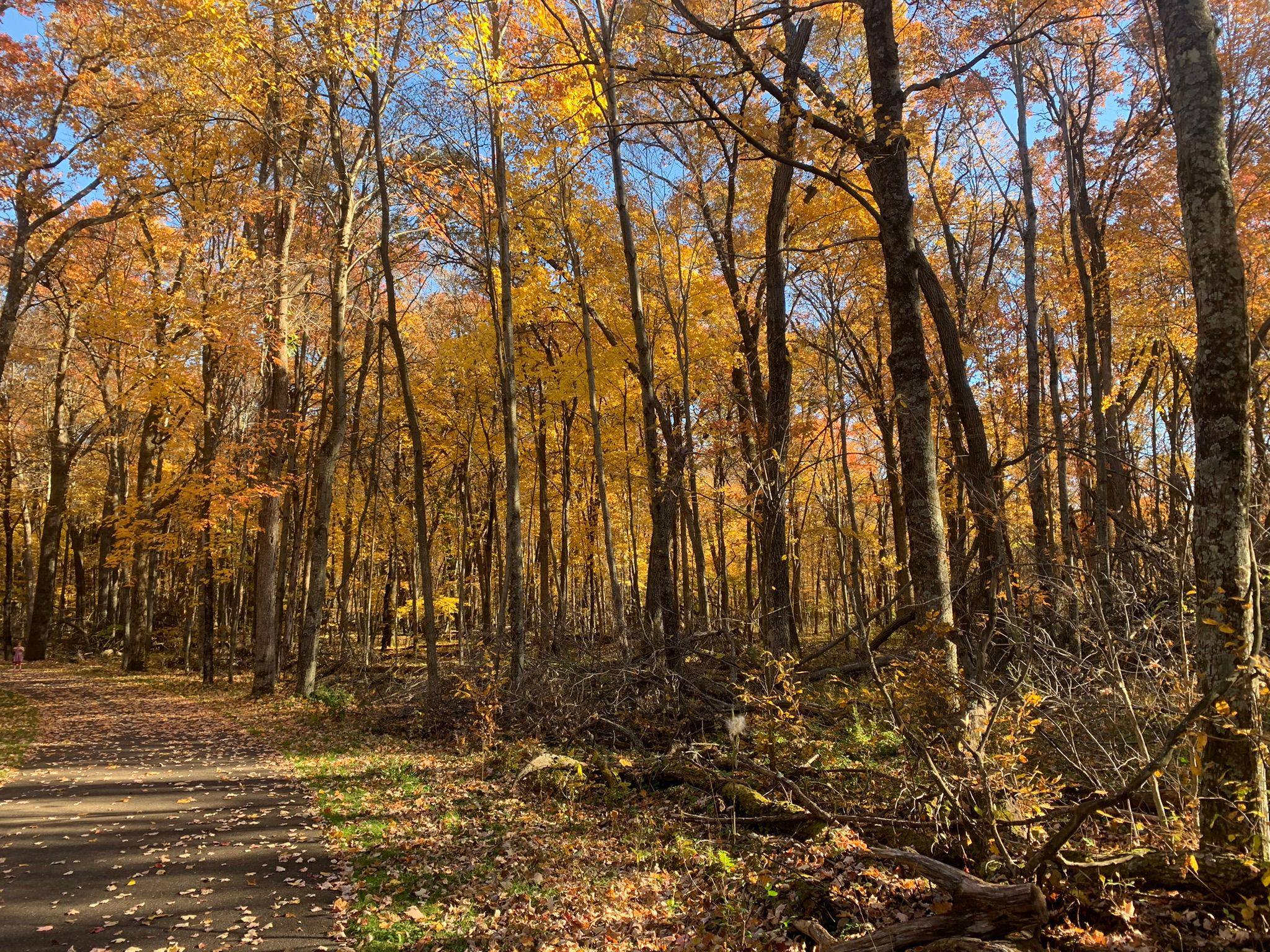
Wild River State Park, North Branch, Minnesota
There’s no better way
to experience autumn colors in the North Branch area than a
hike.

The brilliant yellows, oranges and red of maples to the scarlet
and russets of oaks...
the crisp, fresh autumn air and the last warm rays of sunlight before winter arrives...the crunch of fallen leaves and acorns beneath your boots...stopping to enjoy a warm mug of apple cider or a caramel apple pulled from your backpack – it all calls for an afternoon on the trail.

Fortunately, there are plenty of great autumn trails around North Branch to hike. Some are right out your back door, while some are a day trip that you can do in an afternoon.

Wild River State Park (North Branch)
Silver maple and basswood flourish along the St. Croix River at Wild River State Park. The 1.5-mile River Terrace Loop and its stem trail circles through a bottomland forest in this popular park. Originally called St. Croix Wild River State Park – and it still appears on various maps that way – it’s now just Wild River State Park. From North Branch, take Minn. Hwy. 95 to County Road 12. Drive County Road 12 to the park entrance, and follow the main park road to a parking lot near the picnic area.
***
Autumn colors abound in the floodplain forest at Wild River State Park. The 4.6-mile Sunrise Loop in the park’s north side is little used and so offers lots of solitude as it runs along the St. Croix River. Silver maple, ash, black willow and cottonwood all thrive there. From North Branch, take Minn. Hwy. 95 east/south. Turn left/north on County Road 9, taking it into the hamlet of Sunrise; from there, turn right/north on Ferry Road into the park. When the road runs out, use the parking lot on the left/west. Hike Ferry Road south to the trailhead and cross Ferry Road (which leads to the boat landing) then over the Sunrise River footbridge. On the other side of the bridge, the loop begins.

Minnesota Interstate State Park (Taylors Falls)
The southernmost section of Minnesota Interstate State Park offers a number of great day hiking trails to explore the Dalles of the St. Croix. To reach the area, from U.S. Hwy. 8 in Taylors Falls, turn east onto Milltown Road. A parking lot is at the end of the entry road. Along the parking lot’s northwest side are three trailheads. The Sandstone Bluff Trail heads northwest under Hwy. 8 to a nice vista of the valley and river gorge below. A 1-mile lollipop trail, it’s spectacular in autumn with a mix of colors from the orange maples, red sumac and brilliant yellow oaks.

Swedish Immigrant Trail (Shafer)
Hikers can follow some of the same footpaths and rail lines that the region’s first Swedish immigrants used to settle Chisago County and Minnesota on the Swedish Immigrant Trail. During the late 1800s, many Swedish immigrants took the ferry across the St. Croix River and then footpaths to their destinations. A spur off the St. Paul-Duluth rail route to Wyoming opened during 1880, helping speed the immigration inland. Perhaps the best of the trail’s completed portions is the Shafer Segment, which runs roughly west of the hamlet through wooded areas and past bucolic landscapes. Birch trees dominate in some sections, but the trail is mainly lined by mixed hardwoods that leave the path and its grass shoulders covered in an array of colorful leaves during autumn. Park on the street in downtown Shafer, off of Redwing Avenue near 303rd Street. The trailhead is near 303rd and heads for about two miles east of Redwing. Look for the white signs with the trail logo in the blue and yellow colors of Sweden’s flag.

Wisconsin Interstate State Park (St. Croix Falls, Wis.)
The splendor of fall colors combines with a vista of the St. Croix River and fascinating rock formations on the Summit Rock Trail at Wisconsin Interstate State Park. The 1-mile round trip trail heads to a bluff’s highest point. Moss and autumn leaves cover the surrounding rock and ground while maples, basswood and eastern white pines line the trail. At the top, prickly pear cactus can be spotted amid the outcroppings. The highlight of the hike without question is the incredible view of the riverway from the summit. Looking north, the Old Man of the Dalles rock formation is visible. From St. Croix Falls, take Wis. Hwy. 35 south. Turn right/west into the park and follow the entry road to the parking lot across from the Lake O’ the Dalles.

St. Croix National Scenic Riverway (Osceola, Wis.)

Fantastic river views beneath a colorful forest canopy await hikers on the this pair of trails near Osceola. Not to be confused with Ridgeview Trail at the adjacent Osceola Bedrock Glades State Natural Area, this pair of trails actually are two loops that only locals really know about. They run through the St. Croix National Scenic Riverway and the Osceola State Fish Hatchery on a bluff overlooking a St. Croix River back channel. The oranges and reds of maples dominate here with the occasional pine grove.

Big Marine Park Reserve (Forest Lake)
Hikers can enjoy a walk through a woodlands and on long pier at Big Marine Park Reserve. The unnamed trail in the Washington County park runs 0.75 miles round-trip. The turf trail leaves from the park’s western side, entering a deciduous forest, which makes for a colorful walk among yellow, orange, red, russet and olive leaves in autumn. From Forest Lake, take Minn. Hwy. 97 east. Turn left/south onto County Road 15/Morning Trail North. The park entry road (aka Lomond Trail North) is on the left/east. When the entry road splits, go straight/west, following it to the last/northernmost parking lot (the road loops back onto itself at the lot).


Saturday, February 20, 2016

Trail runs alongside remote section of river

Topo map of Sunrise Loop in Wild River State Park.
Sunrise Landing, courtesy of MN DNR.

Sunrise Loop cuts across nearly 5 miles of woods


Day hikers can enjoy a walk through a bottomlands forest along the St. Croix River in Minnesota's Wild River State Park.

The 4.6-mile Sunrise Loop at the park’s north is little used and so offers lots of solitude. Late summer and early fall mark the best time to hike the loop. During wet years, spring floods and mosquitoes can make the hike difficult.

To reach the trailhead, from Amelund, take Minn. Hwy. 95 north. Turn right/north on County Road 9, taking it into the hamlet of Sunrise; from there, turn right/north on Ferry Road into the park. When the road runs out, use the parking lot on the left/west. Hike Ferry Road south to the trailhead and cross Ferry Road (which leads to the boat landing) then over the Sunrise River footbridge. On the other side of the bridge, the loop begins. Go right/south onto.

Bottomland hardwood forest
The entire trail heads through a bottomland hardwood forest, sometimes referred to as a floodplain forest. For most of the year, these forests just above the river channel remain dry, but the silver maple – as well as some ash, black willow and cottonwood – can support tolerate seasonal flooding. Wild grape, Virginia creeper and other woody climbers also are common here, but there is a distinct lack of shrubs and other understory plants, which usually can’t survive the flooding.

Along the south side of the loop, the route passes an interpretive exhibit for the Arrow Line Railway. In 1907-08, a straight railroad line, which led it to be called The Arrow, was planned for the Twin Cities to Duluth. Part of the rail grade remains here. Work in the project stopped at this spot as the bridge over the St. Croix never was constructed.

The route reaches a junction with the Sunrise Trail at 2.2 miles from the trailhead. A shelter can be found at the intersection. To stay on loop, go left/north.

In short order, the trail comes alongside the St. Croix River. Northern pike, walleye, and smallmouth bass are common in the river. Wisconsin's Governor Knowles State Forest is on opposite shoreline and two islands sit in the river.

Wildlife sightings
A secluded area, the loop is a good place to spot wildlife. You’ll likely see white-tailed deer and paw prints for coyote, red fox, gray fox, and river otters. The trail also crosses a large beaver dam area. Trumpeter swans sometimes can be heard honking overhead. During the spring and autumn migrations, songbirds descend upon the forest.

You’ll know when you’re nearing the end of hike as the Sunrise Landing, where boats can be placed on the river, comes into sight.

Upon arriving back at the footbridge, go right/west, and retrace your steps back to the parking lot.

Final note: Originally called St. Croix Wild River State Park, this park still appears on various maps that way. It’s now just Wild River State Park, though.

Learn about trail guidebooks available in the Hittin’ the Trail series.


Monday, April 28, 2014

Wild River SP trails cross oak forest, prairie

Windfall Trail. Photo courtesy Minnesota DNR.
A diverse array of trails await day hikers at Minnesota's Wild River State Park.

The state park is located along the St. Croix River. Originally called St. Croix Wild River State Park – and it still appears on various maps that way – it’s now just Wild River State Park.

To reach the trail, from North Branch, Minn., take Minn. Hwy. 95 to County Road 12. Drive it to the park entrance, and follow the main park road to your trailhead’s parking lot.

Among the best day hiking trails at the state park are:
g Amador Prairie Loops – Day hikers can choose between a 1-mile or a 2-mile loop that heads through an open area of tall prairie grasses. The loops begin at the park’s Trail Center.
g Amik’s Pond Trail – Brochures for the nature trail can be picked up at its trailhead next to the visitor center. It runs one mile.
g Deer Creek Loop – Part of the pretty trail runs along the historic Old Military Road that once connected what is now the south end of the scenic riverway with Lake Superior. Including the stem trail from either the visitor center or the River Access, the trail runs 4-miles round trip.
g Mitigwaki Loop – The 1-mile loop heads through an oak woods overlooking Dry Creek. The trailhead is at the visitor center.
g Pioneer Trail – Day hikers can experience three ecosystems – on oak woods, a savanna, and a prairie – on this loop that leaves from the Trail Center. Including an access trial, the walk is 3.1-miles round trip.
g River Terrace Loop – The 1.5-mile loop and its stem trail circles through a bottomland forest. It offers views of the Old Nevers Dam site on the river.
g Windfall Trail – Like the Amik's Pond Trail, a brochure for the nature trail is located at its visitor center trailhead. It is 1-mile long.

Read more about day hiking the scenic riverway in my guidebook Hittin’ the Trail: Day Hiking the St. Croix National Scenic Riverway.


Wednesday, January 15, 2014

Discover famous old dam site on hiking loop

Nevers Dam overlook on River Terrace Loop.
Photo courtesy Minnesota DNR. 

Minnesota trail rambles
through bottomlands forest


Day hikers can learn about the power of dams while enjoying a walk along the St. Croix River on the River Terrace Loop in Minnesota's Wild River State Park.

The 1.5-mile loop and its stem trail circles through a bottomland forest in this popular park. Originally called St. Croix Wild River State Park – and it still appears on various maps that way – it's now just Wild River State Park.

Late summer and early fall mark the best time to hike the loop. During wet years, spring floods and mosquitoes can make the hike difficult.

To reach the trail, from North Branch, Minn., take Minn. Hwy. 95 to County Road 12. Drive County Road 12 to the park entrance, and follow the main park road to a parking lot near the picnic area.

The trailhead begins in the picnic area with a short 0.1-mile connector that heads 120 feet down the bluff into the bottomlands and to the loop. Upon reaching the loop, go right/east.

Old Nevers Dam site
In about 0.2 miles, you’ll reach the St. Croix River and the Old Nevers Dam site. Wooden pilings in midstream are all that remain of the dam, which at one time was among the most important in the Midwest.

During the last half of the 1800s, log jams were a regular occurrence on the St. Croix as lumber cut in northern Wisconsin and Minnesota was floated downstream to saw mills. In 1886 when an estimated l50 million feet of lumber backed up on the river, loggers dynamited the tree trunks to break open the jam.

The solution to the log jams was controlling the river flow through a dam. To that end, in 1890, the Nevers Dam opened, virtually eliminating the backups. For the next 65 years, it held the record as the world’s largest pile-driven dam.

As the lumberjacking days ended, Nevers Dam became a river control point that allowed construction of a hydroelectric power dam in St. Croix Falls, Wis., 11 miles downriver.

Spring floods in 1954 demolished Nevers Dam, however. That May, the high waters undermined the dam and washed several sections away. A wrecking crew removed what remained of the unusable dam in 1955.

Flood-tolerant trees
From the Nevers Dam site, go left/north on the trail, which parallels the river for 0.6 miles. Though wooded, during wet years this can be somewhat of a swampy area. Keep an eye out for ducks, herons and bitterns.

When the trail curves southwest and away from the river, you’ll reach another junction. The intersecting trail accesses the campground atop the bluff via 164 winding steps.

The River Terrace loop goes left/south. Camper cabins are on the bluffs about 140 feet above.

As the bottomland forest sometimes is flooded during spring, inundation-tolerant trees – including silver maple and basswood – flourish here.

In 0.5 miles, the trail reaches another junction; go left/east and then within a few feet at the next intersection, go right/south back onto the connector trail leading to the picnic area and your parking lot.

Read more about day hiking the scenic riverway in my guidebook Hittin’ the Trail: Day Hiking the St. Croix National Scenic Riverway.


Saturday, May 18, 2013

Follow pioneers on Swedish Immigrant Trail

During 1800s, rail line helped settle Minnesota interior


Day hikers can follow some of the same footpaths and rail lines that the region’s first Swedish immigrants used to settle Minnesota’s Chisago County on the Swedish Immigrant Trail.

A work in progress, plans call for constructing a 22-mile trail running roughly east-west across the county, linking Taylors Falls, Shafer, Center City, Lindstrom, Chisago City and Wyoming, ultimately meeting the Sunrise Prairie Trail. Sections already have been completed west of Shafer, between Center City and eastern Lindstrom, and from western Lindstrom to Chisago City.

Shafer Segment
During the late 1800s, many Swedish immigrants took the ferry across the St. Croix River and then footpaths to their destinations. A spur off the St. Paul-Duluth rail route to Wyoming opened during 1880, helping speed the immigration inland. Today, Lindstrom rightly proclaims itself “America’s Little Sweden” (Chisago City meanwhile appropriately calls itself the “Gateway to the Lakes,” as Chisago County is the border area between the Minneapolis-St. Paul metro area and the Minnesota Northwoods).

Perhaps the best of the trail’s completed portions is the Shafer Segment, which runs roughly west of the hamlet through wooded areas and past bucolic landscapes. Park on the street in downtown Shafer, off of Redwing Avenue near 303rd Street.

The trailhead is near 303rd and heads for about two miles east of Redwing. Look for the white signs with the trail logo in the blue and yellow colors of Sweden’s flag.

A wide, paved trail, part of the trail follows the historic railroad route, which was abandoned in 1948. Along the way, you’ll pass a pasture for a herd of privately-owned American bison.

More trail coming
Birch trees dominate in some sections, but the trail is mainly lined by mixed hardwoods that leave the path and its grass shoulders covered in an array of colorful leaves during autumn.

This demonstration segment opened in October 2007. A joint effort of the Chisago County Parks Department and the Chisago County Parks and Trails Foundation, the trail is slowly being put together as grant money is garnered, right-of-ways are negotiated, and land purchases made.

As of this posting, efforts focus on connecting the Shafer Segment to Taylors Falls in the east.

Other great trails near Lindstrom-Chisago City-Shafer include:
• Deer Creek Loop – You can hike a segment of the historic Point Douglas to Superior Military Road (aka the Old Military Road) on this three-mile loop in Wild River State Park north of Lindstrom. Access the loop via a 0.5-mile trail from the Visitor Center for a four-mile round trip.
• Ojiketa Regional Park walking trails – Several short walking trails ramble across Ojiketa Regional Park in Chisago City. Located along Green Lake, it’s the county’s newest (and now the city’s largest) park.

Read more about day hiking Northeast Minnesota in my Headin’ to the Cabin: Day Hiking Trails of Northeast Minnesota guidebook.


Wednesday, February 13, 2013

Day hike prairie grasslands at Wild River

Big bluestem grows in the Amador Prairie.

Trail loops in restored meadow


The Northwoods is far more diverse than fragrant pine trees and picturesque lakes. At Wild River State Park, hikers can enjoy some of that variety by taking one of two loops through a restored prairie.

Wild River State Park rests upon the St. Croix River in Chisago County and features an all-season trail center. The Amador Prairie Loops start at the trail center.

Autumn wildflowers
A mild summer day is best for the hike because the trail is open to sun. A warm fall afternoon also is pleasant; in mid-September, asters and goldenrods usually peak, a pretty sight against the tall grasses’ reds.

To reach Wild River, from Amelund take Minn. Hwy. 12 (aka Park Road) east into the park. Past the service road, turn at the first left to the trail center.

Park at the center. At the trailhead, go clockwise, or left/north.

Either loop ranks easy on the difficulty level as they meander through open grassland of big bluestem and Indian grasses with islands of oak savannah. The smaller of the two loops runs for a mile and forms part of the longer trail, which is 2.1 miles long.

Almost extinct
From the trailhead, the path curves northwest for 0.2 miles, where it joins the route to the equestrian trailhead. At that intersection, turn right/north.

A few decades ago, this prairie area almost ceased to exist as farmer-introduced trees and thatch threatened to wipe out the grasses. Controlled burning and annual seed sowing, however, has helped rehabilitate the grassland.

After traveling north for 0.2 miles, hikers have the option of taking a short or a long trail. If you want to make small loop, turn right at the trail intersection and go 0.2 miles across the prairie restoration. At the next trail intersection, you’ll rejoin the larger loop; from there, go right/south for 0.7 miles and back to the trail center.

Along the way, there’s a very good chance that you’ll spot wildlife. Songbirds are prevalent on both prairie loops; May is an opportune time to witness the warbler migration. But white-tailed deer, coyotes, raccoons, squirrels and even black bears sometimes can be seen here as well.

Ancient river's edge
If taking the longer loop, don’t cut across prairie but continue north for another 0.7 miles to the next trail intersection and curve east. Even in a gentle breeze, prairie grass moves and sounds like sea waves as you walk.

The restored prairie, as with the rest of the park, sits upon basalt from 1.1 billion-year-old lava flows. Floodwaters from glacial lakes carved out what is now the St. Croix River Valley and much of the parkland. Look for the bluffs, now sitting far inland, that mark what was the river’s edge some 10,000 years ago.

The longer loop goes 0.5 miles southeast before connecting with Nevers Dam Trail. Continue heading south another 0.2 miles where the path meets the shorter loop’s cut across the prairie. From there, walk 0.7 miles back to trail center.

Dogs are allowed to use the trails if on leashes of no more than six feet. Hikers share the loops with riders and as a courtesy should yield and let horses pass.

Read more about day hiking Northeast Minnesota in my Headin’ to the Cabin: Day Hiking Trails of Northeast Minnesota guidebook.