Showing posts sorted by relevance for query Wild River State Park. Sort by date Show all posts

Wednesday, January 7, 2015

Scenic trails abound in north Chisago Cnty.

Wild River State Park Visitors Center marks the start
of the Amik's Pond and the Windfall trails.
Photo courtesy of  Minnesota DNR.
A prairie, the St. Croix River, and an oak woods are among the many sights awaiting day hikers in the North Branch/Harris area of Minnesota’s northern Chisago County.

A short drive from the northern and eastern Twin Cities, North Branch can be reached via Interstate 35, which runs between Minneapolis/St. Paul and Duluth. Among the highlights of the North Branch/Harris area is the long popular Wild River State Park, which straddles the St. Croix River.

Great day hiking options in the North Branch/Harris area include:
g Amador Prairie Loops – At Wild River State Park, hikers can enjoy one of two routes through a restored prairie on this trail. The smaller of the two loops runs two miles and starts at the Wild River State Park Trail Center.
g Amik’s Pond Trail – Brochures for this nature trail can be picked up at its trailhead next to the Wild River State Park visitor center. It runs one mile.
g Checkerboard Park Trail – A one-mile trail meanders around swimming ponds at the Chisago County park for which the trail is named. The park is on County Road 67 east of North Branch.
g Fish Lake Park trails – Various unnamed paths ramble through Fish Lake County Park west of Harris. Enter the park from Elmcrest Avenue south of County Road 10; parking is free Monday-Thursday except on holidays.
g Mitigwaki Loop – The 1-mile loop heads through an oak woods overlooking Dry Creek. The trailhead is at the Wild River State Park visitor center.
g Pioneer Trail – Day hikers can experience three ecosystems – on oak woods, a savanna, and a prairie – on this loop that leaves from the trail center. Including an access trail, the walk is 3.1-miles round trip.
g River Terrace Loop – The 1.5-mile loop and its stem trail circles through a bottomland forest in Wild River State Park. It offers views of the Old Nevers Dam site on the river.
g Sunrise Prairie Trail – North Branch marks the northern terminus of the 23-mile trail that runs south to Hugo. The trailhead heads south from Minn. Hwy. 95/Main Street between Branch Avenue and Forest Boulevard.
g Windfall Trail – Like the Amik’s Pond Trail, a brochure for this nature trail is located at the Wild River State Park visitor center trailhead. It is 1-mile long.

Learn about trail guidebooks available in the Hittin’ the Trail series.


Friday, October 12, 2018

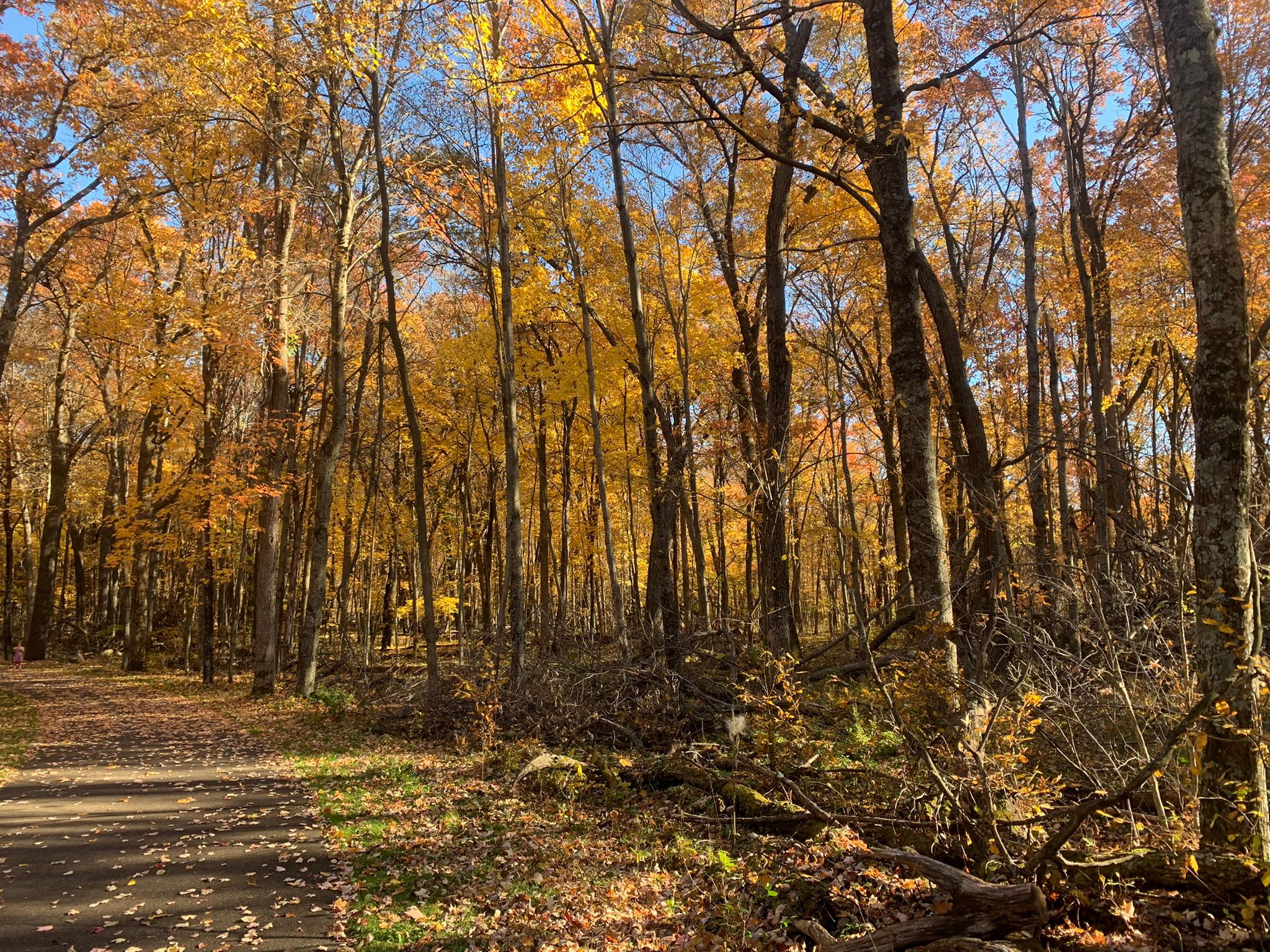
Top fall color hikes around North Branch MN

Wild River State Park, North Branch, Minnesota
There’s no better way
to experience autumn colors in the North Branch area than a
hike.

The brilliant yellows, oranges and red of maples to the scarlet
and russets of oaks...
the crisp, fresh autumn air and the last warm rays of sunlight before winter arrives...the crunch of fallen leaves and acorns beneath your boots...stopping to enjoy a warm mug of apple cider or a caramel apple pulled from your backpack – it all calls for an afternoon on the trail.

Fortunately, there are plenty of great autumn trails around North Branch to hike. Some are right out your back door, while some are a day trip that you can do in an afternoon.

Wild River State Park (North Branch)
Silver maple and basswood flourish along the St. Croix River at Wild River State Park. The 1.5-mile River Terrace Loop and its stem trail circles through a bottomland forest in this popular park. Originally called St. Croix Wild River State Park – and it still appears on various maps that way – it’s now just Wild River State Park. From North Branch, take Minn. Hwy. 95 to County Road 12. Drive County Road 12 to the park entrance, and follow the main park road to a parking lot near the picnic area.
***
Autumn colors abound in the floodplain forest at Wild River State Park. The 4.6-mile Sunrise Loop in the park’s north side is little used and so offers lots of solitude as it runs along the St. Croix River. Silver maple, ash, black willow and cottonwood all thrive there. From North Branch, take Minn. Hwy. 95 east/south. Turn left/north on County Road 9, taking it into the hamlet of Sunrise; from there, turn right/north on Ferry Road into the park. When the road runs out, use the parking lot on the left/west. Hike Ferry Road south to the trailhead and cross Ferry Road (which leads to the boat landing) then over the Sunrise River footbridge. On the other side of the bridge, the loop begins.

Minnesota Interstate State Park (Taylors Falls)
The southernmost section of Minnesota Interstate State Park offers a number of great day hiking trails to explore the Dalles of the St. Croix. To reach the area, from U.S. Hwy. 8 in Taylors Falls, turn east onto Milltown Road. A parking lot is at the end of the entry road. Along the parking lot’s northwest side are three trailheads. The Sandstone Bluff Trail heads northwest under Hwy. 8 to a nice vista of the valley and river gorge below. A 1-mile lollipop trail, it’s spectacular in autumn with a mix of colors from the orange maples, red sumac and brilliant yellow oaks.

Swedish Immigrant Trail (Shafer)
Hikers can follow some of the same footpaths and rail lines that the region’s first Swedish immigrants used to settle Chisago County and Minnesota on the Swedish Immigrant Trail. During the late 1800s, many Swedish immigrants took the ferry across the St. Croix River and then footpaths to their destinations. A spur off the St. Paul-Duluth rail route to Wyoming opened during 1880, helping speed the immigration inland. Perhaps the best of the trail’s completed portions is the Shafer Segment, which runs roughly west of the hamlet through wooded areas and past bucolic landscapes. Birch trees dominate in some sections, but the trail is mainly lined by mixed hardwoods that leave the path and its grass shoulders covered in an array of colorful leaves during autumn. Park on the street in downtown Shafer, off of Redwing Avenue near 303rd Street. The trailhead is near 303rd and heads for about two miles east of Redwing. Look for the white signs with the trail logo in the blue and yellow colors of Sweden’s flag.

Wisconsin Interstate State Park (St. Croix Falls, Wis.)
The splendor of fall colors combines with a vista of the St. Croix River and fascinating rock formations on the Summit Rock Trail at Wisconsin Interstate State Park. The 1-mile round trip trail heads to a bluff’s highest point. Moss and autumn leaves cover the surrounding rock and ground while maples, basswood and eastern white pines line the trail. At the top, prickly pear cactus can be spotted amid the outcroppings. The highlight of the hike without question is the incredible view of the riverway from the summit. Looking north, the Old Man of the Dalles rock formation is visible. From St. Croix Falls, take Wis. Hwy. 35 south. Turn right/west into the park and follow the entry road to the parking lot across from the Lake O’ the Dalles.

St. Croix National Scenic Riverway (Osceola, Wis.)

Fantastic river views beneath a colorful forest canopy await hikers on the this pair of trails near Osceola. Not to be confused with Ridgeview Trail at the adjacent Osceola Bedrock Glades State Natural Area, this pair of trails actually are two loops that only locals really know about. They run through the St. Croix National Scenic Riverway and the Osceola State Fish Hatchery on a bluff overlooking a St. Croix River back channel. The oranges and reds of maples dominate here with the occasional pine grove.

Big Marine Park Reserve (Forest Lake)
Hikers can enjoy a walk through a woodlands and on long pier at Big Marine Park Reserve. The unnamed trail in the Washington County park runs 0.75 miles round-trip. The turf trail leaves from the park’s western side, entering a deciduous forest, which makes for a colorful walk among yellow, orange, red, russet and olive leaves in autumn. From Forest Lake, take Minn. Hwy. 97 east. Turn left/south onto County Road 15/Morning Trail North. The park entry road (aka Lomond Trail North) is on the left/east. When the entry road splits, go straight/west, following it to the last/northernmost parking lot (the road loops back onto itself at the lot).


Tuesday, October 24, 2017

Great autumn hikes around Forest Lake MN

Swedish Immigrant Trail
There’s no better way to experience autumn colors in the Forest Lake area than a hike.

The brilliant yellows, oranges and red
of maples to the scarlet and russets of oaks...the crisp, fresh autumn air and
the last warm rays of sunlight before winter arrives...the crunch of fallen leaves and acorns beneath your boots...stopping to enjoy a warm mug
of apple cider or a caramel apple pulled from your backpack – it all calls for an afternoon on the trail.

Fortunately, there are plenty of great autumn trails around Forest Lake to
hike. Some are right out your back 
door, while some are a day trip that you can do in an afternoon.

Big Marine Park Reserve (Forest Lake)
Hikers can enjoy a walk through a woodlands and on long pier at Big Marine Park Reserve. The unnamed trail in the Washington County park runs 0.75 miles round-trip. The turf trail leaves from the park’s western side, entering a deciduous forest, which makes for a colorful walk among yellow, orange, red, russet and olive leaves in autumn. From Forest Lake, take Minn. Hwy. 97 east. Turn left/south onto County Road 15/Morning Trail North. The park entry road (aka Lomond Trail North) is on the left/east. When the entry road splits, go straight/west, following it to the last/northernmost parking lot (the road loops back onto itself at the lot).

Swedish Immigrant Trail (Chisago)
Hikers can follow some of the same footpaths and rail lines that the region’s first Swedish immigrants used to settle Chisago County and Minnesota on the Swedish Immigrant Trail. During the late 1800s, many Swedish immigrants took the ferry across the St. Croix River and then footpaths to their destinations. A spur off the St. Paul-Duluth rail route to Wyoming opened during 1880, helping speed the immigration inland. Perhaps the best of the trail’s completed portions is the Shafer Segment, which runs roughly west of the hamlet through wooded areas and past bucolic landscapes. Birch trees dominate in some sections, but the trail is mainly lined by mixed hardwoods that leave the path and its grass shoulders covered in an array of colorful leaves during autumn. Park on the street in downtown Shafer, off of Redwing Avenue near 303rd Street. The trailhead is near 303rd and heads for about two miles east of Redwing. Look for the white signs with the trail logo in the blue and yellow colors of Sweden’s flag.

Minnesota Interstate State Park (Taylors Falls)
The southernmost section of Minnesota Interstate State Park offers a number of great day hiking trails to explore the Dalles of the St. Croix. To reach the area, from U.S. Hwy. 8 in Taylors Falls, turn east onto Milltown Road. A parking lot is at the end of the entry road. Along the parking lot’s northwest side are three trailheads. The Sandstone Bluff Trail heads northwest under Hwy. 8 to a nice vista of the valley and river gorge below. A 1-mile lollipop trail, it’s spectacular in autumn with a mix of colors from the orange maples, red sumac and brilliant yellow oaks.

William O’Brien State Park (Marine on St. Croix)
Day hikers can learn about the power of floods on the St. Croix River via the Riverside Trail at William O’Brien State Park. The 1.5-mile trail loops through a floodplain and typically is open during summer and autumn when water levels have gone down. The fresh scent of pine needles upon the trail and the gentle rush of water along the river’s rock walls instantly lulls you into a feeling of serenity. Roughly half of the trail follows the river, mainly through a good mix of hardwoods common to a floodplain forest in this region. During autumn, their leaves turn gold, red, orange and brown. Across the water is Wisconsin, and with the two undeveloped shorelines, tranquility reigns. From Marine on St. Croix, take Minn. Hwy. 95 north into the park. Turn right/east onto O’Brien Trail North/County Road 33. The road curves south, dead ending in a parking area alongside Lake Alice. The trail begins at the picnic grounds immediately east of the parking lot.

Wild River State Park (North Branch)
Silver maple and basswood flourish along the St. Croix River at Wild River State Park. The 1.5-mile River Terrace Loop and its stem trail circles through a bottomland forest in this popular park. Originally called St. Croix Wild River State Park – and it still appears on various maps that way – it’s now just Wild River State Park. From North Branch, take Minn. Hwy. 95 to County Road 12. Drive County Road 12 to the park entrance, and follow the main park road to a parking lot near the picnic area.


Sunday, June 15, 2014

St. Croix riverway abundant with day trails

St. Croix River south of St. Croix Falls, Wis.

National Park unit
includes 252 miles
of scenic shore


With the quiltwork of state parks, forests, and natural areas, county parks and other historical sites in the St. Croix National Scenic Riverway, attractions abound – swimming beaches, boat ramps, campgrounds, shopping in historic towns, ski trails, and more. Well over 70 day hiking trails can be found along the two rivers.

Scenic riverway’s location
From south to north, the scenic riverway begins in Prescott, Wis., where the St. Croix River meets the Mississippi River. This wide stretch of the St. Croix often is referred to as Lake St. Croix, which sports two state parks. At Afton, Minn., and Hudson, Wis., the Interstate 94 bridge handles the greatest amount of vehicle traffic over the river. From there, Willow River State Park sits on a tributary to the St. Croix in what is Lake St. Croix’s most populous stretch, with the cities of Bayport, Oak Park Heights and Stillwater on the Minnesota side and Hudson and North Hudson on the Wisconsin side.

North of Stillwater, the population falls off greatly, with William O’Brien State Park in Minnesota sometimes outpacing the census of the neighboring town, Marine on St. Croix. Then another cluster of villages appears – Osceola, Dresser and St. Croix Falls on the Wisconsin side and Taylors Falls in Minnesota. There the twin jewels of Minnesota and Wisconsin Interstate State Parks straddles the St. Croix O’ the Dalles, a beautiful gorge that the river flows through.

North of this region, the river bulges westward, with a state park in Minnesota and several state forests and state natural areas on both sides, before curving eastward to Danbury, Wis. A few miles north of town, the river ceases to be the state border as it heads northeast, taking in the Namekagon, and then coming to the Saint Croix Flowage near Gordon, Wis. The scenic riverway ends at the dam creating the lake.

West of the flowage, the St. Croix continues northward as a narrow waterway to its headwaters at Upper St. Croix Lake. In all, it’s a 169-mile journey.

The St. Croix’s largest tributary, the Namekagon, meanders for 101 miles, crossing four Wisconsin counties. It’s a major recreational area, with a number of boat landings and campsites, especially in Sawyer and Washburn counties.

From west to east, the Namekagon dips south to Trego, Wis., before heading northeast through Hayward, Wis. Its headwaters are at Namakagon Lake in the Chequamegon National Forest. The tributary runs 101 miles.

Attractions
The National Park Service operates two visitor centers in the riverway. The St. Croix River Visitor Center is in downtown St. Croix Falls and open from mid-April to Oct. 27. It boasts a 500-gallon freshwater aquarium. The Namekagon River Visitor Center is a mile east of Trego and open from Memorial Day Weekend through Labor Day. Hours for both visitor centers are 9 a.m. to 5 p.m. daily.

Major parks, nature centers, and public forests on or near the scenic riverway (from south to north and west to east) include:
g Carpenter St. Croix Valley Nature Center (Hastings, Minn.)
g St. Croix Bluffs Regional Park (Hastings)
g Kinnickinnic State Park (Prescott)
g Afton State Park (Afton)
g Willow River State Park (Hudson)
g William O’Brien State Park (Marine on St. Croix)
g Osceola Bedrock Glades State Natural Area (Osceola)
g Wisconsin Interstate State Park (St. Croix Falls)
g Minnesota Interstate State Park (Taylors Falls)
g Wild River State Park (North Brach, Minn.)
g Governor Knowles State Forest (Grantsburg, Wis.)
g Chengwatana State Forest (Beroun, Minn.)
g St. Croix State Park (Hinckley, Minn.)
g St. Croix State Forest (Sandstone, Minn.)
g Brule River State Forest (Solon Springs, Wis.)
g Chequamegon National Forest (Cable, Wis.)

Read more about day hiking the scenic riverway in my guidebook Hittin’ the Trail: Day Hiking the St. Croix National Scenic Riverway.


Wednesday, April 5, 2017

Southern Minnesota’s Top Wildflower Trails

Home to more than 500 wildflower species, Minnesota stands out as one of the best states to see these beautiful wonders. From the Northwoods where forest floors come alive with color each spring to the prairies where yellow and purple flowers rise above the swaying grasses…from winter’s end when tiny pasqueflowers mark the coming warmth to autumn when sunflowers and goldenrod herald the harvest season…Minnesota offers a variety of great wildflower experiences.

Here are some great wildflower trails to hike in southern Minnesota.

Amador Prairie Loops
Wild River State Park

Minnesota’s Northwoods is far more diverse than fragrant pine trees and picturesque lakes. At Wild River State Park, hikers can enjoy some of that variety by taking the shorter of the Amador Prairie Loops through a restored prairie with plenty of wildflowers. In mid-September on the 2.1-mile trail, asters and goldenrods usually peak, a pretty sight against the tall grasses’ reds. From Amelund, take Minn. Hwy. 12 (aka Park Road) east into the park. Past the service road, turn at the first left to the trail center. Trail map:


Lilydale Park Trail
Lilydale Regional Park

Hikers can see wildflowers of a forest floodplain right in the middle of the state’s largest metro area at Lilydale Regional Park. The 1.6-mile round trip Lilydale Park Trail runs through the 380-acre public area in Saint Paul. Wild ginger, Canadian honewort , pointed-leaf tick-trefoil, and spotted touch-me-not flower are just some of the flowers that can be seen. American lotus dot Pickerel Lake from July to September. From downtown St. Paul take Interstate 35E south. Upon crossing the Mississippi River, exit onto Minn. Hwy. 13/Sibley Memorial Highway. Go left/northeast. Turn right/south onto County Road 45/Lilydale Road. After going under the railroad overpass, look for an entry road on the left/northwest that heads to a parking lot. At the lot’s north side, take the trail northeast. Trail map:


Lower and Upper Cliffline Trails
Blue Mounds State Park

Hikers can experience a bit of the American Southwest at Minnesota’s Blue Mounds State Park. The 4.1-mile Mound Trail loops past prickly pear cactus and across rock formations that look like they would be more at home in Arizona than in Bullwinkle the Moose’s home state. From Luverne take U.S. Hwy. 75 north. Turn right/east onto County Road 20. Park in the lot where the road ends. The trail begins at the lot’s northeast corner. Trail map:


Nature Trail
Eloise Butler Wildflower Garden and Bird Sanctuary

Day hikers can explore the United States’ oldest public wildflower garden near Minneapolis. A 0.72-mile round trip trail runs through a woodland, wetland and prairie at Eloise Butler Wildflower Garden and Bird Sanctuary in Theodore Wirth Park. Among the highlights in April and May are large-flowered trillium, bloodroot, wild ginger, bluebell and trout lily in the woodlands. From the junction of Interstate 35 and Minn. Hwy. 100, take the latter north. Exit onto Glenwood Avenue/County Road 40 and go east. Next, turn right/south onto Theodore Wirth Parkway then left/east onto Butler Garden. A parking lot is on the left across from the entrance. Trail map:


River Terrace Prairie Trail
River Terrace Prairie State Natural Area

Day hikers can explore wildflowers of a gravel prairie at River Terrace Prairie State Natural Area. The 1.54-mile round trip River Terrace Prairie Trail runs along the edges of the state natural area and includes a segment of the Cannon Valley Trail. The natural area is known for its spectacular displays of pasqueflower in April. From Cannon Falls, take Minn. Hwy. 19 east. Turn left/north onto Sunset Trail. After the road and Cannon River make a 90 degree turn east, watch for a dirt jeep trail heading right. Park on the road shoulder near it. Trail map:


South and North Overlooks Trail
Williams Nature Center

Native wildflowers can be enjoyed at Williams Nature Center outside of Mankato. The 1.8-mile round trip South and North Overlooks Trail heads through the 65-acre county park. Three stacked loops wind across the park’s woodlands. Among the flowers you’re likely to see are showy orchid, purple coneflower, and the cup plant. From Mankato take U.S. Hwy. 169 west. Turn right/northwest onto Minn. Hwy. 68. The park entry is on the right/north and ends at a parking lot. Trail map:


Wildflower Trail
Carley State Park

Hikers can revel in the thousands of bluebells and false rue anemone that cover an oxbow in the North Branch of the Whitewater River every May at Carley State Park. The 2.42-miles looping Wildflower Trail follows the river branch through a white pine-lined sunken bowl in the middle of farmland. It’s best done in late April through early May and will be busy when the park holds its annual Bluebell Festival each May. From Plainview, take County Road 4 south. The park entrance road is on the right/west. Once in the park, take the first left/west; this is a loop offering access to the park’s group camps. The parking lot is on the south side of the loop. From the lot, follow the road north then go left/west onto the loop. Trail map:


Saturday, February 20, 2016

Trail runs alongside remote section of river

Topo map of Sunrise Loop in Wild River State Park.
Sunrise Landing, courtesy of MN DNR.

Sunrise Loop cuts across nearly 5 miles of woods


Day hikers can enjoy a walk through a bottomlands forest along the St. Croix River in Minnesota's Wild River State Park.

The 4.6-mile Sunrise Loop at the park’s north is little used and so offers lots of solitude. Late summer and early fall mark the best time to hike the loop. During wet years, spring floods and mosquitoes can make the hike difficult.

To reach the trailhead, from Amelund, take Minn. Hwy. 95 north. Turn right/north on County Road 9, taking it into the hamlet of Sunrise; from there, turn right/north on Ferry Road into the park. When the road runs out, use the parking lot on the left/west. Hike Ferry Road south to the trailhead and cross Ferry Road (which leads to the boat landing) then over the Sunrise River footbridge. On the other side of the bridge, the loop begins. Go right/south onto.

Bottomland hardwood forest
The entire trail heads through a bottomland hardwood forest, sometimes referred to as a floodplain forest. For most of the year, these forests just above the river channel remain dry, but the silver maple – as well as some ash, black willow and cottonwood – can support tolerate seasonal flooding. Wild grape, Virginia creeper and other woody climbers also are common here, but there is a distinct lack of shrubs and other understory plants, which usually can’t survive the flooding.

Along the south side of the loop, the route passes an interpretive exhibit for the Arrow Line Railway. In 1907-08, a straight railroad line, which led it to be called The Arrow, was planned for the Twin Cities to Duluth. Part of the rail grade remains here. Work in the project stopped at this spot as the bridge over the St. Croix never was constructed.

The route reaches a junction with the Sunrise Trail at 2.2 miles from the trailhead. A shelter can be found at the intersection. To stay on loop, go left/north.

In short order, the trail comes alongside the St. Croix River. Northern pike, walleye, and smallmouth bass are common in the river. Wisconsin's Governor Knowles State Forest is on opposite shoreline and two islands sit in the river.

Wildlife sightings
A secluded area, the loop is a good place to spot wildlife. You’ll likely see white-tailed deer and paw prints for coyote, red fox, gray fox, and river otters. The trail also crosses a large beaver dam area. Trumpeter swans sometimes can be heard honking overhead. During the spring and autumn migrations, songbirds descend upon the forest.

You’ll know when you’re nearing the end of hike as the Sunrise Landing, where boats can be placed on the river, comes into sight.

Upon arriving back at the footbridge, go right/west, and retrace your steps back to the parking lot.

Final note: Originally called St. Croix Wild River State Park, this park still appears on various maps that way. It’s now just Wild River State Park, though.

Learn about trail guidebooks available in the Hittin’ the Trail series.


Monday, April 28, 2014

Wild River SP trails cross oak forest, prairie

Windfall Trail. Photo courtesy Minnesota DNR.
A diverse array of trails await day hikers at Minnesota's Wild River State Park.

The state park is located along the St. Croix River. Originally called St. Croix Wild River State Park – and it still appears on various maps that way – it’s now just Wild River State Park.

To reach the trail, from North Branch, Minn., take Minn. Hwy. 95 to County Road 12. Drive it to the park entrance, and follow the main park road to your trailhead’s parking lot.

Among the best day hiking trails at the state park are:
g Amador Prairie Loops – Day hikers can choose between a 1-mile or a 2-mile loop that heads through an open area of tall prairie grasses. The loops begin at the park’s Trail Center.
g Amik’s Pond Trail – Brochures for the nature trail can be picked up at its trailhead next to the visitor center. It runs one mile.
g Deer Creek Loop – Part of the pretty trail runs along the historic Old Military Road that once connected what is now the south end of the scenic riverway with Lake Superior. Including the stem trail from either the visitor center or the River Access, the trail runs 4-miles round trip.
g Mitigwaki Loop – The 1-mile loop heads through an oak woods overlooking Dry Creek. The trailhead is at the visitor center.
g Pioneer Trail – Day hikers can experience three ecosystems – on oak woods, a savanna, and a prairie – on this loop that leaves from the Trail Center. Including an access trial, the walk is 3.1-miles round trip.
g River Terrace Loop – The 1.5-mile loop and its stem trail circles through a bottomland forest. It offers views of the Old Nevers Dam site on the river.
g Windfall Trail – Like the Amik's Pond Trail, a brochure for the nature trail is located at its visitor center trailhead. It is 1-mile long.

Read more about day hiking the scenic riverway in my guidebook Hittin’ the Trail: Day Hiking the St. Croix National Scenic Riverway.


Wednesday, January 15, 2014

Discover famous old dam site on hiking loop

Nevers Dam overlook on River Terrace Loop.
Photo courtesy Minnesota DNR. 

Minnesota trail rambles
through bottomlands forest


Day hikers can learn about the power of dams while enjoying a walk along the St. Croix River on the River Terrace Loop in Minnesota's Wild River State Park.

The 1.5-mile loop and its stem trail circles through a bottomland forest in this popular park. Originally called St. Croix Wild River State Park – and it still appears on various maps that way – it's now just Wild River State Park.

Late summer and early fall mark the best time to hike the loop. During wet years, spring floods and mosquitoes can make the hike difficult.

To reach the trail, from North Branch, Minn., take Minn. Hwy. 95 to County Road 12. Drive County Road 12 to the park entrance, and follow the main park road to a parking lot near the picnic area.

The trailhead begins in the picnic area with a short 0.1-mile connector that heads 120 feet down the bluff into the bottomlands and to the loop. Upon reaching the loop, go right/east.

Old Nevers Dam site
In about 0.2 miles, you’ll reach the St. Croix River and the Old Nevers Dam site. Wooden pilings in midstream are all that remain of the dam, which at one time was among the most important in the Midwest.

During the last half of the 1800s, log jams were a regular occurrence on the St. Croix as lumber cut in northern Wisconsin and Minnesota was floated downstream to saw mills. In 1886 when an estimated l50 million feet of lumber backed up on the river, loggers dynamited the tree trunks to break open the jam.

The solution to the log jams was controlling the river flow through a dam. To that end, in 1890, the Nevers Dam opened, virtually eliminating the backups. For the next 65 years, it held the record as the world’s largest pile-driven dam.

As the lumberjacking days ended, Nevers Dam became a river control point that allowed construction of a hydroelectric power dam in St. Croix Falls, Wis., 11 miles downriver.

Spring floods in 1954 demolished Nevers Dam, however. That May, the high waters undermined the dam and washed several sections away. A wrecking crew removed what remained of the unusable dam in 1955.

Flood-tolerant trees
From the Nevers Dam site, go left/north on the trail, which parallels the river for 0.6 miles. Though wooded, during wet years this can be somewhat of a swampy area. Keep an eye out for ducks, herons and bitterns.

When the trail curves southwest and away from the river, you’ll reach another junction. The intersecting trail accesses the campground atop the bluff via 164 winding steps.

The River Terrace loop goes left/south. Camper cabins are on the bluffs about 140 feet above.

As the bottomland forest sometimes is flooded during spring, inundation-tolerant trees – including silver maple and basswood – flourish here.

In 0.5 miles, the trail reaches another junction; go left/east and then within a few feet at the next intersection, go right/south back onto the connector trail leading to the picnic area and your parking lot.

Read more about day hiking the scenic riverway in my guidebook Hittin’ the Trail: Day Hiking the St. Croix National Scenic Riverway.


Tuesday, August 23, 2016

The 10 Most Beautiful Vistas in Minnesota

Sunset from the ridge top at Blue Mounds State Park. MNDNR photo. 
Despite not having any mountains, Minnesota still boasts some fantastic vistas – the world’s largest freshwater lake, mighty rivers, sprawling forests, and even of prairies grazed by bison. Here are 10 great vistas to check out.

Eagle Mountain
Day hikers can ascend to the highest point in Minnesota via the rugged but incredibly scenic Eagle Mountain Trail. The 7-mile (round trip) out-and-back trail is lengthy and steep at spots. Still, if the challenge isn’t rewarding enough, the views at the top certainly are – sprawling forests, rocky ridges, and the Lake Superior shoreline, which is 602 feet above sea level is the state’s lowest point. To reach the trailhead, from Minn. Hwy. 61 in Grand Marais, take County Road 7 west. Turn north onto County Road 48. Continue west onto Forest Road 158 (aka Bally Creek Road). Take this north to the junction with Forest Road 170 (formerly named Forest Road 153 and aka The Grade). As most of the trail is within the Boundary Waters Canoe Area Wilderness, a permit is required and can be obtained at the trailhead.

Mount Josephine
Located near the U.S.-Canadian border off of Minn. Hwy. 61 in Grand Portage, Mount Josephine isn’t as high as Eagle Mountain, but its views are arguably more spectacular. The Mount Josephine Trail climbs a strenuous 700 feet over the 1.5 miles to the summit, but the vista yields views of Grand Portage Bay, Pigeon Point, the Susie Islands, and Wauswaugoning Bay. Isle Royale, about 30 miles away as the crow flies, can be see on a clear day. Park in the Mount Josephine Trail lot off of County Road 17, near the fort.

Split Rock Lighthouse
You can explore one of the nation’s most famous lighthouses and enjoy impressive cliff top views of Lake Superior at the Split Rock Lighthouse State Park. The 0.8-mile Light Station Trail is a collection of walking paths around the historic lighthouse. Perched atop a 130-foot high solid rock cliff overlooking Lake Superior, Split Rock is among the most photographed lighthouses in the country and offers panoramic views of Lake Superior, the rocky shore, Palisade Head, Carlton Peak, and Oberg and Leveaux mountains. To reach the lighthouse from Two Harbors, drive north about 20 miles on Minn. Hwy. 61. Take the main park road to the parking area for Split Rock Light Station and History Center.

Shadow Rock Lookout
On the north side of Minnesota Interstate State Park, a set of short, interconnecting trails leads past deep potholes formed by swirling glacial floodwaters and The Squeeze, an exceedingly tight, L-shaped break between two ultra-large chunks of rock. But the highlight is a basalt cliff high above the St. Croix River, which whirls below as working its way through a narrow canyon of black volcanic stone. From there, walk to the Angle and the Shadow rock lookouts, which offer two other great vistas of the St. Croix River and gorge rock formations on the Wisconsin side.

Oldenburg Point
Located in Jay Cooke State Park, Oldenburg Point offers a fantastic view of the Saint Louis River, as its rushes over jagged outcrops of slate and greywacke. The scene is particularly beautiful in autumn when the leaves turn yellow and gold. To reach the point, from the park headquarters head east on Minn. Hwy. 210 then turn south into the picnic area for the Organtz Trail trailhead. At the parking lot, head south into the path for Oldenburg Point. The 0.2-mile path loops back to the parking lot. Bring a picnic lunch to enjoy at the pavilion.

Lake Pepin
Hikers can traverse the top and the base of a bluff looming 430 feet above Lake Pepin at Frontenac State Park. The 2.6-mile Bluff Side Loop Trail offers impressive views as it heads up and down the steep bluff with a series of wooden stairs and switchbacks. Fall is a particularly good time to visit with the bird migration through the area at its peak and the leaves resplendent in an array of harvest colors. To reach the trailhead, from the park entrance, go left/northwest on County Road 28; follow the road to its end, where it loops back upon itself and forms a parking lot. A couple of picnic spots along the way offer vistas of the lake below with the visible Wisconsin shoreline about two miles away.

Kings Bluff
Rising 500 feet above the Mississippi River, Kings Bluff at Great River Bluffs State Park southeast of Winona offers exceptional views of the main channel and its vast backwaters. A 4.5-miles round hike takes you atop the hardened sediments deposited around 450 million years ago when this part of the world sat beneath a sea. Along the way, you’ll walk through dense hardwood forests and a grove of northern white cedar, a survivor from the Ice Age. To reach the trail, take the park entrance road to the trailhead.

Minnesota River
You can see across the wide Minnesota River Valley from the vantage point of the state’s pioneers at The Landing – Minnesota River Heritage Park. After hiking the trail past historic sites, at the heritage village’s north end the the river bends about about 40 feet below, with Rice and Grass lakes beyond it. The valley is fairly new in geological terms, forming between 9,400 and 11,700 years ago at the end of the last Ice Age when glacial River Warren carried meltwater to the Mississippi. To reach the trailhead, from Shakopee, take Minn. Hwy. 101 west to the park.

Inspiration Peak
Inspiration Peak rises about 400 feet above the surrounding prairie. 1750 feet above sea level, the conical hill formed when two melting glaciers met here and left a mound of sand and gravel at the end of the last Ice Age. A quarter-mile hike uphill lets visitors see about 50 lakes for 20 miles around. The peak also sits on the border between Minnesota’s deciduous forests to the east and the Great Plains to the west, offering an intriguing twist for vista lovers. To reach the trail in Inspiration Peak State Wayside Park, from Urbank take Minn. Hwy. 28 west then turn right/north onto 435th Avenue, right/east onto 120th Street, and head into the park.

Blue Mounds
You can watch bison gazing on the prairie grasses from an ancient quartzite ridge at Blue Mounds State Park. Up to 100 feet high at spots, the ridge’s rock is about 1.7 billion years old, formed when rivers deposited sediment here as flowing into a shallow sea. From the ridge, the prairie stretches south into Iowa and west into South Dakota. More than 100 bison roam the park. To reach the ridge, from Luverne, take Minn. Hwy. 75 north then turn right/east on County Road 20 and go a mile to the park to the trailhead for the Upper Cliffline Trail.

BONUS TRAIL
St. Croix State Park Fire Tower
Day hikers can walk to and climb to the top of a 100-foot fire tower at St. Croix State Park in Pine County. Looking south from it, Bear Creek runs west to east immediately below. In the distance is the Kettle River, a State Wild and Scenic River, which flows southeast to the St. Croix. To reach the park from Interstate 35 exit onto Minn. Hwy. 48 in Hinckley. At County Road 22, turn south. In about five miles, you’ll reach the park headquarters. From there, turn right/west onto St. John’s Road. At the point the road turns to gravel, you have about a nine-mile drive. Your destination is the Kettle River Highlands, which offers limited parking.

Learn about trail guidebooks available in the Hittin’ the Trail series.


Wednesday, February 13, 2013

Day hike prairie grasslands at Wild River

Big bluestem grows in the Amador Prairie.

Trail loops in restored meadow


The Northwoods is far more diverse than fragrant pine trees and picturesque lakes. At Wild River State Park, hikers can enjoy some of that variety by taking one of two loops through a restored prairie.

Wild River State Park rests upon the St. Croix River in Chisago County and features an all-season trail center. The Amador Prairie Loops start at the trail center.

Autumn wildflowers
A mild summer day is best for the hike because the trail is open to sun. A warm fall afternoon also is pleasant; in mid-September, asters and goldenrods usually peak, a pretty sight against the tall grasses’ reds.

To reach Wild River, from Amelund take Minn. Hwy. 12 (aka Park Road) east into the park. Past the service road, turn at the first left to the trail center.

Park at the center. At the trailhead, go clockwise, or left/north.

Either loop ranks easy on the difficulty level as they meander through open grassland of big bluestem and Indian grasses with islands of oak savannah. The smaller of the two loops runs for a mile and forms part of the longer trail, which is 2.1 miles long.

Almost extinct
From the trailhead, the path curves northwest for 0.2 miles, where it joins the route to the equestrian trailhead. At that intersection, turn right/north.

A few decades ago, this prairie area almost ceased to exist as farmer-introduced trees and thatch threatened to wipe out the grasses. Controlled burning and annual seed sowing, however, has helped rehabilitate the grassland.

After traveling north for 0.2 miles, hikers have the option of taking a short or a long trail. If you want to make small loop, turn right at the trail intersection and go 0.2 miles across the prairie restoration. At the next trail intersection, you’ll rejoin the larger loop; from there, go right/south for 0.7 miles and back to the trail center.

Along the way, there’s a very good chance that you’ll spot wildlife. Songbirds are prevalent on both prairie loops; May is an opportune time to witness the warbler migration. But white-tailed deer, coyotes, raccoons, squirrels and even black bears sometimes can be seen here as well.

Ancient river's edge
If taking the longer loop, don’t cut across prairie but continue north for another 0.7 miles to the next trail intersection and curve east. Even in a gentle breeze, prairie grass moves and sounds like sea waves as you walk.

The restored prairie, as with the rest of the park, sits upon basalt from 1.1 billion-year-old lava flows. Floodwaters from glacial lakes carved out what is now the St. Croix River Valley and much of the parkland. Look for the bluffs, now sitting far inland, that mark what was the river’s edge some 10,000 years ago.

The longer loop goes 0.5 miles southeast before connecting with Nevers Dam Trail. Continue heading south another 0.2 miles where the path meets the shorter loop’s cut across the prairie. From there, walk 0.7 miles back to trail center.

Dogs are allowed to use the trails if on leashes of no more than six feet. Hikers share the loops with riders and as a courtesy should yield and let horses pass.

Read more about day hiking Northeast Minnesota in my Headin’ to the Cabin: Day Hiking Trails of Northeast Minnesota guidebook.


Tuesday, September 17, 2019

Fall color hikes abound in Willmar MN area

Sibley State Park, Willmar, Minnesota
There’s no better way to experience autumn colors in the Willmar,
Minnesota, area than a hike.

The brilliant yellows, oranges and red
of maples to the scarlet and russets of oaks...the crisp, fresh autumn air and
the last warm rays of sunlight before winter arrives...the crunch of fallen leaves and acorns beneath your boots...stopping to enjoy a warm mug
of apple cider or a caramel apple pulled from your backpack – it all calls for an afternoon on the trail.

Fortunately, there are plenty of great autumn trails around Willmar to hike. Some are right out your back door,
while some are a day trip that you can do in an afternoon.

Prairie Woods Environmental Learning Center (Willmar)
A visit to Prairie Woods Environmental Learning Center offers a two-for-one fall color experience – the brilliant purples of prairie grasses and the autumn leaves of maples, oaks and basswoods on the hills. Try the 0.56-mile Kemp Trail, which circles a pond through the woods while dipping briefly into the prairie. From Willmar, take U.S. Hwy. 71 north. Turn left/west onto 122nd Avenue NE/County Road 29. Follow Hwy. 29 when it curves right/north. Go left/west onto the learning center and leave your vehicle at the Trailhead Building. The trail heads northwest near the building into the woods.

Sibley State Park (Willmar)
Hikers can enjoy a panoramic view of fall colors at Sibley State Park. The 3.3-mile Mt. Tom Trail (also known as the Hiking Club Trail) loops through the center of the park’s oak woods as ascending a hill about 200 feet above the surrounding terrain. From Willmar, drive north on U.S. Hwy. 71. Enter the park by turning left/west onto County Road 48 then taking a right/north onto the road to the park office. Once past the office, the road splits; go right/east and park in the interpretive center lot at the road’s end. The trail heads northwest from the lot.

Harvey Waterfowl Production Area (Willmar)
A small woodlands brightens the prairie in autumn colors at the Harvey Waterfowl Production Area. A 0.15-mile one-way path passes trees and leads to the woods near a large pond frequented each fall by migrating birds. Extend the trail into the woods via game trails and degraded footpaths. From Willmar, take U.S. Hwy. 12 east. Turn left/north onto 560th Avenue then right/east onto 290th Street. The entry to the waterfowl area is in 0.66 miles on the right/south; park along the country road.

Lagoon Park (Montevideo)
Autumn colors abound alongside the Chippewa River at Lagoon Park in Montevideo. A 0.6-mile trail combined with the campsite road loops beside a wide meander in the river. From the junction of Minn. Hwy. 7/29 with Canton Avenue in Montevideo, take the latter east. Turn left/north onto North Parkway Avenue. After going under the highway, go left/west onto Forest Avenue. Leave your vehicle in the lot at the park’s southwest corner.

River Warren Outcrops Scientific and Natural Area (Redwood Falls)
One stretch of the Minnesota River in the prairie that brims with harvest colors is River Warren Outcrops Scientific and Natural Area. A 1.6-mile trail loops through the woodlands. Bur oak covers the rock outcrops area above the river while silver maple, American elm, rock elm, and the rare (for Minnesota) Kentucky coffee tree rule the floodplain forest. From Redwood Falls, take County Road 101 north; upon crossing the Minnesota River, it becomes County Road 1. Turn left/northwest onto County Road 15. After passing County Road 21, watch for the natural area driveway and parking lot on the left/south.

Monson Lake State Park (Benson)
Hikers can enjoy the fall colors of oak, ash and basswood as well as sparkling lakes at Monson Lake State Park. The wooded 2-mile round trip Hiking Club Trail passes Monson and West Sunberg lakes, where migrating waterfowl stop over during autumn. From Benson, take Minn. Hwy. 9 east. Turn right/south onto 160th Avenue NE, which when it swerves left/east naturally becomes 15th Street NE. The park entry is on the left/north with the road ending at a parking lot. The trailhead is at the lot’s southeast corner.

Glacial Lakes State Park (Starbuck)
Hikers can cross a terrain deeply shaped during the last ice age and enjoy autumn colors because of it. The 4.8-mile Mountain Lake Trail at Glacial Lakes State Park features a kame, rolling hills, and kettle lake. Yellow-leaved basswood and russet-colored oaks thrive on the kame, a hill created when a melting glacier deposited sediment, while crimson sumac, golden quaking aspen, and orange wild plum fill the flat spaces between the low hills. From Starbuck, take Minn. Hwy. 20 south. Go left-straight/south on County Road 41, which curves left/east into the park. Once past the entrance station, take the third left/east and park in the lot at the road’s end.


Wednesday, March 1, 2017

Wildflower hikes abound in Abbotsford area

Spring beauty
There are plenty of great hiking trails around Abbotsford, Wisconsin, to see wildflowers from spring through autumn. Some are right out your back door, while some are a day trip that you can do in an afternoon.

Cherokee County Park (Abbotsford)
Riverine wildflowers can be seen Cherokee County Park southeast of Abbotsford. The 1.3-mile round trip Indian Trail follows the Big Eau Pleine River shoreline through the 66-acre park. From Abbotsford, take Wis. Hwy. 13 south. Turn left/east onto County Road N. The park entrance is on the road’s left/north.

Campus Trail Park (Medford)
Woodland wildflowers are impressive during spring at Campus Trail Park next to the Taylor County/USDA Agricultural Center. The 1.2-mile Campus Woods Trail consists of two loops that run through the woods. In Medford, from the intersection of Wis. Hwys. 64 and 13, take the latter south. Turn right/west onto East Conrad Street then left/south onto Donald Street. Park in the lot at 925 Donald Street.

Council Grounds State Park (Merrill)
A number of wildflowers carpet the floor of an old-growth forest with a large stand of white pines that escaped the logger’s ax await at Council Grounds State Park. The 0.9-mile Blue Trail runs through the Krueger Pines State Natural Area in the park. Among the wildflowers are large-leaved aster, Canada mayflower, American starflower, shin-leaf, and wild sarsaparilla. From Wis. Hwy. 64 in Merrill, take Wis. Hwy. 107 north. Turn tight/south onto Council Grounds Drive. Follow the road as it loops through the park. Park in the lot on the loops’ southeast side and walk north alongside the road; the trailhead is on the road’s left/west side.

Dells of the Eau Claire County Park (Wausau)
A number of spring ephemerals thrive on the deep, loamy soils of Dells of the Eau Claire County Park. The 6-mile round trip Ice Age National Scenic Trail passes spring beauty, trout-lily, hepatica, and many other common wildflowers. From Wausau, take County Road Z east. Turn left/north onto County Road Y then left/northwest into the park. Follow the trail from the Dells west to County Road Z.

Big Eau Pleine Woods State Natural Area (Stratford)
Hikers can enjoy woodland wildflowers in the Big Eau Pleine Woods State Natural Area. The 3.4-mile round trip Big Eau Pleine Woods Trail runs alongside the Big Eau Pleine River. Bloodroot, hepatica, trillium, violet all bloom in May. From Stratford, take Wis. Hwy. 153 east then turn right/south onto Eau Pleine Park Road. Next, go right/west onto Moon Road; when it curves south, it becomes Eau Pleine Park Road. When the road splits, go left/southeast; at the next split, go right/southwest. The trail begins at the road’s end.

Powers Bluff Maple Woods State Natural Area (Marshfield)
Hikers can explore the edge of a forested bluff rich with wildflowers at Powers Bluff Maple Woods State Natural Area. The 1.05-miles Potawatomi Nature Trail loops through the state natural area and part of the adjacent Powers Bluff County Park & Winter Recreation Area. Both public areas protect 1472-foot tall Powers Bluff, Wood County’s highest point. Among the spring flowers are wild oats, bloodroot, Dutchman’s breeches, white trout lilies, spring beauties, wood anemone, red columbine, blue cohosh, and violets. From Marshfield, take U.S. Hwy 10 east. Turn right/south onto Wis. Hwy. 186. In Arpin, go right/west onto Pine Road then left/south onto County Road E. Next, turn right/west onto Bluff Drive then right/north onto Park Road. Take the next right/east and park in the lot. Head north on the trail.

Schmidt Maple Woods State Natural Area (Stanley)
Showy wildflowers common to Wisconsin’s maple-basswood forests can be seen at Schmidt Maple Woods State Natural Area. The southern half of the natural area boasts hepatica, yellow trout lily, large flowered trillium, Jacob's ladder, wild geranium, large-leaved aster, squirrel corn, and violets. From Stanley, take County Road X east. Turn right/south on Carpenter Avenue. The natural area is about 3 miles south of Wis. Hwy. 29. Park alongside the road and use deer trails or degraded footpaths to cross the area.


Friday, April 24, 2015

Best hikes to find spot spring wildflowers in Minnesota/Wisconsin's St. Croix River Valley

The pasqueflower usually is the first
wildflower to bloom in the St. Croix
River Valley. Photo courtesy of
Wisconsin DNR.
The St. Croix River Valley that forms part of the Minnesota-Wisconsin border marks a great spot to go on wildflower hikes during spring and early summer. In addition, as almost all of the river valley sits in the St. Croix National Scenic Riverway and various state parks and forests, there’s plenty of public access to where wildflowers grow.

In broad terms, the river valley can be divided into two ecosystems. One is the prairie blufftop that overlook the river while the other is the hillside and river bottoms that typically are forested.

The prairie blufftops usually are the first place to see wildflowers each spring. The St. Croix Savanna SNA, south of Bayport, Minn., offers an easy to reach gravel prairie high above the river.

In early April to early May, you’ll know spring has finally arrived when the pasqueflower blossoms there. “Pasque” is French for “Easter,” hence the flower’s name – it usually blooms around Easter.

Skunk cabbage comes next on the blufftops. That usually is followed by pussytoes and then violets.

Wildflowers growing beneath the forest canopy usually blossom in mid-spring. Wood anemones typically are the first to arrive, as they bloom before the trees grow their leaves. These wildflowers are common and typically can be seen in any wooded area throughout the river valley.

Wisconsin Interstate State Park trails are good places to see the next wave of wildflowers that arrive in May. Columbines, May apples, large-flowered trilliums, and wild geraniums are common in the park.

Wetter areas, especially those in the river bottoms, usually offer a different set of wildflowers to see during May. The Indianhead Flowage Trail, north of St. Croix Falls and in the St. Croix National Scenic Riverway, offers a good opportunity to see those flowers, which include whip-or-will trilliums, marsh marigolds, the blue flag iris, and wild geraniums.

The St. Croix River’s tributaries often have the same makeup of forested wildflowers as the St. Croix River Valley. The Apple River at Apple River County Park near Somerset, for example, offers excellent displays of trilliums in spring.

The river valley also is home to some rare flowers, at least for Wisconsin. For example, the Osceola Bedrock Glades State Natural Area’s Ridgeview Trail is one of the few places in the Badger State to host the prairie flame flower. Though common across much of the Great Plains, it isn’t typically found east of the Mississippi River.

A good place to learn about local wildflowers is Willow River State Park, particularly its Hidden Ponds Nature (Black) Trail. The garden at the nature center near the trailhead has 20 common species – including the black-eyed Susan, blazing star, and New England aster – blooming from spring to autumn.

Read more about day hiking the scenic riverway in my guidebook Hittin’ the Trail: Day Hiking the St. Croix National Scenic Riverway.


Thursday, July 3, 2014

Easy to reach St. Croix National Scenic Riverway offers diversity of day hiking trails

St. Croix River shoreline near campsites north of Danbury, Wis.

Adventure awaits
in nat. park unit


A quick travel quiz: Name the national park unit where you can lean against 200-year-old trees, feel the splash of a hidden waterfall, retrace the steps of historic portages, watch bald eagle families soar overhead, walk across billion-year-old rock, and pick apples as autumn leaves turn red and golden.

Yosemite National Park? Nope. Yellowstone? Nuh-uh. Cuyahoga Valley? Sorry, still wrong.

The correct answer: The St. Croix National Scenic Riverway.

Covering more than 250 miles of shoreline, the National Park Service unit straddles the Minnesota-Wisconsin border and includes both the St. Croix and Namekagon rivers. Seven state parks and several state forests, county parks, and nature centers are in the scenic riverway.

Just a few hours’ drive at most for anyone living in Minnesota, Wisconsin, northern Illinois, Iowa, and Michigan’s Upper Peninsula, the scenic riverway’s proximity to the Minneapolis-St. Paul International Airport makes it easier to reach than most national parks. Indeed, the scenic riverway outperforms more than half of all national parks in attendance.

200-year-old trees
Last year, I spent six months hiking 40-plus trails in the riverway as researching my latest book, “Hittin’ the Trail: Day Hiking the St. Croix National Scenic Riverway.” I initially expected to find that every trail was the same: a path through a Northwoods forest with river views. Was I ever wrong.

The St. Croix River begins north of Solon Springs, Wis., where the Bois Brule-St. Croix River Historic Portage Trail runs 4.4-miles round trip. The trail is the same route crossed centuries ago by Daniel Greysolon Sieur duLhut, a French explorer who opened the way for fur traders in the 1680s.

South of there, the St. Croix meets its main tributary, the 101-mile Namekagon River. A plethora of great day hiking trails wind alongside the Namekagon. The Wild Rivers Trail, in Trego, Wis., crosses the waterway on an old railroad bridge near the park service’s Namekagon Visitor Center.

A few miles below the St. Croix-Namekagon confluence is Governor Knowles State Forest. There the Cedar Interpretive Trail heads through a grove of stately eastern white cedar. The cedars that are a foot in diameter were mere saplings during the War of 1812.

Old Man of the Dalles
At Wisconsin Interstate State Park, the Summit Rock Trail climbs to a scenic overlook of the St. Croix River and the Old Man of the Dalles rock formation, which looks like an elderly man’s face. The trail crosses volcanic rock from 1.1 billion year-old lava flows. Families of bald eagles families searching for a meal in the river glide about the summit, sometimes coming within a few feet of hikers.

In nearby St. Croix Falls, Wis., the St. Croix River Visitor Center boasts a 500-gallon aquarium and presents an award-winning film about the riverway. Events featuring authors and artists often are held there.

Day hikers can walk alongside the multi-level Willow River Falls at Willow River State Park east of Hudson, Wis. The rock on the gorge walls’ lowest levels is about 600 million years old.

Apple picking during autumn highlights the stop at the privately-run Carpenter Nature Center. The center sits on the Minnesota side of the riverway close to where the St. Croix flows into the Mississippi River.

Read more about day hiking the scenic riverway in my guidebook Hittin’ the Trail: Day Hiking the St. Croix National Scenic Riverway.


Thursday, January 12, 2017

Trail passes wild river, 400-year-old trees

A section of the West Manitou River Trail.
Photo courtesy of Minnesota DNR.
Day hikers can enjoy rustic North Shore landscapes on a scenic loop at Minnesota’s George H. Crosby Manitou State Park.

The 3.3-mile Middle-West Manitou-Misquah-Yellow Birch Loop combines four trails as it winds through the highlands overlooking Lake Superior. Along the loop, day hikers can experience a river rumbling over ancient rock and an old growth forest boasting centuries-old trees.

George H. Crosby Manitou State Park is perfect for hikers and campers who prefer a primitive nature setting. The park has no developed facilities, in accordance with the wishes of its namesake, a famous Minnesota mining executive who was an avid outdoorsman.

To reach the park, from Silver Bay travel north on Minn. Hwy. 61, turning left/northwest onto Minn. Hwy 1. In Finland, go right/northeast onto County Road 7 (aka Cramer Road). Take a right/east into the park, using the lot where the road loops back on itself.

Superior Hiking Trail
The first leg of the loop, the Middle Trail, starts on the lot’s north side. This portion of the trail also is part of the Superior Hiking Trail.

In keeping with the park’s primitive nature, the gently rolling dirt trail is narrow and crosses several small stones and tree roots. A boardwalk runs over a wet, boggy area, then the trail climbs a rocky slope.

After 0.3 miles, a side trail heads to an overlook. The view is worth the few extra steps. Past the overlook, the side trail rejoins the main route; at that junction, go right/north onto the Middle Trail.

Among the interesting sights following the overlook is a birch tree growing atop a boulder with roots clinging to the rock as breaking into the ground. The trail next passes an open log shelter that is a great spot for a break.

At 0.9 miles, the Middle reaches the West Manitou River Trail. Go left/northwest onto the latter.

River views
An overlook is 0.15 miles from the intersection. The rock knoll offers great view of the river valley below. The vista is stunning in autumn, when the changing leaves paint the forest in a rainbow of harvest colors. From there, descend several wooden steps to the Manitou River’s cascades.

After taking in the rapids, turn back, following the trail southwest along the river, which can be seen through several tree breaks. The Manitou River rushes over basalt set down in lava flows some 1.1 billion years ago. The water is the color of frothy root beer due to the dead leaves, grasses and other organic material that drain into the waterway; the hard rocky river bottom causes the water to tumble and aerate. Manitou means “spirit” in Ojibwe.

In 0.6 miles, after passing several spurs to campsites, the Superior Hiking Trail splits to the left/north where it crosses the river. Instead, go right/south onto the Misquah Trail and away from the Manitou.

This section of the loop heads through an old growth forest for a half-mile with a couple of overlooks just off the trail.

Ancient birch
After passing a spur to campground site 7, the trail curves west. In 0.4 miles from the spur, you’ll reach the Yellow Birch and Cedar Ridge trails. Go right/northwest onto the Yellow Birch.

This portion of the loop also runs through an old growth forest. Some of the birch trees here are around 400 years old, starting as saplings when the Pilgrims first arrived in America. Because of the thick forest, the trail here is rugged.

Wildlife frequently can be spotted along this part of the loop. Be forewarned that black bears are among the park’s denizens; should you see a bear, simply make loud noises to scare it off. Being noisy while you hike usually is sufficient to keep bears deep in the woods.

At 0.3 miles, the trail passes a connector to Bensen Lake. Stay on the main route. Then, in another 0.3 miles, you’ll reach the road to your parking lot. Follow it right/north to your vehicle.

Learn about trail guidebooks available in the Hittin’ the Trail series.