Showing posts with label Osceola. Show all posts

Tuesday, October 30, 2018

Fall color hikes abound in Stillwater MN area

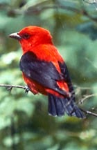
Brown's Creek State Trail
There’s no better way to experience autumn colors in the Stillwater area
than a hike.

The brilliant yellows, oranges and red
of maples to the scarlet and russets of oaks...the crisp, fresh autumn air and
the last warm rays of sunlight before winter arrives...the crunch of fallen leaves and acorns beneath your boots...stopping to enjoy a warm mug
of apple cider or a caramel apple pulled from your backpack – it all calls for an afternoon on the trail.

Fortunately, there are plenty of great autumn trails around Stillwater to hike. Some are right out your back door,
while some are a day trip that you can do in an afternoon.

Brown’s Creek State Trail (Stillwater)
Hikers can enjoy fall colors alongside a river and creek on Brown’s Creek State Trail. The 5.9-mile (one-way) trail connects Stillwater and the Gateway State Trail in Grant. A mile of the trail parallels the St. Croix River while another two miles sticks to its namesake creek. Leaves usually peak late September to mid October. From downtown Stillwater, take Minn. Hwy. 95 north. Park in either lot on the road’s right/east before or after Laurel Street. The trailhead runs north from Laurel Street east of the lots.

Lake Elmo Park Reserve (Lake Elmo)
A variety of autumn colors can be enjoyed in the maple-oak forests at Lake Elmo Park Reserve. The 3.8-mile Eagle Point Trail loops around the wooded lake for which the route is named. Paper birch, ash, cottonwood, as well as several types of evergreens, dot the landscape. From Minn. Hwy. 36 in Lake Elmo, take County Road 17/Lake Elmo Road south. Turn right/west onto County Road 14/Stillwater Boulevard then left/south onto Keats Avenue and enter the reserve. After passing the Nordic Center, go right/west into a parking lot. The trail is on the lot’s west side.

William O’Brien State Park (Marine on St. Croix)
Day hikers can learn about the power of floods on the St. Croix River via the Riverside Trail at William O’Brien State Park. The 1.5-mile trail loops through a floodplain and typically is open during summer and autumn when water levels have gone down. The fresh scent of pine needles upon the trail and the gentle rush of water along the river’s rock walls instantly lulls you into a feeling of serenity. Roughly half of the trail follows the river, mainly through a good mix of hardwoods common to a floodplain forest in this region. During autumn, their leaves turn gold, red, orange and brown. Across the water is Wisconsin, and with the two undeveloped shorelines, tranquility reigns. From Marine on St. Croix, take Minn. Hwy. 95 north into the park. Turn right/east onto O’Brien Trail North/County Road 33. The road curves south, dead ending in a parking area alongside Lake Alice. The trail begins at the picnic grounds immediately east of the parking lot.

Battle Creek Regional Park (Maplewood)
Tan-colored oak and yellow-leaved birch await hikers at Battle Creek Regional Park in Maplewood. The 1.5-mile Battle Creek Loop passes tree-lined ponds and crosses ridgelines overlooking oak-filled gullies. From Interstate 94 east of St. Paul, exit right/south onto White Bear Avenue then turn left/east onto Upper Afton Road. Go right/south onto Winthrop Street then right/west into the park’s lot.

Big Marine Park Reserve (Forest Lake)
Hikers can enjoy a walk through a woodlands and on long pier at Big Marine Park Reserve. The unnamed trail in the Washington County park runs 0.75 miles round-trip. The turf trail leaves from the park’s western side, entering a deciduous forest, which makes for a colorful walk among yellow, orange, red, russet and olive leaves in autumn. From Forest Lake, take Minn. Hwy. 97 east. Turn left/south onto County Road 15/Morning Trail North. The park entry road (aka Lomond Trail North) is on the left/east. When the entry road splits, go straight/west, following it to the last/northernmost parking lot (the road loops back onto itself at the lot).

Osceola Bedrock Glades State Natural Area (Osceola, Wis.)
Fantastic river views beneath a colorful forest canopy await hikers on the this pair of trails near Osceola. Not to be confused with Ridgeview Trail at the adjacent Osceola Bedrock Glades State Natural Area, this pair of trails actually are two loops that only locals really know about. They run through the St. Croix National Scenic Riverway and the Osceola State Fish Hatchery on a bluff overlooking a St. Croix River back channel. The oranges and reds of maples dominate here with the occasional pine grove.


Friday, June 12, 2015

Photo Album of Cascade Falls Trail

Day hikers can take a short walk to a 20-foot waterfall near the St. Croix River.

The Cascade Falls Trail runs about a quarter-mile round trip, with most of it going up and down a steep set of stairs. To see the waterfalls, take Wis. Hwy. 35 into downtown Osceola, Wis. Park along the main street.

The trailhead is near the statue of Indian Chief Osceola (below) – the town’s namesake – just north of the Wis. Hwy. 243 intersection with Hwy. 35.


From there, the trail heads down the staircase, offering glimpses of the waterfalls through the tree breaks (below).


At the stairs’ bottom, the waterfalls – Osceola Creek tumbling over a vertical wall – comes into full view (below).


The gorge at the base of the stairs is known as Wilkie Glen (below).


From the waterfall, Osceola Creek races toward the St. Croix River (below).


Here's a full description of the trail.

Learn about trail guidebooks available in the Hittin’ the Trail series.


Sunday, March 2, 2014

Trail leads to waterfall on ancient river gorge

Cascade Falls in Osceola, Wis.
Cascade Falls Trail
A 25-foot waterfall awaits hikers on a very short trail in the village of Osceola, Wis.

The Cascade Falls Trail runs less than a couple of hundred feet – and most of that is up and down a stairs from the street to the glen where the falls sits.

To reach the trailhead, take Wis. Hwy. 35 into Osceola. As entering downtown, the highway becomes North Cascade Street. Park anywhere downtown along the street.

Signs mark the trailhead, located on the street’s east side across from First Avenue. To reach the trail, a steep staircase that looks like it was extracted from a fire tower heads from the sidewalk to Willkie Glen.

Majestic trees shade the staircase and glen in green. You’ll be able to hear the waterfall’s roar from the sidewalk – and easily spot it once you reach the glen.

Osceola Creek drops over the natural falls as it flows westward on its way to the St. Croix River. Between the village and the river, the creek descends 100 feet in altitude, but this waterfalls is the only large drop.

The falls wouldn’t exist if not for the river. At the end of the last ice age some 10,000 years ago, floodwaters from melting glaciers carved out a large gorge. The waterfall is a one of the vertical wall cuts in that gorge. It measures 30 feet across.

The village itself might not exist if not for the falls. Osceola was settled because the falls could support industry; in the late 1800s, it powered a mill.

The smaller and narrower Geiger Falls is upstream on Osceola Creek, but there’s no hiking path between it and Cascade Falls.

The best time to hike the trail is in spring when snow melt increases the amount of water flowing over the falls. Another good time to visit: at night when the village lights up the falls using LED lighting to mimic the glow of the full moon upon the water; coloring is changed for the seasons.

A dirt footpath does lead from Cascade Falls to the St. Croix. The village has plans to improve the walkway into a more accessible trail.

In the centuries ahead, the waterfalls actually will be its own undoing – the splash of water at its base has created a kickpoint in the vertical wall that is slowly eroding and undercutting the drop, which one day will causing it to collapse. The waterfalls then will become a cascades, or series of rock steps, that the creek flows over.

Read more about day hiking the scenic riverway in my guidebook Hittin’ the Trail: Day Hiking the St. Croix National Scenic Riverway.


Wednesday, June 12, 2013

Polk County (Wis.) Info Center now carrying ‘Headin’ to the Cabin’

The Polk County (Wis.) Information Center is carrying my recent book, Headin’ to the Cabin: Day Hiking Trails of Northwest Wisconsin. The center provides tourism information for visitors to Polk County and Wisconsin in general and includes a gift store featuring books on local topics. Headin’ to the Cabin details more than three-dozen Polk County trails, including those in or near the communities of St. Croix Falls, Osceola, Amery, Frederic, Luck, Turtle Lake and Balsam Lake. The information center is at the intersection of U.S. Hwy. 8 and Wis. Hwy. 35.

Find out about other trail guidebooks available in the Hittin’ the Trail series.


Wednesday, June 5, 2013

Third ‘Hittin’ the Trail’ book, on Polk County, Wisconsin, released

The third book in my Hittin’ the Trail hiking guide series, Hittin’ the Trail: Day Hiking Polk County, Wisconsin, went on sale Tuesday. The ebook lists dozens of great family-friendly trails in all of your favorite Polk County communities, including St. Croix Falls, Osceola, Amery, Turtle Lake, Balsam Lake, Frederic and Luck. Included is a primer about day hiking essentials, such as gear, clothing, navigation, and how to avoid various trail dangers. Day Hiking Polk County, Wisconsin is available as an ebook on Kindle, Nook, iBook/iPad, Kobo, and other formats.

Find out about other trail guidebooks available in the Hittin’ the Trail series.


Monday, March 25, 2013

Great day hiking trails near Osceola, Wis.

Lake O' the Dalles swimming beach at Wisconsin Interstate State Park.
If traveling through or living in Osceola, Wis., this summer, you’ll find plenty of great day hiking trails to enjoy. Among them:
g Ridgeview Trail Hikers can walk across billion-year-old lava flows in a 2.1-mile loop at Osceola Bedrock Glades State Natural Area. This area is one of only three bedrock glade ecosystems in the state.
g Ridge View (Osceola and Chisago loops) Trail This pair of St. Croix National Scenic Riverway trails gives you great close-up views of a St. Croix River back channel. Birds abound in this secluded woodland.
g Lake O’ the Dalles Trail To the north at Wisconsin Interstate Park, a 1-mile loop circles the 23-acre Lake O’ the Dalles. The trail offers exceptional opportunities to view wildlife.
g Riverside Trail – Cross the border into Minnesota for William O’Brien State Park, where this 1.5-mile trail will take you to the shores of Alice Lake and the St. Croix River. There are benches every 900 feet.
g Stower Seven Lakes Trail This trail cuts across Polk County beginning (or ending, depending on your perspective) east of town at Lotus Lake. You can walk about two miles along Horse Creek to Horse Lake for a 4-mile round trip.

Read more about day hiking this and nearby trails in my Hittin’ the Trail: Day Polk County, Wisconsin guidebook.


Sunday, December 23, 2012

Loops offer great views of St. Croix River

The Ridge View Trails head through a maple and oak forest.
Ridge View Trails map. Click for larger version.
Scarlet tanager
Photo courtesy NPS.
Fantastic river views atop beneath a lush forest canopy await visitors to the Ridge View Trail near Osceola, Wis.

Not to be confused with Ridgeview Trail at the adjacent Osceola Bedrock Glades State Natural Area, this pair of trails actually is two loops that only locals really know about. The loops run through the St. Croix National Scenic Riverway and the Osceola State Fish Hatchery on a bluff overlooking the St. Croix River’s back channel.

To reach the trail, take Wis. Hwy. 35 north of Osceola and turn north onto County Road S. Two trailheads are on the road’s west (or driver’s) side. Both trailheads have their own parking areas off of the road. Just beyond 93rd Avenue is the southern-most parking area, which actually is an excellent trailhead for either loop.

Chisago Loop
From that trailhead, head west. At the first fork, continue straight to hike the Chisago Loop. Slightly more than one mile long, it’s the northern trail. Alternatively, at the fork you can head left, or south, for the Osceola Loop, which is about twice as long as its counterpart. Either loop ranges from easy to moderate in difficulty, so the distance you can handle, especially if you have children along, really determines which one to take.

If heading onto the Chisago Loop, you’ll hike clockwise around the trail. It’s mostly level and sometimes covered in a bed of pine needles or ancient, billion-year-old trap rock. You’ll see a number of these basalt outcroppings along the way. Some neat spurs off the trail offer great views of the river below.

About two-thirds of way around, be careful of taking a fork to the right, or north, lest you end up at the second of two parking lots (which is the one where you didn’t park your vehicle).

Osceola Loop
If opting for the Osceola Loop, upon reaching the main trail, go left, or south, so you take it clockwise. This saves the best views for the last half of the hike.

You’ll begin by heading through a pine and deciduous forest in which the canopy arches over the trail. About half-way through as you turn north, through the trees you can see river’s back channel and hear the rush of a rapids-filled stream in the canyon below the bluffs. Watch for pits off of the trail; they are believed to have been made many decades ago by Native Americans.

Either trail is excellent for viewing birds – scarlet tanagers, eagles, turkeys, grouse – and other forest-loving wildlife. Woodland plants you’re likely to spot include include marsh marigolds and large maple trees.

Read more about day hiking the scenic riverway in my guidebook Hittin’ the Trail: Day Hiking the St. Croix National Scenic Riverway.


Monday, July 9, 2012

Walk across billion-year-old lava flows

Osceola Bedrock Glades State Natural Area
Topo map, Osceola Glades SNA, courtesy Wisconsin DNR.

Unique ecosystem thrives at site where continent once tore itself apart


Travelers to Wisconsin can hike across billion-year-old lava flows while seeing a rare, unique glade ecosystem when taking the Ridgeview Trail at the Osceola Bedrock Glades State Natural Area.

Located north of Osceola, from Hwy. 35 turn north on County Road S. After passing 93rd Avenue and crossing two creeks (a total of 1.1 miles), turn left (or west) onto the next unpaved road and park there. The trailhead is to the southeast along the roadside.

The trail leads south into the natural area. You can take two loops, one short (9/10 of a mile loop) and the other long (1.5-mile loop; if taking the uphill route, 2.1-mile loop). You may have to briefly walk cross-country on on a deer trail but the vegetation generally is low and easy to pass through.

Begin by heading a tenth of a mile roughly southwest toward a hill. The greenery of the thin-trunked trees forms a marked contrast with the black rock jutting out of the hard ground. For 200 million years, lava flowed across the region, which at the time was a rift zone in which the land to the west and that to the east shifted apart from one another.

One of three
At the hill’s base, turn right and walk about a third of a mile. Because of the hard, flat volcanic bedrock beneath your feet, very few plants can grow here. Most common are ferns, mosses, low-growing herbs and fungi.

The area itself is rare. In fact, only three other bedrock glade ecosystems exist in Wisconsin.

To take the short trail, upon reaching the hill’s corner head up to its top for three tenths of a mile. The hill summit with its outcropping is about half of this distance. The summit with its basalt outcroppings feels more like a West Coast mountain top than a Midwestern hill. At the hill’s base, upon coming to County Road S, go north one fifth of a mile back to your vehicle.

For the longer trail, instead of turning at the hill’s corner go a tenth of a mile northwest to a rock outcropping. The black, moss-covered rocks gives the area an otherworldly feel. Walk around it, and enjoy a blufftop view overlooking the St. Croix River; you’re at about 876 feet elevation. If children are with you, make sure they stay back from the bluff’s edge.

The trail passes through oak woodland and in areas where the volcanic rock is close to the surface, the bedrock glade. The rare prairie fame-flower can be spotted here. In September, the white arrow-leaved aster blooms, which makes for an interesting accent color before tree leaves have changed to their fall colors.

Autumn insects
Despite the harsh environment for plants, a number of animals live in the bedrock glade. With the thin trees, owls are easy to spot. Around Labor Day, some interesting insects come out. The giant swallowtail caterpillar, which looks more like a knotty branch than a furry little creature, can be seen crawling on prickly ash, and you’ll likely sight a lyre-tipped spreadwing perching on a twig-like branch. During the summer, mosquitoes can be ubiquitous, so don’t forget the bug repellent.

The trail loops seventh-tenths of a mile around the back of the hill. At about two-tenths of a mile on this loop, you will join a jeep trail which you can follow for more ease of walking.

On the southeast side of hill's base, when the trail reaches County Road S, head north for a little more than a fifth of a mile back to your vehicle.

Alternately, you can follow a trail west up to the hill summit and then upon coming down it on its west side, rejoin the trail where you began your loop, retracing it back to your vehicle.

Read more about day hiking the scenic riverway in my guidebook Hittin’ the Trail: Day Hiking the St. Croix National Scenic Riverway.