Showing posts sorted by relevance for query Osceola Bedrock Glades State Natural Area. Sort by date Show all posts

Monday, July 9, 2012

Walk across billion-year-old lava flows

Osceola Bedrock Glades State Natural Area
Topo map, Osceola Glades SNA, courtesy Wisconsin DNR.

Unique ecosystem thrives at site where continent once tore itself apart


Travelers to Wisconsin can hike across billion-year-old lava flows while seeing a rare, unique glade ecosystem when taking the Ridgeview Trail at the Osceola Bedrock Glades State Natural Area.

Located north of Osceola, from Hwy. 35 turn north on County Road S. After passing 93rd Avenue and crossing two creeks (a total of 1.1 miles), turn left (or west) onto the next unpaved road and park there. The trailhead is to the southeast along the roadside.

The trail leads south into the natural area. You can take two loops, one short (9/10 of a mile loop) and the other long (1.5-mile loop; if taking the uphill route, 2.1-mile loop). You may have to briefly walk cross-country on on a deer trail but the vegetation generally is low and easy to pass through.

Begin by heading a tenth of a mile roughly southwest toward a hill. The greenery of the thin-trunked trees forms a marked contrast with the black rock jutting out of the hard ground. For 200 million years, lava flowed across the region, which at the time was a rift zone in which the land to the west and that to the east shifted apart from one another.

One of three
At the hill’s base, turn right and walk about a third of a mile. Because of the hard, flat volcanic bedrock beneath your feet, very few plants can grow here. Most common are ferns, mosses, low-growing herbs and fungi.

The area itself is rare. In fact, only three other bedrock glade ecosystems exist in Wisconsin.

To take the short trail, upon reaching the hill’s corner head up to its top for three tenths of a mile. The hill summit with its outcropping is about half of this distance. The summit with its basalt outcroppings feels more like a West Coast mountain top than a Midwestern hill. At the hill’s base, upon coming to County Road S, go north one fifth of a mile back to your vehicle.

For the longer trail, instead of turning at the hill’s corner go a tenth of a mile northwest to a rock outcropping. The black, moss-covered rocks gives the area an otherworldly feel. Walk around it, and enjoy a blufftop view overlooking the St. Croix River; you’re at about 876 feet elevation. If children are with you, make sure they stay back from the bluff’s edge.

The trail passes through oak woodland and in areas where the volcanic rock is close to the surface, the bedrock glade. The rare prairie fame-flower can be spotted here. In September, the white arrow-leaved aster blooms, which makes for an interesting accent color before tree leaves have changed to their fall colors.

Autumn insects
Despite the harsh environment for plants, a number of animals live in the bedrock glade. With the thin trees, owls are easy to spot. Around Labor Day, some interesting insects come out. The giant swallowtail caterpillar, which looks more like a knotty branch than a furry little creature, can be seen crawling on prickly ash, and you’ll likely sight a lyre-tipped spreadwing perching on a twig-like branch. During the summer, mosquitoes can be ubiquitous, so don’t forget the bug repellent.

The trail loops seventh-tenths of a mile around the back of the hill. At about two-tenths of a mile on this loop, you will join a jeep trail which you can follow for more ease of walking.

On the southeast side of hill's base, when the trail reaches County Road S, head north for a little more than a fifth of a mile back to your vehicle.

Alternately, you can follow a trail west up to the hill summit and then upon coming down it on its west side, rejoin the trail where you began your loop, retracing it back to your vehicle.

Read more about day hiking the scenic riverway in my guidebook Hittin’ the Trail: Day Hiking the St. Croix National Scenic Riverway.


Tuesday, October 30, 2018

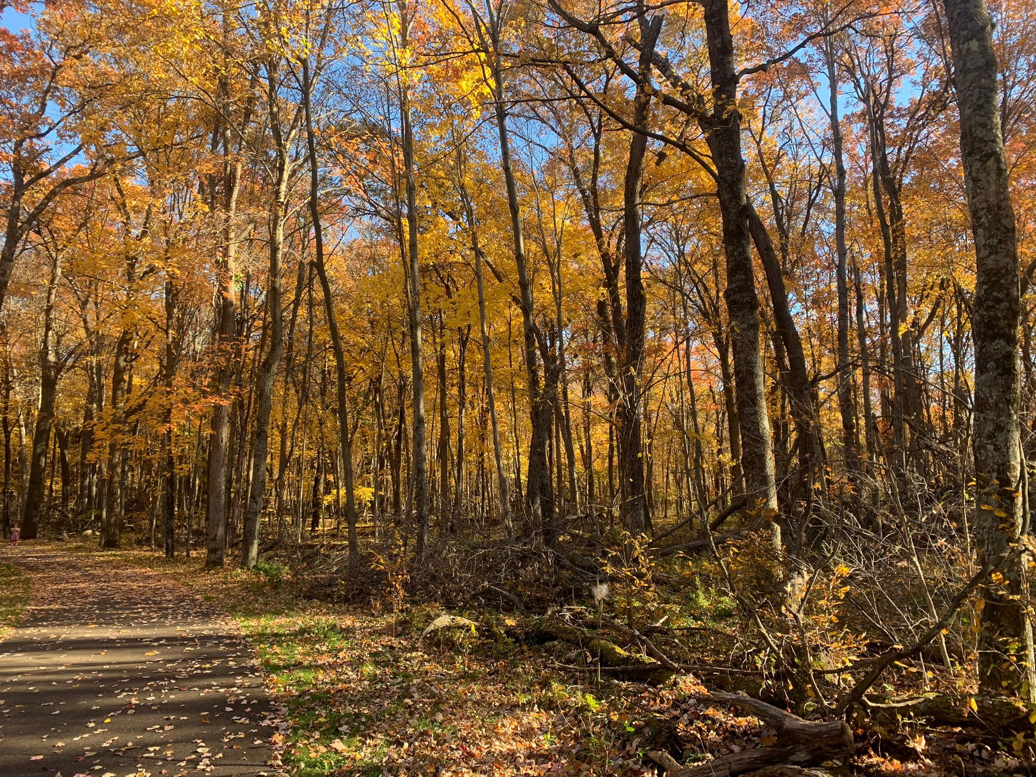
Fall color hikes abound in Stillwater MN area

Brown's Creek State Trail
There’s no better way to experience autumn colors in the Stillwater area
than a hike.

The brilliant yellows, oranges and red
of maples to the scarlet and russets of oaks...the crisp, fresh autumn air and
the last warm rays of sunlight before winter arrives...the crunch of fallen leaves and acorns beneath your boots...stopping to enjoy a warm mug
of apple cider or a caramel apple pulled from your backpack – it all calls for an afternoon on the trail.

Fortunately, there are plenty of great autumn trails around Stillwater to hike. Some are right out your back door,
while some are a day trip that you can do in an afternoon.

Brown’s Creek State Trail (Stillwater)
Hikers can enjoy fall colors alongside a river and creek on Brown’s Creek State Trail. The 5.9-mile (one-way) trail connects Stillwater and the Gateway State Trail in Grant. A mile of the trail parallels the St. Croix River while another two miles sticks to its namesake creek. Leaves usually peak late September to mid October. From downtown Stillwater, take Minn. Hwy. 95 north. Park in either lot on the road’s right/east before or after Laurel Street. The trailhead runs north from Laurel Street east of the lots.

Lake Elmo Park Reserve (Lake Elmo)
A variety of autumn colors can be enjoyed in the maple-oak forests at Lake Elmo Park Reserve. The 3.8-mile Eagle Point Trail loops around the wooded lake for which the route is named. Paper birch, ash, cottonwood, as well as several types of evergreens, dot the landscape. From Minn. Hwy. 36 in Lake Elmo, take County Road 17/Lake Elmo Road south. Turn right/west onto County Road 14/Stillwater Boulevard then left/south onto Keats Avenue and enter the reserve. After passing the Nordic Center, go right/west into a parking lot. The trail is on the lot’s west side.

William O’Brien State Park (Marine on St. Croix)
Day hikers can learn about the power of floods on the St. Croix River via the Riverside Trail at William O’Brien State Park. The 1.5-mile trail loops through a floodplain and typically is open during summer and autumn when water levels have gone down. The fresh scent of pine needles upon the trail and the gentle rush of water along the river’s rock walls instantly lulls you into a feeling of serenity. Roughly half of the trail follows the river, mainly through a good mix of hardwoods common to a floodplain forest in this region. During autumn, their leaves turn gold, red, orange and brown. Across the water is Wisconsin, and with the two undeveloped shorelines, tranquility reigns. From Marine on St. Croix, take Minn. Hwy. 95 north into the park. Turn right/east onto O’Brien Trail North/County Road 33. The road curves south, dead ending in a parking area alongside Lake Alice. The trail begins at the picnic grounds immediately east of the parking lot.

Battle Creek Regional Park (Maplewood)
Tan-colored oak and yellow-leaved birch await hikers at Battle Creek Regional Park in Maplewood. The 1.5-mile Battle Creek Loop passes tree-lined ponds and crosses ridgelines overlooking oak-filled gullies. From Interstate 94 east of St. Paul, exit right/south onto White Bear Avenue then turn left/east onto Upper Afton Road. Go right/south onto Winthrop Street then right/west into the park’s lot.

Big Marine Park Reserve (Forest Lake)
Hikers can enjoy a walk through a woodlands and on long pier at Big Marine Park Reserve. The unnamed trail in the Washington County park runs 0.75 miles round-trip. The turf trail leaves from the park’s western side, entering a deciduous forest, which makes for a colorful walk among yellow, orange, red, russet and olive leaves in autumn. From Forest Lake, take Minn. Hwy. 97 east. Turn left/south onto County Road 15/Morning Trail North. The park entry road (aka Lomond Trail North) is on the left/east. When the entry road splits, go straight/west, following it to the last/northernmost parking lot (the road loops back onto itself at the lot).

Osceola Bedrock Glades State Natural Area (Osceola, Wis.)
Fantastic river views beneath a colorful forest canopy await hikers on the this pair of trails near Osceola. Not to be confused with Ridgeview Trail at the adjacent Osceola Bedrock Glades State Natural Area, this pair of trails actually are two loops that only locals really know about. They run through the St. Croix National Scenic Riverway and the Osceola State Fish Hatchery on a bluff overlooking a St. Croix River back channel. The oranges and reds of maples dominate here with the occasional pine grove.


Sunday, June 15, 2014

St. Croix riverway abundant with day trails

St. Croix River south of St. Croix Falls, Wis.

National Park unit
includes 252 miles
of scenic shore


With the quiltwork of state parks, forests, and natural areas, county parks and other historical sites in the St. Croix National Scenic Riverway, attractions abound – swimming beaches, boat ramps, campgrounds, shopping in historic towns, ski trails, and more. Well over 70 day hiking trails can be found along the two rivers.

Scenic riverway’s location
From south to north, the scenic riverway begins in Prescott, Wis., where the St. Croix River meets the Mississippi River. This wide stretch of the St. Croix often is referred to as Lake St. Croix, which sports two state parks. At Afton, Minn., and Hudson, Wis., the Interstate 94 bridge handles the greatest amount of vehicle traffic over the river. From there, Willow River State Park sits on a tributary to the St. Croix in what is Lake St. Croix’s most populous stretch, with the cities of Bayport, Oak Park Heights and Stillwater on the Minnesota side and Hudson and North Hudson on the Wisconsin side.

North of Stillwater, the population falls off greatly, with William O’Brien State Park in Minnesota sometimes outpacing the census of the neighboring town, Marine on St. Croix. Then another cluster of villages appears – Osceola, Dresser and St. Croix Falls on the Wisconsin side and Taylors Falls in Minnesota. There the twin jewels of Minnesota and Wisconsin Interstate State Parks straddles the St. Croix O’ the Dalles, a beautiful gorge that the river flows through.

North of this region, the river bulges westward, with a state park in Minnesota and several state forests and state natural areas on both sides, before curving eastward to Danbury, Wis. A few miles north of town, the river ceases to be the state border as it heads northeast, taking in the Namekagon, and then coming to the Saint Croix Flowage near Gordon, Wis. The scenic riverway ends at the dam creating the lake.

West of the flowage, the St. Croix continues northward as a narrow waterway to its headwaters at Upper St. Croix Lake. In all, it’s a 169-mile journey.

The St. Croix’s largest tributary, the Namekagon, meanders for 101 miles, crossing four Wisconsin counties. It’s a major recreational area, with a number of boat landings and campsites, especially in Sawyer and Washburn counties.

From west to east, the Namekagon dips south to Trego, Wis., before heading northeast through Hayward, Wis. Its headwaters are at Namakagon Lake in the Chequamegon National Forest. The tributary runs 101 miles.

Attractions
The National Park Service operates two visitor centers in the riverway. The St. Croix River Visitor Center is in downtown St. Croix Falls and open from mid-April to Oct. 27. It boasts a 500-gallon freshwater aquarium. The Namekagon River Visitor Center is a mile east of Trego and open from Memorial Day Weekend through Labor Day. Hours for both visitor centers are 9 a.m. to 5 p.m. daily.

Major parks, nature centers, and public forests on or near the scenic riverway (from south to north and west to east) include:
g Carpenter St. Croix Valley Nature Center (Hastings, Minn.)
g St. Croix Bluffs Regional Park (Hastings)
g Kinnickinnic State Park (Prescott)
g Afton State Park (Afton)
g Willow River State Park (Hudson)
g William O’Brien State Park (Marine on St. Croix)
g Osceola Bedrock Glades State Natural Area (Osceola)
g Wisconsin Interstate State Park (St. Croix Falls)
g Minnesota Interstate State Park (Taylors Falls)
g Wild River State Park (North Brach, Minn.)
g Governor Knowles State Forest (Grantsburg, Wis.)
g Chengwatana State Forest (Beroun, Minn.)
g St. Croix State Park (Hinckley, Minn.)
g St. Croix State Forest (Sandstone, Minn.)
g Brule River State Forest (Solon Springs, Wis.)
g Chequamegon National Forest (Cable, Wis.)

Read more about day hiking the scenic riverway in my guidebook Hittin’ the Trail: Day Hiking the St. Croix National Scenic Riverway.


Friday, October 12, 2018

Top fall color hikes around North Branch MN

Wild River State Park, North Branch, Minnesota
There’s no better way
to experience autumn colors in the North Branch area than a
hike.

The brilliant yellows, oranges and red of maples to the scarlet
and russets of oaks...
the crisp, fresh autumn air and the last warm rays of sunlight before winter arrives...the crunch of fallen leaves and acorns beneath your boots...stopping to enjoy a warm mug of apple cider or a caramel apple pulled from your backpack – it all calls for an afternoon on the trail.

Fortunately, there are plenty of great autumn trails around North Branch to hike. Some are right out your back door, while some are a day trip that you can do in an afternoon.

Wild River State Park (North Branch)
Silver maple and basswood flourish along the St. Croix River at Wild River State Park. The 1.5-mile River Terrace Loop and its stem trail circles through a bottomland forest in this popular park. Originally called St. Croix Wild River State Park – and it still appears on various maps that way – it’s now just Wild River State Park. From North Branch, take Minn. Hwy. 95 to County Road 12. Drive County Road 12 to the park entrance, and follow the main park road to a parking lot near the picnic area.
***
Autumn colors abound in the floodplain forest at Wild River State Park. The 4.6-mile Sunrise Loop in the park’s north side is little used and so offers lots of solitude as it runs along the St. Croix River. Silver maple, ash, black willow and cottonwood all thrive there. From North Branch, take Minn. Hwy. 95 east/south. Turn left/north on County Road 9, taking it into the hamlet of Sunrise; from there, turn right/north on Ferry Road into the park. When the road runs out, use the parking lot on the left/west. Hike Ferry Road south to the trailhead and cross Ferry Road (which leads to the boat landing) then over the Sunrise River footbridge. On the other side of the bridge, the loop begins.

Minnesota Interstate State Park (Taylors Falls)
The southernmost section of Minnesota Interstate State Park offers a number of great day hiking trails to explore the Dalles of the St. Croix. To reach the area, from U.S. Hwy. 8 in Taylors Falls, turn east onto Milltown Road. A parking lot is at the end of the entry road. Along the parking lot’s northwest side are three trailheads. The Sandstone Bluff Trail heads northwest under Hwy. 8 to a nice vista of the valley and river gorge below. A 1-mile lollipop trail, it’s spectacular in autumn with a mix of colors from the orange maples, red sumac and brilliant yellow oaks.

Swedish Immigrant Trail (Shafer)
Hikers can follow some of the same footpaths and rail lines that the region’s first Swedish immigrants used to settle Chisago County and Minnesota on the Swedish Immigrant Trail. During the late 1800s, many Swedish immigrants took the ferry across the St. Croix River and then footpaths to their destinations. A spur off the St. Paul-Duluth rail route to Wyoming opened during 1880, helping speed the immigration inland. Perhaps the best of the trail’s completed portions is the Shafer Segment, which runs roughly west of the hamlet through wooded areas and past bucolic landscapes. Birch trees dominate in some sections, but the trail is mainly lined by mixed hardwoods that leave the path and its grass shoulders covered in an array of colorful leaves during autumn. Park on the street in downtown Shafer, off of Redwing Avenue near 303rd Street. The trailhead is near 303rd and heads for about two miles east of Redwing. Look for the white signs with the trail logo in the blue and yellow colors of Sweden’s flag.

Wisconsin Interstate State Park (St. Croix Falls, Wis.)
The splendor of fall colors combines with a vista of the St. Croix River and fascinating rock formations on the Summit Rock Trail at Wisconsin Interstate State Park. The 1-mile round trip trail heads to a bluff’s highest point. Moss and autumn leaves cover the surrounding rock and ground while maples, basswood and eastern white pines line the trail. At the top, prickly pear cactus can be spotted amid the outcroppings. The highlight of the hike without question is the incredible view of the riverway from the summit. Looking north, the Old Man of the Dalles rock formation is visible. From St. Croix Falls, take Wis. Hwy. 35 south. Turn right/west into the park and follow the entry road to the parking lot across from the Lake O’ the Dalles.

St. Croix National Scenic Riverway (Osceola, Wis.)

Fantastic river views beneath a colorful forest canopy await hikers on the this pair of trails near Osceola. Not to be confused with Ridgeview Trail at the adjacent Osceola Bedrock Glades State Natural Area, this pair of trails actually are two loops that only locals really know about. They run through the St. Croix National Scenic Riverway and the Osceola State Fish Hatchery on a bluff overlooking a St. Croix River back channel. The oranges and reds of maples dominate here with the occasional pine grove.

Big Marine Park Reserve (Forest Lake)
Hikers can enjoy a walk through a woodlands and on long pier at Big Marine Park Reserve. The unnamed trail in the Washington County park runs 0.75 miles round-trip. The turf trail leaves from the park’s western side, entering a deciduous forest, which makes for a colorful walk among yellow, orange, red, russet and olive leaves in autumn. From Forest Lake, take Minn. Hwy. 97 east. Turn left/south onto County Road 15/Morning Trail North. The park entry road (aka Lomond Trail North) is on the left/east. When the entry road splits, go straight/west, following it to the last/northernmost parking lot (the road loops back onto itself at the lot).


Monday, March 25, 2013

Great day hiking trails near Osceola, Wis.

Lake O' the Dalles swimming beach at Wisconsin Interstate State Park.
If traveling through or living in Osceola, Wis., this summer, you’ll find plenty of great day hiking trails to enjoy. Among them:
g Ridgeview Trail – Hikers can walk across billion-year-old lava flows in a 2.1-mile loop at Osceola Bedrock Glades State Natural Area. This area is one of only three bedrock glade ecosystems in the state.
g Ridge View (Osceola and Chisago loops) Trail – This pair of St. Croix National Scenic Riverway trails gives you great close-up views of a St. Croix River back channel. Birds abound in this secluded woodland.
g Lake O’ the Dalles Trail – To the north at Wisconsin Interstate Park, a 1-mile loop circles the 23-acre Lake O’ the Dalles. The trail offers exceptional opportunities to view wildlife.
g Riverside Trail – Cross the border into Minnesota for William O’Brien State Park, where this 1.5-mile trail will take you to the shores of Alice Lake and the St. Croix River. There are benches every 900 feet.
g Stower Seven Lakes Trail – This trail cuts across Polk County beginning (or ending, depending on your perspective) east of town at Lotus Lake. You can walk about two miles along Horse Creek to Horse Lake for a 4-mile round trip.

Read more about day hiking this and nearby trails in my Hittin’ the Trail: Day Polk County, Wisconsin guidebook.


Sunday, December 23, 2012

Loops offer great views of St. Croix River

The Ridge View Trails head through a maple and oak forest.
Ridge View Trails map. Click for larger version.
Scarlet tanager
Photo courtesy NPS.
Fantastic river views atop beneath a lush forest canopy await visitors to the Ridge View Trail near Osceola, Wis.

Not to be confused with Ridgeview Trail at the adjacent Osceola Bedrock Glades State Natural Area, this pair of trails actually is two loops that only locals really know about. The loops run through the St. Croix National Scenic Riverway and the Osceola State Fish Hatchery on a bluff overlooking the St. Croix River’s back channel.

To reach the trail, take Wis. Hwy. 35 north of Osceola and turn north onto County Road S. Two trailheads are on the road’s west (or driver’s) side. Both trailheads have their own parking areas off of the road. Just beyond 93rd Avenue is the southern-most parking area, which actually is an excellent trailhead for either loop.

Chisago Loop
From that trailhead, head west. At the first fork, continue straight to hike the Chisago Loop. Slightly more than one mile long, it’s the northern trail. Alternatively, at the fork you can head left, or south, for the Osceola Loop, which is about twice as long as its counterpart. Either loop ranges from easy to moderate in difficulty, so the distance you can handle, especially if you have children along, really determines which one to take.

If heading onto the Chisago Loop, you’ll hike clockwise around the trail. It’s mostly level and sometimes covered in a bed of pine needles or ancient, billion-year-old trap rock. You’ll see a number of these basalt outcroppings along the way. Some neat spurs off the trail offer great views of the river below.

About two-thirds of way around, be careful of taking a fork to the right, or north, lest you end up at the second of two parking lots (which is the one where you didn’t park your vehicle).

Osceola Loop
If opting for the Osceola Loop, upon reaching the main trail, go left, or south, so you take it clockwise. This saves the best views for the last half of the hike.

You’ll begin by heading through a pine and deciduous forest in which the canopy arches over the trail. About half-way through as you turn north, through the trees you can see river’s back channel and hear the rush of a rapids-filled stream in the canyon below the bluffs. Watch for pits off of the trail; they are believed to have been made many decades ago by Native Americans.

Either trail is excellent for viewing birds – scarlet tanagers, eagles, turkeys, grouse – and other forest-loving wildlife. Woodland plants you’re likely to spot include include marsh marigolds and large maple trees.

Read more about day hiking the scenic riverway in my guidebook Hittin’ the Trail: Day Hiking the St. Croix National Scenic Riverway.


Thursday, September 5, 2013

Great parks, trails await Polk County hikers

An outdoor recreational paradise, Polk County is full of trails to hike or ski, lakes to fish or boat, geological sites to marvel at or explore. For day hikers, a number of major parks and standalone trails can be found in the county.

Parks
The St. Croix National Scenic Riverway runs the length of Polk County’s western side. Its visitor center in downtown St. Croix Falls boasts a 500-gallon freshwater aquarium.

The county also is home to two state parks – Wisconsin Interstate State Park and Straight Lake State Park. Interstate Park sits in the famous Dalles of the St. Croix gorge while Straight Lake, near Luck and Frederic, is deliberately undeveloped to serve those seeking a truly back to nature experience.

Another great state-owned land to hike is the Osceola Bedrock Glades State Natural Area. It sports a rare plant ecosystem that resides on and around 1.1-billion-year-old volcanic rock.

Trails
Ice Age National Scenic Trail finds its western terminus in St. Croix Falls. The trail largely parallels the southernmost advance of the glacier that last covered Wisconsin some 10,000 years ago.

Several old railroad beds have been converted into trails as well. They’re very popular among backpackers and day hikers alike. The four railroad trails are:
g Gandy Dancer Trail – Starting in St. Croix Falls, the trail connects several communities on its 98-mile course north to Superior.
g Stower Seven Lakes State Trail – The 14-mile trail runs past lakes and farmland west of Amery.
g Cattail State Trail – The 18-mile trail also leaves from Amery but heads east to Turtle Lake and Almena in neighboring Barron County.
g Clear Lake-Clayton State Trail – Linking its namesake communities, the trail runs for 11 miles. Note that the railroad beds have a strict carry-in, carry-out policy.

Read more about day hiking this and nearby trails in my Hittin’ the Trail: Day Polk County, Wisconsin guidebook.


Friday, April 24, 2015

Best hikes to find spot spring wildflowers in Minnesota/Wisconsin's St. Croix River Valley

The pasqueflower usually is the first
wildflower to bloom in the St. Croix
River Valley. Photo courtesy of
Wisconsin DNR.
The St. Croix River Valley that forms part of the Minnesota-Wisconsin border marks a great spot to go on wildflower hikes during spring and early summer. In addition, as almost all of the river valley sits in the St. Croix National Scenic Riverway and various state parks and forests, there’s plenty of public access to where wildflowers grow.

In broad terms, the river valley can be divided into two ecosystems. One is the prairie blufftop that overlook the river while the other is the hillside and river bottoms that typically are forested.

The prairie blufftops usually are the first place to see wildflowers each spring. The St. Croix Savanna SNA, south of Bayport, Minn., offers an easy to reach gravel prairie high above the river.

In early April to early May, you’ll know spring has finally arrived when the pasqueflower blossoms there. “Pasque” is French for “Easter,” hence the flower’s name – it usually blooms around Easter.

Skunk cabbage comes next on the blufftops. That usually is followed by pussytoes and then violets.

Wildflowers growing beneath the forest canopy usually blossom in mid-spring. Wood anemones typically are the first to arrive, as they bloom before the trees grow their leaves. These wildflowers are common and typically can be seen in any wooded area throughout the river valley.

Wisconsin Interstate State Park trails are good places to see the next wave of wildflowers that arrive in May. Columbines, May apples, large-flowered trilliums, and wild geraniums are common in the park.

Wetter areas, especially those in the river bottoms, usually offer a different set of wildflowers to see during May. The Indianhead Flowage Trail, north of St. Croix Falls and in the St. Croix National Scenic Riverway, offers a good opportunity to see those flowers, which include whip-or-will trilliums, marsh marigolds, the blue flag iris, and wild geraniums.

The St. Croix River’s tributaries often have the same makeup of forested wildflowers as the St. Croix River Valley. The Apple River at Apple River County Park near Somerset, for example, offers excellent displays of trilliums in spring.

The river valley also is home to some rare flowers, at least for Wisconsin. For example, the Osceola Bedrock Glades State Natural Area’s Ridgeview Trail is one of the few places in the Badger State to host the prairie flame flower. Though common across much of the Great Plains, it isn’t typically found east of the Mississippi River.

A good place to learn about local wildflowers is Willow River State Park, particularly its Hidden Ponds Nature (Black) Trail. The garden at the nature center near the trailhead has 20 common species – including the black-eyed Susan, blazing star, and New England aster – blooming from spring to autumn.

Read more about day hiking the scenic riverway in my guidebook Hittin’ the Trail: Day Hiking the St. Croix National Scenic Riverway.