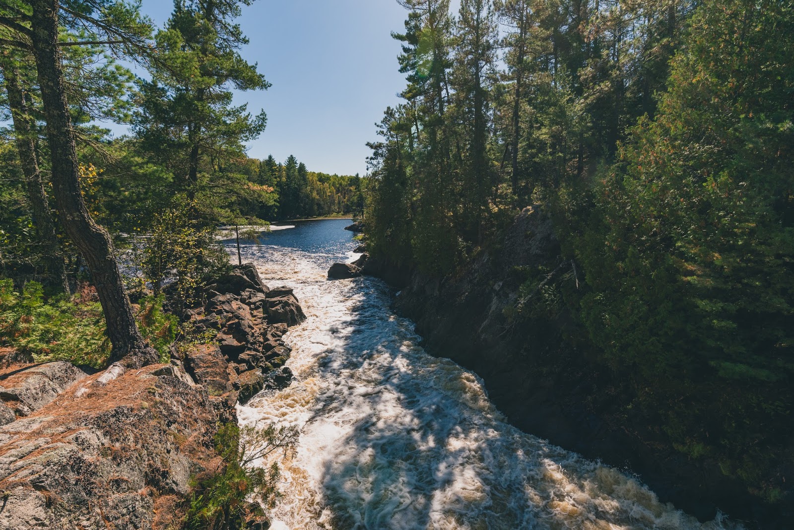
Showing posts with label Superior National Forest. Show all posts

Tuesday, September 3, 2019

Vista offers 30-mile views of autumn colors

Autumn colors spread across the forest around Skibo Vista Overlook.
Skibo Vista Overlook map.
Day trippers can enjoy sweeping 30-mile views of autumn colors at Minnesota’s Skibo Vista Overlook.

Located on Iron Range, the overlook is an easy stroll, consisting of a mere 250 feet of sidewalk. It is located along the 78-mile Superior National Forest Scenic Byway, which connects the Iron Range to the North Shore.

To reach the overlook, from Hoyt Lakes take Lake County 15 (aka Skibo Outlook Road, Forest Route 110 and Forest Route 128) south. After passing Lake County 129, the lookout is on the left/east.

Located 20 stories above the terrain below, the overlook sits on the Laurentian Divide. One of the continent’s great watershed divides, water on the north side of the Laurentian makes its way toward Hudson Bay while that to the south heads either to the Gulf of Mexico or the Atlantic Ocean. The divide stretches from Triple Divide Peak in northwestern Montana, cuts through Minnesota’s Iron Range, and ends on the Labrador Peninsula at the 60th parallel.

Glacier-shaped terrain
Surrounding the overlook are the Toimi Drumlins. Formed during the last Ice Age, viewed from above the drumlin field looks somewhat like a basket of eggs. Drumlins are a series of elongated, teardropped-shaped hills. Around Skibo Vista, each drumlin ridge is about a mile long, a quarter-mile wide, and 30-50 feet high.

Exactly how the drumlins formed is debated among geologists, but all agree that they were shaped by the glacier’s direction – the ridge’s tapered end points the way the glacier was flowing. Here the drumlins run in a southwest-northeast direction.

Quaking aspen dominates the drumlins’ tops. Their flat leaves easily flutter in the wind, in autumn giving the appearance of moving yellow seas below the overlook. Surrounding them is evergreen balsam fir.

In the distance to the west and southwest are tamarack lowlands. Tamarack is among 20 species of trees in the world that are “deciduous conifers,” meaning they grow cones and sprout needles like conifers but each autumn their needles change colors and fall, just as deciduous trees lose their leaves. Each September, the tall tamaracks – they usually grow between 33-66 high with a trunk two feet in diameter – turn a brilliant gold.

Changes
Mixed amid the aspens and tamaracks are pockets of hardwood forests. Sugar maple, basswood, American elm, and oak populate these enclaves, offering hues of orange, red, yellow and brown.

On a clear fall day, it’s quite a view, with multiple Iron Range towns nestled amid the harvest colors. Soaring eagles and migrating hawks often can be spotted overhead.

Not surprisingly, an observation tower for the Superior National Forest used to stand at the overlook, as it’s a perfect spot to watch for forest fires. A concrete foundation is all that remains of the tower.

Collectively called the Laurentian Mixed Forest, the view didn’t look like this during Minnesota’s early days as a state. When this was Native American land Euro-American settlers arrived, this area was much more like the boreal forests to the north. Red and white pine dominated, with aspen, paper birch, spruce, and balsam fir finding niches. After the pine was cut, aspen and paper birch took over. More change likely is to come in the decades ahead, as global warming allows the the hardwood forest pockets to gain a foothold.


Friday, October 27, 2017

Fall hikes abound in Grand Rapids MN area

Scenic State Park, Grand Rapids, Minn.
There’s no better way to experience autumn colors in the Grand Rapids, Minnesota, area than a hike.

The brilliant yellows, oranges and red
of maples to the scarlet and russets of oaks...the crisp, fresh autumn air and
the last warm rays of sunlight before winter arrives...the crunch of fallen leaves and acorns beneath your boots...stopping to enjoy a warm mug
of apple cider or a caramel apple pulled from your backpack – it all calls for an afternoon on the trail.

Fortunately, there are plenty of great autumn trails around Grand Rapids to hike. Some are right out your back door, while some are a day trip that you can do in an afternoon.

Scenic State Park (Grand Rapids)
Day hikers can explore a pine-covered ridge separating two lakes and a woods lit each autumn with colorful leaves at Scenic State Park. The 2.9-mile route combines two trails – Tell Lake and Chase Point – that are popular at the state park. The trail is grassy and wide as heading through a woods of quaking aspen, large-toothed aspen, and balsam poplar. From Grand Rapids take U.S. Hwy 169 east. Just past Taconite, turn left/north onto County Road 7, also known as Scenic Highway. In about 30 miles, go right/north into Scenic State Park on County Road 75. A parking lot is on the road’s right side in 0.4 miles. Park there.

Wabu Woods Scientific and Natural Area (Grand Rapids)
A forest of red oak, sugar maple, and basswood await at Wabu Woods Scientific and Natural Area. You’ll need to rely on deer trails and degraded footpaths to work your way through the woods, but the effort is worth it. Large white pines and occasionally yellow birch dot the forest while low-lying areas offer swamp alder and swamp ash amid white cedar. From Grand Rapids, take Minn. Hwy. 38 north. Turn left/west onto County Road 19. After Cedar Springs Road are signs for the natural area on the road’s right/north side. Park off the road between the signs and head north into the woods.

Maple Hill Park (Hibbing)
A forest of gold, red and orange maples and yellow birch await hikers at Maple Hill Park in Hibbing. A 1.2-mile round trip trail heads around the hill’s northeast base then makes a steep 80-foot climb up its side to a vista. The hike can be extended by taking other trails around the hilltop and its bottom. From U.S. 169 and Minn. Hwy. 73 in Hibbing, take the latter south. Turn left/east onto Lindquist Road then right/south onto Erickson Road. Park in the lot at the road’s end.

Superior National Forest (Chisholm)
An aspen and birch forest awaits along the Sturgeon River in Superior National Forest. The 2.5-mile round trip segment of the Sturgeon River Trail heads through the second-growth forest as well as a stand of stately pines. From Chisholm, head north on Minn. Hwy. 73. Turn left/west onto County Road 65. Look for a large parking on the road’s right/north side in about 1.2 miles. Take the trail northwest to a shelter.

Savanna Portage State Park (McGregor)
Among the best spots in Minnesota to see fall colors is Savanna Portage State Park. Its fairly flat 4.25-mile Continental Divide loop heads through a forest of tall maple, oak, poplar, and birch sprinkled heavily with white and red pine. From McGregor, take Minn. Hwy. 65 north. Turn right/east onto County Road 14; it comes Lake Place upon entering the park. Leave your vehicle in the parking lot on the left/west just before Loon Lake Road. Cross Lake Place and take the Old Schoolhouse Trail north. Make it a loop by going right/south onto the Continental Divide Trail then right/west onto the Anderson Road Trail, which leads back to your trailhead.

Pillsbury State Forest (Brainerd)
Hikers can enjoy great fall colors at Pillsbury State Forest. The 8.2-mile round trip Pillsbury State Forest Trail heads through a mixed forest of gold aspen and basswood, crimson maples and oaks, and green jack and white pine. Half-way through the hike, large, old red pines rise at an old logging road, marking a good turnback spot. From Brainerd, take Minn. Hwy. 210 west. Go right/north onto County Road 18 SW then left/west onto County Road 77 SW. Next, turn left/west onto Pillsbury Forest Road SW and park in the Pillsbury Forest Horse Camp South. The trail heads east from it.

Lake Bemidji State Park (Bemidji)
The vibrant oranges and reds of sugar maples and the golden yellows of basswood await at Lake Bemidji State Park. The 2-mile round trip Rocky Point Trails heads through the hardwood forest alongside the beautiful blue lake; usually about half to three-quarters of all the trees have changed color at the park by the first day of fall. From Bemidji, take County Road 19/Lake Avenue NE north. Pretty Lake Bemidji sits to the left/west, and along the way you’ll cross the Mississippi River, which this close to its headwaters is just a small, shallow river. At Bass Lake Road NE, turn right/east; this eventually becomes New Bass Road North. At County Road 20/Birchmont Beach Road NE, go left/west. Next, turn left/south onto County Road 414/State Park Road NE and enter the park. After crossing Bass Creek, park in the lot on the right/south. Pick up the trail on the lot’s south side; some of it goes southeast but most of it heads northwest to Rocky Point, the highest spot on the lake.

Pine Island State Forest (International Falls)
Say “boreal forest,” and most people think of vast expanses of pine and spruce. In Minnesota, though, paper birch is a major element of the boreal forest, making for spectacular displays of gold leaves atop white trunks against the green conifers. A great place to see birch and conifers during autumn is Pine Island State Forest, the largest of Minnesota’s 59 state forests. Try the Pine Island 3 Trails, which total 7.5 miles one-way. Autumn leaves usually peaks mid to late September on the trail. From International Falls, take U.S. Hwy. 71 south. In Big Falls, turn right/west onto County Road 30. At Gates Corner, go right/north onto Pine Island Road. After passing Fiero Truck Road, watch for the trailhead on the left/east in about 3 miles. Park off the side of the road.


Tuesday, September 27, 2016

Great trails surround Voyageurs National Pk.

Tilson Bay Trail
Several million acres of forest and public land surround Voyageurs National Park. All boast a number of great hikes that pass fascinating rock formations, head to little seen waterfalls, and offer inspiring trailside vistas.

Most of these trails can be found in one of three regions: the International Falls area, east of the city as heading to the national park's Rainy Lake Visitor Center; Kabetogama State Forest, which sits south of the park’s Kabetogama and Ash River visitor centers; and Superior National Forest, which includes the Boundary Waters Canoe Area to the park’s west.

In the International Falls area, a bicycle path runs from the city to the Rainy Lake Visitor Center. Along the way, the Tilson Bay Trail and the Tilson Creek Ski Trails in the Koochiching State Forest allow you to clamber over ancient rocks as heading through lush woodlands.

The Kabetogama State Forest offers a variety of trails and forest roads that can be hiked. The best sight to see is the Ash River Waterfalls Trail, which leads to a little-known three-story waterfall.

Superior National Forest offers two particularly scenic trails near Voyageurs. The Vermilion Falls Trail heads to a 25-foot waterfalls while the Vermilion Gorge Trail overlooks a narrowing of the Vermilion River.

Learn more about the park’s day hiking trails in my Best Sights to See at Voyageurs National Park guidebook.


Friday, July 8, 2016

Northwoods trail heads to river gorge

Vermilion Gorge Trail in Minnesota's Superior National Forest.
Vermilion Gorge Trail topo map.
Day hikers can explore a narrow river gorge just outside of Voyageurs National Park.

The Vermilion Gorge Trail runs 3-miles round trip in Minnesota’s Superior National Forest. Sporting a 282-foot elevation gain over the Vermilion River, it’s best done in April through October and on dry days to avoid slick rocks.

To reach the trailhead, from U.S. Hwy. 53 in Orr, head north on County Road 23 for about 15 miles. In Buyck, take County Road 24 north for about 10 miles; a ranger station is located near end of Hwy. 24. The trailhead is in the parking lot across from the businesses just north of Crane Lake Ranger Station.

The gravel trail initially gains elevation then descends on timbered steps with boardwalks over wet areas. Birch and aspen tower overhead.

This area was well-known to early European explorers even as the interior of what is now Minnesota remained terra incognita. Rene Bourassa ran a fur trading post at the mouth of the river on Crane Lake during the 1730s.

What really attracted European-Americans to the location, though, were minerals. In 1865, first iron ore then gold were reported discovered on Vermilion Lake. The latter set off the famous Vermilion Lake Gold Rush, and by 1866, about 300 people were panning for gold on the lake. No gold was found, but deep iron ore deposits were confirmed. The mining and logging industries soon followed, but today tourism provides most locals with their livelihoods.

Once out of the low-lying area, the trail enters a red pine stand. Be aware that bears do inhabit the area; be noisy on the trail to warn the bears in the distance of your presence so that you don't startle one up close.

After 0.75 miles, the trail reaches the Vermilion River. You can take more steps to the shore and a bobbing dock that floats on the river to get a good view of it in this wide section.

Once you’ve taken in the river, continue to the dock’s right and head up several large rocks. Moss covers many boulders, and bunchberry bushes dominate. The trail narrows and turns to dirt, as taking a sharp turn and following the river upstream.

The path climbs steeply over rocks and roots to an overlook at the gorge’s side. The sheer granite cliff walls are steep, so be careful to not fall.

Between the cliff sides is a 500-foot long narrows through which the Vermilion River takes a perpendicular turn before flowing into Crane Lake.

At the overlook, look west to a marshy plain created by the river spreading out. Sunsets are impressive here. Though not visible from the overlook, Vermilion Falls is a few miles upstream.

Upon reaching a large rock wall, the trail ends. Retrace your steps back to the parking lot.

Dogs are allowed on the trail but must be leashed.

Learn about nearby day hiking trails in my Best Sights to See at Voyageurs National Park guidebook.


Friday, July 1, 2016

Short hike heads to 25' falls in Northwoods

The Vermilion River roils 25 feet down rapids and a small drop.
Vermilion Falls Trail map. Courtesy of U.S. Forest Service.
Day hikers can enjoy one of the few waterfalls in or near Voyageurs National Park on the Vermilion Falls Trail.

The trail to the falls is an effortless walk. Fortunately, the sight makes for easy lingering given the long drive to the falls.

To reach the trailhead, from U.S. Hwy. 53 in Orr, Minn., head north on County Road 23 for about 15 miles. In Buyck, take County Road 24 north then turn left onto Forest Road 491. Drive 5.45 miles. You’re driving through the Superior National Forest and closing on the Vermilion Falls Recreation Area. Turn right/south onto the road heading to the Vermilion Falls Overlook and park at the lot along the loop. If you’ve crossed the Vermilion River, you’ve driven too far.

From the lot, a short handicap accessible trail heads south over a wooden boardwalk to an observation deck above the falls. It is about 0.25 miles round trip.

The Vermilion River tumbles 25 feet over rapids and a large slope through a 10-foot wide gap in the rock.

Smallmouth bass abound in the river below the falls. Crappies, northern pike and walleyes also can be found in the river, which flows out of Lake Vermilion for 40 miles to Crane Lake.

After taking in the falls, head back to the lot. Before reaching it, however, do some of that lingering by turning left/west onto the rugged portage trail. Slightly shorter than the trail to the falls at 0.2-miles round trip, it takes hikers to a scenic view of the river above the falls.

Returning to the falls trail, continue straight/east onto the river trail. The route runs downstream from the falls.

In about 0.25 miles, the river trail meets Forest Road 491. Here on the opposite shore of the river is an extensive wild rice bed. Its shoots usually peak above the water around mid-July. Wild rice actually is an aquatic grass; both people and local wildlife enjoy its seeds and harvest it in late August through October.

Cross the forest road and continue the trail north for about 0.1 miles to The Chute. This is a constriction in the river, forming a Class III-V rapids. Sometimes you pass canoeists on the trail using it as a portage around the rocks.

The trail ends just a little past the rapids; from there, retrace your steps back to the parking lot. In total, you’ll have walked 1.45 miles between the falls, portage and river trails.

A small picnic area and toilets are available along the trail.

Learn more about nearby day hiking trails in my Best Sights to See at Voyageurs National Park guidebook.


Thursday, March 31, 2016

Trail runs to sparkling lakes on North Shore

Map of Superior Hiking Trail, Twin lakes segment, courtesy shta.org.

Superior Hiking Trail goes 7-miles round trip to lakes in rocky bowls


Day hikers can visit twin lakes nestled in the North Shore highlands on Minnesota’s Superior Hiking Trail.

The 7-miles round trip section of the trail passes both scenic Bean and Bear lakes, which sit northwest of Silver Bay. As the lakes are right next to one another and close in size, they often are referred to as the “Twin Lakes.”

To reach the trailhead, from Split Rock Lighthouse State Park, drive north on Minn. Hwy. 61. In Silver Bay, turn left/north onto County Road 5/Outer Drive. The road eventually becomes County Road 11/Penn Boulevard. Drive into the highlands. Turn into the parking lot on the right/north. The trailhead is in the lot’s southeast corner.

Twin Lakes Trail junction
Initially, an ATV trail and the Superior Hiking Trail share the same route. They split in a hundred yards with the SHT going left/north. The trail heads uphill, crossing another ATV trail then passing through a sumac stand along the way.

Next it crosses a gravel road; look to the northwest for the water tanks that supply Silver Bay. The trail then enters a spruce forest, reaches a ridgeline, and junctions with another ATV trail.

At one mile, a series of outcrops on the ridge give excellent views to the west and the south, the latter of which includes Lake Superior and Silver Bay. In 1.3 miles from the trailhead, another great vista of an oak-maple-birch tree ridge comes up.

The SHT junctions with the Twin Lakes Trail at 1.8 miles. The Twin Lakes Trail begins in Silver Bay at the Bay Area Historical Society’s information center, taking the Silver Bay Spur of the Superior Hiking Trail to a loop running along the shores of Bean and Bear lakes. You’re now on that loop, too. Go left/northeast and continue to the lakes.

After crossing a footbridge over Penn Creek and a spur to the Penn Creek Campsite, the trail enters pretty Superior National Forest. On the south face of the highlands, you’ll find maples. Once passing outcrops, the woods turns to oak and sumac with blueberries and juneberries in the undergrowth. There’s also a wetlands with a small pond to the left/west.

Bean and Bear lakes
Next the trail heads atop high cliffs with the twin lakes to the northwest. You’ll first pass about 200 feet above sparkling Bean Lake. Thirty-two acres in size and the larger of the twins, deep Bean Lake is a popular spot to catch rainbow trout.

At 2.6 miles is the Bean Lake overlook. In addition to the lake, look northeast for Mount Trudee, whose flat top covered in red pines will be visible.

Upon coming to Bear Lake, you can scramble down to its blue shores via a 150-yard (one-way) spur trail to the Bear Lake Campsite. This places you at 3.5 miles from the trailhead.

As ascending to the lakeshore, you’ll be able to see Bean Lake in the distance. Any of the rocky outcrops over the lakes make for a great picnic spot.

After taking in the scenery, retrace yours steps back to the Penn Boulevard parking lot.

Note: The Twin Lakes Trail starting in Silver Bay, while scenic, runs about a half-mile longer than the route described here and involves more elevation gain, as it starts at the base of the highlands.

Learn about nearby hiking trails in Day Hiking Trails of Split Rock Lighthouse State Park.


Wednesday, December 30, 2015

Trail heads through ruffed grouse country

A male ruffed grouse performs its mating ritual.
Photo courtesy of  Minnesota DNR/

Mid-spring marks good
time to see game bird's
courtship displays


Day hikers can witness the ruffed grouse’s unique mating dance on Minnesota’s Jenkins Creek Hunter/Hiking Trail.

The 4.5-mile trail (one-way) rambles through aspen groves of various ages in the Superior National Forest. Only a segment of the trail need be walked to spot grouse, however; the segment described here is a 0.85-mile loop.

To reach the Jenkins Creek Hunter/Hiking Trail, from Hoyt Lakes take County Road 110 east for 13 miles. Turn east onto County 16/Forest Road 11. The parking lot is in a half mile. At the trailhead, choose the farthest trail on the right, which initially heads east before turning north.

The landscape surrounding the trail is ideal for ruffed grouse and other birds. Small timber harvests spread out over the years allow various ages of aspen to flourish, giving the birds good cover and sources of food. Grouse particularly like the catkins of alder, ash, aspen, birch and hazel trees.

After 0.4 miles, the trail reaches Junction 1. Go left/northeast onto a connector trail.

April mating rituals
Ruffed grouse are not particularly large, weighing only about 1.5 pounds and reaching a length of about 12 inches. During courtship, however, they’re quite easy to spot. Most noticeable are the banded fan-shaped tails. The males also sport a concealed neck ruff that they will display.

After only a few minutes of walking, the connector trail reaches Junction 2. Go left/southwest onto it.

A dry warm day in late April is a good time to hike the trail as the male ruffed grouse make a drumming sound as part of the mating ritual. This sound is created by compressing air beneath the wings. Many of the males drum atop a log, roots and even boulders, all to better attract a female’s attention.

The trail soon reaches a four-way intersection. Going right/northwest takes you on a spur trail. Going left/southeast takes you to the parking lot and cuts 0.15 miles off the hike. Continue going straight/southwest, however.

Extending the trail
Once mates pair up, hens construct ground nests, usually in a depression near a tree trunk or stump. Hatching typically occurs in mid- to late-May. Within four months, the chicks are fully grown.

After 0.4 miles, the trail reaches the parking lot. You can extend the trail by not taking the connector and instead continuing to Junction 3, where you go left/southwest. This adds 0.6 miles to the hike for a 1.45-mile loop.

Hiking boots definitely are required for much of the trail, which offers lots of rough footing.

The Ruffed Grouse Society, Northwoods Sportman’s Club, and U.S. Forest Service jointly developed the trail.

Read more about day hiking Northeast Minnesota in my Headin’ to the Cabin: Day Hiking Trails of Northeast Minnesota guidebook.


Wednesday, September 9, 2015

Primitive trail heads into Boundary Waters

Topo map for Anglewood Trail. Click on map for larger picture.

Anglewood Trail
crosses creek
on way to lake


Day hikers can glimpse what northern Minnesota looked like in the days before the pioneers arrived via the rugged Angleworm Trail.

The primitive trail heads heads 12 miles total around Angleworm Lake in the Superior National Forest and Boundary Waters Canoe Area Wilderness. For a day hike, the first 1.5 miles (3-miles round trip) of trail can be done.

To reach the trailhead, from Ely drive about 14 miles north on the St. Louis County Road 116/Echo Trail (aka Ely-Buycks Road). Watch for signs pointing to the parking lot, which really is just a turnaround off the road.

Big pines
From the lot, the trail – formerly a forest service road that now doubles as a canoe portage - runs through red and white pine stands. In spring, look for blossoming pink ladyslippers.

The trail quickly descends into a ravine, and at 0.8 miles from the parking lot, a bridge crosses Spring Creek. A secondary trail heads roughly north-south and crisscrossing the stream several times.

At the ravine’s bottom of ravine, the trail enters the Boundary Waters Canoe Area Wilderness. As such, hikers will need a user permit to day hike; you can pick up a free self-issue permit at the trailhead or at any U.S. Forest Service district office for the national forest.

Ascending out of the valley, the pines grow larger in size as you circumnavigate a marshy area. The old growth groves abound in the area.

Lookout tower
At 1.5 miles from the trailhead, the trail reaches wetlands at southern shore of Angleworm Lake. Angleworm in many ways feels more like a river than a lake as it fills a narrow gorge banked by two high ridges.

Looking north, you'll likely see the Anglewood Lookout Tower on the ridge overlooking the lake's west side. The tower sits at 1570 feet elevation.

The main trail continues north while a secondary trail heads south for 1.5 miles to the northern shore of Trease Lake. The intersection with the secondary trail marks a spot to turn back.

Definitely bring topo maps and a compass on the Anglewood, and spruce up on your navigation skills before hittin' this trail. Be aware that some maps and guides refer to the route as the Angleworm Lake Trail or the Angleworm Hiking Trail.

Learn about trail guidebooks available in the Hittin’ the Trail series.


Monday, May 4, 2015

Topo maps for great day hiking trails in Ely, Minn., area

No one ever should hit the trail without a topo map. Here are topo maps for three day hikes in the popular Ely, Minn. region.

Located in the Superior National Forest, Ely is a major gateway to the Boundary Waters Canoe Wilderness Area. Three state parks – most notably Bear Head Lake State Park – are nearby.

Trails are marked in yellow on the maps. Click each map or open it a new window for a larger, printable version.

Bambas Loop


Hidden Valley Recreation Area guide map (courtesy of Ely Nordic Ski Club)


Kawishiwi Falls Trail


Tri-Lake Loop Trail (courtesy of Minnesota DNR)


Learn about trail guidebooks available in the Hittin’ the Trail series.


Sunday, March 29, 2015

Trail reaches top of Laurentian Divide

A segment of the Laurentian Divide Fitness Trail
provides the first leg of the route to the top of Lookout
Mountain. Photo courtesy of U.S Forest Service.

Lookout Mountain tops out
at 1841 feet, north of Virginia


Day hikers can head to the peak of an 1841-foot hill that straddles a major continental divide in Minnesota.

The route is among several cross country ski paths in the Lookout Mountain Trail System that can be day hiked during spring, summer and fall. From the trailhead to the peak is about 2-miles round trip.

The trail is accessible via the Superior National Forest’s Laurentian Divide Recreation Area off of U.S. Hwy. 53/Minn. Hwy. 169. The parking lot and picnic area is about four miles north just before Hwys. 53/169 split.

From the parking area, pick up the Laurentian Divide Fitness Trail, going south from Station A to Station B. The trailhead starts at about 1578 feet elevation.

Rock 2.5 billion years old
The trail system traverses the Laurentian Divide – also known as the Northern Divide – in which water flows to vastly different ends of the continent. Waterways north of the divide head to Hudson Bay while those south of it go to the Gulf of Mexico.

After Station B, continue on the trail to Station C. At Station C, go northeast to Station F.

The Laurentian Divide has its origins in underground rock that cooled into granite some 2.5 billion years ago. Over the thousands of millions of years since, uplift and erosion unveiled the Giants Range Batholith, a hard rock that is literally miles across.

Several different minerals exist within the granite. The pink and white specks are feldspar, the gray crystals are quartz, and the black pieces are biotite and hornblende.

From Station F, go right/southeast onto the jeep trail. You’ll quickly start gaining in elevation, beginning the 220-foot climb to the summit.

Ski lodge history
Pines and mixed hardwoods sit at the hill’s base, but a maple hardwood forest dominates the divide’s crest.

During the late 1950s, local businessmen opened the Lookout Mountain Ski Lodge here, but barely enough money flowed in to enlarge the recreation area or to allow for expansion of summer activities. By the 1960s, the U.S. Forest Service closed the facility because safety requirements couldn’t be met.

About a half-mile from Station F, at 1800 feet elevation, take the spur trail heading directly west. This takes you to just below the rocky summit. From the peak, you’ll be able to see Virginia-Eveleth to the south, open pit mines to the west with smaller ones to the east, and an endless forest to the north.

Marshy areas can be found at the hill’s base, so be sure to don and carry insect repellent.

Learn more about nearby day hiking trails in my Day Hiking Trails of Northeast Minnesota guidebook.


Monday, October 20, 2014

Multiple day hiking trails surround North Shore's Lutsen

Gitchi-Gami State Trail south of Lutsen, Minn.
Photo courtesy of Minnesota DNR.

Minnesota village boasts several miles of walking paths


Lake Superior vistas, mountain summits, and a scenic aspen-birch forest await day hikers on trails in the Lutsen, Minn., area.

The tiny village sits about two-thirds of the way up the North Shore between Duluth, Minn., and the Canadian border. The best way to reach Lutsen is to take Minn. Hwy. 61 north from Duluth.

Among the many great day hikes around Lutsen are:
g C.J. Ramstad/North Shore State Trail (Lutsen segments) – Head 0.75 miles (1.5-miles round trip) west to the Tait River or go east 1 mile (2-miles round trip) to the stream flowing out of Mistletoe Creek into Vat Lake in the Superior National Forest. Park in the lot off of County Road 4 north of the County Road 164 intersection, about 6.5 miles north of Lutsen.
g C.J. Ramstad/North Shore State Trail (Tofte segments) – In Superior National Forest, walk west a little more than a mile (2.25-miles round trip) across the Temperance River to Blind Temperance Creek or go northeast 5.2 miles (10.4-miles round trip) to the Lutsen Trail intersection. Park in the pullout lot at the County Road 2 and County Road 166 intersection about 4.5 miles north of Tofte.
g Gitchi-Gami State Trail (Lutsen Segment) – The trail heads south/west from Lutsen Ski Hill Road. Take it to Rollins Creek for a 3-mile round trip. Park at the designated GGST parking area.
g Gitchi-Gami State Trail (Tofte Segment) – Starting at Tofte Town Park, the trail heads north/east. LeVeaux Creek is about two miles away for a 4-mile round trip.
g Gitchi-Gami State Trail (Ray Berglund State Wayside segments) – Parking at the wayside, either head south/west to LeVeaux Creek for a 4-mile round trip or north/east to Rollins Creek for a 2-mile round trip.
g Lutsen Access Trail – Day hikers can head through a forest of aspen and birch overlooking Lake Superior in the Lutsen Scientific & Natural Area. From Lutsen, take County Road 5 (aka Ski Hill Road) north. In about 1.5 miles, you’ll come to a ditch crossing the road; park off the road here. The trail heads east into the woods for a 3.33-mile round trip.
g NF-1230 Ski Trail – An old forest road turned ski trail makes for a solid hike up the bluffside starting in the Superior National Forest and ending in the Lutsen Scientific & Natural Area. The 3-mile round trip crosses all three of the SNA’s forests. Park in the dirt lot off of County Road 5, about 1.1 miles north of Hwy. 61 in Lutsen.
g Oberg and LeVeaux Mountains Trails – Day hikers can choose between these trails, each of which leads to the summit of two prominent hills in Superior National Forest’s Sawtooth Mountains. Both are well-worn paths and spurs off the Superior Hiking Trail. To reach the trails, from Lutsen take Hwy. 61 south. Turn right/north onto the unpaved Onion River Road (aka Forest Road 336); after passing the mountains, a parking lot is on the road’s left/west side.

Read more about day hiking Northeast Minnesota in my Headin’ to the Cabin: Day Hiking Trails of Northeast Minnesota guidebook.


Thursday, October 16, 2014

Day hike one of two forested ‘mountains’ along Lake Superior in northern Minnesota

Oberg Lake is visible from a vista along the Oberg Mountain Trail.
Photo courtesy of U.S. Forest Service.

Great vistas, lookout tower awaits at summits


Day hikers can choose between trails that lead to the summit of two prominent hills in Superior National Forest’s Sawtooth Mountains.

Both the Oberg and the LeVeaux mountains trails are well-worn paths and spurs off the Superior Hiking Trail. Though technically hills, locals label them as mountains, and for normally flat Minnesota, they do indeed feel more the latter rather than the former.

To reach the trails, from Lutsen, Minn., take Minn. Hwy 61 south. Turn right/north onto the unpaved Onion River Road (aka Forest Road 336). After passing between the two mountains, turn into the parking lot for the Superior Hiking Trail on the road’s left/west side.

From there, hikers have two options: Oberg Mountain or LeVeaux Mountain.

Oberg Mountain Trail
Fantastic vistas await day hikers on the trail to the summit of the slightly higher of these two mountains. The Oberg Mountain Trail runs 2.25-miles round-trip through the woods.

From the parking lot, follow the Superior Hiking Trail east and across Onion River Road. In 0.15 miles, the trail splits; go right/south onto the stem trail.

Most of the uphill portion of the trail comes next on the switchback stem that leads to a loop near the mountain top. Along the stem, the trail gains about 220 feet elevation.

Upon leveling out, the stem joins the loop on the mountain’s western side. Go right/south.

The loop offers nine overlooks. Among the views is the Onion River and LeVeaux Mountain to the southwest. Stretching southeast-northeast of the mountain is Lake Superior. Rollins Creek runs from the base of the mountain’s north side to the southeast into Lake Superior. Moose Mountain rises to the northeast. Oberg Lake, which sports beavers, is on the north side below the mountain.

Maples and pines dominate the mountain, making this a colorful autumn hike. In spring, throated blue warblers light the forest with song.

On the mountain’s north side, the trail climbs about a hundred feet to its summit at 1555 feet elevation. It then slowly descends as coming back to the stem trail. From there, retrace your steps back to the parking lot.

LeVeaux Mountain Trail
A lookout tower awaits day hikers at the top of the LeVeaux Mountain Trail.

The longer of the two trails, it runs 3.5-miles round-trip. The trailhead sits on the parking area’s west end by following the Superior Hiking Trail into the forest.

The first leg offers an opportunity to see deer and even moose. To spot them, though, you’ll need to hike near dawn or dusk when they feed.

Along the way, you’ll pass a stem trail for the Onion River Camp and cross that river.

After a mile, the trail reaches the loop on the mountain’s northwest side. Go right/southeast.

In another 0.15 miles, the trail splits once more. Stay on the loop by going left/southwest. From there, the trail turns steep for about 0.2 miles as it gains 150 feet elevation.

The prize for the hard work is the mountain’s summit, 1550 feet above sea level, at which sits a lookout tower. The tower, referred to on some maps and documents as “US Forest Service Fire Lookout Tower, Onion,” dates to 1928.

South of the tower is a lollipop trail that circles the top of the mountain’s southwest side. It’s about 0.3-miles round trip and worth the walk for the views.

Cliffsides here can be steep, so don’t allow children close to the edge or go on the other side of the guard railing.

Where that lollipop’s stem reaches the main loop atop LeVeaux, take the trail south then northeast as it circles the mountain’s small top. Among the sights are LeVeaux Creek to the west as it runs to the southwest and joins Lake Superior. The lake itself stretches from south of the mountain to the northeast. The Onion River heads from the valley north of the mountain to east then southeast of it. Oberg Mountain is to the northeast.

On LeVeaux’s north side, the trail switchbacks down about 140 feet and below the cliffside rejoins the Superior Hiking Trail. Go right/northeast onto the SHT, which is the same path you took from the parking lot.

Click image for larger version

Read more about day hiking Northeast Minnesota in my Headin’ to the Cabin: Day Hiking Trails of Northeast Minnesota guidebook.


Saturday, August 9, 2014

Minnesota Arrowhead snowmobile trail makes for great summer hikes

The C.J. Ramstad/North Shore
State Trail is named for C.J.
Ramstad, the owner/editor of
Minnesota sports publications
 and an avid snomobiler who
died in a car accident.
A number of snowmobile trails that crisscross northern Minnesota also can be used as hiking trails during summer. One of them is the C.J. Ramstad/North Shore State Trail.

About half of the 146-mile trail that parallels the Lake Superior shore is traversable during summer; that inland stretch links Finland to Grand Marais. Portions of the rest of the trail often are underwater once the snow melts.

This summer trail in turn can be broken into manageable day hikes thanks to several access points.

Most of those hikes will take you into remote, wooded areas where wildlife from moose and black bears to white-tailed deer and wolves can be seen. Fall marks a great time to hike the trail as brilliant maples cover the ridges while bronze-leafed birch and aspen groves hug streams and rivers (One more bonus: The bug count will be low in autumn.).

To ensure you stay on the trail, watch for the snowmobile trail signs, which include diamond-shaped orange blazers, typically found on trees and posts.

Access points for the trail (heading south to north) include:
g Finland – Head west for 2.5 miles (5-miles round trip) to the Baptism River or walk northeast for 1.7 miles (3.4-miles round trip) to Egge Creek. Parking is available off of County Road 7 just south of Airbase Road; take the connecting trail northwest to the trail running through Finland State Forest.
g Cramer – Go southwest for 0.6 miles (1.2-miles round trip) to Rock Creek Cut in Finland State Forest or head northeast, partially through George H. Crosby Manitou State Park, to the creek flowing out of Kowalski Lake. Park at the lot off of County Road 7 south of the Manitou River.
g Tofte – In Superior National Forest, walk west a little more than a mile (2.25-miles round trip) across the Temperance River to Blind Temperance Creek or go northeast 5.2 miles (10.4-miles round trip) to the Lutsen Trail intersection. Park in the pullout lot at the County Road 2 and County Road 166 intersection about 4.5 miles north of Tofte.
g Lutsen – Head 0.75 miles (1.5-miles round trip) west to the Tait River or go east 1 mile (2-miles round trip) to the stream flowing out of Mistletoe Creek into Vat Lake in the Superior National Forest. Park in the lot off of County Road 4 north of the County Road 164 intersection, about 6.5 miles north of Lutsen.
g Grand Marais (Little Devil Track River area) – Walk 2.1 miles (4.2-miles round trip) northwest to Blueberry Lake's shores or go southeast about 0.45 miles (0.9-miles round trip) over the Little Devil Track to the Superior Hiking Trail intersection. Park in the pullouts at the intersection of County Road 6 and Forest Road 1367 in the Superior National Forest.
g Grand Marais (city) – Walk southwest 0.45 miles (0.9 miles round trip) to the Gunflint Trail or head northeast for the same distance to the trail’s second stream crossing in Superior National Forest. Park in the turnaround at the end of Cedar Grove Drive, north of the Cedar Grove Drive intersection in town.

Find out about trail guidebooks available in the Hittin’ the Trail series.


Monday, June 16, 2014

Trail heads to Minnesota’s highest point

View from just below Eagle Mountain's summit. Photo courtesy Wikipedia.

Eagle Mountain
rises to 2301 feet


Day hikers can ascend to the highest point in Minnesota via the rugged but incredibly scenic Eagle Mountain Trail.

The 7-mile (round trip) out-and-back trail is lengthy and steep at spots. Parts of it also are rocky. Still, if the challenge isn’t rewarding enough, the views at the top certainly are.

To reach the trailhead, from Minn. Hwy. 61 in Grand Marais, take County Road 7 west. Turn north onto County Road 48. Continue west onto Forest Road 158 (aka Bally Creek Road). Take this north to the junction with Forest Road 170 (formerly named Forest Road 153 and aka The Grade). A parking area is on the intersection’s north side, with the trail heading north from the lot. As most of the trail is within the Boundary Waters Canoe Area Wilderness, a permit is required and can be obtained at the trailhead.

The trail heads through a hilly jack pine woods dotted with birch groves. If hiking during late June and early July, the forest floor is lit with colorful wildflowers, including pink moccasins and white three-leaved Solomon’s seal.

Whale Lake
Upon reaching Whale Creek, a spruce bog dominates. Yellow pond lilies usually are in bloom here during late June. Fortunately, wooden plank bridges cross the wetlands.

Leaving the bogs, you’ll catch your first glimpses of Eagle Mountain, which is the highest point on the horizon, and Whale Lake, which is to your right.

About two miles from the trailhead, you’ll come to Whale Lake, which sits on the trail’s right/east. The 21-acre lake sports bluegill, Northern pike, white sucker fish, and yellow perch.

After passing Whale Lake, the route junctions with the Brule Lake Trail. Go left/northwest toward the summit; there is a trail marker at the intersection.

The trail then turns steep as it curves upward. There’s about a 600-foot gain in elevation from the trail marker.

Billion-year-old hills
An excellent panorama of the landscape below sits just below the peak. To the west are Crow, Eagle, Shrike and Zoo lakes; to the north is Misquah Hills and the Brule Lookout Tower west of it. On a clear, dry day, Lake Superior – the lowest point in Minnesota at 600 feet elevation – can be seen 15 miles away to the south.

Surrounding Eagle Mountain is a collection of some of Minnesota’s highest points. The hill to the east is 2220 feet high and one beyond it is 2170 feet. The peak to the west is 2100 feet while the one to the northwest is 2180 feet.

To actually peakbag Minnesota’s highest point, you’ll need to continue up a little further to a rocky clearing. A plaque affixed to a rock lets you know that you’re at Eagle Mountain’s summit of 2301 feet elevation. The rocks making up Eagle Mountain and the surrounding hills were formed 1.1 billion years ago and are highly resistant to erosion.

After taking in the views, head back the way you came.

You will need bug repellent in spring through June. Also, don’t confuse this peak with the Eagle Mountain near Lutsen; the mountain at the ski resort is much shorter.

Map

Read more about day hiking Northeast Minnesota in my Headin’ to the Cabin: Day Hiking Trails of Northeast Minnesota guidebook.


Thursday, May 29, 2014

Hidden Valley ski trails make for great day hikes in Northwoods

Paper birch stands dominate Hidden Valley Recreation Area.
Photo courtesy of Minnesota DNR.

Bambas Loop runs
through center of rec area


Several day hiking trails ramble through forested rolling hills at the Hidden Valley Recreation Area near Ely, Minn.

Probably the best cross country ski area in the Ely area, Hidden Valley also makes for a darn good set of hiking and mountain biking trails, as they are groomed year round. One those trails – the Bambas Loop – runs 2.1 miles through the rec area’s heart.

To reach the trailhead, from downtown Ely go east on Minn. Hwy. 169/East Sheridan Street. After passing the Dorothy Molter Museum, take the next right onto Hidden Valley Road. The parking lot is at the chalet area; the trailhead is at the road that the Bambas parallels as heading east. Be careful, as the Stadium Loops’ route shares two trailheads with the Bambas.

Bring trail map
The trail boasts a few minor ups and downs. Paper birch and pine stands dominate the rec area, though there are newly planted red and white pine plantations as well.

Make sure you bring a trail map with you, as the Bambas Loop intersects quite a number of other trails. On the just the loop’s eastern segment, you’ll junction first the Mike Manlove Trail, then the Hang on Tight Trail, and finally the Voyageur’s Highway Trail, all of which go south.

As the trail curves south, there are junctions with three trails that are part of the Sommers Loop, all heading east, and with the Birch Highlands Trail going west.

After the trail curves west and straightens, it junctions with the Voyageur’s Highway Trail going north. Next comes a junction with the northbound Pine Valley Trail.

Ski club-managed trails
The Ely Nordic Ski Club manages the trails. The Bambas Loop is the first trail laid out in Hidden Valley after the ski club was established in the late 1980s; it was named for club members and avid skiers Sidney and Sonja Bambas.

The trail next curves north and makes a hairpin going east. Coming out of the hairpin and heading north again, you’ll reach a junction with a connecting trail to the Stadium Loops.

Nearing the parking lot at the loop’s northwest corner, the loop passes junctions with Pine Valley and the Screamer trails.

Dogs are not allowed on Hidden Valley’s trails.

Read more about day hiking Northeast Minnesota in my Headin’ to the Cabin: Day Hiking Trails of Northeast Minnesota guidebook.


Saturday, May 24, 2014

Forested trails alongside rivers await Babbitt, Minn.-area visitors

Several quality day hiking trails await visitors to Babbitt in the Minnesota Northwoods.

Located north of Duluth, forests surround Babbitt on two sides. The Superior National Forest sits a few miles to the east, and Bear Island State Forest is to the north. The trails run several miles long but can be shortened into day hiking routes.

Recommended Babbitt-area day hiking trails include:
g Iron Ore Trail segment – In nearby Embarrass, a 3.2-mile round trip segment of the old railbed heads north and south of town. Park at the trail access on the north side of County Road 21 near the Waisanen Road intersection; hike north, turning back at County Road 627/Sauna Road.
g Kelly Trail (aka Forest Road 178) segment – East of town, a segment of the jeep trail runs 2.3-miles round trip alongside Stony River in the Superior National Forest. Park at the intersection of Forest Roads 424 (aka New Tomahawk Road) and 178 then hike south, turning back upon reaching a creek flowing into the river.
g Mesabi State Trail segment – A 2.6-mile round-trip segment of the bicycle trail goes east of town along the Stony Spur ATV Trail. Park at the trail entrance off Scott Road just east of Plantation Road; the trail stops at Ely-Babbitt Road.
g Stony Spur II Trail segment – The trail runs 23 miles from Babbitt to just south of Bear Island State Forest, but segments of it can be done as short hikes. A 2.2-mile round trip section near the Dunka River southeast of Babbitt is perfect for such a hike; park off of Scott Road/County Road 623 a little more than a mile southeast of the Matilla Road junction.
g Taconite State Trail Spur segment – North of town, a 3-mile round trip segment of the spur trail rambles through Bear Island State Forest. Park at the trailhead on the north side of County Road 21, east of the electrical station; hike through the woods, turning back at the bridge over Birch River.

Read more about family friendly day hiking trails in my Headin' to the Cabin guidebooks.


Thursday, May 8, 2014

Trail heads to high waterfall in Northwoods

Kawishiwi Falls. Photo courtesy of Jon 'ShakataGaNai' Davis
Day hikers can see a 70-foot waterfall on the Kawishiwi Falls Trail in the Minnesota Northwoods.

The 1.6-mile round trip sits just a few miles east of Ely in the vast Superior National Forest. Many of the national forest’s interesting features require overnight backpacking to see, but the Kawishiwi Falls is a pleasant exception.

Portage trail
To reach the trail, from Ely take Fernberg Road/County Hwy. 18 for about five miles. Watch for signs that have you turn left with a parking lot for the trailhead.

The 0.25-mile stem of this fairly flat lollipop trail heads west then curves northwest. At the Y intersection, go right onto the loop.

In about 0.4 miles from the trailhead, you’ll reach a portage trail connecting Fall Lake to the north with Garden Lake to the south. Between the two lakes is the narrow South Kawishiwi River, which flows south from the Boundary Waters Canoe Area.

Across the lake is a small hydroelectric station. A pair of underground pipes diverts water from Garden Lake – which actually is a man-made reservoir created by a dam constructed in 1923 – to turbine generators. The station can produce up to four megawatts of electricity.

Kwaishiwi Falls
As the trail curves south, the waterfalls comes into view. It tumbles over black rock left here by volcanoes more than a billion years ago.

Because of the falls, for centuries Native Americans and later fur traders had to portage when traveling this section of the Kawishiwi. The long drop wasn’t all that forced them to carry their boats overland, though. Beaver dams can be found farther upstream. In fact, the river gets its name from the Ojibwe word for “river full of beaver or muskrat houses.”

Cliffs near the falls can be steep, so keep an eye on children.

From the falls, the trail curves back to the stem trail; follow that back to the parking lot. To extend the day hike, you can walk the portage as well. It runs 0.4 miles between the lakes.

Read more about day hiking Northeast Minnesota in my Headin’ to the Cabin: Day Hiking Trails of Northeast Minnesota guidebook.