 |
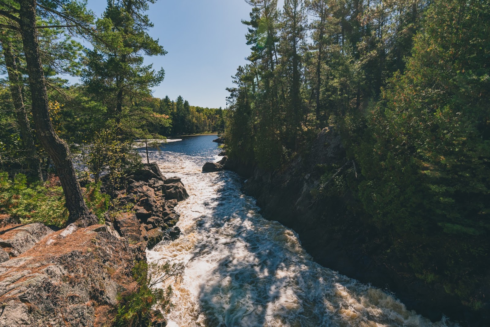
| The Vermilion River roils 25 feet down rapids and a small drop. |
 |
| Vermilion Falls Trail map. Courtesy of U.S. Forest Service. |
The trail to the falls is an effortless walk. Fortunately, the sight makes for easy lingering given the long drive to the falls.
To reach the trailhead, from U.S. Hwy. 53 in Orr, Minn., head north on County Road 23 for about 15 miles. In Buyck, take County Road 24 north then turn left onto Forest Road 491. Drive 5.45 miles. You’re driving through the Superior National Forest and closing on the Vermilion Falls Recreation Area. Turn right/south onto the road heading to the Vermilion Falls Overlook and park at the lot along the loop. If you’ve crossed the Vermilion River, you’ve driven too far.
From the lot, a short handicap accessible trail heads south over a wooden boardwalk to an observation deck above the falls. It is about 0.25 miles round trip.
The Vermilion River tumbles 25 feet over rapids and a large slope through a 10-foot wide gap in the rock.
Smallmouth bass abound in the river below the falls. Crappies, northern pike and walleyes also can be found in the river, which flows out of Lake Vermilion for 40 miles to Crane Lake.
After taking in the falls, head back to the lot. Before reaching it, however, do some of that lingering by turning left/west onto the rugged portage trail. Slightly shorter than the trail to the falls at 0.2-miles round trip, it takes hikers to a scenic view of the river above the falls.
Returning to the falls trail, continue straight/east onto the river trail. The route runs downstream from the falls.
In about 0.25 miles, the river trail meets Forest Road 491. Here on the opposite shore of the river is an extensive wild rice bed. Its shoots usually peak above the water around mid-July. Wild rice actually is an aquatic grass; both people and local wildlife enjoy its seeds and harvest it in late August through October.
Cross the forest road and continue the trail north for about 0.1 miles to The Chute. This is a constriction in the river, forming a Class III-V rapids. Sometimes you pass canoeists on the trail using it as a portage around the rocks.
The trail ends just a little past the rapids; from there, retrace your steps back to the parking lot. In total, you’ll have walked 1.45 miles between the falls, portage and river trails.
A small picnic area and toilets are available along the trail.
Learn more about nearby day hiking trails in my Best Sights to See at Voyageurs National Park guidebook.
