Showing posts with label Orr. Show all posts

Friday, July 8, 2016

Northwoods trail heads to river gorge

Vermilion Gorge Trail in Minnesota's Superior National Forest.
Vermilion Gorge Trail topo map.
Day hikers can explore a narrow river gorge just outside of Voyageurs National Park.

The Vermilion Gorge Trail runs 3-miles round trip in Minnesota’s Superior National Forest. Sporting a 282-foot elevation gain over the Vermilion River, it’s best done in April through October and on dry days to avoid slick rocks.

To reach the trailhead, from U.S. Hwy. 53 in Orr, head north on County Road 23 for about 15 miles. In Buyck, take County Road 24 north for about 10 miles; a ranger station is located near end of Hwy. 24. The trailhead is in the parking lot across from the businesses just north of Crane Lake Ranger Station.

The gravel trail initially gains elevation then descends on timbered steps with boardwalks over wet areas. Birch and aspen tower overhead.

This area was well-known to early European explorers even as the interior of what is now Minnesota remained terra incognita. Rene Bourassa ran a fur trading post at the mouth of the river on Crane Lake during the 1730s.

What really attracted European-Americans to the location, though, were minerals. In 1865, first iron ore then gold were reported discovered on Vermilion Lake. The latter set off the famous Vermilion Lake Gold Rush, and by 1866, about 300 people were panning for gold on the lake. No gold was found, but deep iron ore deposits were confirmed. The mining and logging industries soon followed, but today tourism provides most locals with their livelihoods.

Once out of the low-lying area, the trail enters a red pine stand. Be aware that bears do inhabit the area; be noisy on the trail to warn the bears in the distance of your presence so that you don't startle one up close.

After 0.75 miles, the trail reaches the Vermilion River. You can take more steps to the shore and a bobbing dock that floats on the river to get a good view of it in this wide section.

Once you’ve taken in the river, continue to the dock’s right and head up several large rocks. Moss covers many boulders, and bunchberry bushes dominate. The trail narrows and turns to dirt, as taking a sharp turn and following the river upstream.

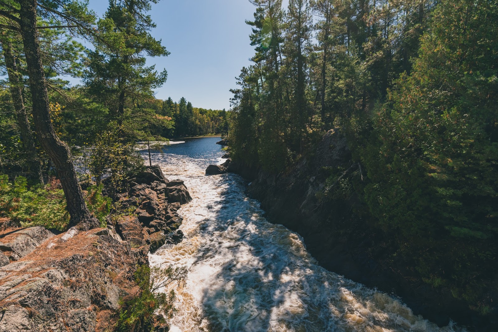
The path climbs steeply over rocks and roots to an overlook at the gorge’s side. The sheer granite cliff walls are steep, so be careful to not fall.

Between the cliff sides is a 500-foot long narrows through which the Vermilion River takes a perpendicular turn before flowing into Crane Lake.

At the overlook, look west to a marshy plain created by the river spreading out. Sunsets are impressive here. Though not visible from the overlook, Vermilion Falls is a few miles upstream.

Upon reaching a large rock wall, the trail ends. Retrace your steps back to the parking lot.

Dogs are allowed on the trail but must be leashed.

Learn about nearby day hiking trails in my Best Sights to See at Voyageurs National Park guidebook.


Friday, July 1, 2016

Short hike heads to 25' falls in Northwoods

The Vermilion River roils 25 feet down rapids and a small drop.
Vermilion Falls Trail map. Courtesy of U.S. Forest Service.
Day hikers can enjoy one of the few waterfalls in or near Voyageurs National Park on the Vermilion Falls Trail.

The trail to the falls is an effortless walk. Fortunately, the sight makes for easy lingering given the long drive to the falls.

To reach the trailhead, from U.S. Hwy. 53 in Orr, Minn., head north on County Road 23 for about 15 miles. In Buyck, take County Road 24 north then turn left onto Forest Road 491. Drive 5.45 miles. You’re driving through the Superior National Forest and closing on the Vermilion Falls Recreation Area. Turn right/south onto the road heading to the Vermilion Falls Overlook and park at the lot along the loop. If you’ve crossed the Vermilion River, you’ve driven too far.

From the lot, a short handicap accessible trail heads south over a wooden boardwalk to an observation deck above the falls. It is about 0.25 miles round trip.

The Vermilion River tumbles 25 feet over rapids and a large slope through a 10-foot wide gap in the rock.

Smallmouth bass abound in the river below the falls. Crappies, northern pike and walleyes also can be found in the river, which flows out of Lake Vermilion for 40 miles to Crane Lake.

After taking in the falls, head back to the lot. Before reaching it, however, do some of that lingering by turning left/west onto the rugged portage trail. Slightly shorter than the trail to the falls at 0.2-miles round trip, it takes hikers to a scenic view of the river above the falls.

Returning to the falls trail, continue straight/east onto the river trail. The route runs downstream from the falls.

In about 0.25 miles, the river trail meets Forest Road 491. Here on the opposite shore of the river is an extensive wild rice bed. Its shoots usually peak above the water around mid-July. Wild rice actually is an aquatic grass; both people and local wildlife enjoy its seeds and harvest it in late August through October.

Cross the forest road and continue the trail north for about 0.1 miles to The Chute. This is a constriction in the river, forming a Class III-V rapids. Sometimes you pass canoeists on the trail using it as a portage around the rocks.

The trail ends just a little past the rapids; from there, retrace your steps back to the parking lot. In total, you’ll have walked 1.45 miles between the falls, portage and river trails.

A small picnic area and toilets are available along the trail.

Learn more about nearby day hiking trails in my Best Sights to See at Voyageurs National Park guidebook.


Saturday, December 26, 2015

Discover Northwoods songbirds near Gheen

Mourning warbler. Photo courtesy of Ohio DNR.
Gheen Hills Trails aerial map

Short loop runs 0.6-miles near Orr


Hikers can spot wildlife and various songbirds on the easy to reach Gheen Hills Trails in Minnesota’s Kabetogama State Forest.

The 4.5-mile system of trails is popular with mountain bicyclists and cross county skiers as well as hikers. Multiple trailheads access the system.

The system is best done in late spring or early summer. Parts of the trail during early to mid-spring can be soggy, and in late summer overgrown with grass, which sometimes hides logs that can be tripped over.

Deer and bear
One good route in the Gheen Hills to day hike is a short loop that covers the trail system's northeastern woods.

To reach the trailhead, from Orr travel south about 3.5 miles on U.S. Hwy. 53. Turn right/west onto Diamond Match Forest Road. A parking area and the trail is less than 200 feet from the intersection.

The trail heads southwest from the lot across open country. This stem to the loop runs about 0.1 miles.

Where the trail divides, go right/west onto the loop, which quickly enters a forest. The majority of trees are stands of aspen, birch and pine.

White-tailed deer and black bear are the largest mammals in the area. Very rarely, moose and wolf make their way into this section of the Kabetogama.

Three songbirds
You have a much better chance of spotting three particular songbirds. Least flycatchers, mourning warblers, and Nashville warblers all make their home near the trail system. Both warblers are yellow-breasted with the mourning warbler nesting here.

Along the way, there are a few intersecting trails that take you deeper into the Gheen Hills. To stay on the loop, always make a left turn at a trail intersection.

When you exit the woods - you’ll be heading roughly northeast - you’ve reached the end of the loop, which runs about 0.4 miles. Go right/northeast onto the stem trail and return to the parking area.

In all, the trail is about 0.6 miles long.

Learn more about nearby day hiking trails in my Day Hiking Trails of Northeast Minnesota guidebook.


Friday, January 16, 2015

Waterfall, young aspen forests await day hikers in Orr, Minnesota

Vermilion Falls Trail. Photo courtesy of USFS.
Several great day trails await day hikers in the Minnesota Northwoods’ community of Orr.

Located in the middle of the Kabetogama State Forest, the small town sits between the Duluth, Minn, metro area and Voyageurs National Park. Orr can be reached by taking U.S. Hwy. 53 north from Duluth or south from International Falls.

Among the great day hikes in the Orr area are:
g Arrowhead State Trail segment – About 22 miles of the 135-mile long state trail runs east of Orr east as heading through the state forest. The northern end of this segment can be accessed from Forest Road 180 near the Pelican River; the southern end only can be reached by hiking the Orr Spur South Trail to it.
g Bug Creek Walking Trails – The trail system heads through a forest of young aspen growing on just-logged lands to a small pond on Bug Creek in Superior National Forest. A trailhead can be found off of County Road 203 about 11 miles from Orr.
g Echo Lake Hunter Walking Trail – The trail rambles 13 miles through a young aspen forest and is prime ruffed grouse habitat. For the trailhead, go 2.2 miles from the County Roads 24/116 junction northeast of Orr.
g Gheen Hills Trails – Hikers are likely to see wildlife and various birds on this 4.5-mile system of trails. Park at the trailhead off of Diamond Match Forest Road, immediately west of the U.S. Hwy. 53 intersection about 3.5 miles south of Orr.
g Herriman Lake Trail – More than half of the 13 miles of trails in this system run through the Boundary Waters Canoe Area Wilderness. The trailhead is in Superior National Forest, off of County Road 24 about 27 miles northeast of Orr.
g Orr Bog Walk – This 0.5-mile loop consists of a floating boardwalk through six wetlands environments. Pick up the trailhead behind the Voyageur Country Visitor Center in Orr.
g Orr Spur North Trail – The 8-miles one-way snowmobile trail connects the northern end of Orr to the Arrowhead State Trail near the Pelican River. Park off of County Road 180 near the river and head south from the Arrowhead for the trail’s quietest segment.
g Orr Spur South Trail – Also 8-miles one-way, the snowmobile trail heads from U.S. Hwy. 53 to the Arrowhead State Trail near Little Elbow Creek. The western end of the trail crosses the Pelican River.
g Pelican Lake Trail – The snowmobile trail runs about 17 miles from Cusson, which is north of Orr, to Ash Lake. Park at the trailhead off of Forest Road 180 where it turns sharp south, about 1.3 miles west of Hwy. 53.
g Vermilion Falls Trail – A small waterfall amid granite outcroppings sits at the end of this 0.25-mile round trip hike in the Superior National Forest; picnic tables and an observation deck overlook the falls. The trailhead is on the Vermilion Falls Recreation Area access road past the Forest Road 491 junction northeast of town.
g Vermilion Gorge Trail – The 2.6-mile round trip trail overlooks the Vermilion River, which runs below sheer granite cliffs in the Superior National Forest. Park in the lot off of County Road 24, just past the Voyageurs National Park office, about 27 miles northeast of Orr.

Read more about day hiking Northeast Minnesota in my Headin’ to the Cabin: Day Hiking Trails of Northeast Minnesota guidebook.