Showing posts with label desert. Show all posts
Saturday, October 13, 2018
7 Tips for Hiking in the Desert
• Desert dangers to watch for on a day hike with children
• Reducing impact on a desert environment when hiking
• Help preserve historical and archeological sites in deserts
• Lost hiking in a desert? Here's how to find water to stay alive
• Consider bringing along specific gear for desert hikes with children
• Stay comfortable, safe during hot weather hikes with children
• How to avoid, treat hyponatremia on hike
Learn about trail guidebooks available in the Hittin’ the Trail series.
Labels:
desert
Thursday, September 6, 2018
Fan palm oasis graces desert canyon
This article originally was written for Uken Report.
A lush desert oasis awaits day hikers on the Andreas Canyon Trail in Palm Springs’ Indian Canyons.
The 2-mile round trip hike sits on the historic Agua Caliente Band of Cahuilla Indians tribal grounds. It’s a fairly flat trail, boasting a mere 50 foot elevation gain, that children can handle and enjoy.
To reach the trailhead, from Hwy. 111 go south onto South Palm Canyon Drive. In two miles, you’ll reach the Indian Canyons tollgate; there is a fee per adult and a lower rate per child. Shortly after the toll, the road splits; turn right and heads to a gravel parking area. The trailhead is northeast of the lot.
Begin the hike along the canyon’s right/northeast side. In a reminder of man’s smallness to nature, a pile of giant slabs and boulders that have broken off a formation greet you.
California fan palm
The trail follows a year-round stream, fed by mountain runoff, with lush vegetation through a rocky canyon. Cascades with bubbling sounds sound downright refreshing in the desert. A number of birds live alongside the stream, and more than 150 plant species flourish in the oasis.
Most noticeable among them are California fan palms. The only palm native to the Western United States, the Cahuilla and other Native American tribes ate its fruit both raw and cooked as well as ground it into cake flour. The palm’s stems were fashioned into cooking utensils while the leaves served as the raw material to make a wide-range of items, from sandals and baskets to thatched roofs.
When the fan palm’s fronds die, they droop around the trunk, forming a skirt protecting it from the desert sun. Many small birds – among them the brilliantly colored orange-yellow hooded oriole – make their homes in the skirt.
A hardy plant, the fan palm can live up to 250 years. In the decades ahead, you’ll probably see more of them across Southern California, as their range is expanding due to global warming.
End of the line
A mile in, the trail reaches a wire fence. Carefully cross the stream here and continue back along the left side. This part of the walk heads through desert so is exposed to sun but gives a view of the canyon bottoms from above.
In another mile, the trail nears the parking lot. Turn north through the fan palms to reach it.
Picnic tables are near the trailhead, so consider bringing a basket lunch to replenish your energy. If you eat at the end of the hike, be sure to leave your food in a cooler with ice.
While the stream and shade keeps the trail’s right side slightly cooler than the surrounding desert, the hike still is best done in October through April when temperatures are more comfortable. Wear hats and sunscreen and always carry water.
Indian Canyons opens at 8 a.m. and closes at night, so this is no spot for a dawn hike. A popular trail, it can be crowded on weekends. Informative tribal ranger tours are available Friday through Saturday.
Learn about trail guidebooks available in the Hittin’ the Trail series.
A lush desert oasis awaits day hikers on the Andreas Canyon Trail in Palm Springs’ Indian Canyons.
The 2-mile round trip hike sits on the historic Agua Caliente Band of Cahuilla Indians tribal grounds. It’s a fairly flat trail, boasting a mere 50 foot elevation gain, that children can handle and enjoy.
To reach the trailhead, from Hwy. 111 go south onto South Palm Canyon Drive. In two miles, you’ll reach the Indian Canyons tollgate; there is a fee per adult and a lower rate per child. Shortly after the toll, the road splits; turn right and heads to a gravel parking area. The trailhead is northeast of the lot.
Begin the hike along the canyon’s right/northeast side. In a reminder of man’s smallness to nature, a pile of giant slabs and boulders that have broken off a formation greet you.
California fan palm
The trail follows a year-round stream, fed by mountain runoff, with lush vegetation through a rocky canyon. Cascades with bubbling sounds sound downright refreshing in the desert. A number of birds live alongside the stream, and more than 150 plant species flourish in the oasis.
Most noticeable among them are California fan palms. The only palm native to the Western United States, the Cahuilla and other Native American tribes ate its fruit both raw and cooked as well as ground it into cake flour. The palm’s stems were fashioned into cooking utensils while the leaves served as the raw material to make a wide-range of items, from sandals and baskets to thatched roofs.
When the fan palm’s fronds die, they droop around the trunk, forming a skirt protecting it from the desert sun. Many small birds – among them the brilliantly colored orange-yellow hooded oriole – make their homes in the skirt.
A hardy plant, the fan palm can live up to 250 years. In the decades ahead, you’ll probably see more of them across Southern California, as their range is expanding due to global warming.
End of the line
A mile in, the trail reaches a wire fence. Carefully cross the stream here and continue back along the left side. This part of the walk heads through desert so is exposed to sun but gives a view of the canyon bottoms from above.
In another mile, the trail nears the parking lot. Turn north through the fan palms to reach it.
Picnic tables are near the trailhead, so consider bringing a basket lunch to replenish your energy. If you eat at the end of the hike, be sure to leave your food in a cooler with ice.
While the stream and shade keeps the trail’s right side slightly cooler than the surrounding desert, the hike still is best done in October through April when temperatures are more comfortable. Wear hats and sunscreen and always carry water.
Indian Canyons opens at 8 a.m. and closes at night, so this is no spot for a dawn hike. A popular trail, it can be crowded on weekends. Informative tribal ranger tours are available Friday through Saturday.
Learn about trail guidebooks available in the Hittin’ the Trail series.
Monday, October 17, 2016
Spot Saguaro National Park wildlife on trail
![]() |
| A desert tortoise finds juicy fruit on the Douglas Spring Trail. |
A good adventure on the trail is a 4.6-mile round trip hike to Three Tanks Trail in the park’s Rincon Mountains (East) section. You can go up to 16.6 miles one-way on the Douglas Springs Trail, however, for a backcountry hike. The trail is best done in October through April; it can be hiked in other months but will be hot much of the way, and in the desert heat, few animals beyond lizards will be out and about.
To reach the trailhead, from Interstate 10 in Tucson take East Speedway Boulevard east. Outside of town, the road dead ends at the trailhead. As the trail is easy to access, the parking lot fills up fast, so you may need to park on the road’s wide shoulder as it approaches the trailhead. Though there’s no fee station, be sure to have your park pass, as rangers regularly patrol the area.
A picnic ramada sits near the trailhead. You’re at an elevation of 2,750 feet.
The trail heads east through mesquite trees that sport some large saguaro. Scotts Knob rises to north, topping out at 2923 feet.
Perfect environment for wildlife
The path junctions the Garwood Trail at 0.3 miles. Continue straight-left/east. In spring or after a rainfall, this area is a good spot for wildflowers with desert senna dominating.
Next the trail crosses fairly open desert then a sandy wash. While wildlife can be found throughout the national park, the Douglas Spring Trail has the advantage of several seasonal streams crossing it. The waterways along with the residual pools they leave behind, attract a variety of animals, making it ideal for spotting wildlife.
A changing landscape helps as well. The trial features slopes, ravines and flat stretches all as gaining elevation. This creates a number of niche environments for different animals.
The Converse Trail junctions from the right at 0.5 miles; continue straight-left/east. The Converse briefly runs with the Douglas Spring Trail that splits to the left/north.
Next the trail gains elevation; wood and stone steps help make traversing it easy. An overlook of a rocky canyon with an intermittent stream and leftover pools in it marks a good spot to spy wildlife.
Roadrunners and coyotes
Look for quail, roadrunner, jackrabbits, coyotes, mule deer and javelina at lower elevations.
The best time to spot the Gambel’s quail is early morning or late afternoon when the temperature is cool. The quail is easy to identify thanks to its black, comma-shaped topknot rising out of its forehead. The desert bird can grow up to 10 inches long and dines on seeds, insects and fruit of available.
Roadrunners, the iconic bird of the American Southwest, can be seen as well. They rarely fly but are fast runners, hitting speeds of 15 mph as they use their tail as a rudder. Adults can stretch up to 23 inches in length with almost as wide of a wingspan. A predator, they eat lizards, small birds, small mammals, and snakes, but also will gobble down fruit and seeds if available.
About 40 medium and large mammals can be found in the park, with more of them in the Rincon Mountain (East) district than the Tucson Mountain (West) area.
Black-tailed jackrabbits are fairly common in both sections of the national park. Larger in size than a typical rabbit, they sport black-tipped ears and tail. They prefer open areas, and when a predator approaches can dash away at 35 mph. The antelope jackrabbit, which is larger than the black-tailed, is rare in the park, but sometimes is spotted in sandy washes.
Coyotes also are common here. They eat a variety of small mammals and can reach speeds of up to 40 mph when chasing jackrabbits. During summer when hunting is more difficult, coyotes will eat saguaro and prickly pear cactus fruit. Even if you never see a coyote, you probably will hear their yelps in the distance and notice their pawprints in the sand.
Javelina and scorpions
Mule deer sport large ears and usually can be seen in the park’s open areas. They generally stick to elevations below 4,500 feet, where they browse woody plants and shrubs, though after seasonal rains they enjoy broad-leaved weeds. Their numbers appear to be declining in the park, largely because of limited habitat range due to urban sprawl and thickening park vegetation, leaving less open space, which they prefer to better spot and run from predators.
Though looking like pigs, javelina – or peccaries – aren’t. Traveling in herds as large as 20 and led by an experienced, older female, they can weigh up to 65 pounds and be 40 inches long. They’re quite common in the park and can be found digging for roots, tubers or foraging for agave, cactus fruit, seeds, mesquite beans, prickly pear pads, and occasionally even carrion.
Several species of scorpions live in the park. Their lineage goes back some 425 million years. Some secrete a wax to protect themselves from the harsh sun and have chemicals beneath their exoskeleton that glow under ultraviolet light.
From the overlook, the trail ascends to a somewhat flat basin then upon reaching a small saddle junctions with the Carrillo Trail at 1.1 miles. You’re at 3120 feet elevation. In 2019, Africanized bees built a hive near the trail here; they are dangerous, so if you see any signs warning that the bees have returned, heed it and turn back.
If there are no bees, continue onward. Ocotillo becomes more dominant and the number of saguaro fewer.
Reptiles
There’s no shortage of reptiles on the trail (or elsewhere in the park for that matter). Saguaro National Park boasts 36 species of reptiles, most notably coral snakes, desert tortoises, diamondback rattlesnakes, Gila monsters, short-horned lizards, spiny lizards, and zebra-tailed lizards.
Should you spot a snake or a Gila monster, be cautious. Avoid them by watching where you step and not putting your hands or feet under rocks or in dark crevices. If you spot one, slowly back off. Snakes and Gila monsters are just as afraid of you as you are of them, so once you give them space, they’ll likely scamper off. If they don’t, turn back, as passing around them isn’t a good option.
Other wildlife you may spot along the way are bobcats, cougars, desert cottontails, elf owl (the world’s smallest owl and raptor), gray foxes, ground squirrels, Harris’s hawk, the endangered lesser long-nosed bat (which lives part of the year in Mexico), ring-tailed cats, white-nosed coatis, and white-tailed deer.
Next the trail descends into a wash. Seep monkeyflowers and Arizona centaury line the moist canyon walls.
Climbing out of the canyon, the trail crosses the top of a V-shaped valley, offering great views of Tucson’s suburbs in the west.
Urban sprawl
Unfortunately, urban sprawl has harmed the wildlife population here. Not only is the habitat range limited, but sprawl’s various pollutions – air, light, noise and water – all stress animals. Visitors in the park, whether they be from Tucson or from a distance, also affect the wildlife. Traffic alone kills about 50,000 animals a year on the park’s roads.
From the overlook, the trail climbs to slickrock that surrounds a stream. There are more pools and wildflowers here, making it another good area to spot wildlife. Palo verde, sotol and ocotillo cover the hillsides.
At 2.3 miles, the path reaches the Three Tanks Trail. You’re at 3695 feet; here there are very few tall saguaro with mostly creosote, mesquite and scrub oak dominating. The trail junction marks a great spot to turn back.
As the trail climbs to higher elevations and reaches Tanque Verde Ridge, the vegetation increases and the temperature cools, offering habitat for larger wildlife. Mountain lions, brown bear – as well as the lower elevation’s bobcats and white-tailed deer – can be found there.
As there’s no shade on the trail, be sure to don sunscreen, sunglasses and sunhat as well as bring water. In addition, due to easy access from populated areas, vehicle break-ins have been reported at this trailhead. Never leave valuables in your vehicle, and consider having someone drop off and pick you up following a hike.
TOPO MAP
![]() |
| Douglas Spring Trail topo map. Click for larger version. |
Friday, September 9, 2016
Six Great National Parks to See Wildlife
![]() |
| Bison can be found on Yellowstone National Park's Lamar Valley Trail. |
America’s national parks are known for their great vistas and fantastic rock formations, but they also preserve another treasure: wildlife.
In fact, national parks rank among the best places to see interesting and rare wildlife. Late summer marks a particularly good time for wildlife viewing at many parks as most mothers bring out their young by that time of the year.
Given the breadth of national park locations, there’s also the opportunity to see almost every kind of North American wildlife, from those that live on mountains, in marine environments, and in the tropics to those that make their homes on prairies, deserts, and in temperate forests.
Mountains
Travelers can explore the “Serengeti of North America” on the Lamar Valley Trail at Wyoming’s Yellowstone National Park. Like the mountain-ringed African plain, Lamar Valley serves as home to the classic megafauna that define North America. Bison, elk, grizzlies, black bears, wolves, coyotes, eagles, osprey and more all can be found at this high elevation. Coyotes also can be seen wandering about, looking for a meal while bald eagles and osprey grace the skies. Grizzlies reside in the hilly woods, but they and the area’s other big two predators – black bears and wolf packs – prefer to remain under cover than be seen.
Marine
You can encounter an array of marine wildlife on the Beach Trail at Alaska’s Glacier Bay National Park. Low tide also provides an opportunity to see intertidal life. As the waters retreat into the ocean – and water levels here can fall 25 vertical feet, among the greatest extremes in the world – a number of animals and plants are exposed. Don’t be surprised to spot starfish and snails on the sands and grasses. On shore, a variety of sea birds gather and fly over, often nabbing exposed intertidal creatures for a meal. During those first moments of sunlight, watch for humpback whales, harbor porpoise, puffins, sea otters, and Steller sea lions, frolicking and feeding in the mouth of the bay. Bring binoculars. If lucky, you’ll also hear the blow of humpback whales.
Tropics
Tropical wildlife can be safely seen from the Anhinga Trail at Florida’s Everglades National Park. The trail’s boardwalk takes you over open water where you can watch for alligators peeking out of a river, as well as turtles, herons and egrets. Winter marks the best season to see the most wildlife. A number of birds spend their time in the Everglades after migrating from a northern clime. Among those you can spot are the double breasted cormorant, great egret, great blue heron, snowy egret, tricolored heron, white ibis and woodstork. Turkey vultures congregate in the marsh during the early morning hours.
Prairies
North America’s largest mammal – the bison – freely roams North Dakota’s Theodore Roosevelt National Park, and the Buckhorn Trail is an excellent place to spot them and other Great Plains wildlife. The trail includes a prairie dog town that stretches for about a mile. You’ll be able to spot them barking from their burrow entrances as they keep an eye out for predators. Hawks, coyotes and rattlesnakes are among the creatures hoping to make an unsuspecting prairie dog its dinner.
Deserts
Four desert ecosystems can be found in North America, and the park closest to a major metro area offers among the best spots to see wildlife of these dry climes. Outside of Tucson, Ariz., Saguaro National Park’s Douglas Spring Trail crosses the Rincon Mountain District (Saguaro Park East), providing the chance to see coyotes, roadrunners, jackrabbits and quail. All four of those creatures thrive in the Sonoran Desert, which stretches across Arizona and northern Mexico, as well as good portions of the continent’s other three desert ecosystems.
Temperate forests
Great Smoky Mountains National Park, though stretching across the Appalachian Mountains, offers the opportunity to see many of the animals that reside in temperate forests covering much of the continent east of the Mississippi River. The Deep Creek/Indian Falls trails in the park’s North Carolina section sports Eastern cottontail rabbit, groundhogs, river otter, and white-tailed deer. Also present but much more elusive, as they keep to themselves, are black bear, bobcat, coyote, red fox, red wolf, and wild boar.
Rob Bignell is the author of several hiking guidebooks, including the bestselling Best Sights to See at America’s National Parks.
Learn more about national park day hiking trails in my Best Sights to See at America’s National Parks guidebook.
Wednesday, December 24, 2014
American deserts offer multitude of trails
![]() |
| Delicate Arch, Arches National Park, Utah. |
Definitions of exactly what is a desert vary depending on the source. Generally, a desert is an extremely arid region, receiving less than 10 inches of precipitation a year. Most of those arid regions also see summer temperatures that regularly exceed 95 F.
Though such definitions leave an image of an inhospitable, empty area, deserts actually are great places to hike. Indeed, at least a couple of months a year offer temperate conditions, usually February through March and September through August. In addition, the arid conditions yield fantastic, otherworldly subregions that will astound any hiker. Just think of the arches and slick rock surfaces in eastern Utah or the vistas and slot canyons of northern Arizona’s Grand Canyon.
Four major deserts can be found in the western United States. The Chihuahuan covers southern New Mexico and southeast Texas. The Sonoran stretches across southern Arizona and southeast California, with the saguaro cactus its hallmark. The Mojave covers the region where California, Nevada and Arizona meet, with its territory almost perfectly matching the Joshua tree’s range. The Grand Basin is the largest and coldest desert, covering almost all of Nevada and Utah as well as large swaths of Oregon, Idaho, Wyoming and parts of Arizona. Each is a unique ecosystem.
Some great trails to day hike in each desert include:
Chihuahuan
g Boquillas Canyon Trail (Texas)
g Pinery Trail (Texas)
Sonoran
g Freeman Homestead Trail (Arizona)
g Great Logs Trail (Arizona)
Mojave
g Amboy Crater Trail (California)
g Golden Canyon Interpretive Trail (California)
Great Basin
g Grandview Trail (Arizona)
g Windows Trail (Utah)
Learn about trail guidebooks available in the Hittin’ the Trail series.
Thursday, April 24, 2014
Activity for hiking kids: Shadow Petroglyphs
Generally, exploring and discovery is enough for kids, but sometimes even they can grow bored with that and become restless. Remember that they naturally have shorter attention spans than adults.Fortunately, there are lots of tried and true activities you can do on the trail that’ll keep kids from getting bored. Among them is Shadow Petroglyphs.
When stopping for a rest break near large rock faces that the sun is shining upon, kids can attempt to make shadows that look like petroglyphs. Many Southwestern petroglyphs have geometric shapes, so have them hold their limbs and bodies to make the shadows appear straight with right angles. This is an excellent opportunity to provide children with some extra knowledge about petroglyphs, so read up on the topic yourself before hitting the trail!
Materials: Rock face with sun cast against it, imagination
Ages: 4 and up
Learn about more than a hundred other hiking diversions for kids in Hikes with Tykes: Games and Activities.
Saturday, March 29, 2014
Lost in the wilds? How to purify water with your pants
![]() |
| Never drink water directly from a stream. Instead, purify it first. Photo courtesy of David Niblack, Imagebase.net |
Denim makes for a great bag to create a filter, but really any material will work, whether it be the leg of rain pants or a canvas bag.
The steps for making a water filter with your pants include:
g Cut off a pants leg where it meets the seam for your other pants leg.
g Tie off the end of the pants leg bottom. This will need to be strong enough to hold weight.
g Gather small stones (gravel works fine) and sand, or at least have them near where you’re working.
g Hang the pants legs from a tree. Rope or a belt can be used; poke holes 180 degrees from one another bear the tip of the pants leg for the rope or belt to be tied. The branch and tie-job will have to be strong enough to bear weight.
g Visually divide the tied-off pants leg into six equal horizontal sections.
g Place the small stones in the first horizontal section at the pants leg’s bottom.
g Place sand in the second horizontal section above the stones.
g Place a layer of small stones in the third section.
g Place sand in the fourth section.
g Place stones in the fifth section.
g Slowly pour water into the sixth section of the pants leg.
g Place a cup below the pants legs where water drips from it; you may need to hold the cup in place with rocks so that it doesn’t fall over in the wind.
This filter only removes large contaminants from the water. To kill bacteria and viruses that may be in the water, boil the water in the cup to have drinkable water.
Read more about day hiking with children in my Hikes with Tykes guidebooks.
Labels:
canteen,
desert,
rope,
water,
water filter
Friday, March 28, 2014
Lost hiking in a desert? Here’s how to find water to stay alive
![]() |
| El Mirage Recreation Area, Mojave Desert, Calif. |
While an arid environment, water does exist in the desert. If not, none of the plants or animals around you could survive. The trick them is to find it in the same way that animals or plant roots do.
Here’s a few ways where you can find drinking water in a desert:
g Follow livestock – If you see cattle or sheep grazing on desert grass, follow them when they move. They need even more water than you do and likely will head to a pond or a trough provided by a rancher.
g Locate water pockets – Depressions atop boulders and beneath ledges all can hold water. Before drinking it, however, soak it up with a cloth and purify if possible. If you can’t reach the water, use a hollow reed or other straw to suck in the water and place it in your canteen.
g Dig a seep hole – If there’s no water in a depression but you notice that the ground is damp, dig a hole there. Gradually water will drain and collect in the hole. Patches of green are neon arrows pointing to where such depressions likely exist.
g Find a spring – The lowest levels of a canyon mark the best places to locate a spring. This will be at the mouth of a canyon. From there, work your way upstream, looking for water pockets and damp ground to dig seep holes.
You stand a good chance of becoming sick from drinking any unpurified water in a desert. That can prove even deadlier as any such illness will quickly dehydrate you. Still, sometimes you must gamble that you’ll be rescued before the illness sets in and can suffer through it in the safety of a hospital room.
One last note: Never drink water from a pool in which a dead animal is nearby. The water may have poisoned the animal or the animal before dying may have infected the water puddle.
Read more about day hiking with children in my Hikes with Tykes guidebooks.
Labels:
dehydration,
desert,
livestock,
lost,
water
Friday, March 21, 2014
Reducing impact on a desert environment when hiking
![]() |
| Nightmare Gulch, Red Rock Canyon State Park, California. |
To limit the impact of your hike upon a desert environment, stick to these simple practices:
g Leave what’s natural in its place – Uprooting plants and moving rocks actually disturbs food and shelter sources for desert animals.
g Walk single file – Doing so restricts the impact of your footsteps to a single narrow path. Stepping off a path can dislodge plant roots, compress soil, or shift rocks about.
g Carry out your leftovers – Rather than decompose, food tossed to the ground often will mummify. Since human foods (such as oranges and bananas) usually aren’t native to deserts, seeing a mummified pealing looks out of place. All other garbage, such as wrappers, should be carried out as well.
g Keep noise down – Our shouts carry farther in the open desert and echoes off rock canyon walls, stressing animals and diminishing the experience for other hikers.
Read more about day hiking with children in my Hikes with Tykes guidebooks.
Monday, March 17, 2014
Desert dangers to watch for on a day hike with children
![]() |
| Opal Canyon, California |
Among the many dangers a desert environment can present are:
g Sun- and heat-related illnesses – Sun stroke, sunburn, heat stroke, and dehydration are serious, life-threatening ailments that often affect hikers who don’t respect the desert. Hiking during more temperate seasons and hours of the day, drinking plenty of water, dressing properly, using sunscreen, and pacing oneself all can go a long way to avoiding these problems.
g Flashfloods – Often trails head down canyons and arroyos, which are perfect spots to get caught in a flashflood. When hiking in such locations, always keep an eye out for an escape route to higher ground. Also keep an ear out for a roar rising in volume up canyon, even on sunny days, as thunderstorms several miles away can quickly send floodwater roiling down a canyon or a dry run. If you hear such a sound, immediately head to higher ground.
g Creepy crawlies – Spiders, scorpions and snakes all can sting or bite, and some are poisonous. To avoid meeting one, don’t place your hand in holes or pick up rocks where these creatures like to hide and don’t place your feet in grass or brush where you can’t see your toes. Should you encounter one, keep your distance and slowly back away.
g Getting overadventurous – Exploring side canyons you don’t have maps for or climbing up rocks and cliff sides that have no easy way down are all no-no’s in the desert. You don’t want to get lost or become trapped so that your water supplies run out before you be rescued.
Of all of these dangers, sun- and heat-related illnesses by far are the most common followed by injuries from climbing where one shouldn’t or letting lost by going off the trail. I’ve spent several years hiking the Mojave, Colorado, Chihuahuan and Sonoran deserts, and during all of that time have encountered one rattlesnake, one scorpion, and zero flashfloods. What’s even better is you can control sun- and heat-related illnesses and being overadventurous simply by using common sense. In short, a desert hike can be fun and safe!
Read more about day hiking with children in my Hikes with Tykes guidebooks.
Labels:
dehydration,
desert,
flashfloods,
heat stroke,
scorpions,
snakes,
spiders,
sun stroke,
sunburn
Wednesday, March 12, 2014
Consider bringing along specific gear for desert hikes with children
![]() |
| Mojave Desert, Calfornia |
Whenever on a desert hike, be sure to have the following equipment or items:
g Boots – You’ll want footgear with ankle support, that breathes, and that has a soft, flexible sole to ensure traction. To that end, wear lightweight, breathable hiking boots. Sandals will expose your skin to sunburn, thorns and sharp rocks while running shoes lack the ankle support needed for crossing rocky terrain.
g Sun hat – A brim provides the extra protection needed to shade your face, not just to avoid sunburn but to prevent being blinded by the sun. Consider getting a sun hat that includes a flap to keep the sunlight off your neck.
g Lighter colored clothing – White and other light colors will better reflect the sunlight than black and dark clothing, which absorb it, resulting in more heat upon the body.
g Sunscreen – An SPF 50 is essential as the sand reflects sunlight back onto the body, resulting in a burn. Sweat will wash away sunscreen, so you likely will need to reapply it during rest breaks.
g Lip balm – The lips also can be burned or chapped by sunlight as well a wind. An SPF 30 balm will protect them. Reapply the balm after drinking water.
g Extra water – Any arid environment requires that you take in more water than usual. Consider carrying it in collapsible canteens to lessen the weight or in a hydration pack, which kids are more likely to regularly use as they can more easily sip water as walking.
g Insect repellent – Usually dry areas are low on bug count, but don’t be surprised to run into sand flies and midges or when near a wet area into mosquitoes.
Read more about day hiking with children in my Hikes with Tykes guidebooks.
Labels:
boots,
canteens,
clothing,
desert,
equipment,
gear,
insect repellent,
lip balm,
midgets,
mosquitoes,
sand flies,
sun hat,
sunscreen,
water
Monday, November 26, 2012
Freeman trail perfect for day hike with kids
![]() |
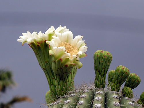
| Saguaro bloom at Saguaro National Park. |
![]() |
| Topo map, Freeman Homestead Trail. |
Classic Sonoran
desertscape
await hikers
Located in the Saguaro National Park’s east district (aka Rincon Mountain District), the Freeman Homestead Trail traverses a beautiful yet also clearly inhospitable desert landscape.
The 1.18-mile trail is a walk through a classic Sonoran Desert landscape of cholla, prickly pear and barrel cactus with barren mountain ranges lining the horizon. A number of small animals also can be spotted along the way, including wrens, flickers, ground squirrels and cardinals.
Saguaro cactus
You’ll also walk through a grove of the giant saguaro cactus, the park’s namesake. An icon of the American West, these lords of the desert can grow up to 50 feet high and weigh several tons. A highlight of the Freeman trail is a 30-armed giant.
With so little rainfall, decades are needed for the saguaro to reach its dominating size. They begin their lives by sprouting under small trees, such as the little leaf palo verde, growing only about an inch a year. They soon dwarf and in the process kill the very trees that sheltered them.
As the giant saguaro sometimes blooms only once every 35 years, they must live an extremely long time for the species to survive. The typical saguaro stays on the earth for 150 years, but some at the national park are more than 200 years old. Decades are needed for each arm to form. In addition, if caught in a storm do not stand near the saguaro as it’s a lightning rod, having absorbed salt from the desert floor.
Not quite half way along the path is the trail’s namesake - the Freeman homestead. During the early 1930s, a family settled here on 640 acres, building a three-room adobe house that is now nothing more than dirt mounds. A row of ocotillo looks suspiciously like a fence, and one might imagine that the lone large tree there once provided shade for the farm family.
Kid-friendly trail
The trail also passes a spring, a rare desert sight. Interpretive signs along the way offer suggestions for kids so they can explore and discover the desert’s wonders.
Indeed, the trail earns extra points for its kid-friendliness. The Junior Ranger kit, available at the visitor center, includes activities related to the trail.
To reach the trail, get on Freeman Road in Tucson, driving south. Turn left on Old Spanish Trail and enter the park. Past the visitor center, turn right onto Cactus Forest Drive. Park at the Javelina Picnic Area. You’ll have to backtrack on Cactus Forest Drive to the trailhead.
The trail is a dirt path with gentle rolls. A few wide rock staircases have been built into steep grades.
The best season to hike the trail is March through May when temperatures are pleasant (so mark this one on your calendar!). Summer will be unbearably hot and winter potentially cool. Many desert plants bloom in April and May, making for a colorful view.
Learn more about national park day hiking trails in my Best Sights to See at America’s National Parks guidebook.
Monday, November 5, 2012
How to find drinkable water if lost in wilds
![]() |
| Avoid directly drinking water from a stream, pond or lake. |
Use spring water; always boil, filter
If you’re lost or forced to stay a night in the wilds, avoid using local sources of drinking water. Still, sometimes you must take a calculated gamble or dehydration will set in.
The first challenge is to find a source of local water. Spring water is the best discovery, as it runs the lowest risk of being contaminated. Your next best bet is finding flowing water from a stream that is high in the mountains or hills, as it’s more likely than not to be clean as it is close to its source, which is melting snow. Flowing water at the bottom of a mountain or hill is your next best choice. Still water on low-lying land is your worst.
Finding water in a desert
If you’re not lost but simply stuck in the wilds for a night due to an injury, check your topo map. Well-known springs often are marked on them.
In a desert, finding water at all can be nearly impossible, but it is out there if you know where to look. On seasonal waterways, the thicker and greener the vegetation the more likely the chance that you’ll find standing water nearby. A grove of cottonwoods and willows almost guarantees that ground water is nearby. If there isn’t any, dig in the cool sand under a willow, and you may find water only a few inches down. Puddles also may exist under large overhangs and in shaded rock crevices, particularly if they are on a hill’s north side.
To collect the water, simply use one of your canteens or water bottles. Don’t dump out good water that you’ve carried in, however, but combine it with water in another partially filled canteen. If the water source is too shallow for a canteen, spread your handkerchief across the water surface. When the handkerchief has absorbed the water, wring it out into your canteen.
Once you’ve collected water, you need to “clean” it before imbibing. There are three options: use water purification tablets, boil it, or use a water filter.
Boil at least 5 minutes
A variety of water purification tablets are available for sale, so follow the instructions on each packet for the best results. Generally, though, tablets have to sit in the water for at least 30 minutes – and if the water is cold, the tablets may need to mix in it overnight. Tablets always will leave a little aftertaste, ranging from iodine-like to a tart flavoring. Be aware that if you or your child has thyroid problems, water purification tablets may contain iodine and probably should not be used.
If boiling, do so for at least 5 minutes. This will kill Giardia and all but the hardiest microscopic bugs. Boiling won’t remove chemical contaminates, however. In addition, if water is cloudy and you can’t see any life such as fish or amphibians in it, boiling probably won’t make it safe. When boiling water, do not do it in your plastic canteen or water bottle. The plastic likely will melt, or you won’t be able to touch it when hot. Given this, you may want to add “cooking pot” to the list of items for your backpack, but I’d only do so if you’re planning a long hike into the backcountry.
A number of water filters exist, all using different filtration systems and coming in different sizes. Whichever one you choose, make sure the filter pores are smaller than 0.2 microns. Anything larger will allow nasty bacteria to get through and remain in the water.
What are the advantages of each filter over the other? One that lacks iodine won’t remove viruses, so you’ll need to use water purification tablets or iodine anyway. A carbon or charcoal filter will remove chemicals that purification tablets and boiling won’t get rid of. Reverse osmosis filters are best of all, removing almost everything bad and even desalinating sea water. Unfortunately, they’re bulky and expensive, and you probably aren’t going to carry one on a day hike let alone a camping trip.
Read more about day hiking with children in my Hikes with Tykes guidebooks.
Friday, September 14, 2012
Be sure children don brimmed hats with chin straps during day hikes
![]() |
| A hat with brim and chin strap is idea for young children on a hike. |
In cool, wet weather, wearing a hat is at least good for avoiding hypothermia, a potentially deadly condition in which heat loss occurs faster than the body can generate it.
Children are more susceptible to hypothermia than adults.
In lower latitudes, higher altitudes, deserts and especially during summer, a hat with a wide brim is useful in keeping the sun out of eyes. It’s also nice should rain start to fall.
For young children, get a hat with a chin strap. They like to play with their hats, which will fly off in a wind gust if not “fastened” some way to the child.
Read more about day hiking with children in my Hikes with Tykes guidebooks.
Friday, March 2, 2012
When not to take kids hiking in certain areas
![]() |
| Avoid desert hikes during summer and the wet season. |
g Coastlines – Always check local tide tables if walking along beaches and coastlines, as you don’t want to get stranded in the ocean or large lake by rising water.
g Cold climates – Winter and spring will be chilly and often wet.
g Deserts – Avoid them during the wet seasons as flash floods can occur, sweeping down sandy washes and canyons, leaving you stranded, wet, or worse drowned. Outside of the wet season, avoid any days in which rain, high wind, and hot temperatures are forecast. This makes summer a bad time for desert hiking. Late autumn and early spring usually are the best times to hike deserts.
g Forests – Spring usually is a wet season to avoid. Summer and autumn make for the best hiking.
g High altitudes – Whenever high winds, precipitation and cold temperatures are forecast at lower elevations, they will be worse in the mountains. Winter, early spring and late autumn are dangerous times to hike high mountains. Low mountains and hilly country are best hiked on pleasant spring days; late summer is best for high mountains.
Read more about day hiking with children in my guidebook Hikes with Tykes.
Subscribe to:
Posts (Atom)