Showing posts with label winter. Show all posts

Saturday, December 22, 2018

6 Super Tips for Hiking with Kids in Winter


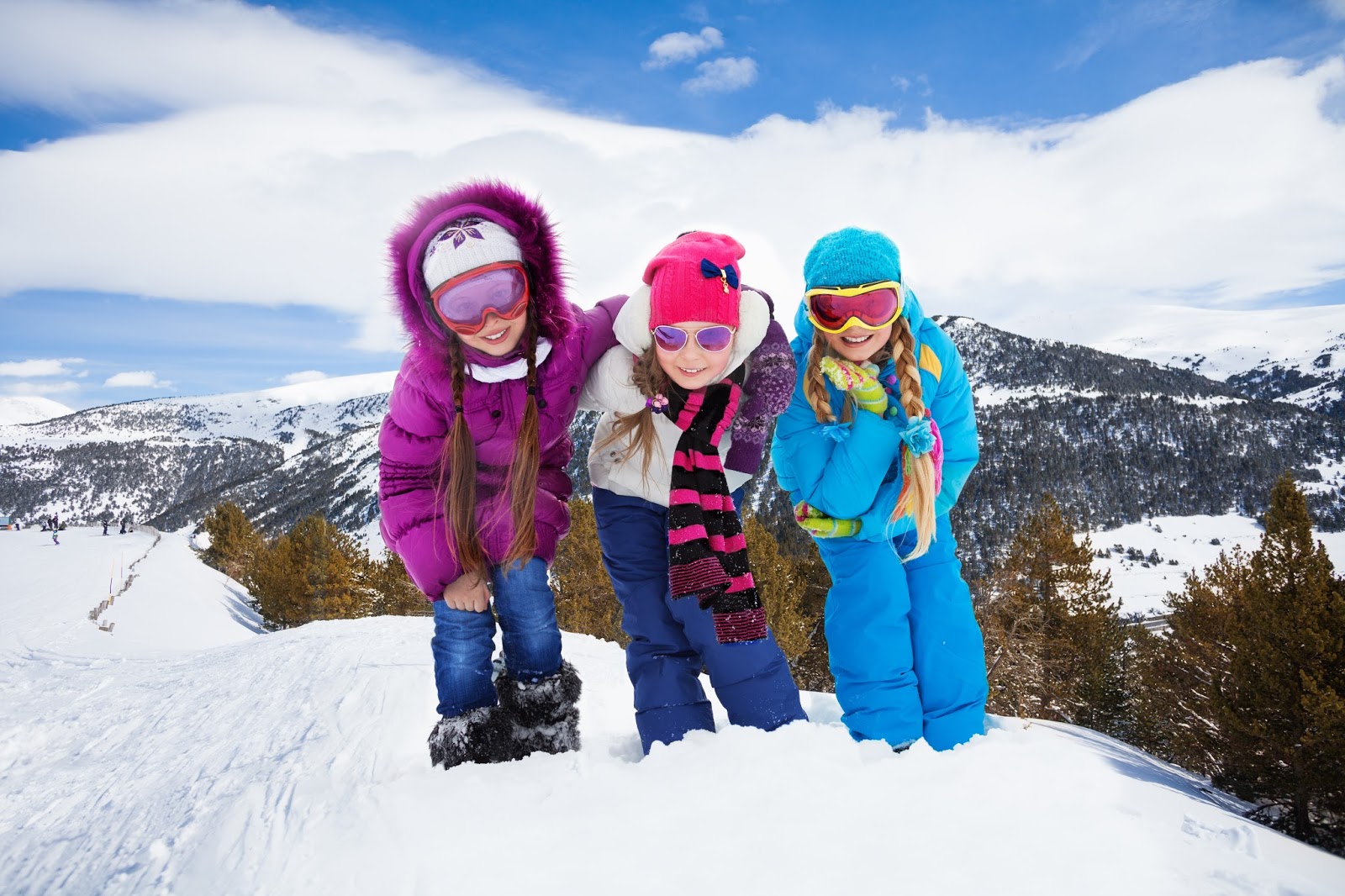
Dress kids properly for cold-weather hikes
Best snacks for a winter day hike – and why you should pig out on them
How to avoid wind burn
What to do if caught in snowstorm on a hike
Bring waterproof matches on winter hikes
Carry space blanket in case of emergency
How to build a snow shelter that'll save your life...
• BONUS: Kids activity on winter hike - Track Detective

Learn about trail guidebooks available in the Hittin’ the Trail series.

Saturday, December 8, 2018

5 Great Tips for Hiking with Kids in Winter


Keep child comfortable by layering clothes
How to walk across snow, ice - without falling - during a winter hike
Guidelines for providing first aid during cold weather
How to avoid/identify/treat frostbite on hikes
What to do if caught in a whiteout during a day hike with children
• BONUS: How to waterproof your day hiking boots

Learn about trail guidebooks available in the Hittin’ the Trail series.

Saturday, November 24, 2018

5 Tips for Hiking with Children in Winter


Plenty of good reasons to day hike during winter months
Winter clothing essentials for children on day hikes
Best snacks for a winter day hike – and why you should pig out on them
How to avoid cold weather injuries when hiking with children
How to survive getting caught in freak snowstorm on a hike
• BONUS: Kids activity on winter hike - Freezing Bubbles

Learn about trail guidebooks available in the Hittin’ the Trail series.

Tuesday, December 20, 2016

Six National Parks to Enjoy the Holidays

Old Faithful Snow Lodge, Yellowstone National Park
The following article originally was written for and appeared in the December 2016 Coach-net newsletter.

A little secret: Among the best ways to escape holiday stress is a national park trip. Though often thought of as a summer destination, only a couple of the parks close in winter, and almost all offer warm, cozy and peaceful holiday experiences. A bonus is that almost all parks are less crowded during winter.

Here are six great holiday-themed must-do’s at our national parks:

Winter wonderland
Yellowstone National Park
Book a getaway at the Old Faithful Snow Lodge, which can only be reached this time of year by snow coach or snowmobile. The Christmas-decorated lodge keeps its fireplace burning with plenty of hot cocoa for visitors. During the day, hike past “ghost trees,” formed when the steam from the Old Faithful geyser freezes on pine tree needles. Bison with snow-covered manes often feed across the geyser valley.

Polar Express train ride
Cuyahoga Valley National Park
Each December prior to Christmas, the Cuyahoga Valley Scenic Railroad’s Polar Express chugs through the scenic Ohio park. Among the highlights on the refurbished passenger train is a reading of the children’s book “Polar Express,” which inspired a movie and this trip. Many passengers ride the train in their pajamas! If in the Southwest, a private company also runs a Polar Express to Grand Canyon National Park.

Luminaria-lit skiing
Denali National Park
Every December, rangers light the small paper lanterns that line ski trails at the Alaska park. Visitors also can snowshoe or stroll the route, which leaves from the Murie Science and Learning Center, Denali’s Winter Visitor Center. Several other National Park Service sites offering luminaria displays and hikes including Florida’s De Soto National Memorial and Arizona’s Tonto National Monument.

Snowshoe wildlife hike
Rocky Mountain National Park
Ranger-led snowshoe tours lead visitors of this Colorado park to a variety of wildlife, including elk, coyotes, deer and snowshoe hares. The trail is utterly quiet as snow-capped mountains and evergreens rise around you on all sides.

New Year’s Eve Candlelight Walk
Mississippi National River and Recreation Area
Bonfires, roasted marshmallows, and miles of candlelit trails can be enjoyed throughout the National Park Service area surrounding North America’s longest river. The festivities are centered on historic Fort Snelling State Park, which sits in the Minneapolis-St. Paul metro area’s national river and rec area.

Caroling in a cave
Mammoth Cave National Park
In early December each year, the Kentucky park holds Christmas carol singing in the world’s longest cave system. It’s a tradition that goes back to 1883 when local residents held the first Christmas celebration in the cave’s passageways. Though this year’s caroling has passed, mark it on the calendar for 2017’s must-do’s!

Learn more about national park day hiking trails in my Best Sights to See at America’s National Parks guidebook.


Thursday, December 1, 2016

Five great national parks to visit in winter

Yosemite Falls in winter at Yosemite National Park.
The following article originally was written for and appeared in Coach-Net’s November 2016 newsletter.

Most travelers think of summer as the best time to hit national parks – but winter also offers several spectacular sights that make for memorable visits.

So when the snow starts falling, consider a road trip to one of the following parks.

Birders paradise
Winter marks the best time to hike Florida’s Everglades National Park, as the subtropical climate means unbearably hot and buggy summers. Indeed, a number of birds already know this and spend their time in the Everglades after migrating from a northern clime. Among those you can spot on the Anhinga Trail are the double breasted cormorant, great egret, great blue heron, snowy egret, tricolored heron, white ibis and woodstork; turkey vultures congregate during the early morning hours.

Wildlife sightings
Leafless trees and snow’s white backdrop makes sighting large wildlife a lot easier in winter than summer. The Warner Point Nature Trail on the south rim of Colorado’s Black Canyon of the Gunnison National Park offers the chance to spot elk and Rocky Mountain bighorn sheep. Look for the elk in clearings and the bighorn sheep on the rocky cliff sides.

Heavy waterfalls
At most parks, waterfalls are most active in spring and early summer, thanks to snow melts. Not so at Washington state’s Olympic National Park. Rain is more likely there during winter, meaning the water flow is higher, making for a more spectacular creeks and falls. One good trail through the park’s lush, old growth forest that ends at a waterfall is the Marymere Falls Trail.

Bearable heat
During summer, unbearable heats makes California’s Death Valley National Park at best a pass through seen from a motor vehicle. The park’s average high in January is a pleasant 67 degrees, though, making winter the perfect time to walk the foreboding desert landscape. Among those sights is the lowest point in North America. Badwater Basin sits 282 feet below sea level and can be accessed in a mile-long round trip hike.

Avoid the crowds
Visitation drops during winter at most parks, so the trade-off for bundling up in coat, cap and gloves is seeing the great scenery without all of the crowds. A good bet is Yosemite National Park’s spectacular Yosemite Valley in California. The Lower Yosemite Fall Trail offers a number of fantastic views of Yosemite Falls in a 1.2-mile loop with the added coolness of falling water frozen in mid-flight on the granite rocks.

Learn more about national park day hiking trails in my Best Sights to See at America’s National Parks guidebook.


Monday, September 7, 2015

Five tips to keep kids warm on fall hikes

Layered clothing can help keep children warm
during autumn.
Children’s clothing needs change for day hikes taken during autumn. As the weather cools, summer’s T-shirt and shorts rarely are sufficient except during the rare heat wave.

Fortunately, ensuring kids stay warm and comfortable during an autumn day hike is easy to do. Just follow these simple guidelines:
Layer clothing – Dressing children in a T-shirt, long-sleeved shirt, and windbreaker actually will keep them warmer and dryer than having them wear a single bulky piece of clothing. Layering offers the added benefit of being to take off and put back on layers of clothing as the weather warms or cools through the day.
Avoid cotton and denim – Though comfortable to wear, these materials take a long time to dry and so are bad news when children get wet. Opt for synthetics, especially for outer layers of clothing.
Don wool socks – Rain boots are great for keeping feet dry, but the rubber does little to keep one’s feet warm. The solution is to wear wool socks, which are superior to cotton socks in retaining body heat.
Wear a hat – Brimmed hats are great for keeping the sun and rain drops out of one’s eyes. In colder weather, a stocking cap will help keep the body warm by preventing heat loss through the head.
Choose mittens over gloves – The former will keep children’s small fingers warmer than the latter. If gloves are a necessity (They do make manipulating objects easier!), be sure to get fleece-lined ones.

Learn about trail guidebooks available in the Hittin’ the Trail series.

Saturday, November 29, 2014

Walk alongside rapids-filled river on trail

Little Falls/Slough Gundy. Photo courtesy of  Price
County Tourism Department.

Trail leads to whitewater
river popular with paddlers


Day hikers can enjoy a peaceful walk between a couple of the Flambeau River’s famous rapids on the Little Falls-Slough Gundy Scenic Area Trail in northern Wisconsin.

Located in the Flambeau River State Forest, the looping trail with two spurs is just a little over a mile.

Kayaking
To reach the trail from Sawyer County, in Winter take County Road W east into the state forest then turn south on County Road M. In 7.5 miles, after crossing the South Fork of the Flambeau River, watch for the signage and take a right/west into the parking lot.

Once parked, hike the stem trail west. At the junction, go right/northwest. You’ll hear the roaring rapids as descending about 60 feet in elevation to the Flambeau’s Slough Gundy, a class II-III rapids.

The trail crosses an intermittent stream, heading north a bit on a spur trail. When the trail peters out in less than 500 feet, turn back. Upon reaching the trail intersection, continue south along the river.

Wild whitewater paddling is popular on the Flambeau, and you’ll likely see kayakers working their way through the rugged rapids. Some kayakers use this segment of the trail to portage between Little Falls and Slough Gundy for repeated trips through the rapids.

Class V rapids
Fishing and picnicking also are popular along this stretch of the river. You may want to pack your own basket to enjoy the beautiful scenery of the boulder-filled river ensconced in pines.

The trail next comes to Little Falls, a class V rapids. As at the Slough Gundy, the trail continues a little south on a spur. After a couple of hundred feet, turn back, and at the trail junction, go right/northeast.

At the next intersection, you’ve reached the stem trail. Head right/east back to the parking lot.

Read more about day hiking Sawyer County, Wisconsin, in my Day Hiking Trails of Sawyer County guidebook.


Friday, November 7, 2014

What tracks tell us about the animals that made them

A newly made track in the snow typically is larger than the actual foot or paw.
Photo courtesy of holder / Photoree.
With winter’s arrival, day hikers have a great opportunity to teach children accompanying them about the animals that live near the trail. This can be done via the tracks those animals make.

For example, a newly made track in the snow is larger than the actual foot or paw size. Snow compresses and better maintains its shape than sand or mud does, so the track itself actually shows a little of the animal’s movement as it steps. The animal that made the track probably is smaller than the track would lead children to believe.

In addition, the older a track is, the more likely that its size is far different from the actual foot. Thawing and refreezing can enlarge the track while blowing snow can fill it in and decrease the size. If the weather has changed over the past couple of days, children with this knowledge might be able to tell if the animal’s actual foot is smaller or larger than the track.

Further, the track’s depth indicates the animal’s size and weight. The smaller the animal, the less likely it is to sink into the snow when walking or running. Heavier and larger animals, of course, usually sink more deeply.

Whether or not the animal is two- or four-legged also can be determined (Birds, of course, are two-legged). Tracks that match a human’s gait are two-legged. Have your child walk alongside the track and compare how the feet fall into the snow.

Tracks also can give clues about where the animal might live. Follow the tracks around. They may lead to a tree or a burrow hole beneath a bush or near a rock. Especially during winter, you may even be able to spot strands of the animal’s hair or bits of it food.

Learn about trail guidebooks available in the Hittin’ the Trail series.

Monday, September 8, 2014

Cornucopia of leaf colors line Wisconsin’s Rim Creek Loop

Sugar maple leaves in autumn.
Photo courtesy of Wisconsin DNR.

Flambeau River State Forest
loop passes maples, birch


A beautiful forest walk with an array of autumn leaf colors awaits day hikers of the Rim Creek Loop in Wisconsin’s Flambeau River State Forest.

Located in Sawyer County east of Hayward, the trail runs about 4.9 miles. To reach the trailhead, from the village of Winter, take County Road W east into the state forest. After crossing the Flambeau River, turn at the first left/north into a parking lot.

From the lot, go on the trail heading left/north. This stem connects to a series of stacked loops that make up the southern end of the Flambeau Hills Trail System. Upon reaching the first junction, go right/east; this puts you on the Short Swing Loop.

The trail navigates some ups and downs across knolls but is nothing that can’t be handled. In any case, you won’t notice, especially if it’s autumn, as you’ll be too enamored with the colorful display of leaves.

Maple forest
Maples dominate the state forest. The two most common here are the sugar maple, which provides the best sap for the maple syrup that goes on your pancakes, and the red maple, a common tree in second-growth forests. In autumn, the sugar maples’ leaves glow a brilliant orange while red maples turn carmine.

Continue on the main trail (veer right/east-north) at the next two trail junctions. Doing so takes you onto the Rim Creek Loop proper.

You’ll soon pass groves of quaking aspen, the preferred habitat for ruffed grouse, one of the most popular upland game birds to hunt. The thinning brush and the aspen’s amber leaves help make the usually well-camouflaged ground birds easier to spot.

Ruffed grouse sport a crest on their heads and have a banded tail with a thick black then gray terminal band. During spring, to attract females the males will beat their wings as standing atop logs.

Rim Creek
A little more than a mile from the trailhead, the path crosses small Rim Creek, which links a couple of ponds to the Flambeau River. In this wetter area, you’re more likely to see yellow birch, whose autumn leaves look bright as a sun on a child’s drawing.

North of the creek, the route intersects a small loop off the main trail; ignore the loop and the two junctions leading to it.

Of course, maples, aspen and birch aren’t the only trees you’ll notice along the walk. Another is the American basswood, which boast multiple trunks and in autumn olive-colored heart-shaped leaves.

In another mile, the trail reaches the top of the loop and the beginning of the next stacked loop. Go left/east then at the following intersection, head left/south, putting you back on the Rim Creek Loop stacked loop.

Alongside Flambeau River
For the next two miles or so, the Flambeau River will be on your right/west with some nice views of it below you. A major tributary of the Chippewa River, smallmouth bass and muskie are numerous in its waters.

In about 0.6 miles from the last intersection, the trail recrosses the Rim Creek you went over on the loop’s other side.

One other hardwood you’re likely to spot in autumn is white ash. Whitetail deer love to munch on its saplings. Each fall, its leaves turn red then a deep maroon.

The next junction brings you back to the Short Swing trail; stay right/southwest. At the intersection after that, you’ve reached the stem trail; go left/south back to the parking lot.

Read more about day hiking Sawyer County, Wisconsin, in my Day Hiking Trails of Sawyer County guidebook.


Sunday, July 6, 2014

Old railbed turned trail passes farms, lakes

Tuscobia State Trail near Couderay. Photo courtesy TravelWisconsin.com

Tuscobia State Trail heads through Sawyer County


Among the premier hiking routes in Wisconsin’s Sawyer County is the Tuscobia State Trail.

Running past farmland, through quaint villages, and across thick forests, the trail begins southwest of Sawyer County in Rice Lake and runs 74 miles northeast to Park Falls. It follows an abandoned railroad grade converted to a hiking and multi-use trail.

Construction of the Omaha rail line that is now the Tuscobia begin in 1899 and lasted for some 15 years. By the 1940s when logging was no longer viable in the region, the rail line saw much less use and eventually ended operations altogether. Bridges over some waterways were removed in 1967, and the following year locals across the region began a long effort to convert it to a hiking trail.

Hiking the trail anytime in summer and autumn will prove enjoyable. Note that the trail closes Nov. 15-Dec. 15 for deer hunting season. Also, ATVs can use the trail from Birchwood to Park Falls April 15-Nov. 15.

The trail can be hiked in segments, with each one treated as an out-and-back trail. Among the Sawyer County trailheads (from west to east) are:

Couderay
East of town, the trail runs alongside the Couderay River. Access the trail where it crosses Valesh Road south of Wis. Hwy. 70.

Radisson
The trail passes the Radisson Flowage on the Chippewa River east of town; west of Radisson, it rambles alongside the Couderay River. The trail can be picked up where it crosses either Hwy. 40 or Ogden Avenue in the block south of Hwy. 70 (aka as Omaha Street).

Ojibwa Park
The Tuscobia runs through a forested area on either side of the park. Ojibwa Park is off of Hwy. 70 east of Radisson; from the parking lot, take the stem trail south to the Tuscobia.

Winter
Going east of town on the trail takes you close to the north shore of 676-acre Lake Winter and over the Brunet River. Pick up the trail in Winter where it crosses Park Street, Main Street, or Crawford Street within a block south of Hwy. 70.

Draper
East of town, the trail runs through a densely wooded area and enters the Flambeau River State Forest. Access the trail anywhere in Draper, as it runs alongside Hwy. 70 through town.

Read more about day hiking Sawyer County, Wisconsin, in my Day Hiking Trails of Sawyer County guidebook.


Monday, June 23, 2014

Day hike to peatlands, scenic lake view in northern Wisconsin

Bass Lake Peatland State Natural Area. Photo courtesy of Wisconsin DNR.

Northwoods forest offers variety of songbirds


Day hikers can discover a clear lake next to peat bogs in Wisconsin’s Bass Lake Peatland State Natural Area.

The Bass Lake Trail runs about 0.84-miles one-way (1.68-miles round trip). Part of the trail is in Sawyer County’s Flambeau River State Forest with another part in Price County’s Bass Lake Peatland. One of the best features of the trail is you’ll never have to walk through the wetlands.

Autumn leaves
To reach the trail, from Winter, Wis., head east on County Road W into the state forest. Turn left/north on Tower Hill Road then go right/east onto Bass Lake Road. Park where the road dead ends.

The Bass Lake Trail travels roughly south through a rich forest of basswood, sugar maple, and white ash. This diversity of trees makes for fantastic autumn leaf displays.

After 0.33 miles, the trail turns southeast, continuing through the northern mesic forest. Expect to see a number of songbirds here, including cedar waxwing, gray jay, Lincoln’s sparrow, Nashville, palm and yellow-rumped warblers, and the yellow-bellied flycatcher. As closing on the shore, often the common loon can be heard and bald eagles seen flying overhead.

The trail next heads straight south in 0.13 miles and follows the county line. Then, in another 0.13 miles, the route meanders southeast.

Peat bogs
For the next quarter mile, the woods transitions to a mature second-growth white pine forest that surrounds the lake. Hemlock grows here as well, but usually only as seedlings; whitetail deer find the tree’s leaves tasty, and their heavy feeding prevents much growth beyond a few years.

Upon reaching Bass Lake’s northwest shores, the clearness of the deep, 94-acre waterbody will make an immediate impression. Small aquatic plants known as sterile rosettes live across Bass Lake’s bottom and absorb all of the sediment’s carbon dioxide, resulting in high oxygen levels.

Look across the lake to its southern and eastern shores for the open peatland. Peat largely consists of waterlogged, partially decayed vegetation and is a major store of carbon dioxide. A carpet of sphagnum mosses covers the peat bogs with occasional hummocks supporting black spruce, tamarack, or shrubs.

After taking in the views of the lake and peat bogs, return the way you came.

Read more about day hiking Sawyer County, Wisconsin, in my Day Hiking Trails of Sawyer County guidebook.

Thursday, June 19, 2014

Trail heads past former cranberry bog

Graphic courtesy of U.S. Forest Service
An old cranberry bog awaits day hikers at the Sobieski Flowage Scenic Area in northern Rusk County, Wis.

Tucked away in the southeastern corner of Flambeau River State Forest, the Sobieski Flowage Scenic Area Trail runs about 0.4-miles one-way (0.8-miles total). The majority of it is in Rusk County with the flowage itself in Sawyer County.

To reach the trail from Sawyer County, in Winter head east on County Road W to the state forest then turn south on County Road M. After crossing Skinner Creek, take the first left/east, which is a dirt road that leads to the flowage’s southern shores. Park in the lot along the shoreline then walk the jeep trail to the road on the out-and-back route.

Some maps refer to the man-make lake as Skinner Creek Flowage, but the trail and scenic area itself is named for Ed Sobieski, who in the 1940s converted his dairy farm here to a cranberry operation. By diking North Fork Skinner Creek, he built the flowage in 1948 to ensure a steady water source for the berries.

As the trail heads west, it passes what once were Sobieski’s cranberry bogs, which consist of soft, marshy peat soil. The cranberry plant with its long-running vines prefer such a habitat.

Contrary to popular opinion, cranberries don’t grow underwater or on the water’s surface. Instead, the night before the harvest, growers flood the bogs with about 18 inches of water. During the harvest, reels nicknamed eggbeaters churn through the water, loosening berries from their vines. As cranberries have a small pocket of air within them, they float on the water surface where they can be easily corralled and loaded into trucks. This wet harvesting typically occurs from mid-September until a week or two before Thanksgiving.

The flowage provided Sobieski with the water he needed to flood his bogs each autumn. Today, the ditches leading from the flowage to the bogs remain as blue streams with green grasses rising between them. Hike the trail in June, and you’ll be treated to lily pad blooms on the flowage.

When Sobieski retired in 1973, he sold the land to Wisconsin so it could become part of the state forest. Today, the scenic area includes habitats for songbird, ruffed grouse, and woodcock.

Part of the trail lacks shade, so be sure to wear sunhat and sunscreen.

Read more about day hiking Sawyer County, Wisconsin, in my Day Hiking Trails of Sawyer County guidebook.


Wednesday, June 4, 2014

Woodland walks await in Flambeau River SF

Flambeau River. Photo courtesy of Wisconsin DNR.
Thick maple forests, wildlife, and other great scenery await day hikers in Wisconsin’s Flambeau River State Forest.

Though the state forest is best known for its whitewater rapids loved by kayakers, there’s plenty for landlubbers to do there. Among the great day hiking trails are:
g Connors Creek Trail – Though primarily used by ATVs and snowmobiles, the trail leading south of County Road W from the Flambeau Hills Trails parking lot can be day hiked a little more than 2-miles one-way (4.2-miles round trip) to Connors Creek.
g Lake of the Pines Trail – Another ATV/snowmobile trail, the route loops wide around the Lake of the Pines from the Flambeau Hills Trails parking lot. Turn around upon reaching the lake’s northern tip, at about 3 miles, for a 6-mile round trip.
g Oxbo Trails – Day hikers can enjoy a walk through a thickly wooded area on a series of five short loops that total up to 8 miles in distance. Loop A, the easiest trail to access from a lot off of Wis. Hwy. 70, runs about 2.4 miles.
g Rim Creek Loop – A beautiful forest walk amid maples and yellow birch offering an array of colors come autumn, awaits day hikers of this 4.9-mile trail. It heads north from the Flambeau Hills Trails parking lot via the Short Swing Loop (see below).
g Short Swing Loop – Among the easiest trails in the state forest is the 1.1-mile Short Swing Loop, which is accessed via a stem trail at the parking lot off County Road W. The loop is used for cross-country skiing in winter.
g Snuss Trail – Day hikers stand a good chance of spotting a variety of wildlife on this 4.3-mile (one way) route. About a mile after Hwy 70 crosses the Flambeau River’s north fork in Oxbo, turn right/south onto Snuss Boulevard; a parking lot is on the left.

Read more about day hiking Sawyer County, Wisconsin, in my Day Hiking Trails of Sawyer County guidebook.


Tuesday, May 27, 2014

Return to ‘deep woods’ without walking far

The Oxbo Pines State Natural Area can be reached via the Oxbo Trails.
Photo courtesy of Wisconsin DNR.

Loop A heads
through maple,
birch forest


Day hikers can enjoy a walk through a thickly wooded area on the Oxbo Trails in Wisconsin’s Flambeau River State Forest.

The trails consist of a series of five short loops that total up to 8 miles in distance. Loop A, the easiest trail to access in the set, runs about 2.4 miles.

No longer groomed
Sometimes referred to as Oxbo Ski Trails, the trails no longer are groomed for cross country skiing or mountain biking, though there is talk among forestry officials of doing so again. These days, the trails primarily are used by hikers and snowshoers.

To reach the trails, from Winter take Wis. Hwy. 70 east into the state forest. About 1.5 miles east of the Flambeau River, turn left/north into a parking lot. At the lot’s northeast corner, take the stem trail east onto Loop A; continue heading straight at the first two junctions.

With many of the same maples, yellow birch and pines of the rest of the forest, both the lack of grooming and the location between a large bend in the North Fork Flambeau River has left the trails running through a thickly wooded area. If you want to feel like you’re in the “real” woods, the Oxbo Trails are for you.

About halfway through Loop A, the trail joins the second stacked loop, which is Loop B. Head left/west at the first junction with Loop B, then at the next intersection, leave the shared trail and go left/south.

Thick red and white pines
The set of trails are named for Oxbo Lake on the peninsula’s northeast side. That lake once was part of the Flambeau River until silt filled in the bends north and south of it, and the river changed its course.

The lake is located in the Oxbo Pines State Natural Area, which the state forest surrounds. Mature white and red pines that are 24-30 inches around dominate the natural area. If continuing on Loop B, and the other trails that are part of this set, you’ll enter the Oxbo Pines.

Loop A has a number of high knolls, but there are no major climbs. Each loop as heading north grows a little hillier, with Loop E showing the greatest change in elevation.

At the next trail junction on Loop A, go left/northwest back onto the stem trail to the parking lot.

Read more about day hiking Sawyer County, Wisconsin, in my Day Hiking Trails of Sawyer County guidebook.


Wednesday, March 5, 2014

Fun game on winter hike: Freezing Bubbles

Illustration courtesy of Maryland DNR.
Generally, exploring and discovery is enough for kids, but sometimes even they can grow bored with that and become restless. Remember that they naturally have shorter attention spans than adults.

Fortunately, there are lots of tried and true activities you can do on the trail that’ll keep kids from getting bored. Among them for a winter hike is Freezing Bubbles.

If going on a winter hike, during a rest break have kids blow bubbles using a classic bubble wand. So long as the temperature is below 32 degrees, the bubble will freeze into a crystal sphere – and then shatter!

Materials: Bubble solution and wand

Ages: All

Learn about more than a hundred other hiking diversions for kids in Hikes with Tykes: Games and Activities.

Wednesday, January 29, 2014

Guidelines for providing first aid during cold weather

Should you need to provide first aid while hiking in cold weather, you’ll want to follow some basic guidelines to ensure that you don’t exacerbate the injury – or put yourself in peril as well.

Among those “rules”:
g Don’t remove your clothing – Though helping an injured person may be easier without gloves on or with a jacket unzipped, this can create problems for you. Gloves taken off might drop into the snow becoming wet, and unlayered protection against the elements exposes you to the cold, as well.
g Perform first aid a warm place – If possible, move the injured person to a place where they can be warm and perform the first aid there. Laying an injured person on the cold ground or removing their clothing in the open only exposes them to the wind and wet.
g Don’t warm by rubbing – This actually can further damage any affected tissue if frostbite occurs. Instead, you want to use the closeness of body warmth or radiant heat to keep a person warm.
g Blankets alone aren’t enough – Use body warmth to keep a person from being cold and wrap the blanket around both of you. If a person has hypothermia, for example, they can’t generate enough heat on their own to rewarm themselves, so a blanket or sleeping bag alone won’t help.
g Loosen constrictive items – Loosening clothing and removing jewelry that restricts circulation is a good idea. Clothing should not be taken off, however, as exposure to the cold can lead to hypothermia.
g Seek medical help immediately – Cold weather injuries such as frostbite and hypothermia require skilled medical professionals working with the patient in a warm, sterile facility. As soon as the injured person is stabilized, get them to a hospital.

Read more about day hiking with children in my Hikes with Tykes guidebooks.

Monday, January 27, 2014

How to avoid cold weather injuries when hiking with children

Avoid cold weather injuries on winter hikes by
practicing prevention.
While winter hiking with children holds a variety of advantages over summer – no bugs, ability to see through foliage, lack of crowds – they also offer up a variety of dangers, from frostbite to snow blindness.

Fortunately, each of these conditions can be avoided so that children don’t suffer winter’s potentially ill effects. It begins with awareness of the time of cold weather injuries that can occur.

Among them are:
g Frostbite In extremely cold conditions, the fluid inside the body’s cells can freeze. As freeing, it expands, rupturing and killing cells. You shouldn’t hike in weather cold enough to give kids frostbite; that threshold is reached when the temperature and wind chill are so low that no amount of bundling up will keep a child warm.
g Hypothermia This dangerous condition happens when heat loss from the body occurs faster than the body can keep up, usually when a person is in wet, cold air or clothes. To avoid, ensure children wear adequate clothing and then layered clothing, including a hat, which can decrease heat loss from body.
g Slips and falls Icy conditions increase the chances of slips and falls, and snow often conceals hidden dangerous such as sharp plant stems or hard rocks. Keep your pace slower on icy and snow-covered trails and wear boots with traction to avoid falling. Here's how to walk across snow and ice.
g Snow blindness – As the white snow reflects light back, the eye can be oversaturated, leading to a temporary inability to see. To protect the eyes, always wear sunglasses on a winter hike.
g Trench foot – When snow gets into a boot, the foot can become wet and cold, leading to blood vessels constricting in that extremity, resulting in numbness and swelling. Have pants cover rather than be tucked into boots so that moisture doesn’t get to the foot.
g Wind burn Winter’s dry wind, unhindered by summer’s lush foliage, can dry the oily layer of a child’s skin, resulting in a burn. To prevent burn, rub moisturizer or petroleum jelly on exposed skin before the hike.

Read more about day hiking with children in my Hikes with Tykes guidebooks.

Friday, January 24, 2014

How to build a snow shelter that’ll save your life

If caught in a freak snowstorm, you always can build a snow shelter
to stay alive. Be sure to carry a shovel in your vehicle.
Photo courtesy of Wikipedia.

Burrow to stay
dry, warm during
an emergency


If forced to stay a winter night in the wilds – perhaps you got lost, maybe a mountain blizzard took you by surprise – your survival in large part will depend on finding shelter. You need to get out of the cold and wet because you’ll freeze to death before you do from dehydration. But what can you do if there’s no shelter – even a ramshackle old cabin – nearby?

The answer is build a snow shelter.

Animals' example
Also known as a snow cave, this shelter isn’t perfect, but it’ll certainly keep you warmer and dryer than if you expose yourself to wind and snowfall. Burrowing is, after all, how smaller mammals stay warm in winter.

The first step to building a snow shelter is location. As you need to dig straight into the snow rather than dig down, locate a sloped hillside with deep snow.

Next, dig out an entrance. This just needs to be large enough for you to crawl and should go about two feet deep.

After that, begin excavating upward to create a domed room that is about five feet high and six feet wide.

Once the room is created, use a stick to poke a hole upward through the domed roof. This one- to two-inch diameter hole serves as an air vent and should be located next to the entry hole.

Pine bough mattress
Following that, create a sleeping bench against the back wall. This can be done by taking snow from the half of the room closest to the entry and piling it up about two feet from the floor. Add some pine boughs to it as a mattress to keep you off the ground.

You’ll want to close up the entry to keep out wind, blowing snow, and curious animals. Do that by rolling a snowball that is large enough to cover the entrance; use snow from outside of the dome room.

Finally, should you have a small candle, you may use to provide light and a modicum of warmth. Don’t start a larger fire, though, as it will melt the snow (and cause the shelter to collapse upon it) or will use up much of the oxygen in the shelter.

Stay in the snow shelter until the storm clears or daylight arrives so that you can set back out on foot to your vehicle.

Read more useful day hiking tips in my Hikes with Tykes guidebooks.

Wednesday, January 8, 2014

If lost on winter hike, build an emergency tree well shelter

The well at the bottom of a tree where no snow falls is
the perfect place to build an emergency shelter.
Photo courtesy of  Wikipedia.
If forced to stay out overnight in the wilds during winter, you’ll want to find shelter right away. This will keep you out of the wind and hopefully ensure you don’t have to lay on the snow, which can lead to hypothermia. Don’t worry if you can’t find a man-made shed or cabin, though – you can build your own shelter in a pinch. One of the easiest to construct is a tree well shelter.

As hiking past evergreen trees, note how there’s a depression of snow around the trunks. Each tree’s canopy of branches limited the amount snow from falling in this zone, which is called the tree well. It’s a perfect place to set up an emergency shelter.

Begin by collecting other boughs that you can prop against the evergreen branches, with the branch’s woody, pole end going into the snow. This is the wall for your shelter. You may need to layer the boughs to minimize the wind coming through it and to ensure that if one bough falls down that there’s no hole in your shelter. Be sure to leave an opening for a doorway and setting aside boughs that can be used to close it.

Next, remove the snow from the tree well by gently pushing it against the boughs used to form the shelter’s walls. Then cover the tree well with boughs. This is the sleeping mat that will keep you off the cold ground.

Have everyone take a potty break at least a hundred feet downwind from the shelter. Finally, once everyone is inside, close up the doorway. Don’t start any fires within this makeshift shelter.

As snow is an excellent insulator, a properly built shelter combined with body heat can result in a pad that is up to 40 degrees warmer than the temperature outside.

Related articles:
g If lost, reassure kids by getting them involved in signaling for help
g Staying the night outdoors because you're lost? Set your priorities
g What to do when lost with children on a hike
g When you have no food but are lost overnight

Find out about trail guidebooks available in the Hittin’ the Trail series.

Sunday, November 17, 2013

Best snacks for a winter day hike – and why you should pig out on them

Mixing carbs and fats in snacks is a good idea for winter
hiking with kids.
Arguably one of the many fun aspects of a day hike in winter is that you can snack – and not just a little snack, like you might enjoy on a summer walk.

Your body uses more energy on a winter day hike than in summer. First, more exertion is required to move over snow, and secondly your body must generate heat to keep itself warm. Because of this, you can burn around 100 more calories an hour than you would during a summer hike on the same trail.

To keep up your energy, during winter you’ll want to mix carbs and fats in your snacks. If you stick only to carbs, you risk a sugar crash in which you’ll become sluggish and cold. Being tired on a trail is never any fun, but when your body struggles to stay warm during a winter hike, that’s problematic.

Some great snack carb/fat combos for a winter day hike include:
g Nuts and dried fruit – Almonds, walnuts, and pistachios provide the fats while dried fruit work as carbs.
g Nuts and chocolate pieces – The sweets give you carbs while the nuts again offer up the fats.
g Candy with cookie wafers – The frosted or chocolate portions provide the fats while the cookie wafer is the carb.

And don’t worry about eating larger portions of these snacks than you would during summer. You almost certainly won’t gain weight because the body actually needs the extra intake of food.

Finally, don’t forget water with those snacks. You’ll need extra water on a winter day hike not just to help to metabolize the nuts, fruits and candy but also to ward off dehydration. Hikers often don’t realize that dehydrating oneself in cold weather is just as easy to do as it is on an extremely hot day. Due to the freezing temperatures, moisture is locked up in the snow, and so the air is desert dry.

Read more about day hiking with children in my Hikes with Tykes guidebooks.