Showing posts with label Zion National Park. Show all posts

Saturday, April 9, 2016

Hike to vista of Zion Canyon’s south icons

The Watchman from the Watchman Trail in Zion National Park.
Topo map, the Watchman Trail.

Watchman Trail heads up canyon wall in Zion NP


Hikers can see several of Zion National Park’s exotic geological formations on the short Watchman Trail.

The trail runs 2.8-miles round trip through Zion Canyon in the Utah park. Among the sights are The Watchman, the Towers of the Virgin, the Altar of Sacrifice, and the West Temple.

Though located in the desert, the trail can be done year round. During summer, however, avoid the midday heat by hiking it early in the morning or early evening.

Virgin River
To reach the trailhead, from Interstate 15 in St. George take Utah Hwy. 9 (aka as the Zion-Mt. Carmel Highway) to the park’s south/west entrance. Once past the ranger station, take the first road heading right/southeast for the Zion Canyon Visitor Center. After crossing the Virgin River, take the next left and park in the large lot. Take one of the access trails on the lot’s northwest side to the Watchman Trail. Go right/northeast on the trail.

You’re starting at 3963 feet elevation and paralleling the Virgin River. For 15 miles in the park, the Virgin River cuts through cream, pink and red rock representing 150 million years of Earth history, leaving soaring towers, spectacular spires, and imposing monoliths.

Once the trail veers away from the river, it crosses a park road and climbs up the canyon wall beneath Bridge Mountain. The route does get steep. Along the way, you’ll pass junipers, pinion pines, and prickly pear cactus.

Finally, at 456 feet above the canyon floor, the trail reaches the viewpoint. The vista is worth the effort. From here, you can see several of the park’s major geological formations.

Vista sights
To the south is the Watchman, a red mountain that rises 2,200 feet above the viewpoint. It is perhaps the park’s most photographed geological feature.

Directly across the canyon to the east is Mount Kinesava, which tops out at 7285 feet. Hoodoos sit near the mountain’s top, and petroglyphs can be seen on the trail leading to its peak.

To Kinesava’s right/north is The West Temple. The highest exposure of the famous Navajo sandstone – the thick, usually red rock making up Zion's steep cliffs – can be seen on the mountain. This peak reaches 7810 feet elevation.

Right of The West Temple and northwest of the viewpoint is the Towers of the Virgin formation. The Altar of Sacrifice peaks out at 7505 feet in the Towers. A deep stain on the Altars stone looks like blood.

Looking north is The Sentinel, which tops out at 7157 feet. To the northeast is The East Temple, which rises to 7709 feet.

Short loop
To get a slightly closer view of these features, you can take a 0.3-mile loop that leaves from the viewpoint.

The viewpoint is a great spot for a picnic. After enjoying lunch and taking in the sights, retrace your steps back to the lot.

Learn more about national park day hiking trails in my Best Sights to See at America’s National Parks guidebook.


Tuesday, February 9, 2016

Zion N.P. trail heads to hanging gardens

Weeping Rock, Zion National Park. Photo courtesy of Wikipedia.
Topo map, Weeping Rock Trail.

Park's popular
Weeping Rock
Trail runs half
mile round trip


NOTE: This trail was temporarily closed in August 2019 due to a rock fall. 

Day hikers can walk through a natural hanging gardens on the Weeping Rock Trail at Zion National Park.

A great family-friendly hike, the footpath ascends a hillside to a concave cut into a rock face from which water seeps. Though the walk leading to the hanging gardens is somewhat steep, the trail is only a half-mile long.

A popular hike because of the hanging gardens, the great view from it, the short length, and the ease of access, expect the trail to be busy, especially in summer. Still, March through October mark the best time to visit the site, as during winter a flood of water often pours down the rock face and the cold fills the alcove with icicles. Avoid it during rainfalls as well, as the mist that is part of the hanging gardens’ beauty will be absent.

Shaded walk
Reaching the trail during spring through autumn requires taking a park shuttle. Private vehicles generally aren’t allowed April 1-Oct. 30 in Zion Canyon, where the trail is located. A shuttle can be picked up at the Zion Canyon Visitor Center; once on it, get off at the Weeping Rock shuttle stop. If driving, from Utah Hwy. 9 turn north onto Zion Canyon Scenic Drive (also known as Floor of the Valley Drive) and use the Weeping Rock parking lot. The shuttle stop and parking lot are one and the same.

From the parking lot, take the East Mesa Trail south, crossing Echo Canyon Creek via a footbridge. On the bridge’s other side, you’ll immediately reach the junction for the Weeping Rock Trail. Go left/east onto to it.

For about 0.2 miles, the trail rises a hundred feet through shady maples, cottonwoods and ash trees. Cable Mountain rises above the trail to the right/southeast.

The trail recrosses the creek via a footbridge. From here, the path is uphill all the way as the canyon walls close about you.

Weeping Rock
The out-and-back trail ends at the Weeping Rock. Water seeps from the wall because the Kayenta layer of rock beneath it prevents moisture from seeping further downward. The only place the water can go is out the layer of sandstone here.

The result is a lush garden fed by the spring water, which has been in the rock for about 1200 years. Mosses, ferns and columbines all can thrive on the moist vertical walls.

When standing next to the alcove, you’ll definitely feel the mist form the sprinkles. You’ll also notice that the moisture keeps the area a few degrees cooler than the rest of the trail.

On the way back to the parking lot, you’ll be treated to a great view of The Organ and Angels Landing rock formations. The former rises over the Virgin River’s Big Bend west of the Weeping Rock.

Be sure to watch your step on this trail, as the rock surfaces can be slippery. Though the trail is paved, it’s too steep for wheelchairs or strollers.

Learn more about national park day hiking trails in my Best Sights to See at America’s National Parks guidebook.


Thursday, August 13, 2015

Video of Zion N.P.’s Emerald Pools


Day hikers can enjoy a natural hanging gardens in the desert on the Emerald Pools Trails in Zion National Park.

A combination of paths meander 2.4 miles through a desert oasis in which waterfalls over red sandstone support a lush array of vegetation around three pools. Among the plants are ferns, mosses and a variety of flowers, but even fragrant juniper, oak, pinyon, cottonwood and boxelder trees can be spotted in alcoves and notches.

Here’s a video of the Emerald Pools:


Also see:
Article more fully describing the trail

Learn more about national park day hiking trails in my Best Sights to See at America’s National Parks guidebook.


Wednesday, March 18, 2015

Video of Zion National Park’s The Narrows

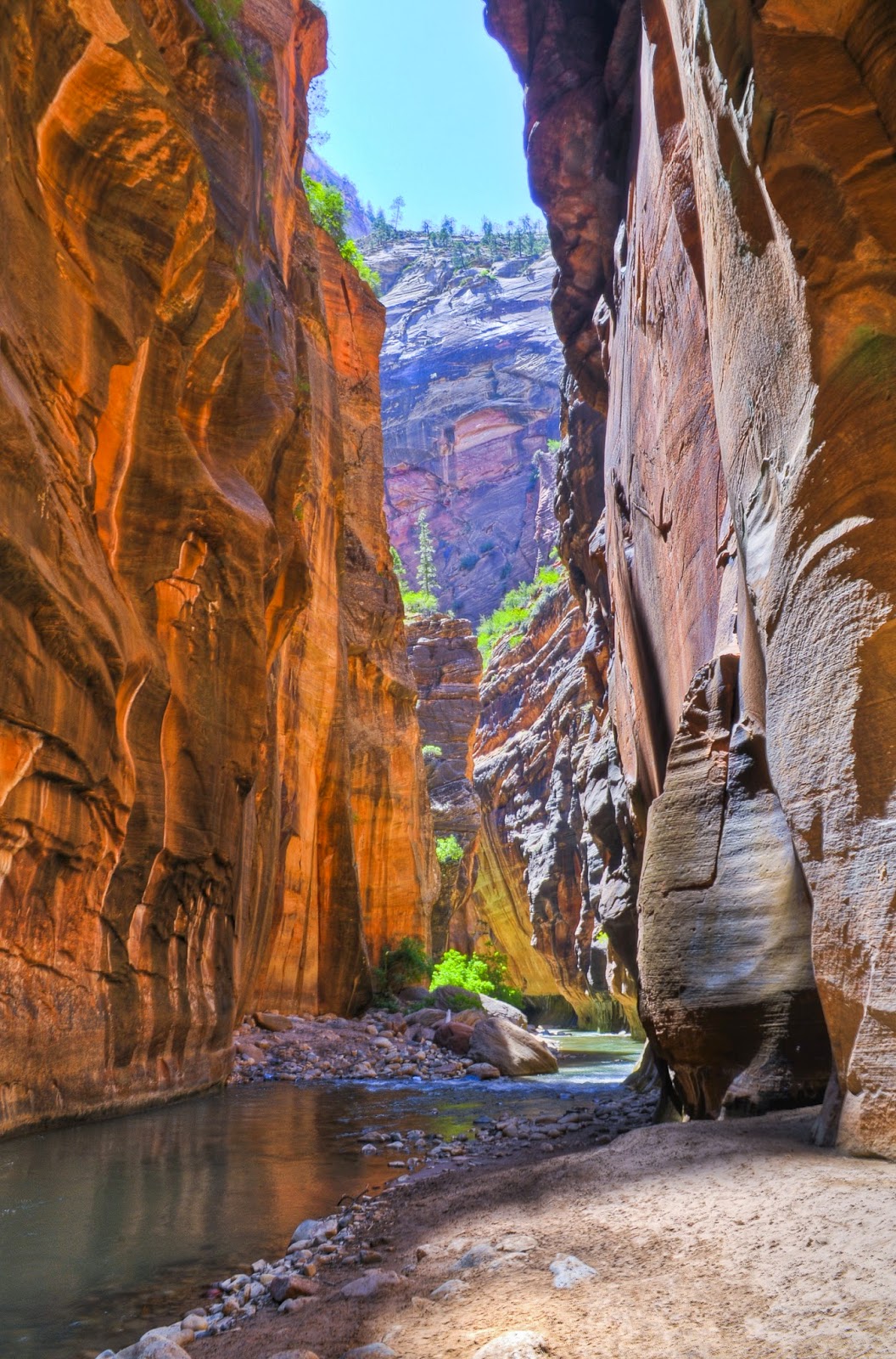
In Zion National Park at the famous Virgin River narrows, water is forced between two narrow but high sandstone walls, an impressive sight. The 2-mile round-trip Riverside Trail leads to the narrows opening.

The Narrows are located in Zion Canyon. The gorge’s walls can reach 1000 feet high with only 20-30 feet between them.

Here’s a brief video showing The Narrows:


Hike the trail in late summer when the water is warmer and lower than earlier in the year, so that you can wade into the narrows. When water levels are too high or flash floods occur, the park services closes the trail.

Learn more about national park day hiking trails in my Best Sights to See at America’s National Parks guidebook.


Sunday, August 3, 2014

Best trails for enjoying Zion NP’s wonders

Riverside Trail through Zion Narrows
Among the best ways to see Zion National Park’s top sights is via a day hike. Just five trails will allow you to enjoy each of the park’s highlights – a canyon’s exotic geological features, the world’s second longest arch, an incredible river narrows, hanging gardens, and magnificent California condors.

Zion Canyon
For 15 miles, the Virgin River cuts through cream, pink and red rock representing 150 million years of Earth history. The result is soaring towers, spectacular spires, and imposing monoliths. The 2-mile round trip Watchman Trail allows hikers to see several of the canyon’s exotic geological formations, including the Beehives, the Towers of the Virgin, the West Temple, the Altar of Sacrifice and the Watchman.

Kolob Arch
The park boasts the world’s second longest natural arch, Kolob Arch, which spans 287.4 feet. It can be seen in a long day hike through the backcountry on the 14-mile round trip Kolob Arch Trail, which leaves from the Lee Pass parking area.

Zion Narrows
At the famous river narrows, water is forced through a narrows between two high sandstone walls, an impressive sight. The 2-mile round-trip Riverside Trail leads to the narrows opening. Hike the trail in late summer when the water is warmer and lower than earlier in the year so that you can wade into the narrows.

Hanging gardens
At Weeping Rock, water seeps out of a concave cut in a sandstone wall, allowing for a lush hanging gardens to flourish amid the desert. The 1-mile round-trip Weeping Rock Trail is uphill with a steep stairs leading to the hanging gardens, but the site’s beauty is worth the climb.

California condors
More than 200 bird species can be found in the park, and the most magnificent of them is the rare California condor. They usually can be seen flying over the 5-mile round-trip Angels Landing Trail; the trail does have steep drop-offs so is not for young children.

Learn more about national park day hiking trails in my Best Sights to See at America’s National Parks guidebook.

Wednesday, September 25, 2013

See Zion Canyon’s famous sites from vista

Zion Canyon from vista point on Canyon Overlook Trail.
Photo courtesy NPS.
Topo map for Canyon Overlook Trail.
Families can hike past hoodoos to a vista that affords a fantastic view of Zion National Park’s famous Beehives, East Temple, the Streaked Wall, and the Towers of the Virgin, on the Canyon Overlook Trail.

The 1-mile round trip hike is excellent any summer day, but temps are cooler in the morning and late evening. The trailhead is along the park’s major highway, Utah Hwy. 9 (aka Zion-Mt. Carmel Highway or S.R. 9) on the east side of the Zion-Mt. Carmel Tunnel near the ranger booth. A parking lot sits on the opposite side of the road from the trailhead; overflow lots are a little farther east down the road.

An easy trail for adults, its 163-feet elevation gain makes this moderately difficult for young children. Most of the trail consists of sandstone with a few sections of packed dirt.

From the parking lot, use the crosswalk over Utah Hwy. 9. The trail begins with steps carved into sandstone, taking hikers above the tunnel.

Below the trail to the north is Pine Creek Canyon. The waterway through a narrow slot canyon is popular among canyoneers. If you hear a scream from below, it’s probably a canyoneer stepping into the ice cold creek, which can stretch from wall to wall.

Most of the trail is exposed, so you’ll definitely want to slather on sunscreen and wear a sun hat. About a quarter mile from the steps, shady overhang with green maidenhair fern offers some relief. Water seepage through the sandstone allows the ferns and other plants at the alcove to flourish.

From the alcove, the trail gains in elevation as it passes slickrock hoodoos. These pinnacles of rock formed because erosion-resistant hard rock rests on top of softer sandstone, which wind and rain cut and carve.

The trail next comes close to the cliff edge, so make sure children remain away from the railing. Immediately after a rain, the trial can be wet and slippery, making this is particularly dangerous spot.

A half-mile from the trailhead, you’ll reach a vista that overlooks lower Zion Canyon. Among the famous sites, from east/right to west/left, are:
g Beehive – Look straight ahead at the large crown of white, rounded tuft that appears like its namesake.
g East Temple – The pine-covered peak above the beehives tops out at 7709 feet, almost a half-mile above you.
g Switchbacks – Hwy. 9 winds down the cliffside into lower Zion Canyon.
g The Sentinel – To the northwest is this monolith that appears to guard over the canyon from its far side.
g Streaked Wall – Left of the Sentinel is a massive sandstone striped in red and white.
g Altar of Sacrifice – Directly west of the vista and south of the Sentinel is a red-streaked formation; the red is caused by water leeching iron oxide out of the rock.
g Sundial – South of the Altar is a formation that looks much look a horizontal sundial.
g West Temple – South of the Sundial is a monolith whose rocks began to form in the Middle Jurassic. The Altar of Sacrifice, Sundial and West Temple, are collectively known as the Towers of the Virgin.
g Bridge Mountain – South of the vista point on the other side of the tunnel is a peak topping out at 6,180 feet and that boasts two freestanding arches.

If looking at a topo map of the trail, you may wonder where the Great Arch is located. You’re actually standing atop it. For many years, the footpath was known as the Great Arch Trail. Civilian Conservation Corps in 1993 constructed the current trail.

If raining, do not walk this trail, as the wet rock is too slick. Also avoid it if there is lightning.

Learn more about national park day hiking trails in my Best Sights to See at America’s National Parks guidebook.


Monday, April 8, 2013

Fantastic sights await on Emerald Pools hike

Emerald Pools Trail, an oasis in the Utah desert.
Topo map for Emerald Pools Trail.

Paths meander
through oasis
at Zion N.P.


Waterfalls, dazzling pools and rock monoliths await hikers on the Emerald Pools Trails in Utah’s Zion National Park.

To reach the set of trails, enter the national park on Utah Hwy. 9. Park at the Zion Canyon Visitor Center, where you’ll pick up a shuttle to the Emerald Pools parking lot at Zion Lodge. The shuttle typically runs April 1-Oct. 20.

Summer offers the best weather for visiting, but be forewarned that the trail is among the most popular in the park and so will be busy. The higher elevation will mean potentially cold and wet days in spring and autumn.

The route actually is collection of short, meandering trails through this desert oasis. Walking west, cross the road your shuttle took to reach the lodge. A footbridge heads over the North Fork Virgin River that runs along the canyon floor.

Emerald Pools
After the footbridge, the trail splits. Going left puts you on the Middle Emerald Pools Trail. Going right places you on the Lower Emerald Pool Trail. Which trail you takes depends a lot on your energy level, your children’s capabilities, and what you’d like to ultimately see.

The Middle Emerald Pools runs a mile and allows you to see more pools; it also connects to the Upper Emerald Pools Trail. The Lower Emerald Pool runs 0.6 miles but places you closer to a stream flowing into the North Fork Virgin River. If you have a baby stroller or wheelchair, the Lower Emerald Pool out-and-back is the best route.

If opting for the Middle Emerald Pools Trail, you’ll climb a little over 100 feet to reach the middle pools. Shallow streams from side canyons feed the pools and cross the trail at a few points. You’ll spot waterfalls here as well; make sure children stay within the chained areas as algae and wet rocks make footing difficult.

Looming over the pools to the west is Red Arch Mountain at the center and Lady Mountain about 3,000 feet directly above the canyon floor. Cathedral Mountain can be seen to the north.

Lush hanging gardens
Between the two pools, you can go left along the Upper Emerald Pool Trail. The steep and sandy trail runs 0.4 miles along a ridge to the base of a 300-foot cliff where the Upper Emerald Pool sits. The secluded, boulder-rimmed pool is popular among canyoneers.

Upon returning to the Middle Emerald Pools Trail, you’ll pass the second of the two pools and then have a choice of either returning on the Lower Emerald Pool Trail or the Kayenta Trail that heads 0.9-miles to the Grotto Picnic Area and then the 0.6-mile Grotto Trail back to Zion Lodge.

If opting to take the Lower Emerald Pool trail, you’ll find the path paved and shaded with cottonwoods and box elders. Twin waterfalls form lush hanging gardens over the Lower Emerald Pool, and the trail goes behind them for a unique sight. Ferns, moss, monkey flower, shooting star and columbine line the mountainside.

Recommended route: Start on Middle Emerald Pools Trail (1 mile). Turn on Upper Emerald Pools Trail (0.8 miles out and back), and return to the parking lot on Lower Emerald Pool Trail (0.6 miles) for a 2.4-mile hike.

Tips: As tempting as it may be, make sure children keep their hands out of the pools and stay off the ledges. The first helps preserve the pools’ emerald green color and the latter ensures your child’s safety. Water, food and gift shop are available at Zion Lodge.

Learn more about national park day hiking trails in my Best Sights to See at America’s National Parks guidebook.