Showing posts with label Two Harbors. Show all posts

Friday, June 3, 2016

Variety of great hikes surround Split Rock

Iona's Beach pink rocks.
While Minnesota’s Split Rock Lighthouse State Park offers plenty of scenic and fascinating day hikes, the area surrounding it also offers an ample number of excellent trails.

Those trails generally can be accessed via Minn. Hwy. 61 either southwest or northeast of the park.

Southwest of Split Rock
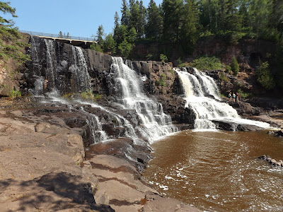
The section of Hwy. 61 southwest of Split Rock to Gooseberry Falls State Park is only a few miles long but boast some of the most visited and hiked trails in Minnesota. That’s for good reason – among the sights are five waterfalls within a mile of another (River View Trail), a beach of utterly pink rock (Iona’s Beach Trail), and a moon-like landscape of billion-year-old stone (Picnic Flow Trail).

Northeast of Split Rock
The section of Hwy. 61 northeast of Split Rock to Tettegouche State Park stretches a few more miles than that heading south to Gooseberry Falls and is no less spectacular. The sights include the highest waterfall entirely in Minnesota (High Falls Trail), a cliff dramatically rising 300 feet above Lake Superior (Palisade Head), and great vistas from the hills overlooking the lake (Superior Hiking Trail).

Learn about nearby hiking trails in Day Hiking Trails of Split Rock Lighthouse State Park.


Thursday, June 2, 2016

Hiking guide to Gooseberry Falls now out

My latest hiking guidebook, Day Hiking Trails of Gooseberry Falls State Park, was released Wednesday. Detailing more than 30 trails on Minnesota’s North Shore, the book focuses on those at Gooseberry Falls while including several south of the park to Two Harbors and those north to Split Rock Lighthouse State Park.

Minnesota’s second most visited state park, Gooseberry Falls is famous for its five waterfalls that tumble over billion-year-old rock, grand Lake Superior vistas, and historic CCC buildings constructed during the Great Depression. The famous Superior Hiking Trail and the Gitchi Gami State Bike Trail both cut through the park.

Part of the “Hittin’ the Trail” series, the title marks my 17th hiking guidebook. It is available for purchase online in paperback or Kindle ebook.

Learn about trail guidebooks available in the Hittin’ the Trail series.


Thursday, May 26, 2016

Several great trails await at Split Rock park

Historic light station buildings on the Split Rock Light Station Trail.

Routes head to rare rock, historic light station, lakeshore vistas


Though incredibly diverse in its trail offerings, Minnesota’s Split Rock Lighthouse State Park is not so large that they can’t all be hiked in a week. Many visitors to the North Shore usually tackle one or two of them each year over a decade. Whichever approach you use, each day hike is certain to lead to a wonderful experience and memory.

Among some of the great Split Rock trails to day hike (from southwest to northeast) are:

Split Rock River Trail
A red rock gorge with waterfalls awaits day hikers of this 4.4-miles round trip trail. Due to the great scenery and ease of access, it’s also among the Superior Hiking Trail’s most popular segments. To reach the trail, at mile marker 43.2 on Minn. Hwy. 61, turn into the parking lot for the Split River Rock Wayside on the road’s north side.

Corundum Mine Trail
Day hikers can explore the history of a wild Lake Superior shoreline on this 4.2-miles round trip. Besides being a back-to-nature hike, the trail passes ruins of old logging and mining operations. Park at the same DOT wayside as for the Split Rock River Trail.

Merrill Logging Trail
Hikers can travel into the highlands overlooking Lake Superior via a century-old railroad grade on this trail. Including the access from the Split Rock River wayside via the Gitchi-Gami Trail, the route runs 2.7-miles round trip. It crosses an area that many visiting the state rock bypass in favor of the historic lighthouse.

Little Two Harbors Trail
Great views of the park’s famous lighthouse and of Lake Superior from a pebble beach await on the this trail. The 3.2-mile round trip ranks among the park’s most popular. To reach the trailhead, use the entry road and parking lots for the light station visitor center; rather than go to the center, though, follow the trail heading southwest from the lot.

Split Rock Light Station Trail
Day hikers can explore one of the nation’s most famous lighthouses and enjoy impressive cliff top views of Lake Superior on this trail. The 0.8-mile walk heads through a collection of walking paths around the historic Split Rock lighthouse. Perched atop a 130-foot high solid rock cliff overlooking Lake Superior, Split Rock is among the most photographed lighthouses in the country. Use the parking area for Split Rock Light Station and History Center.

Learn about nearby hiking trails in Day Hiking Trails of Split Rock Lighthouse State Park.


Wednesday, May 18, 2016

Explore Split Rock’s history via day hikes

Aerial view of Split Rock Lighthouse, courtesy of Wikipedia.
Minnesota’s Split Rock Lighthouse State Park enjoys a rich history that ranges from shipping and mining to Native Americans and modern tourism. Several of the park’s day hiking trails explore this past.

Ojibwa Indians dominated the entire Minnesota North shore beginning in the 1700s. By the mid-1800s, the first white settlers in what is now the state park established a fishing village at Little Two Harbors. Cement foundations of the houses and fish processing buildings are all that remain. The Little Two Harbors Trail heads from the lighthouse to the village ruins.

From 1899-1906, a logging camp was set up at the mouth of the Split Rock River, down shore from Little Two Harbors. A rail line heading into the highlands also was constructed. It can be hiked via the Merrill Logging Trail. The logging camp ruins can be seen on the Corundum Mine Trail.

In 1901, the North Shore Abrasives Company set up shop at Corundum Point after a prospector misidentified the anorthosite there as corundum, which is used as an industrial abrasive. When the company realized it had the wrong rock, operations were abandoned. Cement footings of the company’s building and other relics from the mining operation still can be found at the park, also visible from the Corundum Mine Trail.

A horrible gale in November 1905 damaged 29 of U.S. Steel’s bulk ore carriers on Lake Superior. Two of them were wrecked on the rocky shoreline that now is the state park. The result was construction of Split Rock Lighthouse, which is the park’s main attraction. It became operational in 1910.

After Hwy. 61 was constructed in 1924, the lighthouse became an unintentional tourist attraction. Thousands of people began parking on the road and walking through the woods to the scenic point where the lighthouse stood.

A half century later, however, technology had made the old lighthouses obsolete. Many lighthouses across the country subsequently were automated while others closed. In 1969, Split Rock’s lighthouse was shut down.

Two years later, the state of Minnesota purchased the 25-acre lighthouse site. It was restored to its early 1920s appearance. Today, the lighthouse sits amid Minnesota’s fifth most-visited state park. The lighthouse and its grounds can be toured on the Split Rock Light Station Trail.

Learn about nearby hiking trails in Day Hiking Trails of Split Rock Lighthouse State Park.

Tuesday, May 10, 2016

Trails crisscross Split Rock landscape

Stony Point as seen from the cove on the Two Little Harbors Trail.
Several day hiking trails explore the interesting geography of Minnesota’s Split Rock Lighthouse State Park.

The park essentially consists of two landforms.

The first is the highlands that rise a few hundred feet above Lake Superior. This entire section is located west of Minn. Hwy. 61. The Split Rock River Loop runs alongside Split Rock River as the waterway cuts downward through the highlands toward Lake Superior. The Merrill Logging Trail follows a former rail line that winds into the highlands.

The rocky shoreline with several headlands – erosion-resistant rock that sticks out into the lake – forms the second geographical region. All of it is east of Hwy. 61. Among the headlands, from north to south, are Split Rock Point, Corundum Point (which includes Day Hill), Stony Point (where the lighthouse is located), and Gold Rock Point.

Stony Point, which rises about 150 feet straight out of the lake, offers the most dramatic of vistas at the park. The Split Rock Light Station Trail runs across the top of Stony Point while the Little Two Harbors Trail heads down that point to a rocky shoreline on a cove.

Learn about nearby hiking trails in Day Hiking Trails of Split Rock Lighthouse State Park.

Monday, May 2, 2016

Trails explore Split Rock State Park geology

Split Rock Lighthouse sits atop a massive 1,1-billion-year-old block of rock.
Split Rock’s great scenery would not exist if not for 1.1 billion-year-old lava flows that formed when North America began to separate into two, creating what today is called the Mid-Continent Rift. The rift extends all across the Great Lakes to as far south as Kansas.

In Minnesota, those lava flows along Lake Superior are known as the North Shore Volcanic Group. Occurring over millions of years, the flows can run up to 30,000 feet in the region.

Much of the state park sits atop a single, large block of anorthosite. A buoyant mineral, it floated atop the magma as the rift grew. The mineral is also quite resistant to erosion – so resistant that during the early 1900s the Minnesota Mining and Manufacturing Company (now known as 3M) mistakenly thought the rock there might by corundum, which is used in abrasives.

Fast forward to 10,000 A.D. After eons of being buried by sediment, the great glaciers of the last ice age had scraped off most of the terrain, leaving only the basalt and a thin layer of till over them. Cold Lake Superior is merely what remains of a melted glacier in a low spot of the 1.1 billion-year-old rift, and the rivers along the North Shore are carving through the remaining till and sediment and exposing the underlying basalt.

Some great trails to explore Split Rock’s geology include:
Corundum Mine Trail
Split Rock River Trail
Day Hill Trail
Palisade Head Trail

Learn about nearby hiking trails in Day Hiking Trails of Split Rock Lighthouse State Park.

Monday, March 7, 2016

Secluded waterfalls awaits on North Shore

Map of West Split Rock River Falls Trail, courtesy Minnesota DNR.

Trail rambles
1.6-miles total
alongside river


Day hikers can enjoy a pleasant walk to a little-known waterfall on the Superior Hiking Trail in Minnesota’s Split Rock Lighthouse State Park.

With the North Shore well-known for its many waterfalls, few offer much solitude. The West Split Rock River Falls Trail, 1.6-mile round trip hike, offers the opportunity for just that. Spring is the best time to visit, as by August the waterfalls will be barely a trickle.

To reach the trailhead, from Two Harbors, drive north on Minn. Hwy. 61. At mile marker 43.2, turn into the parking lot for the DOT’s Split River Rock Wayside on the road’s north side.

The path – a leg of the Split Rock River Loop – heads up the west shore of Split Rock River through a birch grove. The trail is a gradual climb, offering nice views of the river valley below. Be aware that the clay banks on this side of the root beer-colored river at times are steep and after a rainfall can be slick; boardwalks, timbers and bridges make up part of the rugged trail’s surface.

At 0.5 miles from the trailhead, the spur reaches the junction with the actual Superior Hiking Trail; go right/north, remaining along the river. Watch for the blue blazes that mark the SHT.

A wooden bridge crosses the West Fork of the Split River, a small creek that drains into the main waterway, at about 0.8 miles from the trailhead. Large, mature cedars grow near the confluence, and a rock ledge allows a great place to rest and even enjoy a picnic as viewing West Split Rock River Falls, which tumbles 20 feet over gray rock.

Once taking in the falls, retrace your steps to the parking lot.

Learn about nearby hiking trails in Day Hiking Trails of Split Rock Lighthouse State Park.


Sunday, February 28, 2016

SHT walks ridgelines over Split Rock park

Superior Hiking Trail - DOT Wayside to Southeast Split Rock River
Campsite segment, courtesy Minnesota DNR.
Superior Hiking Trail - DOT Wayside to ATV Trail on
Chapins Ridge segment, courtesy shta.org.

Minnesota trail
offers views of
Lake Superior


Day hikers can enjoy great views of Lake Superior on two segments of the Superior Hiking Trail in Minnesota’s Split Rock Lighthouse State Park.

While the segments share the same access trails, upon reaching the SHT, hikers can go in one of two directions – left/southwest to the Southeast Split Rock River Campsite or right/northeast to an ATV trail on Chapins Ridge. The former is shorter while the latter offers better vistas of Lake Superior.

To reach the trailhead, from Two Harbors travel north on Minn. Hwy. 61. Park at the Split Rock River Wayside. Take the access trail around the lot and under the highway to the Gitchi-Gami Trail. Go left/northeast on the trail.

In 0.3 miles, look for the Merrill Grade Trail. It is to the left on the other side of Hwy. 61 and is marked with a yellow gate. Carefully cross the busy highway to the trail; you may need to walk a ways in the ditch or along the shoulder to reach the gate.

After walking 0.2 miles up a steep grade, you’ll reach the first junction with a connector to the SHT. Go left/northwest onto in. These by far are the most arduous portions of the hike. In 0.2 miles, you’ll reach the SHT. You’ll have to decide there which segment you want to take.

Left/southwest to Split Rock River campsite
This route heads to the Southeast Split Rock River Campsite for a 3.2-mile round trip from the DOT Wayside.

When the connector reaches the SHT, go left/southwest. For most of this segment, the trail follows the ridgeline at about 850 feet elevation. It’s about 0.9 miles from the connector to the campsite.

The campsite marks a good spot to turn back. Alternately, you can continue on; in 0.6 miles is the footbridge across the Split Rock River. This reaches the end of the Split Rock River Trail described in another entry.

Right/northeast to ATV Trail
Following the ridgeline, the trail offers excellent vistas of Lake Superior and the Split Rock Lighthouse below for a 5.6-mile round trip.

When the connector and the SHT meet, go right/northeast.

Along the way, the trail passes several rock outcroppings. Most of these mark the former shoreline of ancient Glacial Lake Duluth.

The trail soon begins a long but gradual descent to a wetlands surrounding Split Rock Creek. A footbridge heads over the stream, and then it’s uphill once more.

Next the SHT junctions with the Merrill Grade Trail at 0.8 miles from the connector. From there, the SHT leaves Split Rock State Park, as heading north along the century-old railroad line that was used to haul fallen logs out of the highlands to the lake.

Eventually the SHT splits from the old railroad grade and heads through a spruce forest. Rocky ridges with steep drops and lichen-covered boulders offer visual delights.

In 1.3 miles from the Merrill Grade Trail, the SHT intersects an ATV trail. This marks a good spot to turn back. If continuing on, however, the SHT reaches the Chapins Ridge Campsite in 0.4 miles.

Learn about nearby hiking trails in Day Hiking Trails of Split Rock Lighthouse State Park.


Wednesday, February 24, 2016

Trail offers snapshot of Split Rock’s features

Gitchi-Gami State Trail bridge over Split Rock River, courtesy of Wikipedia.
Map of DOT Wayside to Park Road segment.
Map of Split Rock Lightstation to Park Road segment.
Map of Split Rock Lightstation to Gold Rock Point segment.
Click on maps for larger images.

Gitchi-Gami runs 3.8 miles through Minnesota park


Day hikers can get a good sense of what Minnesota’s Split Rock Lighthouse State Park is all about via the Gitchi-Gami State Trail, the only route that runs from one end of the park to the other.

Though primarily a bicycle trail, the paved Gitchi-Gami can be walked as well. When completed, the trail will run 88-miles from Two Harbors to Grand Marais. One of its longest finished sections runs from Gooseberry Falls State Park to Beaver Bay, which takes it straight through Split Rock.

The trail rambles about 3.8 miles across the park. If split up, three trail segments make for great day hikes.

DOT Wayside to Park Road segment
This 2.6-mile (one-way) section cuts across Split Rock’s southern half.

To reach the trailhead, from Two Harbors take Minn. Hwy. 61 about 21 miles north. At Split Rock Lighthouse State Park, park at the DOT wayside overlooking Split Rock River.

From the wayside, pick up the stem trail on the lot's west side, taking it under the highway to the trail, which runs between the highway and Lake Superior. There’s a small sand bar beyond the stem and the main trail’s intersection. A logging camp existed here in 1899-1906.

Go left/northeast on the main trail and cross the Split Rock River's mouth with Lake Superior. In short order, you’ll reach the junction with the Corundum Mine Trail. That trail explores the remnants of a mining operation from the early 1900s.

At 0.3 miles from the trailhead, the Gitchi-Gami junctions with the Merrill Logging Trail. The Merrill Logging Trail was built on an old railroad grade that brought white pine from the Arrowhead to Lake Superior.

In 0.9 miles from the trailhead, you’ll come across the junction with a connector trail that heads to the Corundum Mine Trail. At 1.2 miles is the junction with the other end of Corundum Mine Trail.

The Gitchi-Gami next crosses Rock Creek, which flows out of the highlands into Lake Superior.

On the other side of bridge is a connector leading to the Day Hill Trail. At 1.4 miles, you’ll come to yet another connector to that trail. Day Hill is a large block of erosion-resistant anorthosite that is more than a billion years old.

At 1.5 miles, the Gitchi-Gami reaches a three-way intersection with the Day Hill Trail. Go left/north and hike the backside of Day Hill and its base as you come back alongside Hwy. 61.

Along the way, you’ll a pass wayside for Hwy. 61. From the wayside, you’ll get an outstanding view of Split Rock Lighthouse, which was constructed on 1910.

At 2.6 miles, the Gitchi-Gami reaches the park road. Though you’ve hardly covered the length of the trail in Split Rock, this marks a good spot to turn back for a 5.2-mile round trip.

Split Rock Lightstation to Park Road segment
This 0.6-miles one-way hike (1.2-miles round trip) runs through the park’s center portion.

To reach the trailhead, enter Split Rock as if going to the lightstation and park in its lots. From the southwest lot, pick up the access trail. When the trail splits, go left/south-west.

The trail follows the park road then swerves away from it to near the Little Two Harbors Trail. The Little Two Harbors offers great views of Lake Superior and leads to a beach.

Next the Gitchi-Gami crosses a creek. When it arrives at the park road, you’ve reached the spot where the previous segment ended. This marks a good spot to turn back.

Split Rock Lightstation to Gold Rock Point segment
This 0.9-mile one-way (1.8-mile round trip) heads into park’s northern section.

Enter the park as if going to the Split Rock Lightstation and park in its lots. As in the previous segment, from the southwest lot, pick up the access trail. When the trail splits, however, go right/north-east and cross the park road.

The trail closely parallels the park road then Hwy. 61 for 0.8 miles, where it arrives at a parking lot. From the lot, a 0.1-mile spur trail heads to a bay west of Gold Rock Point.

After taking in the lake views, retrace yours steps back to the lot. Alternately, you can continue north/east from parking lot to park boundary, which is in 0.7 miles; that addition, which crosses two creeks, makes for a 3.2-mile round trip hike.

Final note: Though the trail runs through wooded areas its entire length in Split Rock, it is wide, so you’ll want to wear a sunhat and don sunscreen.

Learn about nearby hiking trails in Day Hiking Trails of Split Rock Lighthouse State Park.


Tuesday, February 16, 2016

Trail heads along beach south of lighthouse

Pebble Beach. Photo courtesy of MN DNR.
Map of trail, courtesy of MN DNR.

Little Two Harbors route
rambles through state park


Great views of a famous lighthouse and of Lake Superior from a pebble beach await on the Little Two Harbors Trail along Minnesota’s North Shore.

The 3.2-mile round trip trail ranks among the most popular at Split Rock Lighthouse State Park. To reach the trailhead, from Two Harbors take Minn. Hwy 61 north to the state park. Use the entry road and parking lots for the light station visitor center. Rather than go to the center, though, follow the trail heading southwest from the lot.

Initially, the trail offers access to a few of the light station’s historic sites. The first junction is for a path that loops back to light station while the second junction is with a trail heading to the lake. At both intersections, continue straight/west.

Pebble Beach
In short order, the trail curves southwest. It heads downhill over a wide trail with round cobbles on it; it is a terrace formed some 9000-10,000 years ago when Glacial Lake Duluth covered this area and was some 30-40 feet higher than Lake Superior is now.

When a footbridge crosses an intermittent creek, pause to look over the sides as the angular, step-like rocks of the rock outcrop. This is a distinctive type of basalt lava flow called Tortured Basalt because of the way the rock breaks off, which is due to weathering along the fractures crisscrossing it. The rock is best seen in late summer and autumn when water levels are low.

Asters bloom along the trail here during the same period. Most are white and purple. Bush honeysuckle and an impressive grove of birch trees also are present, as well as spruce trees.

As the trail arrives at the lake, it reaches Pebble Beach on Little Two Harbors. The protected cove is the perfect spot to take a safe swim in Lake Superior or to enjoy lunch; picnic tables are beyond the treeline along the beach. Three trail junctions across along the beach lead to the picnic area and a parking lot.

Trail's namesake
Be sure to take a gander north along the shoreline and you’ll be treated to a great view of the Split Rock Lighthouse. The century-old lighthouse sits atop Stony Point.

At the beach’s southwest end is the trail’s namesake, Little Two Harbors, where a small fishing village existed about a century ago. Ellingson Island sits just offshore, and the lighthouse still is visible.

After passing a portage route to the lake – the cove is popular with kayakers – the trail curves south. There’s a carry-in campsite in this area as well.

The junction with Day Hill Trail marks the end of the Little Two Harbors Trail. This is a good spot to turn back.

Learn about nearby hiking trails in Day Hiking Trails of Split Rock Lighthouse State Park.


Friday, February 12, 2016

Gooseberry Falls offers variety of great trails

Vista of Gooseberry River flowing into Lake Superior.
Imagine a place where five waterfalls spill over billion-year-old rock, where both incredible vistas of the world’s largest freshwater lake and paths pass an array of sweet-scented wildflowers, where you can traipse through historic handcrafted stone buildings or alongside a creek meandering about an evergreen forest.

The place is real: It’s called Gooseberry Falls State Park. Many consider the crown jewel of Minnesota’s multitude of natural gems.

Located along the North Shore about 30 miles northeast of Duluth, Gooseberry Falls is an outdoor recreational paradise. Minnesota’s second most visited state park, it’s popular among hikers, campers and nature lovers of all stripes. With about 630,000 annual visitors, more people visit Gooseberry Falls than half of all national parks.

Some great trails to hike in Gooseberry Falls include:
Waterfalls
Lake Superior vista
Wildflowers
Historic CCC buildings
Forest stream

Learn about more day hiking trails at and near Gooseberry Falls State Park in Day Hiking Trails of Gooseberry Falls State Park.


Monday, February 8, 2016

Trail follows creek up Great Lakes bluffside

Juneberry fruits often are mistaken for blueberries.
Photo courtesy of Minnesota DNR.
Split Rock Creek Trail map, courtesy of Minnesota DNR.

Split Rock Creek Trail runs
2.5 miles in Minnesota park


Day hikers can explore a bluffside overlooking Lake Superior on the Split Rock Creek Trail at Minnesota’s Split Rock Lighthouse State Park.

The 2.5-miles round trip trail parallels Split Rock Creek. It’s one of the park’s less hiked trails and so offers a nice dose of solitude.

To reach the trailhead, from Minn. Hwy. 61 use the park’s main entry road for the historical lighthouse. Follow the road all the way to its end, where there’s a parking lot.

The trail leaves from the lot’s south side, heading to Lake Superior. Pass through the first junction then in 0.1 miles from the lot, at the second junction, go right/northwest on the Day Hill Trail. For the next 0.4 miles, the trail wraps around the hill’s northern base.

Upon reaching the paved Gitchi-Gami trail, go left/southwest for 0.15 miles. At the second intersection, go right/west; you’re now on the Split Rock Creek Trail.

Juneberries
Juneberry bushes grow in abundance for the next 0.1 miles as the trail reaches Hwy. 61. Sometimes called service berries, Saskatoon or shadbush, the fruit looks very similar to blueberries but tastes more like black cherries. The fruit typically ripens in late June to early July.

Carefully cross the busy highway and continue up the slope paralleling Split Rock Creek past birch and alder trees for the next 0.5 miles. The trail climbs more than 100 feet during that stretch.

A wide jeep trail, the Split Rock is wooded the entire way. Most of the stretch consists of spruce and maple with a large number of birch and balsam poplar dead or dying. Beneath the birch, look for flat-topped white, large-leaf, and pinnacled asters. These plants are typical of aging birch forests along Lake Superior.

Plants common in local grassy lawns have to be mowed in sections where they’re taking over the trail. Among them are buttercups, plantain, red and white clover, strawberries. Meanwhile, bracken fern, bush honeysuckle, large-leafed aster, and raspberries line the trail as it ascends.

Diabase and boulders
Geology-wise, the trail crosses an outcrop of diabase, a hard, erosion-resistant rock that has existed here for more than a billion years. A couple of the boulders in the outcrop that stand out consist of dark-colored schist and another of pink monzonite.

As gaining altitude, the trail pass white cedar with high branches. The lower ones all have been browsed by white-tailed deer.

One thing you won’t see too much of is Split Rock Creek, which mostly is separated from the trail by trees. Forming farther up in the highlands, the creek spills into Lake Superior between Split Rock and Corundum points. Some maps do not call Split Rock Creek – the stream actually has no official name – though locals have called it that since the 1920s, and most official Minnesota maps now refer to us as such.

After passing through a grove of large, aged cedars with younger, smaller balsam poplars, you’re closing in on the Superior Hiking Trail. At the SHT, turn back, retracing your steps back to the parking lot.

Learn about nearby hiking trails in Day Hiking Trails of Split Rock Lighthouse State Park.


Thursday, February 4, 2016

Great trails surround Gooseberry Falls

Lake Superior vista from Silver Creek Cliff Wayside Trail.
While Minnesota’s popular Gooseberry Falls State Park offers plenty of trails to explore for more than a few days, there are a number of great sights nearby that bear visiting.

The majority of them stretch between Two Harbors and the state park. Among the highlights are inspiring vistas of Lake Superior, agate-laden beaches, and modern harbors. The trails include:
Silver Creek Cliff Wayside Trail
Flood Bay Beach Trail
• Lighthouse Point Trail

Several great hiking trails also can be found north of Gooseberry Falls on the short stretch to Split Rock Lighthouse State Park. The sights include a beach of pink rock, trails winding through rare giant tufts of Arctic lichen, and a red rock gorge. Those trails are:
Iona’s Beach Trail
Superior Hiking Trail, Blueberry Hill Road to Split Rock River Valley segment
Split Rock River Trail

Learn about more day hiking trails at and near Gooseberry Falls State Park in my Day Hiking Trails of Gooseberry Falls State Park guidebook.


Sunday, January 31, 2016

Beach, forest walks await in Two Harbors

The Silver Creek Cliff Segment of the Gitchi-Gami trail runs on old Minn.
Hwy. 61 roadbed north of Two Harbors. 
Many visitors to Two Harbors, Minn. – the first major city on the Minnesota North Shore after leaving Duluth – think the only great sights of nature to enjoy are those at Gooseberry Falls and Split Rock Lighthouse state parks. There are plenty of fantastic outdoors sights to see before ever reaching those parks, though.

Among the best trails in and around Two Harbors (not including the state parks) are:
Flood Bay Beach – The crescent-shaped, agate-laden beach with a panoramic view of Lake Superior runs about 0.9-miles round trip if walking from the parking lot to one end of it then to the other end and back to the lot. About a mile north of town on Minn. Hwy. 61, between mileposts 27 and 28, look for signs to the wayside/beach and turn right/east into the parking lot.
Kelsey Beach Trail – This gem is one of the North Shore’s best kept secrets. Less than a couple of hundred feet in distance, the cobblestone beach sits at the mouth of the Stewart River as it flows into Lake Superior. To reach the trailhead, from Two Harbors take Hwy. 61 north; immediately past the Stewart River Bridge, turn right/southeast into the parking lot.
Knife River Rest Area Trail – Day hikers can amble across billion-year-old rock along a river’s edge at the Knife River Rest Area. To reach the Knife River Rest Area Trail, take Hwy. 61 south from Two Harbors. After milepost 18, exit to the left and double back to a parking area. The trail runs about 250-feet round trip.
Gitchi-Gami Trail, Silver Creek Cliff Segment – The 1-mile round trip trail makes use of the Old Hwy. 61 roadbed and offers a 4000-foot vista of Lake Superior. Park at the Silver Creek Wayside Park and walk south/west to the western end of Silver Creek Cliff.
Lake County Demonstration Forest Trail – About four miles of trails on an equal number of stacked loops can be found in the county forest. Parking and a trailhead are off of County Road 131/Drummond Grade at 2.7 miles from County Road 124/Holm Road.
Lighthouse Point Trail – The rugged 1-mile trail runs along a rocky coast and through a cedar grove on a point separating Agate and Burlington bays. Start at the southern end of the Agate Bay Beach parking lots and turn back upon reaching the junction with the Sonju (aka Two Harbors Lake Walk) Trail.
Sonju Trail – A number of great sights – a trio of Great Lakes docks, wildlife including white-tailed deer, and a lakeside pine forest – await hikers on the Sonju. Perhaps the most impressive part of the trail is the rock beach overlooking Burlington Bay. The paved bicycle and walking trail runs from Paul Van Hoven Park through Lakeview Park for about 2.4-miles round trip.
Superior Hiking Trail, Camp Creek to Encampment River segment – The 4.5-mile round trip trail through a fragrant evergreen forest connects Crow Creek and the Encampment River south of Gooseberry Falls State Park. The trailhead is on Lake County Hwy. 106/W. Castle Danger Road north of Hwy. 61; at the Castle Danger Trailhead parking lot, go west and cross Hwy. 106.
Superior Hiking Trail, McCarthy Creek segment – The 6.2-mile round trip trail heads through a sugar maple and a balsam fir forest. The parking lot off of County Road 261/Rossini Road; head east to the McCarthy Creek crossing.
Superior Hiking Trail, Wolf Rock segment – Day hikers can enjoy impressive views of Lake Superior on the 1-mile round trip. It generally is considered one of the Superior Hiking Trail’s most visually dramatic sections. Use the same lot as for the SHT's Camp Creek to Encampment River segment.
Two Harbors Breakwall – You can head about a third of a mile (0.66-miles round trip) into Agate Bay along the breakwall. Park in the lots for Agate Bay Beach at the end of Third Street.

Learn about trail guidebooks available in the Hittin’ the Trail series.


Wednesday, January 27, 2016

Gooseberry Falls boasts three unique parts

Middle Falls, River View Trail.
Minnesota’s Gooseberry Falls State Park largely can be divided into three distinct areas, each offering its own unique flavor.

The most popular section of the park is south of the Gooseberry River, where trails leading to the waterfalls, the visitor center, and the campground are located. Trails there include:
River View Trail
Picnic Flow Trail
CCC Buildings Trail

Less visited is the section north of the river and east of Minn. Hwy. 61, which has only two walking paths but great views of Lake Superior and historic structures. Those two trails are:
Gitchi Gummi Trail
Gitchi-Gami Trail (bicycle trail)

Visitors can find solitude in the section west of Hwy. 61, in which a number of trails heads into the highlands overlooking Lake Superior. A couple of great trails in this section are:
Fifth Falls Trail
Superior Hiking Trail
Nelsens Creek Trail

Learn about more day hiking trails at and near Gooseberry Falls State Park in my Day Hiking Trails of Gooseberry Falls State Park guidebook.


Saturday, January 23, 2016

Trail follows historic rail line into bluffs

Map of Merrill Logging Trail.

Route heads through Split Rock state park


Day hikers can travel into the bluffs overlooking Lake Superior via a century-old railroad grade at Minnesota’s Split Rock Lighthouse State Park.

The Merrill Logging Trail, including an access trail from Split Rock River, runs 2.7-miles round trip. It crosses an area that many visiting the state rock bypass in favor of the historic lighthouse.

To reach the trailhead, from Two Harbors travel north on Minn. Hwy. 61. Park at the DOT Wayside for Split Rock River. From the lot, go north on walking path and take an immediate left/north onto the access trail for the Gitchi-Gami State Trail; this stem runs under the highway.

Once at the main trail, go left/northeast onto it. Follow it for 0.25 miles, then turn left/north onto the Merrill Logging Trail. A crossing of Hwy. 61 is required here, so be careful, as the road is busy.

Merrill Grade
Once across the highway, the grassy trail angles to the northeast into the woodline and climbs the Merrill Grade. Though steep, gaining about 150 feet in 1.1 miles, it is the easiest way to head up the bluffside.

From 1899 to 1906, the Merrill & Ring Lumber Company ran a logging camp at the mouth of the Split Rock River. A rail line headed 10 miles into the bluffs and backcountry, hauling timber to the river mouth. The trail follows a segment of that rail line.

About 0.2 miles from the Gitchi-Gami, the Merrill route reaches its first trail junction, a connector to the Superior Hiking Trail. Continue straight/northeast.

During the 1860s, Thomas Merrill – the product of a Maine lumber family – started a number of logging companies in Michigan. In 1886, he joined forces with Clark Ring, and they based their company out of Saginaw, Mich.

Split Rock Creek
In another 0.2 miles, the walking path junctions another connector to the Superior Hiking Trail. Go right/east here and continue up the bluff. In short order, the trail angles north.

As the white pine forests of the Great Lakes states thinned in the 1890s, Merrill & Ring purchased land in Washington state. In 1902, they moved their headquarters there.

About 0.7 miles from the last junction, the Merrill Logging Trail intersects the Superior Hiking Trail at Split Rock Creek. The creek rises from even higher in the bluffs, at an elevation more than 200 feet above this point.

The creek marks the park's northern boundary and the end of the Merrill Logging Trail. Turn back here, retracing your steps back to the wayside parking lot.

Learn about nearby hiking trails in Day Hiking Trails of Split Rock Lighthouse State Park.


Tuesday, January 19, 2016

Diverse landscapes await on GFSP trails

Lower Falls at Gooseberry Falls State Park. Photo by Kieran Bignell.
Most visitors to Minnesota’s Gooseberry Falls State Park go to see the fantastic set of waterfalls that are within a few hundred yards of one another. But there are more landscapes and ecosystems to see at the park than those around the waterfalls.

Indeed, three general landscapes dominate the picturesque park.

The first is the shoreline with Lake Superior that largely runs south of Minn. Hwy. 61. Outcroppings of the ancient 1.1-billion-year-old basalt are common just above the waterline. The Picnic Flow Trail is an excellent route to explore the park’s shoreline.

The second zone consists of the highlands rising sharply above the shore, mainly north of Hwy. 61. A variety of trees grow along the hills as the elevation changes, resulting in a range of micro ecosystems. The Superior Hiking Trail heads into and atop those highlands in the park.

A third zone is the Gooseberry River itself, which forms a gorge cutting through the hills and then flows in a shallow cut through the shoreline area. Rather than replicate the surrounding hills or shoreline, the river with its five waterfalls creates its own unique environment for plants. Two good trails to discover all the river has to offer is the Gooseberry River Trail and the River View Trail, the latter of which heads to the park’s iconic waterfalls.

Learn about more day hiking trails at and near Gooseberry Falls State Park in my Day Hiking Trails of Gooseberry Falls State Park guidebook.


Friday, January 15, 2016

Trail heads to fantastic Lake Superior vista

Map of Day Hill Trail
Routes lead to Day Hill summit at Split Rock


Hikers can head to what is arguably one of the Minnesota North Shore's best vistas on the Day Hill Trail at Split Rock Lighthouse State Park.

Two routes can take you to the top of this tall chunk of volcanic rock that sits over Lake Superior. The shorter out-and-back trail runs about 1.4-miles round trip while a longer lollipop trail runs about 1.8 miles.

To reach the trailhead, from Two Harbors, drive north on Minn. Hwy. 61 for 19 miles. Use the park entrance road for the lighthouse but continue driving southwest to the parking lot at its end. The Day Hill Trail leaves from the lot's south side. Art the first trail junction, continue straight/south.

Short route
At the next junction, go right/north. The well-groomed trail heads 0.4 miles around Day Hill's north side, gradually ascending the rock.

Day Hill is a large block of anorthosite, one of three in the park, the other two being Corundum Point and Stony Point. Formed 1.1 billion years ago, anorthosite lacks iron-bearing minerals so is highly resistant to erosion.

At the next junction, turn left/east. This goes a little under 0.2 miles to Day Hill’s summit where there’s an overlook. The summit sits at 840 feet elevation, about 240 feet above the lake.

From the slab of gray stone that makes up the overlook, vast blue Lake Superior stretches before you. The peninsula sticking into the lake to the southwest is Conundrum Point; to the northeast is Ellingson Island and Little Two Harbors with the lighthouse looming above the small bay. On a clear day, Wisconsin’s Apostle Islands can be seen about 20 miles to the southeast.

You'll also see the remnants of an old stone fireplace. Its origins remain a mystery, but legend says that around 1900, Duluth businessman Frank Day began building a house atop the rock for he and the woman of his dreams, but when she did not return his love, he gave up on the project.

Long Loop
The short route is only a segment of the Day Hill Trail. If you have more energy, rather than turning to head around the hill’s north side, instead continue straight/southwest and swing around Day Hill’s lake side.

After passing a spur trail to a cart-in campground on the lake, head right/north at the next junction. You’ll then travel along the hill's southwest side below its summit.

At the next junction, which is the Gitchi-Gami Trail, head right/northeast. Then take the next right/east trail to Day Hill's summit.

Upon coming down from the summit, go right/northeast to wrap around the base of the hill's north side. At the next junction, go left/east on the stem, heading back to the parking lot.

Learn about nearby hiking trails in Day Hiking Trails of Split Rock Lighthouse State Park.


Monday, January 11, 2016

Trails unveil Gooseberry Falls area history

Among the historic sights to see at Minnesota's
Gooseberry Falls State Park are handcrafted stone
buildings, including the Lakeview Shelter. Photo
courtesy of Minnesota DNR.
Most people visit Minnesota’s Gooseberry Falls State Park for its fantastic set of waterfalls. But a number of trails also explore the park’s intriguing history.

Native Americans, including the Cree, Dakotah and Ojibwe, have long resided in what is now the state park. Gooseberry River naturally attracted a variety of game and offered a good spot to fish.

French explorers Médard Chouart des Groseilliers (The anglization of his name, “Mr. Gooseberry,” appears in English texts of the time.) and Pierre-Esprit Radisson were the first Europeans to pass the area in the mid 1600s. They clained the region for France, which lost it to the British in 1763. The burgeoning United States won the territory in 1783.

More than another century would pass, though, before American pioneers began to harness the North Shore’s great resources. Most notably for what is now Gooseberry Falls State Park, in 1900 the Nestor Logging Co. set up its headquarters at the mouth of the Gooseberry River and built a railroad – the Nestor Grade – to remove the vast white pine forest stretching across the Arrowhead. Most of the logs were rafted over Lake Superior to sawmills in Wisconsin and Michigan. By the 1920s, though, the white pine forests were gone. Signs of that logging era can be found on the River View Trail.

Despite the barren landscape, North Shore residents hoped tourism would make up for the collapsed logging industry. Their efforts paid off, and by 1933 the state voted to preserve the area making up the state park. The Civilian Conservation Corps built roads, trails, a campground, a picnic area, and a visitor center; the structures are notable for their use of red, blue, brown and black basalt in the construction. In 1937, the state park was established. Many of the beautiful, handcrafted stone buildings erected by the CCC can be seen on the CCC Buildings Trail.

The park was named for the river, but the origin of the waterway’s name remains somewhat unclear. Some say the riverway was named for des Groseilliers while others believe it’s a translation of the Ojibwe word Shab-on-im-i-kan-i-sibi, the gooseberry plant that grows along the riverbanks. Those berry bushes can be seen on the Gooseberry River Trail.

Today, the park stands at 1,682 acres in size. In addition to the waterfalls, Lake Superior scenery, and CCC buildings, the Joseph N. Alexander Visitor Center, erected in 1996, also is a draw; among its most popular interpretive displays is that of the dire wolf, a freakishly large stuffed male wolf that died in the area during 1991.

Learn about more day hiking trails at and near Gooseberry Falls State Park in my Day Hiking Trails of Gooseberry Falls State Park guidebook.


Wednesday, December 2, 2015

Historic CCC buildings abound on day hike

Lady Slipper Lodge, a CCC-constructed building at Gooseberry Falls
State Park in Minnesota. Photo courtesy of Wikipedia.
Map of CCC Buildings Trail, courtesy of Minnesota DNR.

More than 80
stone structures
can be found in
Minnesota park


Several impressive historic buildings constructed by the Depression-era Civilian Conservation Corps await in the state park.

The 0.9-mile looping CCC Buildings Trail is not an official park trail but a combination of trail segments and park roads that pass several prominent CCC structures. Among them are a “lodge,” shelters, an ice house, a water tower, and a pump house.

More than 80 handcrafted stone buildings, structures and objects – all built between 1934 and 1941 – can be found at Gooseberry Falls. Known architecturally as the CCC/Rustic Style, the Minnesota Historical Society notes that "This stonework is the most visually distinctive masonry construction in the state park system." Italian stonemasons supervised the work.

The CCC consisted of unemployed young men who worked on several improvement projects across the nation during the Great Depression. Each man was paid $30 per month, much of which was sent back home to help their families.

Campground cluster
To reach the trailhead, from Two Harbors drive north on Minn. Hwy. 61, turning into the park at its rest area/visitor center. Rather than park at the lots here, continue south on the entry road to the picnic area parking lot near the campgrounds.

From the lot’s east side, take the middle footpath to the campground, walking down the road between campsites 62 and 63. At the next road intersection, go right/west, following the pavement.

A parking lot is on the west side; across from it, take the footpath on the road’s east side to the first CCC structure, the Campground Shelter. Built in 1937-38, the Campground Shelter originally was a combination laundry and utility room. It since has been converted to a shelter.

Return to the campground road, then go right/northwest. After passing the next two roads leading to campsites, take the footpath going left/west to the Ice House. Among the last buildings constructed in 1940-41, the Ice House once was an important part of the camping trip but with modern gear and refrigeration is obsolete.

Upon returning to the campground road, go left/north. At the second road intersection, go left/west onto it. Follow it around to near Campsite 17. A footpath leads to the Water Tower. Among the first CCC structures built in the park, the stonework surrounds a 10,000-gallon tank.

Back on the campground road, head left/northeast. Take the next foot trail left/north to the Lady Slipper Lodge. Containing a fireplace and benches, the shelter gives the feeling of a true Northwoods cabin. It was the first building that the CCC erected, in 1935, as a kitchen shelter.

Lake views
Continue to the other side of the shelter and pick up the park entry road. Go right/southeast onto it. Then take the footpath running left/northeast to the Lake View Shelter. Sitting on a hill overlooking Lake Superior, the log and stone building opened in 1936. It has picnic tables and modern restrooms.

Directly northeast of the shelter is the Pump House. Built in 1940, the campground used it to draw water from Lake Superior.

Looking across the Gooseberry River, you should be able to spot the Lookout Shelter. Opening in 1936, it can be seen up close on via the Gitchi Gummi Trail.

From the Pump House, retrace your steps back to the Lake View Shelter. A footpath runs southwest back to the parking lot where you began.

There are several other CCC structures in the park that are worth seeing. Most notable among them is the Castle in the Park, a retaining wall that can be seen via the Gitchi-Gami State Trail; the CCC Worker statue on the Gateway Plaza atop the retaining wall pays homage to those who built those who served here. A trail shelter is on the Gitchi Gummi Trail, which includes a switchback staircase. The Falls View Shelter can be seen on the Nelsens Creek Trail near Upper Falls.

Learn more about nearby day hiking trails in my Day Hiking Trails of Gooseberry Falls State Park guidebook.