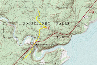
No one ever should go hiking without a map. Here are maps for nine trails in Gooseberry Falls State Park, Minnesota’s second most visted state park.
Located on Minnesota’s scenic North Shore, Gooseberry Falls offers a number of great sights, including five waterfalls, 1.1-billion-year-old rock, grand vistas of the world’s largest freshwater lake, an agate beach, and more.
To reach the park, from Two Harbors drive north on Minn. Hwy. 61. Turn right/southeast into the the Goosberry Falls rest area and visitor parking. Almost all of the park’s trails can be reached from this location.
Trails are marked in yellow on the maps. Click each map or open it a new window for a larger, printable version.
River View Trail
Picnic Flow Trail
Gitchi Gami Bike Trail
Gitchi-Gummi Trail
Fifth Falls Trail
Gooseberry River Trail
Superior Hiking Trail
Nelsens Creek Trail
High Point Trail
Learn about trail guidebooks available in the Hittin’ the Trail series.


