Showing posts with label Colorado. Show all posts

Monday, April 9, 2018

Rocky Mountain hiking guidebook released

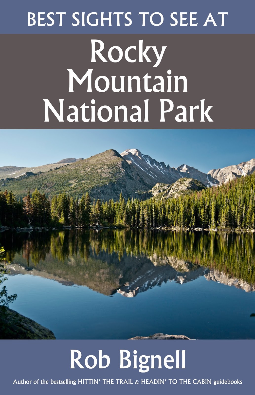
My latest hiking book, “Best Sights to See at Rocky Mountain National Park,” hit bookstore shelves today. The third title in the bestselling “Best Sights to See” series, this book details the 10 must-see sights and the trails to experience them at the popular Colorado national park. It also lists similar nearby trails in the park. In addition, the book includes two bonus primers on day hiking and on national parks. The series’ previous two titles, “Best Sights to See at America’s National Parks” and “Best Sights to See at Great Smoky Mountains National Park,” both hit No. 1 on Amazon.com. My new book can be purchased online in paperback or as a Kindle ebook.

Learn about trail guidebooks available in the Hittin’ the Trail series.


Monday, July 10, 2017

11 Great Day Hikes in Colorado

Alberta Falls in Rocky Mountain National Park
Alberta Falls Trail
Rocky Mountain National Park
Lush green woodland, a waterfall, and a Rocky Mountain high await day hikers on the Alberta Falls Trail near Estes Park. The 1.4-mile out-and-back trail sits in the heart of Rocky Mountain National Park. Seventy-two of the mountain peaks in the national park rise 12,000 feet above sea level.

Best sites to see at Rocky Mountain National Park
Among the best ways to see Rocky Mountain National Park’s best sights is via a day hike. Just five short trails will allow you to enjoy each of the park’s highlights – the Continental Divide, montane forests, waterfalls, mountain wildlife, and peaks over 14,000 feet high.

Best trails to Great Sand Dunes' wonders
Sand dunes cover more than 30 square miles at Great Sand Dunes National Park. Among the best ways to see Great Sand Dunes National Park’s top sights is via a day hike. Just four short trails will allow you to enjoy each of the park’s highlights – sand dunes, large prairie wildlife, autumn colors, and even a beach with ocean-like waves.

Warner Point Nature Trail
Black Canyon of the Gunnison National Park
An array of wildlife and a canyon bottoms that almost never sees sunlight are in store for day hikers walking Warner Point Nature Trail in Black Canyon of the Gunnison National Park. The park follows 12 miles of the Black Canyon, a scenic gorge that drops as much as 2,250 feet from rim top to river below. Of the gorge’s two sides, the north rim entrance usually closes during winter, but the south rim is more developed. 

Learn more about national park day hiking trails in my Best Sights to See at America’s National Parks series.


Thursday, December 8, 2016

5 Great Day Hiking Trails in Colorado

Black Canyon of the Gunnison
Chapin Creek Trail
Rocky Mountain National Park
All too often, national park visitors find themselves limited to the popular sites without easy access to the wild interior. The Old Fall River Road solves that problem for Rocky Mountain National Park visitors. A great hike to take from the road is the Chapin Creek Trail, which offers opportunities to see moose and elk on a primitive path. It can be hiked about 1.6-miles round trip to the creek crossing or 6.6-miles round trip on a mostly backcountry route to the Poudre Trail.

Badger House Community Trail
Mesa Verde National Park
Families can learn how a forest recovers from fire and then explore six centuries of Anasazi village ruins, including a great kiva and a mysterious tunnel, on the Badger House Community Trail at Mesa Verde National Park. The 2.5-mile trail sits atop the Weterhill Mesa in the Colorado park, which represents the United States’ largest archaeological preserve. More than 600 ruins can be found across 81.4 square miles.

Best Trails at Black Canyon of the Gunnison National Park
Among the best ways to see Black Canyon of the Gunnison National Park’s major sights is via a day hike. Just three short trails will allow you to enjoy each of the park’s highlights – the steep river canyon, the world’s fastest bird, and rare mountain wildlife.

BONUS: Avoid losing your breath at high altitudes
When hiking at high altitudes – usually above 5,000 feet – losing your breath is easy, especially when exerting yourself with a child carrier or pack on your back. But you can keep from losing your breath in the thin air by using the simple technique of pressure breathing.

Learn more about national park day hiking trails in my Best Sights to See at America’s National Parks series.


Monday, October 31, 2016

3 Great Day Hiking Trails in Colorado

Mesa Verde National Park's Cliff Palace
Bear Lake Loop
Rocky Mountain National Park
Day hikers can circle a beautiful subalpine lake in the heart of Rocky Mountain National Park on the Bear Lake Loop. The 0.6-miles round trip trail is particular gorgeous in autumn when aspens around the lake turn gold. 

High Dune Trail
Great Sand Dunes National Park and Preserve
Families can day hike to the top of a sand dune that would reach half-way up the Empire State Building at Great Sand Dunes National Park and Preserve. The national park boasts North America’s tallest sand dunes. Star Dune reaches 750 feet when measured from base to crest while High Dune is 650 feet high.

Cliff Palace
Mesa Verde National Park
Among the largest cliff dwellings ever constructed hundreds of years ago by the Ancient Puebloans, also known as the Anasazi, is Mesa Verde National Park’s Cliff Palace. It contains 150 rooms and 23 kivas constructed of sandstone, mortar and wooden beams. The 0.25-mile round trip hike only can be done via a ranger-guided tour. Tickets typically must be purchased an hour ahead of the guided tour time.

BONUS: How to avoid, treat altitude sickness in kids
Since air pressure is lower at higher elevations, you will inhale less oxygen in mountainous areas. For most hikers, the problem begins when reaching 8,000 feet above sea level, in which acute mountain sickness can affect both child and adult.

Learn more about national park day hiking trails in my Best Sights to See at America’s National Parks series.


Monday, September 26, 2016

Trails explore Rocky Mountain's geology

Several trails explore Rocky Mountain National Park's geology.
3 Rocky Mountain National Park Geological Trails
Day hikers can explore the complex geology of Rocky Mountain National Park via several excellent trails. The park’s geology began about a billion years ago when molten lava formed large amounts of granite in what is now Colorado. 

High Dunes Trail
Great Sand Dunes National Park
Day hikers can traipse across North America’s highest sand dunes at Great Sand Dunes National Park. Mountains of sand rise out of a dune field covering nearly 30 square miles. One of the dunes – Star Dune – at 750-feet high would reach half-way up the Empire State Building. The best day hike through the sand dune is the 2.5-mile round trip High Dune Trail.

Warner Point Nature Trail
Black Canyon of the Gunnison National Park
Day hikers can walk along the rim of a canyon so deep that its bottom almost never sees sunlight, via the Warner Point Nature Trail in Black Canyon of the Gunnison National Park. The 1.5-mile round trip trail allows hikers to see The Painted Wall, Colorado’s tallest sheer cliff at nearly half a mile high.

Best trails for seeing Mesa Verde’s wonders
Among the best ways to see Mesa Verde National Park’s top sights is via a day hike. Just four short trails will allow you to enjoy each of the park’s highlights – a cliff palace, a panoramic view of four states, six centuries of Anasazi ruins, and a cuesta wilderness.

Great day hiking trails in Colorado for children
With the spine of the Rocky Mountains running through most of Colorado, the state is chock full of great day hiking trails that kids will love. Here are five to add to your to-do list.

Learn more about national park day hiking trails in my Best Sights to See at America’s National Parks series.


Monday, September 5, 2016

Variety of trails found on Trail Ridge Road

Trail Ridge Road at the treeline. Photo courtesy Rocky Mountain NPS.
Most visitors to Rocky Mountain National Park will travel U.S. Hwy. 34 – aka Trail Ridge Road – which traverse the Colorado park from Estes Park to Grand Lake. A number of diverse trails can be found along the highway.

Note that Hwy. 34 is known as Fall River Road from Estes Park west to the U.S. Hwy 36 intersection at Deer Ridge Junction. Also, Trail Ridge Road also closes during the winter as heavy snowfall makes it impassable at high elevations.

Heading east to west, the trails include:
Lawn Lake Trail – The trailhead sits just north of Hwy. 34 off of Endovalley Road. Heading south, the trail crosses the Fall River and enters the meadow West Horseshoe Park. Going north, the trail runs to Roaring River near Horseshoe Falls.
Ute Trail (Deer Ridge section) – At Deer Ridge Junction, go left/east onto U.S. Hwy. 36. The Ute Trail heads south from the Deer Junction Trailhead on its way to Upper Beaver Meadows.
Ute Trail (Trail Ridge section) – This route, used by Native Americans to reach summer hunting grounds, crosses an alpine tundra. Park in a pull-off along the road’s south side.
Forest Canyon Overlook Trail – A short trail cuts across the alpine tundra to a vista of a forest in the valley below. The parking lot is less than a mile from the Ute Trail trailhead.
Mushroom Rocks Trail – A small trail heads to some interesting rock formations. Parking is in a pullout on the road’s south side, so be careful when crossing the highway.
Toll Memorial Trail – The trail heads over an alpine tundra and past the Mushroom Rocks formation. It ends at sister rock outcroppings just beyond the Mushroom Rocks.
Ute Trail (Fall River Pass section) – At the Fall River Pass, the trail goes west and downhill over more alpine tundra to the evergreen Forest Canyon Pass. Park in the lot for the Alpine Visitor Center.
Alpine Ridge Trail – The route heads a mere 0.3 miles from the Alpine Visitor Center up 300 feet through an alpine tundra to the summit of Huffer’s Hill. Because of the altitude – 12,000 feet above sea level – it’ll probably be the toughest third of a mile you’ve ever walked.
Poudre River Trail – After descending the ridge from the Alpine Visitor Center, this trail heads north through evergreens. It parallels the Cache la Poudre River.
Milner Pass Trail – The route, a segment of the Ute Trail, crosses the Continental Divide, as it heads north from the Poudre Lake Trailhead toward the alpine tundra. It can be taken all the way to the Alpine Visitor Center.
Lake Irene Trail – A short trail heads to pretty Lake Irene, which is surrounded by evergreens. The trail leaves from the Lake Irene Picnic Area.
Colorado River Trail – The route runs to the ruins of an 19th century mining town, Lulu City, in a 6.2-miles round trip with 320-foot elevation gain. The trail leaves from the Colorado River Trailhead lot’s north side at 9040 feet above sea level.
Timber Lake Trail – The trail runs south across Beaver Creek through an alpine forest to Timber Creek. The lot is on the road’s east side across from the Colorado River Trailhead.
Holzwarth Trail – The trail – unpaved Ditch Road – crosses the Colorado River and ends at the Holzwarth Historic Site. To find the parking lot, watch for the sign announcing the historic site.
Bowen/Baker Trail – The sand road crosses the Colorado River and a meadow then enters the forest. Baker Trail splits north, paralleling a creek through Barker Gulch then curving around Baker Mountain to a mountain pass. Bowen Trail heads south to Gaskill Cemetery in Bowen Gulch.
Coyote Valley Trail – The trail runs north-south alongside the Colorado River. An expansive meadow sits west of the path.
Onahu Creek Trail – The route heads north from the trailhead to Onahu Creek and splits with one route heading back to a point farther north on the highway and the other eastward alongside the creek. It also goes south to the Green Mountain Trail.
Green Mountain Trail – Going west on the trail leads hikers through a forest beneath Green Mountain to a meadow surrounding Tonahutu Creek. Crossing the highway to the eastern portion of the trail loops through woods past Harbison Meadows.
Kawuneeche Visitor Center Trail – From the Kawuneeche Visitor Center, the trail goes east into the forests alongside Harbison Ditch. Crossing the highway, it connects with the Green Mountain Trail.

Learn more about the park's day hiking trails in my Best Sights to See at Rocky Mountain National Park guidebook.


Thursday, September 1, 2016

Great trails await on Old Fall River Road

Alluvial Fan Trail. Rocky Mountain NPS photo.
Before the modern, safer U.S. Hwy. 34 was constructed, Rocky Mountain National Park visitors traversed the park via Old Fall River Road. That road still can be driven, offering access to sights usually not be seen by others exploring the main tourism areas.

To reach Old Fall River Road, take U.S. Hwy. 34 west from Estes Park. Turn right/north onto Endovalley Road. The road turns to dirt and becomes Old Fall River Road right after the turnoff to Endovalley. It closes during winter due to the heavy snowfall.

Among the many trails along Old Fall River Road:
Lawn Lake Trail Immediately north of the Hwy. 34 junction, the northern portion of the trail heads to Roaring River and then meets the Ypsilon Trail. The southern route crosses Hwy. 34 and goes to the meadow West Horseshoe Park.
Alluvial Fan Trail – The short hike crosses a spread of rocks and sediment left by Roaring River where it slows before it joins the Fork River. An east and a west trailhead are along the road.
Chasm Falls Trail – Literally less than a hundred feet in length, the trail heads from a parking lot alongside the road to the Fall River waterfall. The rock here funnels the water into a narrow gorge where it drops 25 feet.
Chapin Creek Trail – The trail starts about nine miles from the Hwy. 34 junction and heads north to Chapin Pass, which sits at 11,202 feet. There the trail diverges: the north route goes to Chapin Creek and a meadow; the south route goes to an alpine tundra and the Mt. Chapin summit.
Alpine Ridge TrailAfter crossing alpine tundra, the road ends at the Alpine Visitor Center and rejoins Hwy. 34. This trail can be taken to a point 300 feet above the center.

Learn more about the park's day hiking trails in my Best Sights to See at Rocky Mountain National Park guidebook.


Monday, August 29, 2016

Trail heads to summit of 14er Longs Peak

Longs Peak from the north.
East Long Peaks Trail. Courtesy of NPS.
While certainly no day hike, you can walk to the summit of Longs Peak, the highest point on Rocky Mountain National Park. Around 15,000 mountaineers try it each year.

At 14,259 feet, Longs Peak is one of Colorado's most visibly prominent fourteeners – a mountain more than 14,000 feet high – on the Front Range. Longs Peak is the northernmost of Colorado's famed Fourteeners.

To reach that trailhead, from Allenspark drive north on County Road 7. Turn left/west onto Longs Peak Road. Upon entering the park and just before the campground curve left/south. The trailhead is past the ranger station at the end of the road.

The East Long Peaks Trail runs 13.6 miles one-way. You start at an elevation of 9418 feet and will gain 4786 feet. It’s a well-marked trail.

The trail initially parallels Alpine Brook then later crosses it as well as Larkspur Creek and Boulder Brook. A spur leads to Chasm Lake. Ultimately, the trail ends just past an area known as Boulderfield, where there is a campground.

Major Stephen Long first explored this region of Colorado for the United States in 1820. His expedition didn't enter the mountains, but he recorded sighting the park's highest point - Longs Peak - which was named for him. Explorer John Wesley Powell made the first recoded ascent of Longs Peak in 1868.

Due to the high altitude, you definitely need to be physically fit and spend a couple of weeks acclimating your body before attempting this adventure.

Since air pressure is lower at higher elevations, you will inhale less oxygen in mountainous areas. For most hikers, the problem begins when reaching 8,000 feet above sea level, in which acute mountain sickness can affect you.

More serious and deadlier problems can occur at higher than 12,000 feet, and parents shouldn’t take their children above that level. Children will suffer from altitude sickness more readily than adults. As their bodies are still developing, they simply don’t have the ability to adjust as quickly to changes in oxygen levels as do adults.

To avoid altitude sickness, go at a slow pace that allows time for your body to adjust to the changes. Limit altitude changes to no more than 2000-3000 feet so long as you’re returning to your starting point.

Signs of altitude sickness include shortness of breath, dehydration, headache, nausea and dizziness. If you become confused, clumsy, vomit and have a dry cough, the condition is serious. Treating altitude sickness requires descending to a lower elevation where there’s more oxygen. In addition, drink extra water to avoid dehydration, and eat light, high-carbohydrate meals. If the condition is serious, get medical attention immediately.

A route at a lower altitude with great views of Longs Peak is the Bluebird Lake Trail, which runs south of the Fourteener.

Learn more about national park day hiking trails in my Best Sights to See at America’s National Parks series.


Thursday, August 25, 2016

Where to enjoy the night sky in RMNP

Milky Way over Sprague Lake. Photo courtesy of Rocky Mountain NPS.
The best places to see the night sky in Colorado’s Rocky Mountain National Park is just about anywhere away from the urbanized edge of the Front Range or near Grand Lake. The glow of man-made lights diminishes the number of stars and anything else that can be seen in the night sky.

Alpine tundras far from visitor centers or campgrounds are ideal, as there are no man-made lights or treeline to obscure views. Sundance Mountain and the Mushroom Rocks along Trail Ridge Road are two such areas. Always face away from the highway so that headlights from passing vehicles don’t temporarily blind you.

From mid-June through mid-August, the park offers a variety of astronomy-oriented activities. They include Party with the Stars, Astronomy in the Park (which meets at the Upper Beaver Meadows Trailhead), and the Rocky Mountain National Park Night Sky Festival.

If visiting the park in August, drive to the top of Trail Ridge Road to watch the annual Perseid meteor shower. The shower consists of debris and dust, left by a passing comet, which burn up in the atmosphere as falling to the ground. The peak shower usually is Aug. 11-13.

Learn more about the park's day hiking trails in my Best Sights to See at Rocky Mountain National Park guidebook.


Monday, August 22, 2016

Trails head to historical RMNP sights

McGraw Ranch barn, built in 1884, and corral fence. NPS photo.
From mining to cattle ranching, Rocky Mountain National Park enjoys a fascinating history, some of which is preserved via buildings, ruins and trails. A good sampling of those historic areas include:
McGraw Ranch – The working cattle ranch operated near Estes Park from 1884 to 1948. Many structures, including the barn and corral from 1884, still stand. It can be reached via the Cow Creek Trailhead in a 0.33-miles walk.
Utility Area Historic District – Buildings in this area reflect the national parks' rustic design popular when they were built in the 1920s and 1930s. Some were constructed by the Civilian Conservation Corps. The area is off of the Park Entrance Road west of Marys Lake Road.
Ute Trail – Arapaho and Ute Indians for centuries crossed Trail Ridge as one of their routes to reach their summer hunting grounds on the Great Plains. This area off of U.S. Hwy. 34 is alpine tundra.
Lulu City – The ruins of an 19th century mining town can be seen on the 6.2-miles round trip Colorado River Trail. The town was created when silver was discovered there in 1879.
Holzwarth Trail – A historic ranch started by a German immigrant in the 1910s is preserved on the park’s west side in the Kawuneeche Valley. It can be reached by hiking unpaved Ditch Road, which crosses the Colorado River and ends at the historic site.
Gaskill Cemetery – About all that remains of the 1880s mining town of Gaskill is its cemetery. It can be reached via Bowen Trail, a sand road, which crosses the Colorado then heads south to Gaskill Cemetery in Bowen Gulch on a 6-miles round trip hike.

Learn more about the park's day hiking trails in my Best Sights to See at Rocky Mountain National Park guidebook.


Friday, August 19, 2016

Explore Rocky Mountain NP’s scenic lakes

Mt. Meeker and Longs Peak, the highest points in Rocky Mountain National
Park, rise above scenic Lily Lake. NPS photo.
Multiple lakes can be found even at Rocky Mountain National Park’s high elevations. Often surrounded by fragrant evergreens with a rising peak reflecting off the crystal blue water, all are beautiful sights to visit.

Many of the Colorado park’s most scenic lakes can be reached via a hike.

Wild Basin Area
Lily Lake – An extremely easy lake to reach, the trailhead starts at the lake off of Colo. Hwy. 7 south of Estes Park. The 0.8-mile wheelchair accessible-trail circles the lake.
Ouzel Lake – The remote lake fills a low spot in a marshy area. From the Wild Basin Trailhead, head west on the trail then go southeast on Thunder Lake Trail then west on Bluebird Trail and lastly south on the spur to the lake for a 10.2-mile round trip.
Thunder Lake – The lake sits below the timber line and is excellent for fishing. Take the same route as for Ouzel Lake except don’t turn onto Bluebird Trail for a 13.2-miles round trip journey.
Sandbeach Lake – As the lake’s name implies, a sandy beach actually sits on the edge of this lake, a rarity for the mountains. From the Sandbeach Trailhead, take the Sandbeach Lake Trail for a 8.8-miles round trip hike.

Bear Lake area
Sprague Lake – Easy to reach, Sprague is a Rocky Mountain classic with trees reflecting off the surface while a mountain range rises behind it. Take Bear Lake Road west then Sprague Lake Road south; from the parking lot, the 0.9-mile trail circles the lake.
Nymph, Dream and Emerald lakes – All three lakes in Tyndall Gorge can be visited on a 3.6-mile round trip. From the Bear Lake Trailhead, head south from Bear Lake to the Emerald Lake Trail.
Lake Hiayaha – Large boulders surround the lake, which sits at the base of Chaos Canyon. Follow the route to Nymph Lake and once past it go left/south on the Glacier Gorge Trail for a 3.9-mile round trip.

Glacier Gorge Trailhead
The Loch, Lake of Glass and Sky Pond – These three lakes contain populations of hybrid cutthroats (Lake of Glass) and brook trout (Sky Pond). The route runs 5.4-miles round trip from the trailhead on Bear Lake Road.
Mills Lake – This lake can be reached via the Glacier Gorge Trail for a 5.3-mile round trip hike. The lake is filled with rainbow and brook trout.
Black Lake – Past Mills Lake, the Glacier Trail ends at boulder-strewn Black Lake and Ribbon Falls just before it. Brook trout thrive in the lake, which is a 9.6-miles round trip walk.

Fern Lake Trailhead
Spruce Lake – Take the Fern Lake Trail into the forest then turn onto Spruce Lake Trail for a 9.1-mile round trip hike. Primitive unofficial paths lead from it upstream to a pond then Loomis Lake.
Fern Lake – The alpine lake feeds Big Thompson River via Fern Creek, which includes Marguerite Falls. Take the Fern Lake Trail past all three to the lake for a 7.7-miles round trip journey.
Odessa Lake – Continue on the Fern Lake Trail past Fern Lake (9.2 miles round trip) to this waterbody in Tourmaline Gorge. The lake contains rainbow and brook trout.

Lumpy Ridge Trailhead
Gem Lake – The small lake sitting next to a wall of granite is past the Estes Park Overlook. Take stem trail from the trailhead and then the Gem Lake Trail north for a 3.5-miles round trip journey.

Lawn Lake Trailhead
Lawn Lake – In 1982, the earthen dam holding back the lake broke, sending water down Roaring River and killing three people. From the Lawn Lake Trailhead, head north on the Lawn Lake Trail along Roaring River for a 12.5-mile round trip.
Crystal Lake – Hardly a day hike, this beautiful mountain lake is worth the effort if you like backcountry camping. Continue on the Lawn Lake Trail past Lawn Lake for a 14.7-mile round trip.
Ypsilon Lake – The lake sits at the edge of the treeline beneath Ypsilon Mountain. Start on the Lawn Lake Trail then go left/west on the Ypsilon Lake Trail and cross Roaring River for 8.75-miles round trip.

Trail Ridge Road
Lake Irene – A short trail heads to the evergreen-encircled lake on the park’s west side. The 0.9-mile trail leaves from the Lake Irene Picnic Area.

Learn more about the park's day hiking trails in my Best Sights to See at Rocky Mountain National Park guidebook.


Thursday, August 11, 2016

Explore Rocky Mountain’s great meadows

Rocky Mountain Iris and Golden Banner bloom in a Rocky Mountain
National Park meadow. Photo courtesy of Rocky Mountain NPS.
Among the most pleasant scenes at Rocky Mountain National Park are the many montane meadows. Generally found in valleys between 5600-9500 feet elevation, these grass-dominated sections of the valleys usually are too wet or too dry for trees to grow.

The grasses and forbs in these meadows provide food and habitat for an incredible number of animals. In fact, if you want to spot wildlife at the park, the meadows are a great place to do so.

Rocky Mountain’s meadows attract elk, deer, both Wyoming and golden mantled ground squirrels, as well as a variety of migrating birds and insects. Several animals use the meadows seasonally as winter buries their mountainside homes in snow. Among them are bighorn sheep, black bear, and mountain lion.

Locally called “parks,” these meadows typically formed when glacial lakes drained at the end of the last ice age. This can leave many meadows with sandy topsoil and a generally flat terrain.

Several scenic mountain meadows, full of wildlife and wildflowers, can be found in the national park. Most of these can be reached via a day hike. They include:
Big Meadows – The largest montane meadow in the park, it’s an excellent place to spot moose, elk and deer grazing in the grass or the fen. The 3.6-mile round trip Green Mountain Trail heads to a clump of boulders at the meadows’ edge. The path is a segment of the Continental Divide National Scenic Trail.
Long Meadows – Stretching two miles between Timber and Onahu creeks, this is an isolated meadow. Small streams in the meadow create a small marshy area. The Timber Lake Trail runs 7.6-miles round trip primarily through forests to the meadow.
Upper Beaver Meadows – This broad meadow offers great views of Longs Peak and mountains on the Continental Divide. The 5-mile Upper Beaver Meadows Loop circles and also cuts through the grassland. Hike the trail clockwise.
Hollowell Park – This large and marshy meadow along Mill Creek is known for moose and packs a lot of local history. Ranchers and sawmills could be found in the area through the early 1900s. The Hollowell Park Trail runs 2.75-miles round trip to Mill Creek Basin.
Shipler Park – A small meadow sits along the Colorado River at the base of Shipler Mountain. The La Poudre Pass Trail crosses the meadows on the way to the historical mining ruins of Lulu City, which is 3.1 miles from the Colorado River trailhead.
Kawuneeche Valley – A large meadow fills this area, whose name comes from the Arapaho word meaning “valley of the coyote.” The aptly-named Coyote Valley Trail runs through part of the meadow. Visit in spring when an array of wildflowers bloom.

Learn more about the park's day hiking trails in my Best Sights to See at Rocky Mountain National Park guidebook.


Monday, August 8, 2016

Where to see Rocky Mountain NP wildlife

Bull elk at Rocky Mountain National Park
A wide range of animals reside in Rocky Mountain National Park – but unlike bears or bison at Yosemite or Abert’s squirrels at Grand Canyon – wildlife here is a bit more standoffish. That doesn’t mean they can’t be seen, just that you should be aware of where, when and how to spot them.

Mule deer
Common across the West, mule deer have extremely large ears that resemble those of a mule. Up to three feet high at the shoulder, they weigh between 100-300 pounds. They tend to live in the park’s lower hills and in light forests. About 500 of them gather in Estes Valley each winter.

Moose
The largest animal in the park, they can stand up to seven feet high at the shoulder and weigh 1500 pounds. With only 30-50 moose residing there, they are a rare sight. The best spot to see them is on the park's west side grazing along the Colorado River banks and in the Kawuneeche Valley.

Elk
Bull elks can stand up to five feet tall and weigh 1100 pounds. They make a distinctive bugling sound each autumn to mark the beginning of the breeding season. Typically then can be seen in Moraine Park grazing during summer and the lower meadows during fall. About 300-400 elk winter in the park and another 500-600 winter in Estes Park.

Bighorn sheep
The park’s on and off official symbol, most recently appearing on its centennial logo, a male bighorn can weigh 300 pounds and stand three feet at the shoulder; females are about half this size. Bighorn often can be spotted at Big Thompson Canyon and Sheep-Horseshoe Park between 9 a.m. and 3 p.m.

Black bear
Ranging between 5-6 feet long and weighing between 200-600 pounds, black bears are an impressive sight. Despite their bulk, they easily can outrun a human being. The good news is that they are rarely seen, as they avoid people. Only about 20-24 black bears remain in the park with the few sightings occurring in the backcountry.

Mountain lions
Males stretch up to eight feet long and weigh 200 pounds; they can jump 18 feet high and 40 feet long in a single bound. Rare to see, they are most frequently spotted on park's west side, especially near rocky canyons and meadows. An estimated 20-30 mountain lions live in the park.

Coyotes
About three to four feet long and weighing 20 to 50 pounds, coyotes are much smaller than wolves. With a reputation as survivors, they thrive in a park where concerted efforts at the beginning of the 20th century were made to remove them and wolves; the effort with wolves succeeded. Coyotes usually feed on rodents and deer but have been observed pack hunting bighorn lambs and ewes.

Pika
Small mammals that look like hamsters, pikas actually are more closely related to rabbits. Weighing a mere six ounces, they sit on rock outcroppings and talus slopes near the treeline, especially around Rock Cut on the 0.6 miles round-trip Tundra Communities Trail off of Trail Ridge Road.

Yellow-bellied marmot
This cute member of the squirrel family can weigh 11 pounds and are up to two feet long. They hibernate about 200 days a year. Living in colonies, Rock Cut and the Tundra Communities Trail is a great place to spy them.

Tips for seeing wildlife
You can improve your chances of seeing wildlife at the park by:
Getting up early – Animals are most active at sunrise from sunrise until 10 a.m. and then at sunset from 4 p.m. until dark.
Opting for clouds – Cooler, cloudy days are better than sunny days, but if rain or snow is falling, don't expect to see many if any at all.
Seeking dark spots in the grass – Along with antlers just above the grass, these are two good signs that an animal is there. Be patient and wait for it to rise or see if you can get to higher ground for a better view.
Refusing to seek the animal’s attention – Yelling, honking or throwing a rock at an animal will cause it to run rather than look your way. To get a better view, bring a binoculars or use the telephoto lens on your camera.

Learn more about the park's day hiking trails in my Best Sights to See at Rocky Mountain National Park.


Thursday, August 4, 2016

Waterfalls abound at Rocky Mountain NP

Fern Falls is a roaring respite along the trail to Fern Lake. NPS photo
Rocky Mountain National Park is a waterfall lovers’ paradise. With 30 named waterfalls and many more unnamed and seasonal falls in the backcountry, they can’t all be seen in one visit.

Among the park’s best falls and the trails to see them are:
Adams Falls – Rainbows shine through the 55-foot-high falls’ mist during the early morning hours. Adams Falls sits at the end of a 0.6 miles round trip in-and-out trail. Use the East Inlet Trailhead near Grand Lake.
Alberta Falls – The 1.4-mile out-and-back Alberta Falls Trail heads through lush green woodland on its way to this popular 25-foot waterfall. Pick up the trail at the Glacier Gorge Trailhead parking lot.
Bridal Veil Falls – A 6.4-miles round trip hike heads past historic McGraw Ranch and through an aspen forest to the 40-foot falls. Start at the Cow Creek Trailhead.
Cascade Falls – The wide waterfall offers flat rocks perfect for picnicking. The 3.5-mile hike through lodgepole pines starts at the North Inlet Trailhead near Grand Lake.
Chasm Falls – A mere 100 feet from Old Fall River Road, this is perhaps the most accessible waterfall in the park. There the Fall River cuts through a narrow gorge and drops 30 feet.
Columbine Falls – The 110-foot waterfall is about 6-miles round trip from the Longs Peak trailhead. After Roaring Fork tumbles over the cliffside, it gathers in Peacock Pool.
Copeland Falls – Two small waterfalls – an upper and lower that drop a combined 12 feet – are a short distance apart on the first waterfall from the Wild Basin Trailhead, a mere 0.8 miles round trip. Another 1.4 miles up the trail is the Calypso Cascades, which tumbles 90 feet over boulders.
Fern Falls – The 60-foot waterfall casts a fine mist across the forested trail. Seeing the falls requires a 5.4-miles round trip hike on the way to Fern Lake.
Horseshoe Falls – A long cascade waterfall, Horseshoe Falls can be seen from the Alluvial Fan Trail in a short 0.4-miles round trip hike. In total, water drops 250 feet here.
Ouzel Falls – The waterfall drops 40 feet over a cliffside and across boulders. It’s a 5.4-mile round trip hike from the Wild Basin Trailhead; hiking to this trail allows you to also see Copeland Falls and the Calypso Cascades.
Timberline Falls – Though a long day hike at 8-miles round trip, the effort is worth it, as the falls drops 100 feet with a great view of The Loch and the mountain valley. Use the Glacier Gorge trailhead.
West Creek Falls – This is a great waterfall for those looking to get away from crowds. A spur off the North Boundary Trail, you’ll walk 4.75 miles round trip from the Cow Creek Trailhead to the 22-foot falls.

Learn more about the park's day hiking trails in my Best Sights to See at Rocky Mountain National Park.


Thursday, July 28, 2016

Kids’ activities abound at Rocky Mtn. NP

Ranger-led program at Rocky Mountain National Park.
Courtesy Rocky Mountain NPS.
A trip to Rocky Mountain National Park can be an educational experience for kids – though they may be having too much fun to even notice that they’re learning!

The park delivers a variety of great activities that children can participate in from spring through autumn. Among the many offerings:
Ranger-led events – Free programs for kids throughout the park focus on a range of interests, from wildlife and plants found in the Rocky Mountains to preserving local natural and cultural treasures. Check the current park newspaper for topics, times and locations.
Junior Ranger Kids – Kids between the ages of 5-12 can become a Junior Ranger. They’ll first need to obtain a Junior Ranger booklet (available online and at any park visitor center) and complete its activities, and then they can receive a Junior Ranger badge.
Junior Ranger Headquarters – From late June to mid-August, several ranger-led programs for kids are held at Hidden Valley off of Trail Ridge Road. Programs are offered four times a day, every day of the week, with each lasting about a half-hour.

Learn more about the park’s day hiking trails in my Best Sights to See at Rocky Mountain National Park guidebook.


Monday, July 25, 2016

Best times to visit Rocky Mountain Nat Park

The Alluvial Fan, just west of Horseshoe Park and on
the way to Old Fall River Road, is a favorite driving
destination. NPS photo by John Marino
June through October marks the best time to visit Rocky Mountain National Park.

Summer temperatures typically top out in the 80s with lows hitting the 40s at night. Remember, though, that each 1000-foot gain on average means a 3 degree drop in temperature, so you may want to carry extra clothing depending on your destination. For example, if the high in Estes Park is 70 degrees, expect it to be a crisp 57 at the Alpine Visitor Center.

During spring and summer, sun-drenched skies are common during the morning, but afternoon thunderstorms can form quickly and result in lightning, hail and high winds. If clouds build up anytime between 9 a.m.-noon, you probably have about two hours before a storm; you’re usually safe if clouds build after noon. If clouds build before 9 a.m., the day probably will be lost to rain.

Beware that July is the busiest month, and with the national park’s growing popularity, certain sections – especially those closest to Estes Park and attractions right off the road – can be crowded.

Post-Labor Day September often marks an ideal time to visit. Not only are there smaller crowds, but dry weather and cooler temperatures (though often only reaching the 50s for a high) dominate. There’s the added bonus of changing leaf colors at the lower elevations and bugling bull elks in the distance. By mid-October, though, snow usually falls, closing Trail Ridge Road through winter until late May.

When visiting Rocky Mountain National Park, no matter what the season, three great sites you must see include:
• 14,000-Foot Peaks (Bluebird Lake Trail)
• Mountain Waterfalls (Alberta Falls Trail)
• Mountain Wildlife (Lawn Lake Trail)

Learn more about the park's day hiking trails in my Best Sights to See at Rocky Mountain National Park.


Thursday, July 21, 2016

How to reach Rocky Mountain National Park

Cub Lake in Rocky Mountain National Park.
Sitting in Colorado’s famous Front Range about 90 minutes north of Denver, Rocky Mountain National Park is easy to reach.

From the south and east, Interstates 76, 70 and 25 converge upon Denver. From there, take I-25 north then exit onto U.S. Hwy. 36, which heads through Boulder on its way to Estes Park. You then can choose to enter the park via U.S. Hwys. 34 or 36 or Colorado Hwy. 7. A great hike to take near these entrances is the Alberta Falls Trail, which heads to a popular waterfall amid the mountain scenery.

If coming into Colorado on I-25 from Wyoming to the north, exit onto Hwy 34 and head east through Loveland into Estes Park. The Lawn Lake Trail, which offers an opportunity to see a lot of park wildlife, is easy to reach from this approach.

Those arriving from the west via I-70 can exit on U.S. Hwy 40 and head north through the mountains to Grandby. From there, take Hwy. 34 north to Grand Lake and into the park. The Colorado River Trail marks a good option for exploring this side of the park.

Anyone visiting who doesn't live at a high altitude should take a day to acclimate upon arriving in the park. There really is less oxygen that high up, and altitude sickness can be a problem if you jump right into hiking the sights.

Learn more about national park day hiking trails in my Best Sights to See at America’s National Parks series.


Monday, July 18, 2016

Trails explore Rocky Mtn. NP’s diverse areas

Rocky Mountain National Park, courtesy Rocky Mountain NPS.
Rocky Mountain National Park is a roughly square-shaped wilderness surrounded by the Roosevelt National Forest on the east and north sides and the Arapaho National Forest on the south and west.

Most of the national park’s best sites rest along or near U.S. Hwy. 34, which enters the park at two locations: the most popular one on the northeast side a few miles west of Estes Park and leading to the Fall River Visitor Center; and then the southwest corner at Grand Lake. Also known as Trail Ridge Road, the highway offers access to and parallels the famous Old Fall River Road, the precursor to the federal highway, the Alpine Visitor Center, the Continental Divide, the Colorado River, and the Kawuneeche Valley with its visitor center.

U.S. Hwy. 36 also offers access to a couple of regions south of the Hwy. 34 entrance. Among them are the Moraine Park, Bear Lake, Glacier Gorge, and Loch Vale areas. The Beaver Meadows and the Moraine Park visitor centers can be accessed via this highway. One great waterfall trail here heading out from Glacier Gorge is the Alberta Falls Trail.

A few other interesting sites along the park's eastern border can be reached via Colo. Hwy. 7, which runs from Estes Park to Meeker Park and Allenspark. Among them are Tahosa Valley – which includes famous Longs Peak, the park’s highest point at 14,259 feet – and the Wild Basin. The Bluebird Lake Trail in Wild Basin gives visitors a good sampling of the region as well as awesome views of Longs Peak.

Continuing west on Hwy. 34 brings visitors deeper into the Rocky Mountains and to the Continental Divide at Milner Pass, some 10,758 feet high. The divide cuts roughly diagonally through the park. All water east of the divide ultimately ends up in the Atlantic while water west of it reaches the Pacific. The Alpine Visitor Center is located at nearly two miles above sea level. The visitor center area can be explored via the Alpine Ridge Trail and the divide on the Milner Pass Trail.

After crossing Milner Pass, Hwy. 34 runs mainly south to the Grand Lake area. The Kawuneeche Valley, from which the Colorado River flows, can be found here, as well as Shadow Mountain Lake and Lake Granby. The road then exits the park and joins U.S. Hwy. 40, which connects with Interstate 70. The Adams Falls Trail is a scenic sight close to Grand Lake.

Learn more about the park's day hiking trails in my Best Sights to See at Rocky Mountain National Park.


Thursday, July 14, 2016

Trails explore Rocky Mountain NP’s history

Elk have been wiped out in and returned to what is now Rocky Mountain
National Park during the past 150 years.
The earliest indication of people being in what is now Rocky Mountain National Park dates to 10,000 years ago when mammoth hunters lost projectile points on Trail Ridge; day hikers can hike a number of trails along Trail Ridge Road. Use of the mountains as a thoroughfare for hunters continued for millennia.

Indeed, during the 1800s, the Ute and Arapaho hunted and traveled across the park, but there's no sign of permanent settlements. The Ute primarily resided west of the Continental Divide near Grand Lake and came onto the prairie to hunt bison. The Arapaho lived east of the divide on the Plains and hunted the area that is now Estes Park. Pawnee, Sioux and Apache also crossed this region.

Major Stephen Long first explored the region for the United States in 1820. His expedition didn't enter the mountains, but he recording sighting the park’s highest point – Longs Peak – which was named for him.

European-Americans began settling the area in 1843 when hunter Rufus Sage set up his home there. In 1858, Joel Estes sought elk in the area to feed Colorado miners. After the elk were wiped out and cattle grazing in the high mountain meadows proved unprofitable, Estes and his neighbors decided to offer boarding to those wanting to see the Front Range’s spectacular sites. Thus began the region’s tourism industry.

News about exploration of the area helped fuel tourism. Explorer John Wesley Powell made the first recorded ascent of Longs Peak in 1868; hikers also can ascend the mountain via the East Longs Peak Trail. Local homesteader Abner Sprague peakbagged a number of other area mountains in the years that followed.

Teenage miner Enos Mills’ building of a cabin in Tahosa Valley during 1884 certainly didn’t attract much attention, but it proved to be a pivotal moment in the park’s history. A few years later, Mills spent time in California with American naturalist John Muir and afterward returned to Longs Peak, where he dedicated his life to conservation. Mills since has become known as the “Father of Rocky Mountain National Park.”

Freelan Stanley, inventor of photographic plates, moved to the area in 1905, opened an inn and became a leader in the tourism economy. He worked to return elk to the park by transplanting the species from Montana. Today, elk often can be seen on the Alpine Ridge Trail.

The combined efforts of these men and many others ultimately led to the creation and opening of Rocky Mountain National Park in 1915.

That same decade, Fall River Road was constructed to link Estes Park and Grand Lake in the summer, increasing accessibility to the Front Range's interior; the road still exists today, and the Chapin Creek Trail is a good day hike on it. Then in the Great Depression, the better quality Trail Ridge Road was constructed, allowing motorists to discover the park in the post-war boom.

In September 2013, a flood damaged a number of the park's east-side trails and bridges when 18 inches of rain fell over three days. Communities at lower elevations suffered far more damage than did the park, but even today short detours remain on some trails to avoid fallen trees, lost water crossings, and unstable slopes.

Learn more about the park's day hiking trails in my Best Sights to See at Rocky Mountain National Park.


Thursday, July 7, 2016

Trails explore RMNP’s varied geography

Mt. Meeker and Longs Peak (l-r), the highest points in Rocky Mountain
National Park stand above scenic Lily Lake. The lake is adjacent to Colo.
Hwy. 7 south of Estes Park. NPS photo.
Rocky Mountain National Park marks only a small portion of Colorado’s Front Range. Indeed, those advocating establishment of the national park during the early 20th century sought to protect a million acres but only got a park a quarter that size. Still, at 415 square miles the park is quite representative of the Southern Rocky Mountains, which stretch from just northwest of Cheyenne south to Santa Fe and at its widest from the Great Plains to the desert along the Colorado-Utah border.

The park’s terrain is entirely mountainous and at a high altitude – the lowest point is at 7,860 feet, nearly a mile and a half above sea level. The highest point is Longs Peak at 14,259 feet, and more than 77 mountains soar higher than 12,000 feet.

Because of this, the park’s geography perhaps is best thought of vertically and in 3D rather than horizontally across a 2D map. Elevation is the main determinant of how different parts of the park appear.

Indeed, three distinct ecosystems make up the park. The lowest and most visited is the montane ecosystem, which ranges from 5,600 to 9,500 feet. There you can find mountain meadows and green forests of ponderosa pine, Douglas-fir, and lodgepole pine. A great hike through the montane ecosystem is the Alberta Falls Trail.

Above it is the subalpine ecosystem, which begins between 9,000-9,500 feet and continues to about 11,000 feet. With higher snowfalls, the winters are longer and colder than at the montane elevations below. Trees here include the hardier limber pine, Engelmann spruce, and subalpine fir. The park's Bear Lake Loop explores the subalpine region.

The highest ecosystem is the alpine tundra, which begins at 11,000 feet. It’s mostly treeless with only the robust of plants able to grow there. A day hike cutting through this low-oxygen terrain is the Alpine Ridge Trail.

Through these ecosystems run 473 miles of streams, many feeding the park's 147 lakes. The park is the headwaters for several important rivers in Colorado, including the Big Thompson, Cache la Poudre and Fall, and for the most important waterway in the Southwest, the Colorado.

The diversity of landscapes across the park serves as the home for more than a thousand kinds of flowering plants, 280 bird species, 141 types of butterflies, and 66 mammals. At the park’s high elevation, though, only one kind of snake – the harmless garter – can survive. Most flora and wildlife here can be found well beyond the park boundaries.

Learn more about the park's day hiking trails in my Best Sights to See at Rocky Mountain National Park.