 |
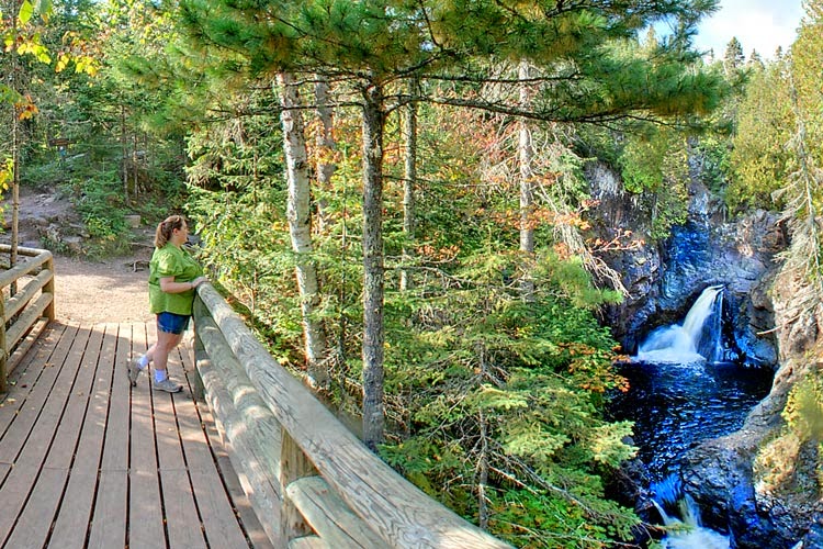
| Walking bridge over Cascade River. Photo courtesy of Minnesota DNR. |
Superior Hiking Trail segment follows river
The Cascade River drops over two waterfalls as it rambles through a fern-laden gorge of 1.1 billion-year-old volcanic rock. A segment of Minnesota’s Superior Hiking Trail heads about 0.85 miles round trip to Cascade Falls and the Cascades, a set of small drops just above it.
To reach the trail, take Minn. Hwy. 61 north from Lutsen. Immediately past the Cascade Lodge, park in the lot on the highway’s left/north side. The trail leaves from lot’s northeast corner.
Spawning salmon
That connector passes beneath a canopy of aspen, birch, and fragrant cedar, fir and spruce trees, angling toward and joining the Superior Hiking Trail along the Cascade River.
While spring marks the best time to see the heaviest waterfall as snow melts off the nearby hills, late summer and early fall offer the surprise of Chinook and pink salmon swimming upriver from Lake Superior to spawn. Regardless of the season, along the shore you’ll pass anglers trying to catch rainbow and brook trout.
In about 0.2 miles, the trail arrives at Cascade Falls, which plunges 25 feet over the black volcanic rock that hardened here some 500 million years before animals appeared on the planet. Despite the basalt’s resistance to erosion, the river still has managed to carve out 120 feet of drops during its last quarter-mile stretch before joining Lake Superior.
After the waterfall, continue north on the trail for about 0.15 miles to The Cascades, a set of five small drops that the river is named for.
Walking bridge
As returning, hikers can cross a walking bridge over the river gorge. It offers incredible views of the cascades that are upstream and of the river flowing downstream. On the bridge, you can feel the vibrations of the rushing water.
On the river’s east side, take the trail about 0.1 miles south to Cascade Falls for another perspective of it.
Hikers will a little extra energy to burn can continue walking south to the extend trail by 0.2 miles (0.4 miles round trip). While heading back to the parking lot by crossing the Hwy. 61 bridge over the Cascade is possible, for safety reasons it’s inadvisable. You’re better to retrace your steps across the walking bridge over the Cascades and return down the river’s west side.
Upon reaching the parking lot, drive across the state highway to the wayside for some nice views of Lake Superior and the Cascade’s confluence with it.
Read more about day hiking Northeast Minnesota in my Headin’ to the Cabin: Day Hiking Trails of Northeast Minnesota guidebook.
