Showing posts with label Yosemite National Park. Show all posts

Monday, July 3, 2017

5 Great Hikes in Yosemite National Park

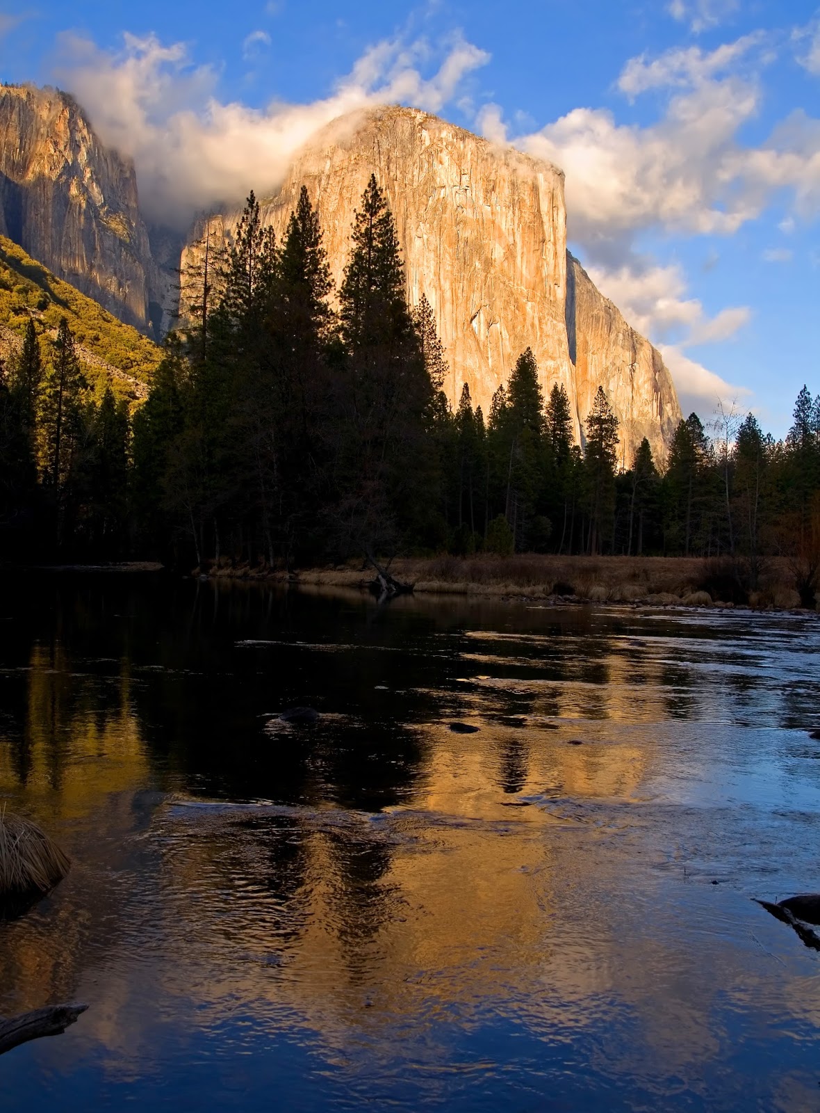
El Capitan reflected in Mirror Lake.
Artist Point Trail
Families can enjoy one of the most photograph-ed vistas at Yosemite National Park with a day hike on the Artist Point Trail. Located at the western end of Yosemite Valley, most of the 3-mile round trip trail follows the Old Stagecoach Road that used to run through the area.

McGurk Meadow Trail
While Yosemite Valley bustles with activity, deep atop its south wall lay several quiet places for enjoying the area’s natural beauty. One of those easy day hikes is the McGurk Meadow Trail. The 1.8-mile round trip trail can be accessed from Glacier Point Road. Unlike some Yosemite Valley trails that head up mountainsides, the smooth McGurk offers a mere elevation change of no more than 100 feet.

Mirror Lake Trail
Day hikers can enjoy a swim in a pool reflecting two of Yosemite National Park’s famous landmarks on the Mirror Lake Trail. Located in Yosemite Valley’s east end, the trail to the pool – Mirror Lake – is popular during summertime. The trail runs 2-miles round trip but by heading up the canyon can be extended to either a 4.6-mile round-trip or a 5-mile loop around the lake.

Sentinel Dome and Taft Point Loop
If you have elementary-aged school children, the Sentinel Dome and Taft Point Loop at 4.9 miles may be a bit much to handle. In such cases, the trail can be broken into two out-an-back trail segments.

Yosemite Valley West Loop
Day hikers can see some of western Yosemite Valley’s most famous sites – including Bridalveil Fall, Merced River, Ribbon Fall, El Capitan, and Cathedral Rocks – on a loop of connecting trails. The Yosemite Valley West Loop, consisting of four trails, forms a 4.95-mile circuit. To begin the loop, park in the Bridalveil Fall lot north of the waterfall on Southside Drive.

Learn more about national park day hiking trails in my Best Sights to See at America’s National Parks series.


Thursday, November 10, 2016

Trails explore Devils Postpile region

Devils Postspile. NPS photo.
Among the best ways to see the top sights of Devils Postpile National Monument – located southeast of Yosemite National Park – is via a day hike.

Just four trails allow you to enjoy each of the park’s highlights – hexagonal columns of rock, a waterfalls, and mountain-rimmed lakes high in the Sierra Nevada (All distances are from the Devils Postpile trailhead):
Devils Postpile – A massive collection of nearly perfect hexagonal columns of rock await day hikers on the Devils Postpile Trail. The trail is an easy 0.9-mile round trip hike. This 60-foot high wall sports some of the most perfect examples of columnar basalt in the world – if not mathematically flawless, it certainly is visually. About 55 percent of the columns are six-sided hexagons.
Rainbow Falls – A 101-foot high waterfall sits at the end of on the Rainbow Falls Trail, which heads into the Inyo National Forest. Sunny afternoons are the best time to take this 6-mile round trip hike – not just for the good weather but because rainbows will appear in the mist. From the ranger station, go south; this can be combined with a hike to the Devils Postpile.
Minaret Lake Trail – A 150-foot long cascade just across the national monument border in the Ansel Adams Wilderness awaits at the end of this 2.8-mile round trip hike. Hikers also can enjoy views of Minaret Lake, the headwaters of Minaret Creek, which the trail parallels part of the view. From the trailhead, take the John Muir Trail west then the Sierra High Route/Pacific Crest Trail north.
Fern Lake Trail – Hikers also can explore the Ansel Adams Wilderness on this 8.9-mile round trip trail that runs to a lake almost 9000 feet above sea level. Three great peaks – one in the north, one in the west, and one in the south – rise over the lake. After crossing the Middle Fork San Joaquin River, take the pack trail southwest.


Sunday, June 12, 2016

Yosemite trails offer look at park’s geology

Glaciers carved the valleys and fascinating granite shapes at Yosemite.
Today’s fascinating geography of Yosemite National Park arose from a complex number of geological events that date to well over 540 million years ago. Prior to that time, the area where the park sits marked the edge of the North American continent. Rivers carried sediment from inland into a shallow sea; over hundreds of millions of years, this sediment hardened into rock, ultimately claiming the sea for the continent.

As the North American tectonic plate collided with another plate, those rocks – metamorphosized into marble, quartzite and slate – rose above the seabed. Chains of island volcanoes formed in the ocean off the continent and gradually was rode its plate into and combined with ancient North America. These rocks can be seen in isolated sections of Yosemite’s central and northern section as well as the neighboring Emigrant Wilderness of the neighboring Stanislaus National Forest.

Much of the granite exposed today at the national park formed deep underground during these plate collisions about 210 million to 80 million years ago. As plates continued to strike one another, the heavier ocean floor drove beneath the lighter continental land mass, beginning lifting up the Sierra Nevada mountains about 10 million years ago. Over time, softer rock eroded away, exposing much of the granite now seen at the park.

A series of ice ages beginning about 3 million years ago covered Yosemite in glaciers. As these hefty masses of ice pushed through the mountains, melting and advancing again and again, they carved out the deep valleys and shaped the granite. In some cases, the glaciers sheared massive chunks of the exposed granite domes and left creeks and rivers dropping hundreds and sometimes thousands of feet down newly created cliffs. The glaciers’ action can most dramatically be seen in Yosemite Valley, especially the Cook’s Meadow Loop and Lower Yosemite Fall Trail. You can hike up through some of the rock currently being cut away by the Merced River on the Mist Trail.

Learn more about national park day hiking trails in my Best Sights to See at America’s National Parks guidebook.


Tuesday, May 31, 2016

Eight must-see national parks waterfalls

Yosemite Falls in Yosemite National Park. Courtesy of Photoree.
The following entry originally was written for and appeared in Coach-net’s May 2016 newsletter:

Nothing quite demonstrates the awesome power and beauty of Mother Nature like a waterfall – hundreds of gallons of water rushing several stories over a cliffside, the vertical stream nestled in lush greenery, the mist and droplets that splash on you at the fall’s base.

Fortunately, several of our national parks preserve many of the country’s most fantastic falls. Many of them are quire easy to reach via short hikes.

Yosemite Falls
If there is one waterfall that everyone absolutely must see, it’s this one in California’s Yosemite National Park. Actually consisting of seven waterfalls, Yosemite Falls sends water rushing 2,425 feet downward into the valley. Depending on snow melt, the falls’ peak flow typically occurs in May when up to 2,400 gallons of water flow down Yosemite Falls every second.

You can hike 1.2-miles round trip to the base of North America’s tallest waterfall. During spring, you may want to take the trail on a clear night when the moon is full, especially if on a romantic trip. Moonlit rainbows – called moonbows – span the waterfalls.

Queenie and Fido also can enjoy the waterfalls, as leashed dogs are allowed on the trail. Be sure that your dog is comfortable with crowds and other people, however.

Tokopah Falls
Not many travelers have heard of Tokopah Falls, but it’s an incredible site. A series of cascades, it drops 1200 feet – almost the height of the Empire State Building – at California’s Sequoia National Park. It’s a park of tall trees and tall waterfalls.

A glacier carved Tokopah Valley, leaving high gray cliff walls that cradle a meadow, creeks, and a pine and fir forest. The 3.8-mile (600 foot elevation gain) Tokopah Falls Trail leads to its namesake, which is the park’s highest waterfall.

Avalanche Lake waterfalls
With melting glaciers and high mountains, waterfalls can be found aplenty in Montana’s Glacier National Park. Melting glaciers feed several lakes across the park, including Avalanche Lake

Start on the Trail of the Cedars then turn off onto the Avalanche Lake Trail. The 4.7-miles round trip (505-foot gain) trail heads to Avalanche Lake, where several waterfalls from Sperry Glacier drop several hundred feet to fill the valley with its turquoise waters.

Hidden Falls
You can enjoy this waterfall and then a vista at 7200 feet elevation on Grand Teton National Parks’ Hidden Falls-Inspiration Point Trail. The trail runs 3.8-miles round trip into Cascade Canyon. Though technically not a waterfall but a series of cascades running 200 feet over several multiple steps, Wyoming’s Hidden Falls still impresses.

Because only part of the cascades are steep, there's a lot of confusion among various sources about exactly how high the drop that looks most like a waterfall actually is – some say 80 feet and others say 100. Afterward, visit Inspiration Point, a short walk from the falls.

Fairy Falls
The trail to Fairy Falls at Yellowstone National Park offers a three-for-one deal: the multi-colored Grand Prismatic Spring, an array of geysers, and the 197-foot waterfall. If going to see Old Faithful, this is a perfect nearby trail to hike the same day.

The 5.6-mile hike begins with geysers then arrives Grand Prismatic Spring, a wonder that boasts multicolored rings of algae. About 370 feet in diameter, Grand Prismatic is the largest hot spring in the United States and the third largest in the world.

Fairy Falls comes next. The waterfalls’ base supports a variety of vegetation. If looking for a place to picnic, the rocks downstream from the falls where raspberry bushes grow make a perfect spot.

Marymere Falls
A trail through a lush, old growth forest that ends at this waterfall will delight anyone hiking the Marymere Falls Trail at Olympic National Park in Washington. The 1.6-mile round trip trail really is like taking two entirely different hikes in one. Most of the trail heads through a intensely green Pacific Northwest rain forest while the last portion at the destination is purely about the waterfalls.

Marymere Falls is about 90 feet high, and you’ll get really close to it as the trail passes the small plunge pool. Hikers also can take a stairs to see the falls’ upper segment. A few landings on the stairs offers fantastic views of the falls from different angles.

Laurel Falls
Though Rainbow Falls is the tallest at Great Smoky Mountains National Park, many visitors eschew it because of the strenuous hike. One that’s much easier to reach and still spectacular in its own right is Tennessee’s 80-foot Laurel Falls.

The Laurel Falls Trail runs 2.6-miles round trip through a pine-oak woods with hemlock and beech along the stream, making for a colorful walk in autumn. May also is impressive, as mountain laurel blooms along the trail and near the falls, which runs its highest that month. Deer, often with fawns, wood squirrels, and songbirds are common on the trail.

The waterfall on Laurel Branch consists of an upper and a lower section. A wide walkway crosses the stream where the mist from the falls roils over her head.

Brandywine Falls
This 65-foot waterfalls awaits visitors on the Brandywine Gorge Trail at Ohio’s Cuyahoga Valley National Park. The Brandywine Gorge Trail loops 1.5 miles to the falls then back to the trailhead with several crossings of Brandywine Creek.

The area surrounding the falls is gorgeous in October beneath autumn leaves, but the trail can be hiked any season. It's shaded almost the entire way by red maples with eastern hemlocks and green moss upon the ground once closer to the falls.

Learn more about national park day hiking trails in my Best Sights to See at America’s National Parks guidebook.


Sunday, May 15, 2016

Hike across Yosemite’s subalpine meadows

Lambert Dome rises over Tuolumne Meadows. Courtesy of Wikipedia.
Topo map for Tuolumne Meadows-Soda Springs Trail.

Fast-moving river, soda springs, granite dome await on trail


A lush subalpine meadow, a soda springs, and fascinating granite formations await day hikers on the Tuolumne Meadows-Soda Springs Trail at Yosemite National Park.

Not the official name of the trail, the route runs about 2-miles round trip depending on how much exploring you do of the exposed rocks along the way. The hike can only be done in summer as the highway to reach the trail – the Tioga Road – closes November through May. Early summer marks the best time hike the trail as the meadow will be greener.

To reach the trailhead, from Yosemite Valley take Big Oak Flat Road northwest. In about 10 miles at Crane Flat, turn right/north onto Calif. Hwy. 120, aka Tioga Road. The meadow is another 40 miles away, so be prepared for a long albeit scenic drive. After passing Tenaya Lake, watch for the Tuolumne Visitor Center; just east of it is a park in pullout along the road’s north side. Park there.

You’re at about 8619 feet elevation. The trailhead is a wide gravel path heading northeast from the pullout's center into Tuolumne Meadows.

Tuolumne Meadows
Western white pine, mountain hemlock, and lodgepole pine punctuate the subalpine meadow that is lush with a variety of grasses. When snow melts in spring, the meltwater often floods the flatland, turning it into a lake.

To the trail’s northwest is the Tuolumne River, which begins as two streams, one flowing from Lyell Glacier and the other from Mount Lyell, the national park's highest point. The fast-moving river ultimately runs 149 miles out of the Sierra Nevada into California’s Central Valley.

Continuing up the trail, an exposed formation of ancient sits to the east. Footbridges then cross two streams, the latter of which is Unicorn Creek. Both flow into the river.

Next the trail crosses Tuolumne, which is full of riffles. A small dirt path runs along the river’s north shore, which you can take as a spur to get a closer look at the waterway.

The trail continues northeast, passing a road leading to Parsons Memorial Lodge. Briefly follow the dirt path along the road to Soda Springs, from which carbonated, cold water bubbles out of the ground. A log enclosure protects the spring.

Lembert Dome
Return to the main trail and go left/north. When the trail curves more easterly, it parallels the river’s north shore. Exposed granite appears with increasing abundance.

The trail soon passes a road heading north to Tuolumne Stable. Immediately past the junction sits a large set of exposed rocks on the path's north side that are fun to scramble over.

Lembert Dome looms to the east (John Muir called it Glacier Rock in his books), rising 290 feet above the meadow. The dome is absolutely gorgeous at sunset as the orange light reflects off its granite surface. It’s a good reason to stay overnight at the meadows.

After taking in an explore of the rocks, retrace your steps back to the parking lot.

Learn more about national park day hiking trails in my Best Sights to See at America’s National Parks guidebook.


Thursday, March 24, 2016

Trails lead to Yosemite’s historical sites

El Capitan reflected in water at Yosemite Valley.
A number of great trails allow hikers to experience Yosemite National Park’s rich heritage.

The area now making up Yosemite National Park has been inhabited for at least 3000 years. The native Indians living there in the 1800s called themselves the Ahwahneechee, and among their trading routes with other tribes were those to Mono Lake.

Following the California Gold Rush, tensions rose between the Ahwahneechee and the white settlers. This led to the Mariposa War, during which the U.S. Army forced the Indians under the leadership of Chief Tenaya to a reservation near Fresno, Calif., in 1851. A reconstructed Ahwahnee village stands today by the current Yosemite Museum.

Dr. Lafayette Bunnell, a surgeon with that Army battalion, named Yosemite Valley. Awestruck with the valley’s beauty, he later wrote the book “The Discovery of the Yosemite.”

Entrepreneur James Mason Hutchings and artist Thomas Ayres visited the area in 1855. Hutching’s articles about Yosemite and Ayres’ artwork of Yosemite Valley spurred tourism to the region.

Concerned with how commercial interests might change Yosemite, a movement began to preserve the area. In 1864, President Abraham Lincoln signed a land grant in which Yosemite Valley and the Mariposa Grove was set aside as a state park run by the state of California. This was the first instance of the federal government establishing a park for preservation and public use, a precedent that allowed Yellowstone to become the country’s first national park in 1872.

Perhaps the most famous name associated with Yosemite – naturalist and explorer John Muir – arrived in the area during the late 19th century. Muir’s lobbying led Yosemite to becoming a national park in 1890 – though California still retained control of Yosemite Valley and Mariposa Grove. This park included the Tuolumne Meadows. Then in 1903, Muir took Theodore Roosevelt camping there – a move that convinced the president three years later to place Yosemite Valley and Mariposa Grove under federal protection as part of the national park.

Initially, the U.S. Army patrolled Yosemite National Park. Among them was the famous Black 9th Cavalry, known to most as the Buffalo Soldiers. From the Army troops stationed at Yosemite came the distinctive “ranger hat” that National Park Service rangers now wear.

In 1916, Congress created the NPS. New lodges, campgrounds, trails, and all-weather highways soon followed. A controversial dam in the Hetch Hetchy Valley also was constructed. A century later, Yosemite ranks as the third most visited national park with 3.9 million experiencing its beauty in 2015.

For trails leading to various sites associated with these historical events, click the links in the text.

Learn more about national park day hiking trails in my Best Sights to See at America’s National Parks guidebook.


Wednesday, December 23, 2015

Best trails for seeing Yosemite’s wonders

Half Dome from the Yosemite Valley floor.
Among the best ways to see Yosemite National Park’s top sights is via a day hike. Just five short trails will allow you to enjoy each of the park’s highlights – towering granite cliffs, waterfalls taller than skyscrapers, sequoia groves, the pristine Sierra Nevada wilderness, and the famous Hetch Hetchy Valley.

Towering granite cliffs
Several granite monoliths line Yosemite Valley. El Capitan peaks out at 7569 feet, and hikers can enjoy several perspectives of it on the Yosemite Valley West Loop, consisting of four trails that form a 4.95-mile circuit. The iconic Half Dome rises 4,737 feet above the valley and can be seen via the short 1-mile Cook’s Meadow Loop.

Waterfalls taller than skyscrapers
Yosemite Falls – North America’s tallest waterfall – sends water rushing 2,425 feet downward into Yosemite Valley. The Lower Yosemite Fall Trail offers a number of spectacular views of the falls in a 1.2-mile loop, a must-do trail for anyone visiting Yosemite.

Sequoia groves
Yosemite’s largest grove of sequoias includes both the park’s tallest and most voluminous tree – the Columbia Tree tops out at 285 feet high while the Washington Tree takes up 35,950 cubic feet of space (In the same space, you could dump 269,298 gallons of milk.). Several footpaths at Mariposa Grove of Giant Sequoias allow you to see those and other impressive sights.

Pristine Sierra Nevada wilderness
Yosemite sits at the heart of the Sierra Nevada mountain range that naturalist John Muir made famous in his many writings. An easy way to experience the Sierra Nevada’s meadows and mountains is the Bridalveil Creek Trail, a 5.5-mile loop off of Glacier Point Road.

Hetch Hetchy Valley
North of Yosemite Valley, a dam holds back the Tuolumne River, creating the eight-mile long Hetch Hetchy Reservoir, whose 117 billion-gallons supplies drinking water to 2.4 million residents and industrial users in the Bay Area. The 2.8-mile Lookout Point Trail allows hikers to walk the reservoir’s edge and see a waterfall.

Learn more about national park day hiking trails in my Best Sights to See at America’s National Parks guidebook.


Sunday, August 9, 2015

Video of natural, rare firefall in Yosemite

Day hikers can enjoy a spectacular natural firefall in Yosemite Valley a few days each winter – if events conspire to their favor.

The second week of February, around 5:30 p.m. local time, the setting sun illuminates the upper reaches of Horse Tail Fall so that the water flows orange and red, as if glowing lava. The waterfall tumbles 1,570 feet down El Capitan’s east face.

Here’s a video of a recent firefall:


Unfortunately, the firefall doesn’t occur every year. There must be enough snowpack, and temperatures must be warm enough to melt it so that water can flow. In addition, the western sky also must be clear at sunset. In fact, a firefall is quite rare.

Just how rare? The famous John Muir never noted a firefall at Horsetail Fall despite several years of living in and exploring the park.

So this winter watch the snowpack and temperature reports for Yosemite to determine if you should visit in February. If you do, a pullouts for Horse Tail Fall and El Capitan off of Northside Drive offers great views. A walking trail parallels the Merced River both east and west of the pullouts.

Also see:
Connecting trails take day hikers past El Capitan, two major waterfalls


Learn more about national park day hiking trails in my Best Sights to See at America’s National Parks guidebook.


Wednesday, April 15, 2015

Video of Yosemite National Park’s El Capitan

Among Yosemite National Park’s many iconic sights is El Capitan.

A granite monolith towering over Yosemite Valley’s northwest side, El Capitan peaks out at 7569 feet. Formed about 100 million years ago when molten rock underground cooled and hardened, uplift and erosion since has exposed the giant rock, which is now a favorite challenge of climbers.

Here’s a brief video showing El Capitan:


Some great trails to see El Capitan from include:
g Yosemite West Loop
g Bridalveil Falls Trail
g Four Mile Trail
g Artist Point Trail
g Sentinel Dome and Taft Point Loop

Learn about trail guidebooks available in the Hittin’ the Trail series.


Saturday, April 11, 2015

Video of Yosemite’s famous Sentinel Fall

Among Yosemite National Park’s many iconic sights is Sentinel Fall.

Located on Yosemite Valley’s south side next to Sentinel Rock, the waterfalls drops 1920 feet over five drops. It’s among the world’s hundred highest waterfalls, ranking at No. 60. The best time to see the falls is May and early June; by July, it usually is dry.

Here’s a brief video showing Sentinel Fall:


A couple of great trails to see Sentinel Fall from include:
g Four Mile Trail
g Artist Point Trail

Learn about trail guidebooks available in the Hittin’ the Trail series.


Monday, March 30, 2015

Video of Yosemite’s popular Bridalveil Fall

Among the many iconic sights of Yosemite National Park is the famed Bridalveil Fall.

Bridalveil Fall drops 620 feet – the height of a 62-story building – on Yosemite Valley’s southern wall, between Cathedral Rocks and the Leaning Tower. When wind blows the waterfall’s mist sideways, it resembles a bridal veil. It’s the highest waterfall in the national park that flows year-round

Here’s a brief video showing Bridalveil Fall:


A few great trails to see Bridalveil Fall from include:
g Artist Point Trail
g Bridalveil Fall Trail
g Yosemite Valley West Loop

Learn about trail guidebooks available in the Hittin’ the Trail series.


Thursday, March 26, 2015

Video of Yosemite’s iconic Half Dome

Among Yosemite National Park’s many iconic sights is the Half Dome rock formation.

Located in Yosemite Valley, the granite crest was formed underground millions of years ago then thrust upward and exposed as mountains in the national park were built. Half Dome rises 4,737 feet above the valley.

Here’s a brief video showing Half Dome:


Some great trails to see Half Dome from include:
g Cook’s Meadow Loop
g Sentinel Dome and Taft Point Loop

Learn about trail guidebooks available in the Hittin’ the Trail series.


Wednesday, February 18, 2015

Video of falls on Lower Yosemite Fall Trail

Day hikers can walk to the base of North America’s tallest waterfall on a must-do trail for anyone visiting Yosemite. The Lower Yosemite Fall Trail offers a number of spectacular views of Yosemite Falls in a 1.2-mile loop. 

Actually consisting of seven waterfalls, Yosemite Falls sends water rushing 2,425 feet downward into the valley. Depending on snow melt, the falls typically flows from November through early July with peak flow in May. 

Here's a video of Lower Yosemite Falls:


Here's an article more fully describing the trail to the falls.

Learn about trail guidebooks available in the Hittin’ the Trail series.


Wednesday, June 25, 2014

Day hike to quiet wildflower-filled meadow

Wooden cabin at McGurk Meadow.
Photo courtesy Wikipedia.
While Yosemite Valley bustles with activity, deep atop its south wall lay several quiet places for enjoying the area’s natural beauty. One of those easy day hikes is the McGurk Meadow Trail.

The 1.8-mile round trip trail can be accessed from Glacier Point Road. Unlike some Yosemite Valley trails that head up mountainsides, the smooth McGurk offers a mere elevation change of no more than 100 feet.

July marks the best time to hike the McGurk as meadow wildflowers are in bloom and the brook near trail’s end is full. Because of the high altitude, Glacier Point Road generally is only open from June through October.

Evergreen forest crossing
To reach the trail, from Yosemite’s southern entrance drive State Hwy. 41 north for 17 miles. Turn right/east on the well-marked Glacier Point turnoff. The trail is about 7.5 miles from the junction, about a mile past Summit Meadow. Watch for the McGurk Meadow sign on the road’s north/left side. The Bridalveil Creek Campground is 0.2 miles past it.

There’s no parking lot at the trailhead. However, about 100 yards to the east on the road’s left side is a wide shoulder that accommodates about 10 vehicles. Don’t leave any food or other scented items (such as sunscreen or gum) in the vehicle; instead, place them in the nearby bear boxes. If you fail to do this, don’t be surprised upon returning to your vehicle to find that a black bear has broken in.

From the parking lot, walk along the roadside, going right at the McGurk Meadow sign. The trailhead starts at 6900 feet elevation.

The sun-dappled trail heads through an evergreen forest. In about 10 minutes, the trail begins its descent to the meadow.

After 0.7 miles, a wooden cabin sits just off the trail to the left. Many years ago, cattle ranchers built and used the shelter during bad weather. Children will enjoy going inside, as the door is just right for them at about four feet high.

McGurk Meadow
In another 0.1 miles, the trail reaches McGurk Meadow. Wildflowers in an array of red, blue, violet and yellow blossoms almost always are in bloom here.

A brook runs through the meadow’s center. Take the trail to the wooden bridge that crosses it.

Keep walking for about five minutes to an opening that yields an even larger meadow. If you’ve brought a snack with you, enjoy it atop a large log on the trail’s right side. After the snack, return the way you came.

If you have some extra energy and the day is young, extend the hike by a half-mile to the Pohono Trail junction. The Pohono heads west to Dewey Point and east to Bridalveil Creek.

If rain has recently fallen or if the meadow grass is vibrant green – meaning it’s wet – you'll want mosquito repellent for the hike.

Find out about trail guidebooks available in the Hittin’ the Trail series.


Wednesday, June 18, 2014

Hike past granite boulders on trail segment

Families can hike a forested mountainside past giant granite boulders on a segment of the Smith Peak Trail at Yosemite National Park.

Located in the park’s Hetch Hetchy section, the 2.32-miles round trip trail is one of two routes to Smith Peak (The other is described in the Lookout Trail description.). This option makes a nice alternate route as the more popular trail that leaves from the ranger station can be soggy in springtime.

To reach the trailhead, from Yosemite Valley drive Big Oak Flat road north to Calif. Hwy. 120. Turn left onto Hwy. 120. Past Hodgdon Meadow Campground, turn right onto Evergreen Road. In about eight miles is a T-intersection at Camp Mather; turn right at this intersection onto Hetch Hetchy Road. After passing the Hetch Hetchy Entrance Station, in six miles you’ll see a pullout on the road’s north side. The trailhead is east of the pullout on the road’s south side.

The trail crosses through forest with a number of boulders around you. Among the dominant trees are California black oak, gray pine and incense cedar. Spring and early summer offer a variety of wildflowers along the way, including buttercup, lupine, monkey flower and wallflower.

Virtually all of the rocks you’ll see are granite, which sparkle in the sunlight. Millions of years ago, magma several thousand feet beneath the surface crystalized and hardened as it cooled. Since that time, erosion from rain, streams, wind and glaciers have eroded the topsoil as tectonic action thrust the mountain higher.

Smith Peak, the highest point on the horizon, sits east of the trail. Named after a sheep farmer who used the Hetch Hetchy Valley as a summer pasture, the peak tops out at 7751 feet and offers views of the Hetch Hetchy Reservoir to the north.

In 1.16 miles, the trail comes to a junction, which marks a good turnaround point. If going left/east, you’re on your way to Smith Peak, which is 5.48 miles away; if going straight/south, you’re heading back to the Mather Ranger Station, which is about 6 miles away.

There are some open spots on this segment, so don sunscreen before setting out.

Find out about trail guidebooks available in the Hittin’ the Trail series.


Wednesday, June 11, 2014

Day hike to little known 90-story waterfall

Wapama Falls. Photo courtesy
Yosemite NPS.

Spring walk offers benefit of additional
waterfall in Hetch Hetchy region


Families can day hike to a little known 1,080-foot waterfall on the Wapama Falls Trail in Yosemite National Park.

The 5.5-miles round-trip in the park’s Hetch Hetchy section is little traveled compared to those in Yosemite Valley, making it a perfect hike for those who want to get close up and personal with one of the park’s many wonders. Spring marks the best time to hike the trial, as you’ll get to see an extra waterfall and wildflowers galore. Don't go too early in spring, however, as the heavy water flow can make the trail impassable.

To reach the trailhead, from Yosemite Valley drive Big Oak Flat road north to Calif. Hwy. 120. Turn left onto Hwy. 120. Past Hodgdon Meadow Campground, turn right onto Evergreen Road. In about eight miles is a T-intersection at Camp Mather; turn right at this intersection onto Hetch Hetchy Road, which after a few miles strangely enough becomes Evergreen Road again.

The parking lot is on an expansive pullout southwest of the dam. The trailhead starts at the dam, which you get to cross the top of. Sitting at an elevation of 3,728 feet, O'Shaughnessy Dam is a 430-foot high concrete arch-gravity dam. Holding back the Tuolumne River, it opened in 1923.

Along the reservoir
After crossing the curved dam top, the trail descends somewhat and runs along the Hetch Hetchy Reservoir’s shoreline. At 8-miles long, the 117 billion-gallon reservoir supplies drinking water to 2.4 million residents and industrial users in the Bay Area some 150 miles to the west.

Along the way, the conical-shaped Kolana Rock stands out across the blue reservoir. The granite dome towers 2000 feet above the water.

After about a mile, the path junctions with a trail that switchbacks up the gorge’s side. Continue east, paralleling the reservoir’s shore.

About 1.8 miles from the trailhead, during spring the trail passes Tueeualala Falls. The water is overflow from Falls Creek, which feeds Wapama Falls. At 800-foot high, for about 600 of those feet the water falls free at Tueeualala. A wooden footbridge heads over the fall’s base as the water rushes into the reservoir.

Wapama Falls
At 2.25 miles from the trailhead is the base of Wapama Falls, where rainbows rise in the mist as the water tumbles 1,080 feet into the reservoir. Flowing out of Vernon Lake to the northwest, upon reaching the gorge’s rim the creek hits three drops, with the longest of them 300 feet high.

The waterfall actually once was 1480 feet high, but Hetch Hetchy Reservoir submerged more than a third of it. Still, today it ranks as the world’s 148th highest waterfall in world; if not for the reservoir, it would rank 133rd highest.

In spring, you’ll get wet if crossing the bridges at either falls, so bring along rain gear or a change of dry clothes in a waterproof bag. If water is flowing over a bridge, for safety’s sake, do not cross it.

After taking in the views at Wapama Falls, head back the way you came. Note that the Hetch Hetchy entrance gate closes by 9 p.m. in summer and earlier the rest of the year, so leave well before nightfall.

Find out about trail guidebooks available in the Hittin’ the Trail series.


Thursday, June 5, 2014

Hike among white blossoms, incense cedars

Incense cedar in Yosemite National
Park. Photo courtesy Yosemite NPS.

Forested segment runs 4.6 miles
from Wawona Road/Calif. Hwy. 41


A classic Western walk through a ponderosa pine and incense cedar forest awaits day hikers on the Wawona to Mariposa Grove Trail in Yosemite National Park.

Rather than do the entire trail, which will be a bit much for younger kids, instead do a segment of it for a 4.6-mile round trip. Late spring or early summer mark the best time to see wildflowers on the trail.

To reach the trail, take Wawona Road/Calif. Hwy. 41 to Wawona village. It’s about 4.6 miles from the Yosemite south entrance. At the village, turn north on Chowchilla Mountain Road into the Wawona Hotel and park there. Head behind the hotel to the last uphill building, which is Moore Cottage. A sign marked “Two Hour Trail Ride” is about 50 yards uphill at the trailhead.

This is a stem that leads to the actual Wawona to Mariposa Grove Trail. Once you reach the trail junction, go right/southeast on the trail proper.

The segment described here is fairly flat covered by clumps of trees. While that’s easy on the knees, you’ll need suncreen as the trail heads through some open areas.

Magnificent trees
If hiking in May or June, watch for the showy white flowers of the Pacific (mountain) dogwood, which appears amid the ponderosa pine and incense cedar between 2500 and 5000 feet elevation. The trail is close to the tree’s range in altitude and its southern limit on the continent.

In a little more than a half-mile, the trail splits, forming a loop. Go straight (that is, right/southeast).

While the ponderosa pines along the trail here do not carry a strong scent, they do tower and offer a pretty, distinctive bark. The cinnamon-colored trunks with their black crevices can reach over 235 feet tall. A bit of trivia: The trees seen in those famous black and white videos of nuclear test blasts are ponderosa pines. The U.S. Forest Service transplanted 145 pines in the Nevada desert so the military could determine what affect a nuclear blast would have on a forest.

In contrast to the ponderosa pine, the incense cedar is quite fragrant and perfumes the air as you hike, especially on a warm day. The trees grow up to 150 feet high.

Shortening/extending the hike
In another 0.75 miles, you’ll reach an intersection with the loop that split at the last junction. Turn onto the loop (that is, go left/northeast). You’ll notice that the first 40 percent or so of the loop boasts a denser forest than the first part of the hike.

In 1.5 miles, the loop rejoins the main trail (This is the first junction that you passed). Go right/northwest here and return the way you came back to the Wawona Hotel.

If you have walking preschoolers, you can further shorten the hike by turning back at either the first or the second junction of the main trail with the loop. This way you skip walking the loop.

Alternately, to extend the hike, rather than take the loop, keep walking southeast to the Grizzly Giant in the Mariposa Grove. Going one way, this a six-mile hike. Take the Wawona-Mariposa Grove free shuttle bus back to the hotel and your vehicle.

Find out about trail guidebooks available in the Hittin’ the Trail series.


Wednesday, May 28, 2014

Enjoy great views – and one great workout – on national park's Upper Yosemite Fall Trail

Segment leading to Columbia Rock perfect for day hike in California


Day hikers can get a great view of Yosemite Valley – and a good work workout – by walking a segment of the Upper Yosemite Fall Trail at the national park.

Rather than hike the entire trail – which is 7.2 miles and extremely steep (Just hiking to the top of the trail would be the equivalent of taking the stairs to the top of the Empire State Building – twice), consider only going as far as a mile to Columbia Rock. The first portion of the shortened hike still is strenuous with a lot of short switchbacks over rocky ground but is doable.

Switchbacks
If hiking the trail during summer, leave early in the morning to avoid the heat. Take mosquito repellent, too, especially in spring, as part of the trail parallels a creek. Be sure to use the trailhead bathrooms, too, for there are none along the way.

To reach the trail’s beginning, from shuttle stop #7 cross the road, and walk about 5 minutes to the Yosemite Falls Trailhead in the Sunnyside campground (Camp 4) near Yosemite Lodge. The trailhead is at 4000 feet elevation.

While the switchbacks through the pine forest are steep and plentiful, the trail is well-shaded. Eagle Peak looms at the 11 o'clock position most of the way up. Be sure to take rests when you encounter breaks in the trees for great views of Half Dome and Awahnee Meadow.

After about a 700 feet gain in elevation – all on switchbacks – the trail veers northeast and upon crossing the creek levels out some. Take solace not just in the views and the Stairmaster workout but that you’re also experiencing history: This is one of the Yosemite National Park’s oldest trails, with construction on it beginning in 1873.

Columbia Rock
Switchbacks take over the trail as nearing Columbia Rock, which sits at 5,036 feet. Look east for a fantastic view of Half Dome. Cook’s Meadow lays below Half Dome with the Royal Arches to its front left.

The trail continues another 2.6 miles up to the top of Yosemite Falls, North America’s tallest waterfall.

After enjoying the view at Columbia Rock, instead head on back down. Be careful when walking, however; the heavy foot traffic over the years actually has polished stones sticking out of the trail and so can be slippery.

Also, whenever hiking the Upper Yosemite Fall Trail, always stay on the trail as steep drops sometimes can be found nearby.

Learn more about national park day hiking trails in my Best Sights to See at America’s National Parks guidebook.


Wednesday, May 21, 2014

Hike to rocky vista of Hetch Hetchy Valley

Hetch Hetchy Reservoir.
Photo courtesy Yosemite NPS.

Steady climb leads to panoramic view
of dam, reservoir, countryside


Day hikers can enjoy an impressive outlook of the famous Hetch Hetchy Valley via the Lookout Point Trail at Yosemite National Park.

The 2.8-miles round-trip demands a steady climb to the lookout, with a 500-foot elevation gain, but the out-and-back trail isn’t steep. May through mid-June marks the best time to visit, as water flow over the waterfalls is at its highest and wildflowers abound along the way. However, if snowfall was high during the winter, that will leave you with a few small streams to cross.

Bear-proof your vehicle
To reach the trailhead, from Yosemite Valley, drive Big Oak Flat road north to Calif. Hwy. 120. Turn left onto Hwy. 120. Past Hodgdon Meadow Campground, turn right onto Evergreen Road. In about eight miles is a T-intersection at Camp Mather; turn right at this intersection onto Hetch Hetchy Road. In a mile is the Hetch Hetchy Entrance Station.

Park at a pullout just beyond the entrance station; the trailhead is across the road. If the pullout is full, explain to the station attendant that you wish to hike to Lookout Point, and typically you’ll be cleared to park in the lots for one of the nearby buildings. Also, if you have food in your car – even if it’s just a simple candy bar – be sure to store it in the bear-proof storage lockers at the pullout.

The trailhead begins at about 4,750 feet above sea level. Within a few yards you’ll have to pass through the first of two gates to the lookout. From there, the trail parallels the road for about a third of a mile.

In about a mile, the trail forks. Go left for the final stretch to a rocky outcropping that overlooks Hetch Hetchy Valley. Lookout Point’s elevation is 5,280 feet.

Dam, reservoir, waterfall
The point offers a 360 degree panorama of the area. Gazing from southwest to northeast is the Hetch Hetchy Valley. West of the valley, the landscape descends into California’s agricultural Central Valley; east of the valley, it rises to the highest points of the Sierra.

The highlights are all to the valley’s northeast: Partial views of the eight-mile long Hetch Hetchy Reservoir, of the O'Shaughnessy Dam, and of Wapama Falls. The dam holds back the Tuolumne River to form the 117 billion-gallon reservoir, which supplies drinking water to 2.4 million residents and industrial users in the Bay Area. Wampama Falls drains into the reservoir’s north side.

After taking in the views, head back the way you came. Be sure to do so in plenty of time before darkness falls; during summer the road gates at Camp Mather close no later than 9 p.m. and sometimes earlier (The Yosemite road conditions line at 209-372-0200 – enter 1 after the first two voice prompts – lists the current closing time.).

Learn more about national park day hiking trails in my Best Sights to See at America’s National Parks guidebook.


Wednesday, May 14, 2014

Hike beneath aromatic cedars, pines on spur

Grove of California incense cedars. Photo courtesy USDA.

Walk heads up mountain
in Yosemite National Park


Day hikers can enjoy a walk through a forest of stately cedars and sugar pines on a spur of the Alder Creek Trail in Yosemite National Park’s Wawona area.

The 1.5-mile out-and-back trail is a spur leading to the lengthy Alder Creek Trail, which heads into the Yosemite backcountry to an impressive 100-foot waterfall. That long trip at best can be shortened to about 12 miles length and will take several hours to complete. This segment, however, offers plenty for families with children to see and enjoy.

To reach the trail, take Calif. Hwy. 41/Wawona Road about a couple of miles past Wawona. Turn right/northeast into a pullout on hairpin turn. Cross the highway to the Alder Creek Trailhead.

Cedar and pine
The trail climbs uphill, briefly paralleling Mosquito Creek to the left/north. Though a steady climb, the aromatic scent of the incense cedars will have you intoxicated with clean mountain air.

The California incense cedar grows tall and narrow. It can reach heights of 90 feet with a trunk diameter of a yard. Because it’s drought tolerant, the tree often is used as an ornamental plant, and because of its soft wood that doesn’t splinter, is the preferred material for making wooden pencils.

Sugar pines grow primarily to the trail’s left (which generally is to the north). They’re the tallest and most massive of the varied pine trees, reaching the same height as cedars though of a smaller diameter. If the bough tips are bent, it’s due to the pine cones’ heavy weight.

Below your feet, watch where you step. The mountain misery shrub boasts a sticky (though pleasant scented) oil that will stick to your shoes. From May through July, you’ll notice when you’ve come across mountain misery as their quarter-sized white flowers with yellow centers are in bloom.

Violets and songbirds
From March through June, you also might spot mountain violets in bloom. Despite their name, the flower primarily is yellow with dark purple backs.

All along the trail, songbirds typically provide a sweet concert from above. Several types of songbirds live in this area, but they are difficult to spot as they stay high in the canopy of cedars and sugar pines.

After a half-mile, the trail begins to level and sugar pines dominate. At 0.75 miles, the route junctions the actual Alder Creek Trail leading from Wawona to Alder Falls. This marks a good spot to turn around – and the hike is all downhill from here.

Learn more about national park day hiking trails in my Best Sights to See at America’s National Parks guidebook.