Showing posts with label Palm Desert. Show all posts

Monday, September 19, 2022

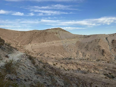
Vista awaits 110 stories above Palm Desert

The Bump and Grind Trail heads up the foothills
overlooking Palm Desert and Rancho Mirage.
The following article originally was written for and published by Uken Report.

Great views – and an invigorating workout – await on the Bump and Grind Trail in the Palm Desert-Rancho Mirage, Calif., area.

A 4-mile loop and spur, the route actually combines three trails – the Mike Schuler, the Hopalong Cassidy, and the Mirage. It’s located in the Santa Rosa and San Jacinto Mountains National Monument.

To reach the trailhead, from Calif. Hwy. 111 in Palm Desert, turn west onto Fred Waring Drive. Go left/south onto Painters Path. The trailhead is in about 100 yards on the right/west. Park along the street. The trailhead is in Palm Desert, but most of the hike occurs in Rancho Mirage’s city limits.

At the trailhead, you can go one of two directions. Use the Mike Schuler Trail, which heads right/north and connects to the Bump and Grind. You’ll start gaining altitude quickly, as the trail is steep. The views of Palm Desert – and later of Rancho Mirage – are quite striking. Some hikers tackle the trail for a night hike to see the grid pattern of lights below.

Mike Schuler segment
After switchbacking up the side of a small foothill, the trail heads west along its rolling tip. This offers a nice view of the Santa Rosa Mountains to the south. The Little San Bernardino Mountains and the Indio Hills are to the north.

There isn’t much in the way of wildlife or interesting flora on this part of the trail. You will see a lot of people, though, as it’s a popular route.

From the hilltop, the trail steeply descends – it’s a mean 9 degree grade – and crosses three washes. From there, it heads up the side of a foothill.

At 0.8 miles, you arrive at the top. There, the Mike Schuler junctions with the Mirage Trail, which heads left/west, and the Desert Drive Trail, going right/east.

Heading onto the Mirage Trail, go left/west onto it. You’ll following a ridgeline that rises above the path you’ve walked so far. From this segment of the trail, you can catch a good view of the Porcupine Creek Golf Club in the cove to the right.

Bighorn sheep
At 2 miles, the trail reaches a gate. A spur there leads to a summit, which is a half-mile away.

The trail to the summit passes through an important lambing area for peninsular bighorn sheep. Because of this, foot traffic to the summit is prohibited from Feb. 1-April 30. You still can hike the rest of the trail throughout the year. If you cut the trip to the summit, the hike becomes a 3-mile loop.

About 950 bighorn sheep live in the mountains surrounding the Coachella Valley. They blend in quite well with the tawny landscape, but their size gives them away when they move. Adult rams can weigh between 150-200 pounds – as much as a full-grown man – and ewes usually are 100-125 pounds. The adult ram’s horns sometimes reach 30 inches each in length and at the base are 15 inches in circumference.

Bighorn often can be seen feeding on acacia, encelia, krameria and sweetbush, but they will adapt their diet to what’s available. Indeed, father south in the Coachella Valley, some bighorn have migrated onto golf courses where they browse on the greens and drink from water hazards.

Summit view
The summit sits at 1,280 feet, a full 110 stories about Palm Desert and Rancho Mirage. This affords great views of both Mount San Jacinto and Mount San Gorgonio – the latter the highest point in Southern California – to the northwest.

Going south form the gate, you’ll descend the ridge and the side of the foothills, ultimately reaching the Hopalong Cassidy Trail. Take a left onto it and head back to the trailhead and your vehicle. The last quarter mile can be moderately strenuous – even though you’re going downhill, maintaining your footing on such a steep slope requires some effort.

While you can time the hike so you’re walking in the mountain range’s shadow, most of the day the trail is open to the sun. Be sure to wear sunscreen and don sunglasses and sunhat. Always carry plenty of water on this trail. If hiking at night, bring a flashlight.

Bump and Grind Trail topo map. Click for a larger version.


Thursday, October 14, 2021

Oasis awaits on trail in Palm Desert foothills

A small California fan palm oasis can be reached via the Dead Indian
Canyon Trail.
Dead Indian Canyon Trail topo map.
Click map for larger version.
The following article originally was written for and appeared at the Uken Report.

Day hikers can hike to a small oasis in the foothills above Palm Desert on the Dead Indian Canyon Trail.

Running 2.3 miles round trip, the trail is fairly straight and gains less than 300 feet elevation. It does close at times, usually Jan. 1 to Sept. 30, when Bighorn sheep inhabit the area. So you'll want to get in a hike there within the next couple of weeks or you'll have to wait until next fall.

To reach the trailhead, from Calif. Hwy. 111 in Palm Desert, take Calif. Hwy. 74 south into the mountains. After passing the Santa Rosa & San Jacinto Mountains National Monument Visitor Center, a parking lot for the Art Smith Trail will be on the right/west. Form the lot, head northwest and round the edge of the ridge into a sandy wash.

The trail heads west from there. There is a gate to the canyon - if it's open, feel free to enter; if it's closed, then bighorn sheep likely have lambs in the area, and you'll want to hike a different trail.

Once the canyon narrows, interesting rock formations appear. Sometimes you can spot bighorn sheep on them. You're certain to see harmless collared lizards resting on and darting between the rocks.

The canyon was formed by Dead Indian Creek carrying rainfall and snowmelt from the higher elevations in the foothills. The canyon, though, can go dry for years.

Mistletoe and gourds
Though fairly barren, the canyon still boasts flora, including a couple of interesting plants amid the desert scrub.

One of them is desert mistletoe, which lives throughout the Mojave and Sonora deserts at elevations of up to 1400 feet. The end of the trail marks about the highest you'll find this plant in these foothills

Bearing no leaves, mistletoe attaches itself to woody plants - such as mesquite, ironwood, acacia, palo verde, and desert buckthorn - then pulls water and minerals from its host. During winter, look for its modest though fragrant flower. It grows berries that range from red to translucent; flycatchers eat this fruit and spread the plant's seeds, which they can't digest.

Another interesting plant is coyote brush, which bears small gourds. Boasting large leaves and spreading vines, its taproots can spread several feet into the ground. It bears large, bell-shaped flowers.

December is a good time to spot the bush's striped gourd. It's not edible (though coyotes allegedly enjoy them), but Native Americans used them to make soap and did grind the seed for food.

Desert oasis
Near the end of the trail, where Grapevine Creek spills into the canyon from the south, you'll have to scrabble over large boulders. The effort is worth it, though, as you'll reach a small oasis of California fan palms where Ebbens Creek joins the canyon.

That oasis probably was the reason the canyon got is name. According to legend, when Euro-Americans arrived in the area, some visited the canyon at night and heard strange sounds. They claimed an Indian spirit made them. Dry palm fronds rubbing against one another in the night breeze probably created the sounds, however.

Because the trail is quite rocky, you'll want to wear quality hiking boots to protect your feet and to ensure you have good traction. The canyon walls can cast shadows over the trail, but it otherwise is open to the sun, so always don sunscreen, sunglasses and sunhat when on it.


Thursday, June 17, 2021

Palm Desert, Calif., trail offers great workout

The Mike Schuler Trail is a hike more for those seeking exercise outdoors
 than those looking to commune with nature.
Mike Schuler Trail aerial map. Click for larger version.
The following article originally was written for and appeared in Uken Report.

Sometimes trails aren’t about getting back to nature but just for exercising outdoors.

Such is the case with the Mike Schuler Trail in Palm Desert’s foothills. Though short at 1.6 miles, its 272 feet of elevation gain up and down two foothills, makes it a fantastic workout.

The trail overlooks both Palm Desert and Rancho Mirage. For backpackers or trail runners looking to get an even harder workout, the trail connects to the Bump and Grind Trail and as often done in conjunction with it; in fact, some trail maps identify this route with that name as well.

To reach the trailhead, from Calif. Hwy. 111 in Palm Desert, turn west onto Fred Waring Drive. Go left/south onto Painters Path. The trailhead is in about 100 yards on the right/west. Park along the street.

Up and down
At the trailhead, you can go one of two directions. The Mike Schuler Trail heads right/north and connects to the Bump and Grind. The section heading left/south runs to the Hopalong Cassidy Trail in Palm Desert.

Go right/north onto the Mike Schuler and enter the Santa Rosa and San Jacinto Mountains National Monument. You’ll start gaining altitude quickly as the trail is steep. The views of Palm Desert – and later of Rancho Mirage – are quite striking at night.

After switchbacking up the side of a small foothill, the trail heads west along its rolling tip. This offers a nice view of the Santa Rosa Mountains to the south. The Little San Bernardino Mountains and the Indio Hills are to the north.

There isn’t much in the way of wildlife or interesting flora on the trail. You will see a lot of people, though, as it’s a popular route.

Bump and Grind
From the hilltop, the trail steeply descends – it’s a mean 9 degree grade – and crosses three washes. From there, it heads up the side of a foothill.

At 0.8 miles, you arrive at the top. The trail junctions with the Bump and Grind, which heads left/west, and the Desert Drive Trail, going right/east. The latter descends to the end of Desert Drive in Rancho Mirage. This marks a good turnback spot.

The trail memorializes long-time Palm Desert resident Michael Schuler, who designed and built many horse and hiking trails in the area. Among them are the Hopalong Cassidy Trail, the Art Smith Trail, and Pacific Crest Trail segments. Schuler passed away in 2012.

You’ll want to wear sneakers with good tread if exercising. Water and sunscreen is a must, though, depending on the season the trail can be largely hiked in the shadows of the mountains to the west. Dogs are not allowed on the trail.


Monday, December 21, 2020

Hopalong Cassidy Trail crosses foothills

The Hopalong Cassidy Trail winds up and down canyons in the foothills
overlooking Palm Desert.
Hopalong Cassidy Trail topo map. Click for larger version.
The following piece was originally written for and first appeared in the Uken Report.

Hikers can head through the foothills overlooking Palm Desert, California, on the Hopalong Cassidy Trail.

The 9.5-mile round trip trail runs through the Santa Rosa & San Jacinto Mountains National Monument. It’s popular with trail runners as well as hikers.

To reach the trailhead, from Calif. Hwy. 111 in Palm Desert, take Fred Waring Drive west. Turn left/south onto Painters Path. Park along the curb behind the Desert Crossing Shopping Center. At the trailhead, go left/south onto the Hopalong Cassidy Trail. The other route, heading straight/northwest, is the Mike Schuler Trail.

The trail is a moderately strenuous hike during the first quarter mile. As ascending higher into the foothills, though, it goes up and down canyons. The upside is an invigorating workout with increasingly expansive views of the Coachella Valley atop the ridge lines as you ascend.

Herb Jeffries and Gaby Hayes trails
At about 0.66 miles, the route junctions the Herb Jeffries Trail, which runs to the left/southeast. You’re near Fox Canyon just north of Cahuilla Hills Park. To stay on the Hopalong Cassidy, continue right/west.

Though seemingly barren from the distance, as hiking the singletrack, you’ll spot a great variety of flora. Three desert plants dominate, though – barrel cactus, cholla, and creosote.

A connector trail leads to the Gaby Hayes Trail at 1.66 miles. If you want to shorten the trail, this is a good spot to do so, by taking the connector to Gaby Hayes, which links up with the Herb Jeffries, then back to the trailhead. This abbreviated hike comes to about 3.4 miles round trip.

Ignoring the connector trail and continuing upward, however, and at 1.8 miles from the trailhead you’ll reach the junction with the Gaby Hayes Trail, which comes in from the left/east. The Gaby Hayes leads to Cahuilla Hills Park. Stay right to remain on the Hopalong Cassidy.

Barrel cactus
Along the way, watch for barrel cactus. There actually are a variety of species that carry this moniker, but as their name suggests, all are barrel shaped. Look for their brilliant yellow or orange flowers on the barrel’s top in April. While tiny, they are tough little plants. In fact, they’ll probably outlive you, as they boast a lifespan of 100 years.

At 2.85 miles feet, the Homestead Trail heads downhill to the left/east. Continue right/west up the hill.

Cholla also can be seen long the trail. Several varieties of cholla grow across the American Southwest, but all have cylindrical stems. The California variety often looks like a miniature saguaro.

The trail reaches the edge of Stone Eagle Golf Course at about 3.3 miles.

Creosote is an evergreen shrub that can grow up to almost 10 feet high. It is so named because of its smell, which is similar to a preservative used on railroad ties. When the bush’s oldest branches die, the crown usually splits with the new one becoming a clone. In fact, the King Clone creosote bush found in nearby Lucerne Valley is one of the Earth’s oldest living organisms, having been around around for an estimated 11,700 years.

Palm Desert Cross
At 4.75 miles, the Hopalong Cassidy Trail ends at the Palm Desert Cross. A Palm Desert icon, the cross at night can be seen from miles away thanks to its 6-watt LED bulbs powered by photocells. St. Margaret’s Episcopal Church in Palm Desert and the Stone Eagle Golf Course maintain the cross. The 16’ by 30’ cross was erected as an Eagle Scout project in 1996. St. Margaret’s holds services there on Ash Wednesday and other select days.

After taking in the cross and valley views, retrace your steps to the parking lot. To add a little variety to route, take the Gaby Hayes Trail to the Herb Jeffries Trail then back to the main route. This is a slightly longer route, however, then simply following the Hopalong Cassidy Trail the whole way.

The Hopalong Cassidy Trail is named for the famous fictional cowboy who first appeared in short stories then in the 1930s through the 1950s was wildly popular first in film then television. Palm Desert resident William Boyd played Hopalong in the franchise’s first movies. The Gaby Hayes Trail is named for an actor who played one of Hopalong’s sidekicks, the grizzled Windy Halliday. The Herb Jeffries Trail is named for the “Sensational Singing Cowboy” actor who played in several western films aimed at black audiences.

The entire route is open to the sun, so be sure to don sunscreen, sunglasses and sunhat as well as bring plenty of water. No dogs are allowed on the trail.

Monday, September 28, 2020

Trail heads through rare bighorn sheep area

An endangered bighorn sheep blends in almost perfectly on its cliffside
perch along the Carrizo Canyon Trail.
Carrizo Canyon Trail topo map. Click for larger version.
The following article originally was written for and appeared in the Uken Report.

Day hikers can see endangered bighorn sheep and fascinating rock formations on the Carrizo Canyon Trail near Palm Desert.

The 2.7-mile trail preserves a breeding ground and longtime water supply for peninsular bighorn sheep on 1000-acre Carrizo Canyon Ecological Reserve run by the California Department of Fish and Wildlife. Gaining 413 feet in elevation, the canyon leads to a waterfall and an overlook of the Coachella Valley. It is only open Oct. 1 to Dec. 31.

To reach the trailhead, from Calif. Hwy. 111 in Palm Desert, take Calif. Hwy. 74 (the Pines to Palms Highway) south into the mountains. Turn right/west into the Art Smith Trailhead parking lot.

The trail leaves from the western lot’s southern side, crossing a wide open wash. Water rushing down the Carrizo Canyon to the south and Dead Indian Canyon to the west formed the wash.

Creosote bush scrub dominates the sandy area. The wide variety of creosote bush species are a common sight across the Southwest, as they cover much of the desert floor and the flat alluvial fans of the Mojave, Sonoran and Chihuahuan deserts. In the Coachella Valley, the Coahuilla Indians traditionally used the local variety for intestinal issues and tuberculosis.

After a mile, the wash and its soft sands give way to narrow Carrizo Canyon. Some of the Coachella Valley’s most interesting geologic wonders can be seen here, thanks to the intermittent stream carving through the mountainside. Colorful rock walls abound but most spectacular are the large twists and turns of the rocks as they’ve been folded and refolded over millions of years. These formations formed as the Pacific and North American tectonic plates slid against one another, just a few miles to the east at the San Andreas Fault.

Bighorn sheep
Keep an eye out for the bighorn sheep on cliffs overlooking the canyon. About 950 bighorn sheep live in the mountains surrounding the Coachella Valley. They blend in quite well with the tawny landscape, but their size gives them away. Adult rams can weigh between 150-200 pounds – as much as a full-grown man – and ewes usually are 100-125 pounds. The adult ram’s horns sometimes reach 30 inches each in length and at the base are 15 inches in circumference.

Bighorn often can be seen feeding on acacia, encelia, krameria and sweetbush, but they will adapt their diet to what’s available. Indeed, some bighorn have migrated onto golf courses where they browse on the greens and drink from water hazards.

Lambs usually arrive in January-June, with most births in February-April. Sometimes parts of the trail are closed during birthing season. Golden eagles will prey upon the younger lambs; coyotes, mountain lions and wolves are the bighorn’s main predators.

If you don’t spot any bighorn sheep, don’t fret. There are plenty of other animals in the canyon, including mule deer, coyote, bobcat, gray fox, Gambel’s quail, mourning dove, and the black-throated sparrow. You’ll at least spot their tracks and likely hear the birds’ calls.

This section of the trail does require some agility, as you’ll have about a half-dozen climbs over boulders. The boulder fields largely are behind you., though, once you reach a lone palm tree, though.

Overlook and waterfall
You’ve also come to a fork in the trail.

Go left/southwest first. This heads to an overlook with a nice view of Coachella Valley and a tucked away palm oasis. Palm Desert takes up most of the view with the hills of the Coachella Valley Preserve just behind it. The brown mountains rising beyond that are the Little San Bernardinos, which forms the Coachella Valley’s eastern wall.

Return to the lone palm tree and go right/southwest at the fork for a short walk to a seasonal waterfall. It’ll be dry in autumn with the waterway running through the canyon at best a trickle, but you can spot a lot of animal prints in the sand. If agile enough to climb up the roughly 12-foot waterfall, the trail continues to that small oasis of California fan palms.

Once you’ve taken in the waterfall or the oasis, retrace your steps back to the parking lot.

If you feel more comfortable hiking with others, be sure to check out the Thursday morning hikes offered in November and December by the Friends of the Desert Mountains. Volunteer trail guides offer a plethora of information about the canyon, help you search for wildlife, and even point out an Indian grinding stone.

If rain is falling, forecast or fell during the past day in the higher elevations, do not hike this trail, as flash flooding can occur. Always bring your own water and do not drink from the stream should it be flowing. Dogs also are prohibited on the trail, as canines – seen as predators – cause unnecessary stress to bighorn sheep.


Monday, June 8, 2020

Hike to oyster fossil field in California desert

The West Mesa Trail passes the full length of the Willis Palms.
Some 3.1 million years ago, the smoothound shark lived in the waters
covering the Coachella Valley.
West Mesa Trail topo map. Click for larger version
This article originally was written for and appeared on the Uken Report.

Day hikers can head to an oasis brimming with wildlife and fossils on the West Mesa Trail near Palm Desert.

The 2.2-mile lollipop trail sits at the base of Little San Bernardino Mountains in the Coachella Valley Preserve. It’s sometimes referred to as the Willis Palms and West Mesa Trail on maps and in other literature.

To reach the trailhead, from Interstate 10 take Ramon Road east at Thousand Palms. As approaching the foothills, turn left/north onto Thousand Palms Canyon Road. A parking lot is on the road’s left side in about 0.66 miles. The trail heads northwest from the lot along the base of the mountains.

Desert flowers
The trail’s opening section consists of loose sand, as the route heads through a wash. Be sure to wear quality hiking boots; a trekking pole also can help with stability.

In about a quarter mile, leave the trail’s stem for the loop. Go right/northeast around the base of the foothill in front of you. The trail gradually gains elevation.

At about 0.8 miles from the trailhead, you’ve reached the loop’s north side. The trail then heads up and crosses the foothill. Your reward for the exertion are great views of the Coachella Valley spreading before you (Thousand Palms and Palm Desert are directly ahead) with the Santa Rosa and San Jacinto Mountains rising above it.

At roughly a mile in, you’ll begin the descent down the foothill. If hiking a day or two after a rainfall in late winter or early spring, wildflower blooms usually can be spotted along the way. Chia, the desert gold poppy, desert sand verbena, dune evening primrose, and sand blazing star all grow in the area. Butterflies and the carpenter bee often flit about the blossoms.

Desert wildlife
Though appearing like wasteland, a number of creatures actually thrive near the wash and on the foothill. The lizard is ubiquitous with the zebra tailed, dune and leopard species, as well as chuckwallas, all common. Footprints of roadrunners, black-tailed jackrabbits, and coyotes usually grace part of the trail. If you’re really lucky, you may sight the paw prints of the rarely seen bobcat, desert kit fox, or raccoon.

Once at the foothill’s base, the trail turns southeast and quickly arrives at Willis Palms. The oasis of California fan palms stretches 1200 feet from northwest to southeast. It is one of several oasis that line the San Andreas Fault, which causes water from the valley’s aquifer to seep upward through cracks in the earth.

Willis Palms is a testament to nature’s resilience. A fire burned much of the grove in November 2010, but within weeks the flora already was growing back. Bats and birds lost their homes when the fire destroyed the palms’ skirts, but all have since returned.

Today, Willis Palms is a good spot for birdwatching. Cactus wrens, hummingbirds, mourning doves, and Gambel’s quail have been spotted there. Look up, and you may see an American kestrel, raven, red-tailed hawk, or even a great horned owl eyeing the ground for a meal.

Oyster fossil field
Sign of life from a long ago age also can be found at the oasis. Erosion has exposed an oyster fossil field formed when this part of the world was at the bottom of an ancient sea about 3.1 million to 3.2 million years ago. At that time, the Gulf of California extended into the Coachella Valley with the warm shallow waters running about 30 to 98 feet. Fossils for at least four kinds of sharks and rays as well as three kinds of fish also have been found around the oasis.

To locate the oyster fossil fields, look for large white patches as the ground rises off the desert floor beneath the fan palms. Oyster shells stick out of the fairly soft rock. Only take pictures, though – collection of the ancient marine fossils is illegal.

Around 1.9 miles in, you’ll reach the stem trail. Continue straight/southeast to the parking lot.

The West Mesa is not the best-marked trail and there are crossing routes, so be sure to carry a map and compass. Almost all of the trail is exposed to the sun and wind, so always don sunscreen, sunglasses and a sunhat. To avoid the desert heat, the trail is best done October through March; the preserve is open 7 a.m. to 5 p.m. during those months.


Monday, February 3, 2020

Cali trail heads past master of camouflage

Among the highlights of the Indian Palms Trail is spotting the threatened
flat-tailed horned lizard.
Indian Palms Trail map. Click for larger version.
Day hikers at California's Coachella Valley Preserve can encounter a lizard whose camouflage is so good that it has virtually no shadow.

The 1.6-miles round-trip Indian Palms Trail also heads to two small oases. From June through September, the 17,000-acre preserve is open from 6 a.m. to 8 p.m. then in winter from 8 a.m. to 4 p.m. Wednesday through Sunday.

To reach the trailhead, take Interstate 10 to Thousand Palms and exit onto East Ramon Road. Go east on it. Next, turn left/north onto Thousand Palms Canyon Road. A parking lot is on the road's left/southwest side; this serves the McCallum Trailhead with Indio Hills Palms and the Center for Natural Lands Management located there. Take the trail heading southeast toward the Pushawalla Palms Trailhead.

To the trail's south is Squaw Hill, which rises about 70 feet. Another path heads to its top, which gives a great view of the valley's western side.

Upon reaching the highway, cross it to the trailhead sign. The stone-sided trail begins by entering a wash. Floods in autumn 2018 covered the wash, but the trail since has been repaired.

Flat-tailed horned lizard
While the preserve is more known for the endangered Coachella Valley fringe-toed lizard, plenty of other reptiles live there. Among them is the camouflage master flat-tailed horned lizard.

Found only in southeastern California, southwestern Arizona, Sonora, and Baja California Norte, the lizard has a round, flat body with a dark vertebral stripe and a broad, flat tail. Long spines sit on its head. The lizard’s color changes to match the local sand, so the Coachella Valley's denizens tend to be whiter than its counterparts. The Coachella Valley marks the northern margin of the species’ range.

The flat-tailed horned lizard mainly eats ants though sometimes it will dine on beetles and other bugs. As standing water is rare in the preserve and other locations that the lizard lives, it acquires most of its water when eating.

In short order, the trail splits. Each way takes you to a desert oases to either the north or south.

Go left to the northern grove. The trail heads up a slight slope and then loops around a small group of California fan palms. Water seeping up through faults in the area helps water the palms.

Saltbush
Among the rocks only a few feet from the oasis are barrel cactus, creosote bushes, and sandpaper plants.

Another plant you'll pass along the way is four-wing saltbush. Slow down when you do, as these plants mark the best places to spot the flat-tailed horned lizard. As the saltbush produces fruit even during droughts, they naturally attract large ant populations, which in turn draws the flat-tailed horned lizard.

Four-wing saltbush is a type of evergreen shrub. They usually grow 2-4 feet high with thin leaves about 0.5-2 inches long. Their fruit is what really makes them stand out, though. The fruit has four wings at right angles to one another. The wings are densely packed on long stems.

Finding the flat-tailed horned lizard will be tougher than you think. As the sides of their flat bodies thin to an edge and they press their bodies to the ground, there's no shadow to make them stand out. The fringed scales on their sides further obscure them by helping them blend into the sand.

South grove
After looping around the grove, head to back to the junction and then go to the south grove. Though smaller than the northern oases, usually puddles of water can be spotted.

The flat-tailed horned lizard faces a number of threats. Kestrels and shrikes will hunt them, so their populations tend to be low with 0.1 miles of roads, which provide open ground and poles and power lines for the birds to perch. In addition, Russian thistle and Sahara mustard can limit movement of the lizards, which tend to be wide-bodied. Further, populations are becoming fragmented, reducing breeding populations. In the Coachella Valley, Interstate 10, the Coachella Canal, and other small roads effectively divide up the lizards' habitat.

After taking in the south grove, return to the junction and retrace your steps to the parking lot.

Avoid this trail during summer or anytime temperatures are in the 80s or higher. Always don sunscreen, sunglasses and a sunhat, as there is no shade on the trail. Pets are not allowed in the preserve.


Monday, December 2, 2019

Day trail leads to iconic Palm Desert cross

Map of Homestead Trail to Palm Desert Cross
The following article originally was written for and appeared at the Uken Report.

Day hikers can head to the Palm Desert Cross on an easy hike into the foothills.

Though short at 2.6 miles round trip, it’s uphill much of the way to the cross with an elevation gain of 643 feet. The hike starts on the Homestead Trail then includes a segment of the Hopalong Cassidy Trail.

To reach the trailhead, from Calif. Hwy. 111 go north on Calif. Hwy. 74 (the Pines to Palms Highway). In a little more than a mile, turn right/west onto Thrush Drive; when it splits, veer left/west onto Thrush Road. Then turn right/north onto Cil De Los Campesinos. Park in the gravel turnout where the road ends.

The trail heads west from the turnout into a wash at Palm Desert’s Homme Park. In about 400 feet, Upon leaving the wash, the trail turns north and ascends the side of the Santa Rosa Mountain foothills. Wooden boards along the way help to minimize erosion.

You’ll soon reach a flat area with a structure. It’s a good spot to take a break and enjoy the first of many great views of Palm Desert below and the Little San Bernardino Mountains in the distance.

Continuing on, the trail turns west and climbs again, this time on a couple of steep switchbacks.

Hopalong Cassidy Trail
The trail then heads along the ridge’s backbone. Upon intersecting another ridge, go right/west rather than left, which heads down to the wash

In about 400 feet, the path reaches the Hopalong Cassidy Trail, which goes both straight west and to the right/north. Continue straight west. From here, the trail rolls up and down small ridges.

In short order, you’ll arrive at the cross. A Palm Desert icon, the cross at night can be seen from miles away thanks to its 39 6-watt LED bulbs powered by photocells. St. Margaret’s Episcopal Church in Palm Desert and the Stone Eagle Golf Course – which sits to the west on the ridge’s other side – maintain the cross.

A College of the Desert student raised the first cross at the site around Christmas 1981. Then in 1996 the current 16’ by 30’ cross was erected with underground wiring later added as an Eagle Scout project. St. Margaret’s holds services there on Ash Wednesday and other select days.

Alternate way down
At Christmastime, sometimes hikers decorate the desert bushes around the cross. While the intention is noble, it is ill-advised. Bighorn sheep that resides in the mountains often attempt to eat the shiny decor, which can cause them to become ill or even die.

To return home, retrace your steps back to the intersection with the Homestead Trail. Then in 400 feet when reaching the ridgeline you came up on, if you’re intrepid head right/southeast down another ridge. This goes into the same wash that you entered after parking but offers some different views of the valley below. It’s also a but steeper than the ridge you came up on.

Not an iota of shade can be found the entire way, so be sure to don sunscreen, brimmed hat, and sunglasses. The trail is dog friendly trail and fairly busy, especially at sunset; indeed, it’s a great summer evening hike as the mountains generally casts a shadow over the foothills.

Learn more about national park day hiking trails in my Best Sights to See at America’s National Parks series.


Thursday, October 3, 2019

Hike heads to prominent Indian Wells peak

Eisenhower Mountain, seen from the trailhead at the Living Desert Zoo and
Gardens, rises to nearly 2000 feet.
Eisenhower Mountain Trail Map Plate I
Eisenhower Mountain Trail Map Plate II
Eisenhower Mountain Trail Map Plate III
Eisenhower Mountain Trail Map Plate IV
Day hikers can head to the base of one of Indian Wells’ iconic peaks on the Eisenhower Mountain Trail.

The 4.3-miles round trip actually is a collection of three trails – a stem and two stacked loops – that
sits in both the Living Desert Zoo and Gardens’ 360-acre nature preserve and the San Jacinto-Santa Rosa Mountains National Monument. Storm damage temporarily closed the trail in winter 2018-19, but it since has reopened.

Though the mountain and the trail are in the Indian Wells city limits, the best way to access the route is via a trailhead in neighboring Palm Desert at the Living Desert Zoo and Garden. To reach the trailhead, from Calif. Hwy. 111 in Palm Desert, turn south onto Portola Avenue. Park at the Living Desert Zoo and Gardens on the road’s left/east side. An entry fee is required.

Desert scrub and wash
You’ll get to explore a little of the Living Desert Zoo and Gardens. The trailhead is at the facility’s northern edge on the north side of a spur jutting out of the foothills. The hike starts at about 320 feet elevation.

The trail quickly splits to form the western end of the first stacked loop, which is known as the Adventure Loop. Go left/northeast onto the trail so that you take the route clockwise.

You’ll cross a desert riparian woodland. Scrubland surrounds the path, but after a rainfall it comes alive with the color of desert wildflowers.

The trail next passes over a desert wash or arroyo. In doing so, the trail dips and briefly becomes quite sandy.

East of the wash, the trail reaches the western segment of the second loop, the Wilderness Loop. Go left/north onto it. The route starts to gain elevation, as it heads up a desert mountain ridge.

Eisenhower Mountain
The trail’s eastern leg is its high point, specifically a picnic shelter at close to 1000 feet elevation. This offers a fantastic view of Eisenhower Mountain, which tops out at 1952 feet.

While a mountain by Minnesota or Maine standards, in California it’s really just a steep foothill. Still, it’s a prominent peak in the foothills above Indian Wells, dominating the southern skyline beyond the Eldorado Country Club.

Once taking in the sights, begin the return leg to the Living Desert Zoo and Gardens. The trail back descends through a rocky desert draw. The path narrows and requires a little boulder scrambling. This is a good section to spot rare bighorn sheep.

The return trip offers great views of Indian Wells to the north and northeast and Palm Desert to the northwest. Looking west, you can see the summit of San Jacinto Peak which rises over Palm Springs about 15 miles away.

Along the way down, the trail passes Hidden Valley on the left/south, a built-up area on a low saddle in the spur coming out of the foothills.

San Andreas side trail
Once past Hidden Valley, the trail junctions with the eastern loop of the Adventure Loop. Go left-straight/west onto it.

Just before reaching the loop’s stem, take a side trail to the left for an interpretive exhibit about the San Andreas Fault. There’s a great view of the fault, which sits on the valley’s other side, running in a line just north of Indio to just south of Desert Hot Springs.

An alternate trail to Eisenhower Mountain’s summit runs from Eldorado Country Club. but the route is extremely steep and partially runs up draws.

As there is little shade except the foothills’ shadow, be sure to don sunscreen, sunglasses and a brimmed hat for the hike. Bring plenty of drinking water as well. The trail is open only from October 1 to May 30.


Thursday, October 18, 2018

Trail heads to springs in Santa Rosa Mtns.

Toro Peak is the highest summit in the Santa Rosa Mountains.
Cactus Spring Trail's west side
Cactus Springs Trail's east side
What Mount San Jacinto is to Palm Springs, California, so the Santa Rosa Mountain Range is to the central Coachella Valley, rising high above the southern horizons of neighboring Palm Desert and La Quinta.

Day hikers can explore the range by hiking a segment of the lengthy Cactus Springs Trail. The 9-mile round trip described here runs about 4779 feet below the range’s highest peak and about 3800 feet above La Quinta. It is located in the Santa Rosa & San Jacinto Mountains National Monument.

To reach the trailhead, from Calif. Hwy. 111 in Palm Desert take Calif. Hwy. 74 south into the Santa Rosa Mountains. Upon reaching the Pinyon Pines, turn left/southeast onto the Pinon Flats Transfer Station Road. Just before the station, turn right/east into the parking lot.

From the lot, walk the dirt road east about 800 feet to Pidgeon Springs Road. Go right/south onto it and then in about 70 feet take the very next left, heading east onto Cactus Springs Trail proper.

In about 500 feet, the trail splits; go right/southeast. The rest of the trail crosses rolling terrain, but the route essentially descends toward Horse Thief Creek.

The Cahuilla Indians used this trail for centuries, mainly because it passed water sources. In more recent times, an effort was made to mine dolomite here; you'll pass the abandoned operation as the trail curves southeast.

Toro Peak
Though high above the desert floor, the climate on the mountainside trail is similar. You'll pass plenty of cactus gardens, chaparral, pinyon pine and juniper on the way. During wet springs, blooming wildflowers – especially the brilliant blue and purple phacelia – are a treat to the eye.

To the south, Toro Peak rises above the trail. The highest mountain in the Santa Rosa Mountain Range, it tops out at 8717 feet. From its summit, in good weather, you can see Charleston Peak in Nevada.

A short range, the Santa Rosa Mountains cover 437 square miles. Geologically, they are part of the Peninsular Ranges, which run to Baja California Peninsula’s southern tip in Mexico.

At 2.4 miles in, the trail crosses Horse Thief Creek. The stream usually flows year around between its canyon walls. Cottonwoods line the creek and in autumn turn golden. The canyon marks a good spot to turn back; the more physically fit and adventurous, though, can continue onward.

From the creek, the trail climbs to the springs. Pine-covered Martinez Mountain, at 6500-feet high, looms in the distance.

Little Pinyon Flat
The terrain evens out as nearing the springs. Cahuilla families often used this flat as a gathering place, and pottery sherds still can be found there.

At 4.5 miles, the trail reaches Little Pinyon Flat Cactus Spring. The spring actually is a shallow, grass-covered mud hole, and a filter is needed to drink from it. But in the days before modern wells and piping, this was a major water source. No sign marks the spring, but once you spy a lot of animal tracks and human boot prints, you're close.

The springs is a good spot to turn back. The trail actually goes east for several more miles but can be difficult to follow at times. About 8.8 miles from the trailhead is the Agua Alta spring, and in 17.6 miles is Martinez Canyon.

This hike is best done in spring and autumn when temperatures are still comfortable. The desert route is mostly exposed to the sun, so bring plenty of water and be sure to don sunscreen and a sunhat. Dogs also are allowed on the trail.


Thursday, September 20, 2018

Bighorn sheep await on Palm Desert trail

The following article originally was written for and appeared at the Uken Report.

Hikers can enjoy panoramic views of the Coachella Valley with the opportunity to spot rare bighorn sheep on the Art Smith Trail.

The out-and-back trail runs 8.3 miles one way but can be shortened depending on your level of physical fitness. It’s best done September through May. Mornings offer cooler temperatures with the added bonus of blooming wildflowers if hiked after a rainfall.

To reach the trailhead, from Calif. Hwy. 111 in Palm Desert turn south onto Calif. Hwy. 74. In about four miles, just past the Santa Rosa and San Jacinto National Monument Visitor Center entrance, turn right/west into the parking lot. You also can park in a smaller lot before the reaching the visitor center entrance.

From there, follow the Dead Indian Creek wash roughly northwest via a 0.2-mile connector until reaching the Art Smith Trail proper. If you were able to park in the smaller lot north of the visitor center, cross the wash directly onto the trail.

Spectacular views
The three miles beyond the connector are strenuous, thanks to elevation gains. The trailhead starts at 1000 feet elevation and rises another 1465 feet.

Your reward for that effort are increasingly fantastic views of the Coachella Valley below. The Big Horn Golf Course and homes initially appears below then the whole of Palm Desert and Rancho Mirage with Cathedral City and Palm Springs to the northwest. Across the valley stand the Little San Bernardino Mountains and Joshua Tree National Park.

A variety of desert plants can be spotted along the trail. Barrel cactus, beavertail cactus with its magenta flower, Christmas and staghorn cholla, and fishhook cactus dominate. After a rainfall, though, bring a wildflower guide and see if you can spot blossoming blazing star, brittlebush, California Fagonbush, chia, chuparosa, creosote, desert lavender, desert lupine, indigo bush, pink globemallow, notch-leaf phacelia, Spanish needles, white desert puncushion, white globemallow, or the yellow sweetbush.

The trail passes plenty of interesting desert rock formations, many informally named after animals they resemble. Make a game of it and see if you identify Squirrel Rock, Gorilla Rock, Two Toads, and Turtle Rock.

Peninsular bighorn sheep
Certainly the highlight of the trail is spying the endangered Peninsular bighorn sheep, a Coachella Valley icon.

About 950 bighorn sheep live in the mountains surrounding the Coachella Valley. They blend in quite well with the tawny landscape, but their size gives them away. Adult rams can weigh between 150-200 pounds – as much as a full-grown man – and ewes usually are 100-125 pounds. The adult ram’s horns sometimes reach 30 inches each in length and at the base are 15 inches in circumference.

Bighorn often can be seen feeding on acacia, encelia, krameria and sweetbush, but they will adapt their diet to what’s available. Indeed – no doubt like hikers admiring the lush valley below – some bighorn have migrated onto golf courses where they browse on the greens and drink from water hazards.

Lambs usually arrive in January-June, with most births in February-April. Sometimes parts of the trail are closed during birthing season. Golden eagles will prey upon the younger lambs; coyotes, mountain lions and wolves are the bighorn’s main predators.

If no bighorn show, don’t fret. Plenty of other animals inhabit this seemingly desolate terrain, and your certain to see Baja California Collared and side-blotched lizards, roadrunners, chipmunks, and maybe even burrowing owls and chuckwallas.

Shorten the trail
Unless backpacking, you’ll want to cut this trail short rather than do the entire length. A couple of good spots to turn around are at a palm oasis – there’s one at 2.5 miles in then another at about three miles, where the trail mostly levels out.

Should you wish to continue onward, the trail at five miles passes palm-filled Magnesia Canyon’s upper reaches. After that, it intersects Hahn Buena Vista Trail at Dunn Road, offering more great views of the valley below. The Hahn Buena Vista connects with the Wild Horse and Garstin trails and ends in Palm Springs about eight miles on. Dunn Road and the Cathedral Canyon Trail head into Cathedral City.

The trail’s namesake was a trail boss for the Desert Riders. He developed a number of area trails to move horses from Palm Springs to Anza and escape the summer heat.

Note that the trail offers little shade, so be sure to don sunhat and sunscreen, as well as bring plenty of water. Also, to protect bighorn sheep, dogs are not allowed on the trail.

Learn about national park day hiking trails in my Best Sights to See at America’s National Parks series.