 |
| Silver Creek Canyon |
The 1.8 miles round trip Five Mile Canyon Trail heads into Silver Creek Canyon. If water levels are low enough, you usually can extend the hike by crossing it to trails on the creek's other side, and there's an option to hike more of the rim.
To reach the trailhead, from Snowflake, take Ariz. Hwy. 77 north. After passing Despain Avenue, look for a gravel road on the right/east. This heads to a turnaround at the canyon's edge; park in the turnaround.
Walk the canyon rim north to Five Mile Draw. A bridge on Hwy. 77 marks the draw's upper reaches.
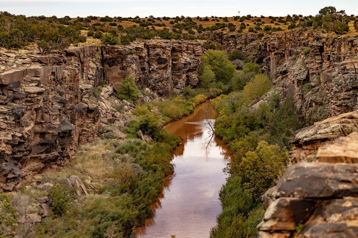
The draw acts as a ramp that descends to the bottom of the 50-foot deep canyon creek. Where the two meet, the canyon makes a sharp bend.
Petroglyphs can be seen on the canyon walls at Five Mile Draw. They also appear at at Four Mile Draw on the stream, though the hike described here doesn't go that far.
At the canyon bottom, go right/south. You can follow footpaths that meander around bushes alongside the creek.
The greenery and water attract a number of birds. Sometimes a lone coyote can be spotted in the grasslands on the canyon rim.
Along the way are some neat pools let behind as the water levels drop through the summer.
There also are plenty of neat rock formations created by floodwaters through the canyon.
Silver Creek runs 45 miles from south of Snowflake north to the Little Colorado River. It often appears brown as it carries sediment downstream.
Unfortunately, some canyon visitors have added graffiti to the rocks. Don't do that. It destroys the canyon's wildness that makes it so appealing and places the historic petroglyphs at risk.
The trail is on private land. Be respectful of others who've opened their property to the public, as well as other hikers, by not littering. Always close any gates behind you.
TOPO MAP

Click for larger, printable version.
