 |
| Escudilla Mountain sits in Apache-Sitgreaves National Forest. |
Trail.
The 6.6 miles round trip trail sits in the White Mountains of Apache-Sitgreaves National Forest. It sports an elevation gain of 1315 feet at a high altitude. It’s best done from late spring to early autumn; snow covers the mountain the rest of the year.
To reach the trailhead, from Springerville, Arizona, take U.S. Hwy. 180/191 south/east into the national forest. Turn left/east onto the gravel Forest Road 8056, which leads to the Hulsey Lake Fishing Site. When the road splits, go left/east. In about 0.28 miles is the trailhead; park off the right/west side of the road. You’re at about 9560 feet above sea level.
2011 Wallow Fire
The trail heads northeast up the side of Escudilla Mountain. Some maps label this trail is No. 308. In short order, you’ll enter the Escudilla Wilderness Area.
Take your time and drink plenty of water. You’re extremely high up, and there really is less oxygen at this elevation. Go too fast, and you’ll lose your breath. If you feel nauseous, dehydrated despite drinking water, and can’t catch your breath, rest, return to your vehicle, and descend to a lower elevation. Altitude sickness can be deadly.
The trail switchbacks up the mountain side used to be a 4x4 road before the area was designated a wilderness
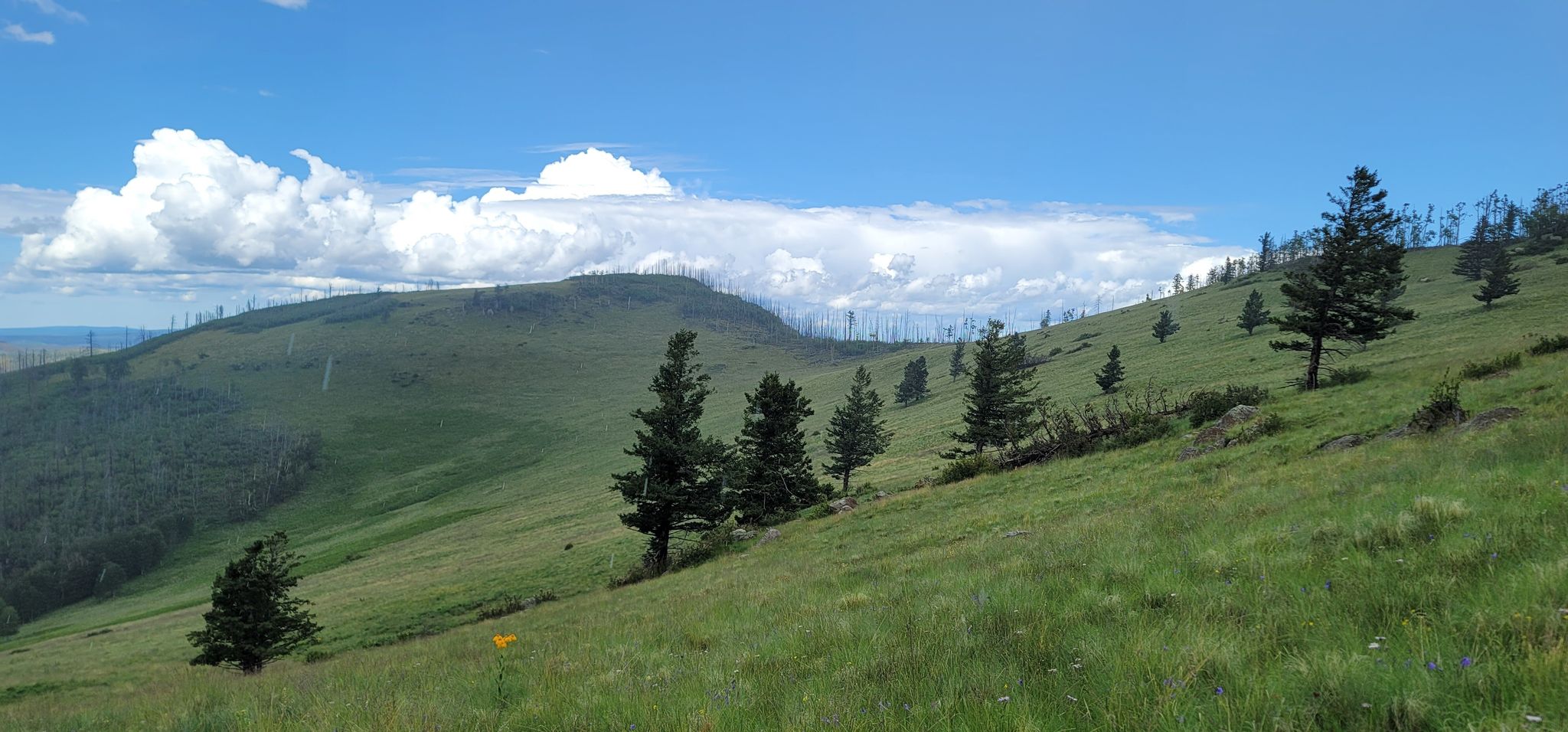
The 2011 Wallow Fire – at the time it was Arizona’s largest – ravaged swaths of the mountain and more than a half-million surrounding acres. The forest on Escudilla is recovering and now covered mainly by white-barked aspen. This makes for spectacular autumn colors.
Some of the aspen has been cut, at about 0.7 miles, as part of the Wildlife Habitat Improvement Project. This increases browse for deer.
Where fire didn’t hit, expect to see a lot of fir and Engelmann spruce, two evergreens hardy enough to handle cold winters at this altitude. Oak also can be found at the trail’s lower elevations.
The 6.6 miles round trip trail sits in the White Mountains of Apache-Sitgreaves National Forest. It sports an elevation gain of 1315 feet at a high altitude. It’s best done from late spring to early autumn; snow covers the mountain the rest of the year.
To reach the trailhead, from Springerville, Arizona, take U.S. Hwy. 180/191 south/east into the national forest. Turn left/east onto the gravel Forest Road 8056, which leads to the Hulsey Lake Fishing Site. When the road splits, go left/east. In about 0.28 miles is the trailhead; park off the right/west side of the road. You’re at about 9560 feet above sea level.
2011 Wallow Fire
The trail heads northeast up the side of Escudilla Mountain. Some maps label this trail is No. 308. In short order, you’ll enter the Escudilla Wilderness Area.
Take your time and drink plenty of water. You’re extremely high up, and there really is less oxygen at this elevation. Go too fast, and you’ll lose your breath. If you feel nauseous, dehydrated despite drinking water, and can’t catch your breath, rest, return to your vehicle, and descend to a lower elevation. Altitude sickness can be deadly.
The trail switchbacks up the mountain side used to be a 4x4 road before the area was designated a wilderness
The 2011 Wallow Fire – at the time it was Arizona’s largest – ravaged swaths of the mountain and more than a half-million surrounding acres. The forest on Escudilla is recovering and now covered mainly by white-barked aspen. This makes for spectacular autumn colors.
Some of the aspen has been cut, at about 0.7 miles, as part of the Wildlife Habitat Improvement Project. This increases browse for deer.
Where fire didn’t hit, expect to see a lot of fir and Engelmann spruce, two evergreens hardy enough to handle cold winters at this altitude. Oak also can be found at the trail’s lower elevations.
Black bears
Around 1.3 miles, the trail enters Tool Box Meadow. The meadow offers nice panoramic views. Sometimes elk hang out in the open area, usually at dawn and dusk.
The route junctions the Government Trail #119 at 1.9 miles. Continue straight-right/north.
Black bears do live in the wilderness area. To protect yourself, don’t carry food with you, and should you make that mistake anyway, definitely don’t open it. If you spot a bear, they’ll probably be more afraid of you than you are of them and will run off. Never, however, get between a mother and her cubs.
There are two spur trails as you near the summit. The first goes to the left; you’ll want to continue right. The second spur heads right to Bead Springs Meadow; stay to the left.
Summit
At 3 miles, the trail reaches the summit. You’re at 10,912 feet. Only two mountains are higher in Arizona - nearby Mount Baldy at 11,420 feet, which requires more than a day hike to reach, and Humphreys Peak, north of Flagstaff at 12,633 feet.
On the summit, you can climb a 40-foot iron fire watchtower for an excellent vista.
You’ll be able to see quite far on a clear day. To the northwest are the San Francisco Peaks. Mt. Graham, the Mogollon Mountains, and Black Range of the Gila Wilderness Area are to the southeast. The Blue Primitive Area is to the south.
If you spot two peaks that sort of resemble rabbit ears, you’re looking at the Lost Adams Diggings, site of the richest gold finds ever in North America. The nuggets were larger than robin eggs.
In addition to the fire tower, you also can walk over to a knoll to the northwest, which tops out at 10,893 feet.
After taking in the sites, retrace your steps back to the trailhead.
If rain is falling or you see an approaching thunderstorm, stop the hike and return to your vehicle. You’re at increased risk of a lightning strike while on a mountaintop.
Some maps and guidebooks refer to this hike as the Escudilla Mountain Trail.
TOPO MAP
 |
| Click for a printable version. |