 |
| Map of Hot Springs National Park. Click on map for larger version. Map courtesy of WikiTravel. |
Among the best of them is the 1.7-mile Hot Springs Mountain Trail. It heads through a beautiful mixed hardwood and pine forest that sits 1,200-plus feet above sea level, offering views of the pretty Arkansas countryside, the city of Hot Springs, and the ancient Ouachita Mountains.
Valley of the Vapors
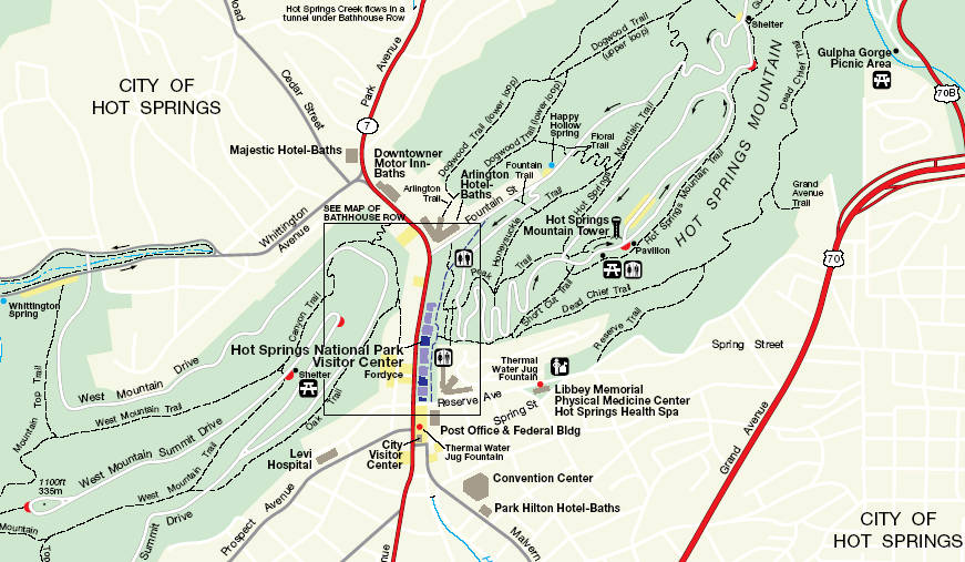
Hot Springs National Park is in downtown Hot Springs; the visitor center is located on Ark. Hwy. 7 or Central Avenue. To reach the Hot Springs Mountain Trail, take Hot Springs Mountain Drive to the summit. A parking lot is next to the Hot Springs Mountain Tower. The trail begins at the Pagoda shelter just below the tower.
For more than 8,000 years, Native Americans from a variety of tribes would gather at the springs to enjoy the hot waters, setting aside their differences during the visit. They called the area the “valley of the vapors.” Today, the national park is known as "The American Spa.”
Heading away from the picnic area, take the southeastern side of the trail, which parallels Hot Springs Mountain Drive. The trail descends through a beautiful mixed hardwood and pine forest. Autumn marks the best time to hike the trail, not just because of the cooler temperatures but also for the fall leaf display.
About halfway down, a trail shelter marks the Gulpha Gorge Trail intersection. Continue straight/northwest and descend the northwestern side of the slope. At the next junction, turn left/south; continuing straight would put you on the Dogwood Trail.
Ancient fault line
While parts of the trail can be steep, it offers impressive vistas. The mountains surrounding Hot Springs are part of the Ouachitas, which some 300 million years ago were as tall as the Rockies.
Thanks to an ancient fault line in the range, hot water bubbles up through the springs on the base of Hot Springs Mountain’s western slope. The hot water reaches 143 degrees F, and up to 700,000 gallons of it is collected annually.
A serpentine path continues to Hot Springs Mountain Drive. Cross it, and hike up the northwestern slope of Hot Springs Mountain. At the junction with Honeysuckle Trail, stay left/southwest to complete the loop. After crossing Hot Springs Mountain Drive two more times, the trail arrives back at the picnic area.
Learn about trail guidebooks available in the Hittin’ the Trail series.
