Located north of Duluth, forests surround Babbitt on two sides. The Superior National Forest sits a few miles to the east, and Bear Island State Forest is to the north. Many of the trails run several miles long but all can be shortened into day hiking routes.
Trails are marked in yellow on the maps. Click each map or open it a new window for a larger, printable version.
Iron Ore Trail segment
In nearby Embarrass, a 3.2-mile round trip segment of the old railbed heads north and south of town. Park at the trail access on the north side of County Road 21 near the Waisanen Road intersection; hike north, turning back at County Road 627/Sauna Road.

Mesabi State Trail segment
A 2.6-mile round-trip segment of the bicycle trail goes east of town along the Stony Spur ATV Trail. Park at the trail entrance off Scott Road just east of Plantation Road; the trail stops at Ely-Babbitt Road/County Road 70.

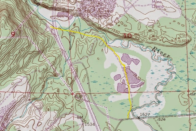
Stony Spur II Trail segment
The trail runs 23 miles from Babbitt to just south of Bear Island State Forest, but segments of it can be done as short hikes. A 2.2-mile round trip section near the Dunka River southeast of Babbitt is perfect for such a hike; park off of Scott Road/County Road 623 a little more than a mile southeast of the Matilla Road junction.
Learn about trail guidebooks available in the Hittin’ the Trail series.
