 |
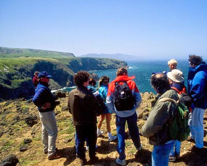
| Park Service rangers offer informative guided tours of the Cavern Point Loop Trail. Photo courtesy of NPS. |
Rare scrub jay, plants found
on largest Channel Island
Spectacular views of the ocean and California coast await day hikers on the Cavern Point Loop Trail at Channel Islands National Park.
The moderately difficult, 2-mile round trip trail sits on Santa Cruz Island, the largest of the park’s five isles. The trail gives but a glimpse of all that the island, at 96 square miles in size with an official population of two, has to offer.
The two main ways to reach the island is via public boat transportation from either Ventura or Oxnard or public airplane transportation from the Camarillo airport, all on the California mainland. This is a great hike for those who want to camp or just make a quick visit, as the closest landing to the trail is the pier at Scorpion Anchorage on the island’s northside.
From the anchorage, hike the trail southwest to the campground. The trail quickly leaves the rocky beach, then crosses and parallels a creek flowing out of the island's central mountain range. Upon reaching the Service Road, you’ll arrive at the campground, which is a quarter mile from the pier.
At the campground, look for the Cavern Point Loop trailhead near site #22. The trail goes northwest through a wooded area and then cuts its way over short, grassy hills. For the greenest flora, which makes a wonderful contrast with the blue sky above and turquoise ocean in the distance, hike the trail in spring.
Oceanside
Along the way, watch for the island scrub-jay, which only resides on the Santa Cruz Island. Having adapted to the unique environment, the island's jay is 33 percent larger than its mainland cousin. Eight plant species also are found exclusively on Santa Cruz, which along with the other Channel Islands have been isolated from the mainland for millions of years.
The hiking path soon intersects North Bluff Trail, which branches west. Staying on the loop, you’ll come to Cavern Point, a little more than mile into the hike.
The point offers excellent views of the Pacific Ocean below with the California mainland to the north and west. Looking straight north is the city of Carpinteria with Santa Barbara to its left. Enjoy the moment – tens of thousands of people on the mainland everyday see the island and wish they were where you are standing. Be sure to wave.
As the trail swings east, it stays along the cliffside with the cities of Ventura and Oxnard coming into view. Two sea caves sit below you, but they are closed to the public.
Be aware that winds can be very strong along the point. Also, avoid the cliff edges, as they can crumble.
Extending the hike
The trail then descends through woods to Scorpion Anchorage. At one time, the anchorage was a sheep farm. Ranch buildings you saw along the hike are being renovated and eventually will be opened to the public.
The National Park Service, which shares the island with the Nature Conservancy, offers excellent guided hikes of the loop. If interested in learning about the island’s history, geology and ecology, definitely sign up for the hike.
The trail can extended by following the branching North Bluff Trail west for two miles to Potato Harbor. This adds up four miles to the hike.
Learn more about national park day hiking trails in my Best Sights to See at America’s National Parks guidebook.
