Showing posts with label Pepin County. Show all posts

Saturday, April 23, 2016

How to reach Chippewa Valley hiking trails

White pines on the Bjornson Education-Recreation
Center Loop
Wisconsin’s Chippewa Valley – loosely defined as Chippewa, Eau Claire, Dunn and Pepin counties –boasts a number of parks and trails ideal for hiking. Several major highways offer access to the valley.

From the Minneapolis-St. Paul area, take Interstate 94 east. Trails in Dunn and Pepin county trails can be accessed by exiting on Wis. Hwy. 25, while many trails in Eau Claire and Chippewa counties can be reached by exiting onto U.S. Hwy. 53 or U.S. Hwy 12. An easy to reach Chippewa Valley trail from I-94 is the Bjornson Education-Recreation Center Loop.

From northern Wisconsin and Minnesota, take Hwy. 53 south into Chippewa County. Continue south into Eau Claire County or take Wis. Hwy. 29 west to Dunn County. A good valley trail close to northern Wisconsin and Minnesota is the Circle Loop.

From southern Minnesota and Iowa, either Interstate 35 can be taken north to Minneapolis-St. Paul and then I-94 east into Dunn and Eau Claire counties or U.S. Hwy. 63 can be taken north to I-94, which then is traveled east. A fun valley trail that is close to southern Minnesota and Iowa is the Silver Birch Park Trail.

From eastern Wisconsin, either U.S. Hwy. 10 or Hwy. 29 can be driven east to I-94. A good trail for visitors from that area is Lake Wissota State Park's Lake Trail.

From the Upper Peninsula, take U.S. Hwy. 8 west then Hwy. 53 south. Some excellent valley trails along this route are those at the Chippewa Moraine State Recreation Area.

From southern Wisconsin and Illinois, head north on I-94 into Eau Claire County. Among the first trails visitors from that area can reach is the Coon Fork Lake Trail.

Learn more about nearby day hiking trails in my Day Hiking Trails of the Chippewa Valley guidebook.


Friday, April 15, 2016

Variety of day trails explore Pepin County

Silver Birch Lake Trail view of its namesake.
Though small, Wisconsin’s Pepin County offers several great day hiking opportunities.

The Chippewa River splits the northern section of the county in half then forms its eastern border before draining into the Mississippi River. A majority of its day hiking trails are located along or near the Chippewa River. Most notably, the southern/western terminus of the Chippewa River State Trail is in Durand.

Much of Pepin County consists of a system of ridges and valleys that make up the area around the Chippewa and Mississippi rivers. This region ecologically is part of the Western Coulee and Ridges area.

Depsite its small size, the county is big in history. In the late 1600s, Frenchman Nicholas Perrot brashly claimed all lands west of the Great Lakes for his king, and during the next century France dominated mining, trading and trapping in the region. Archeological evidence indicates several French trading posts existed on Lake Pepin during the 1700s. Fast-forward a century when pioneers from the East Coast arrived, and it’s the setting of the “Little House in the Big Woods,” the first in the Laura Ingalls Wilder series.

Three great trails or areas to hike in Pepin County include:
Chippewa Valley State Trail
Silver Birch Lake Trail
Tiffany Bottoms State Wildlife Area trails

Learn about trail guidebooks available in the Hittin’ the Trail series.


Tuesday, March 29, 2016

My latest hiking guidebook now on sale

My latest book, Day Hiking Trails of the Chippewa Valley went on sale Monday. The book lists more than a hundred great family-friendly trails in Wisconsin’s Eau Claire, Chippewa, Dunn and Pepin counties. Among them are the Chippewa River State Trail, the Red Cedar State Trail, the Old Abe State Trail, and the Ice Age National Scenic Trail. Two state parks – Lake Wissota and Brunet Island – are explored as well. The book includes a bonus primer about day hiking essentials such as gear, clothing, navigation, and how to avoid various trail dangers. Day Hiking Trails of the Chippewa Valley is available as a paperback and as an ebook on Kindle/ Ebook versions for Nook, iBook/iPad, Kobo, and other formats are coming out later this month.

Learn about trail guidebooks available in the Hittin’ the Trail series.


Friday, March 18, 2016

Parks, trails abound in Chippewa Valley

Brunet Island State Park. Photo courtesy of Wisconsin DNR.
Wisconsin’s Chippewa Valley – loosely defined as Chippewa, Eau Claire, Dunn and Pepin counties –boasts a number of parks and trails ideal for hiking.

Highlighting those attractions are two state parks. Brunet Island State Park covers 1300 acres on the Chippewa River and boasts several quiet lagoons. To the south, Lake Wissota State Park spans over a thousand acres along a reservoir on the Chippewa.

Several minor state public areas as well as county and city parks can be found in the region.

The Chippewa Moraine State Recreation Area at more than 3000 acres in size preserves several unique landforms created during the last ice age. Hoffman Hills Recreation Area covers a little more than 700 acres and includes an observation tower at its highest point.

Each of the Chippewa Valley’s three largest cities operate large parks. Chippewa Falls’ Irvine Park includes a zoo, cave and walk along a creek. Eau Claire’s Carson Park offers historical museums and a trail near the Chippewa River. Menomonie’s Wakanda Park sits on Lake Menomin and adjoins a game park with nature trail.

Four lengthy trails crisscross the valley. The Chippewa River State Trail runs 26 miles along its namesake from Durand to the Lake Hallie area north of Eau Claire. The Old Abe State Trail heads 19.5 miles along the Chippewa River from Chippewa Falls to Brunet Island State Park. The Red Cedar State Trail hugs the Red Cedar River for 14.5 miles from Menomonie to northeast of Durand. Each of those three trails were built on old railroad grades. A fourth trail, the Ice Age National Scenic Trail, marks the farthest advance of glaciers in the last ice age, and runs for 23 miles in Chippewa County, from north of Stanley to northeast of New Auburn.

Learn more about Chippewa Valley day hiking trails in my Day Hiking Trails of the Chippewa Valley guidebook.


Wednesday, March 2, 2016

Trails explore Chippewa Valley geography

Chippewa River near Ella, Wis. Photo courtesy of Wikipedia.
The geography of Wisconsin’s Chippewa Valley – defined loosely as Eau Claire, Chippewa, Dunn and Pepin counties – includes three distinct areas. A number of trails allows hikers to explore the landforms.

The Chippewa River runs about 183 miles from northern Wisconsin into the Mississippi River, where sediment helps back up the river and forms Lake Pepin. Only the Chippewa River’s lower 50 miles from the Mississippi River northward is navigable.

About half of Chippewa County – the northeast corner – sits in the Northern Highlands. The site of an ancient mountain range, it is now a hilly region will virtually no lakes or swamps. It mostly belongs to the North Central Forest ecological zone.

Most of Dunn County, the southwestern half of Chippewa County, and the northern and eastern portion of Eau Claire County are in the Central Plain. Half-a-billion years ago, much of this area was a coastal plain bordering a sea. It has since been uplifted hundreds of feet with erosion over the millennia and the most recent ice ages reducing the terrain to the fairly flat surface that once existed here. Ecologically, it’s part of the Western Coulee and Ridges area.

The western edges of Dunn County, much of Pepin County, and the southeastern portion of Eau Claire County is part of the Western Upland. A system of ridges and valleys make up the area around the Chippewa and Mississippi rivers. This region ecologically also is part of the Western Coulee and Ridges area.

Great trails to explore the area’s geography include:
Jean Brunet Nature Trail (Northern Highlands)
Tower Ridge Recreation Area trails (Central Plain)
Tiffany Bottoms SWA trails (Western Upland)

Learn about trail guidebooks available in the Hittin’ the Trail series.


Tuesday, February 23, 2016

Trails explore Chippewa Valley’s geology

Waterfall at Devils Punch Bowl near Red Cedar River. These rocks were
formed from sediment at the bottom of a sea some 500 million years ago.
The geology of Wisconsin’s Chippewa Valley – defined loosely as Eau Claire, Chippewa, Dunn and Pepin counties – shows two major periods very distant in time. A number of hiking trails offers access to the geological sights.

While rock can be found in Wisconsin’s Chippewa Valley that dates to at least 1.85 billion years, most of the area’s bedrock was formed much later. Prior to 545 million years ago, the four counties making up what is now the river valley sat off the edge of the North American continent near the equator.

Over the next 50 million years, the bedrock for most of Eau Claire and Chippewa counties formed in the Cambrian period and then in the 50 million years following during the Ordovician, the bedrock for Dunn and Pepin counties developed. Most of the sandstone above this bedrock is visible in road cuts and where the Chippewa and Eau Claire rivers have carved through it.

Much of the geological record between 443 million and 1.8 million years ago has disappeared from the Chippewa Valley. During that time, the area probably lay under a sea for several million years with the rest lost to erosion, both from everyday causes such as rain and wind and from the glaciers that swept through the area.

Much of the landscape today in the Chippewa Valley is shaped by the glaciers of the past ice age, which ended about 10,000 years ago. As the glaciers’ advance stopped in northern Chippewa County, sediment brought from those melting ice sheets formed a thin layer over much of the area’s existing bedrock. How the melting ice shaped the Chippewa Valley – the Chippewa River itself was a major channel for the meltwater flowing into the Mississippi River – is a complex story that varies across the region.

Great hiking trails for discovering the Chippewa Valley’s geology include:
Big Falls Trail (1.85 billion year old rock)
Irvine Park Loop (rock from Cambrian period)
Devils Punch Bowl Trail (rock for Cambrian-Ordovician periods)
Circle Trail (Ice Age moraines)

Learn more about Chippewa Valley day hiking trails in my Day Hiking Trails of the Chippewa Valley guidebook.


Wednesday, February 3, 2016

Three trails explore Chippewa bottomlands

The broad floodplains along Wisconsin’s Chippewa River as it flows into the Mississippi River makes it more easily to traverse by boat than foot. Still, three primitive trails in the Tiffany Bottoms State Wildlife Area give some access to this unique and interesting wilderness area.

The 13,000-acre wildlife area stretches alongside both sides of the Chippewa River just south of Durand to the Mississippi. It is one of Wisconsin's largest continuous bottomland hardwood forests.

Because of the protected space’s vastness, a variety of wildlife are able to call the bottomlands home. Among them are beaver, otter, muskrat, raccoon, ruffed grouse, wood ducks, and whitetail deer. It's also a great area to spot several endangered and threatened species, including bald eagles, great egrets, red-shouldered hawks, Blanding's turtle, and the massasauga rattlesnake.

In Pepin County, on the Chippewa River's west side, two trails run through the wildlife area.

The Swede Ramble Trail runs about 4-miles one-way through a meadow and the bottomland hardwood forest. Start at the parking lot off of Swede Rambler Lane southeast of Little Plum Creek and end at another lot off of Tulip Lane east of Big Hill Road. A couple of spur trails run west off of the main trail.

South of that area is the Five-Mile Bluff Prairie Trail, which runs about 3-miles total. From a parking lot at the end of 16th Creek Road, the trail heads north at the base of Five Mile Bluff then loops to and over its top, which is more than 300 feet above the river.

On the Buffalo County side of the Chippewa River, the Thibodeau to Trevino Trail rambles about 15 miles, often alongside various sloughs including a crossing of Buffalo Slough. For day hiking, a 10-mile round trip hike from the parking lot, off of Wis. Hwy. 25 just north of Thibodeau Road, to Buffalo Slough is a long enough route. If making it a point-to-point trail, the full trail ends at a boat ramp off of Wis. Hwy. 35 on the Chippewa's eastern shoreline.

Be forewarned that the trails are not marked, and especially during spring are prone to flooding. Always carry insect repellent with you and stay on the walking path.

Learn about trail guidebooks available in the Hittin’ the Trail series.


Wednesday, November 11, 2015

Trails follow Chippewa Valley’s history

Red Cedar River along the Red Cedar Trail
Located along Wisconsin’s Chippewa, Red Cedar and Mississippi Rivers, the Chippewa Valley offers plenty of great trails opportunities for day hikers.

Originally the term “Chippewa Valley” referred to the Chippewa River watershed, but in the public’s eye soon came to more narrowly mean the Eau Claire-Chippewa Falls metro area. As the nearby communities of Menomonie and Durand became increasingly intertwined economically with those cities, the “valley” has broadened to include those towns.

Today, hiking trails in the area tend to offer glimpses of the area’s natural beauty that existed before the logging industry cleared the forests. A number of trails also honor the region’s history, from burial mounds and pioneers to logging and the great railroads.

Before Europeans arrived, the Dakota Sioux dominated the Chippewa Valley, and remnants of their presence via effigy mounds still can be found. The first Euro-Americans to explore the region were the French, and Lake Pepin – which the Chippewa River forms by dumping sediment into the Mississippi River – likely was named for two of those adventurers, the brothers Pierre Pepin and Jean Pepin du Cardonnets. These explorers primarily sought a water passageway through North America to the Pacific Ocean, and portages from the Great Lakes to the Mississippi River brought them to the Chippewa River Valley.

In the late 1600s, Frenchman Nicholas Perrot brashly claimed all lands west of the Great Lakes, and for the next century his country dominated mining, trading and trapping in the region. Archeological evidence indicates several French trading posts existed on Lake Pepin during the 1700s.

With the growth of the American colonies on the East Coast, Native American tribes migrated west, leading to conflicts with the already existing Indian nations. Among them was the pressing of the Ojibwa in northern Wisconsin into Dakota Sioux territory. For Euro-Americans, this heightened the value of the Chippewa River as a route between Lake Superior and the Mississippi River to avoid being caught up in tribal tensions.

Great Britain ended French dominance in the area during the French and Indian War of 1754-63, and when the American colonies gained independence, they claimed the area as part of the Northwest Territories.

Wisconsin became a state in 1846, but most of the population lived in the southern portion near the Illinois border. The Chippewa River served as a major route to the great pineries of the north as settlers arrived in the area during the next five decades. The river also was the main waterway for bringing felled logs to sawmills in Chippewa Falls and Eau Claire and then exporting the cut lumber via the Mississippi River to other parts of the rapidly growing United States.

Two of the most famous children’s stories of pioneers – those of Laura Ingalls Wilder and Caddie Woodlawn – both have their origins in the Chippewa Valley. “Little House in the Big Woods,” the first in the Laura Ingalls Wilder series, is set north of Pepin, while the Caddie Woodlawn tales took place south of Menomonie.

With the great forests logged off and arrival of the railroads, agriculture quickly became the mainstay of communities throughout the Chippewa Valley. Dairy farming in particular dominated with manufacturing springing up in the region’s larger cities.

Among the great Chippewa Valley trails to hike area:
Chippewa River State Trail – Follows Chippewa River on old rail line between Eau Claire and Durand)
Bjornson Education-Recreation Center Loop – Heads through grove of towering red pines and past ruins of an old dairy farm
Lake Trail – Passes effigy mounds at Lake Wissota State Park
Red Cedar Trail – Parallels Red Cedar River on old rain line between Menomonie and Durand
Tower Ridge Recreation Area trails – Runs through oak forest east of Eau Claire

Learn more about Chippewa Valley day hiking trails in my Day Hiking Trails of the Chippewa Valley guidebook.


Saturday, November 7, 2015

Western Wisconsin trail passes scenic lake

Silver Birch Lake
Map of Silver Birch Park Trail,
courtesy of Pepin County, Wis.
Day hikers can enjoy a walk alongside a lake and through the woods on the Silver Birch Park Trail in western Wisconsin.

The 0.6-mile round trip trail runs through Silver Birch Park to Holden Park Campground in Pepin County.

To reach the trail, from Durand, head west on Wis. Hwy. 25. Upon crossing the Chippewa River, turn left/south onto County Road P. Go left/south onto Silver Birch Road. At County Road NN/Round Hill Road, turn right/west. The next left/south is the park entry road. Use the parking spaces near the boat ramp.

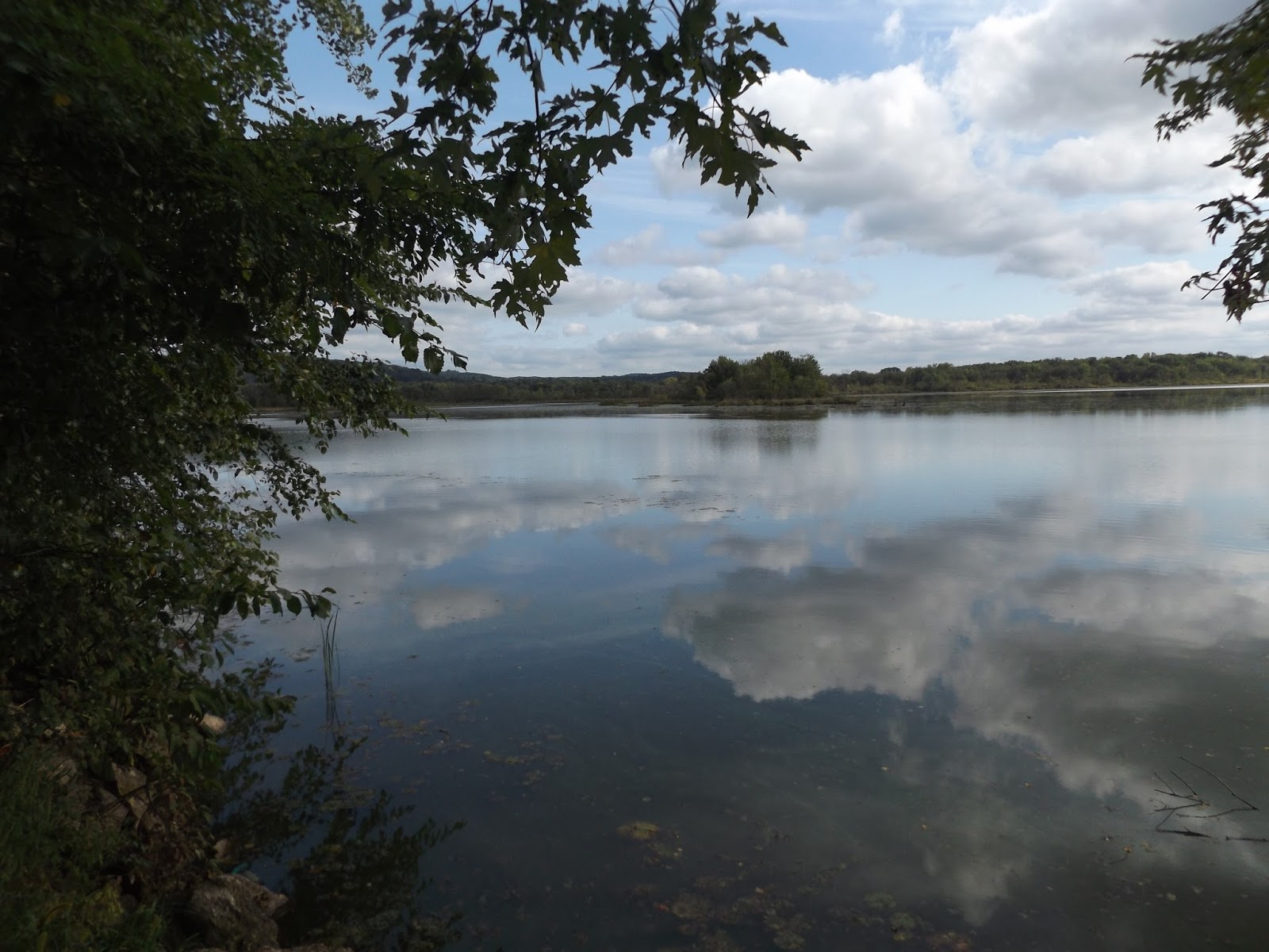
Before hitting the trail, take a walk across the picnic area to Silver Birch Lake. As if it were a mirror, the lake impressively reflects the blue sky and clouds on days when the wind is low. The reflection seems to stretch forever - not surprisingly as the lake’s surface area covers 145 acres and contains two small islands. The lake is popular with fishermen as it offers catfish, largemouth bass, northern pike, walleye and a variety of panfish.

For the walking path, head to the picnic area’s north side and follow the paved road east. Where the road forks, go right/southwest.

You’ll soon come to a walking path that cuts right/west between two fences. Take that path. After a bit, a tree canopy covers the route, which makes for a nice autumn walk when leaves change color.

Upon reaching the next asphalt road, you’ve arrived at Holden Park Campground. This marks a good spot to turn back.

The area surrounding and including Silver Birch Park is remarkably flat. That’s because it is an outwash plain formed some 8000-12,000 years ago at the end of the last ice age. As glaciers melted, the water flowed southward in broad sheets centered on the nearby Chippewa River. It dropped sand and other sediment to the ground as leveling out the terrain.

Learn more about Chippewa Valley day hiking trails in my Day Hiking Trails of the Chippewa Valley guidebook.


Thursday, September 4, 2014

Retrace steps of Indian maiden’s lover’s leap

Lake Pepin from atop Maiden Rock Bluff.
Maiden Rock Bluff Trail topo map. Click for larger version.

Romantic views
of Lake Pepin
await day hikers


Day hikers can explore the bluff from which a forlorn Indian princess allegedly leaped to her death rather than marry a man she didn’t love.

The Maiden Rock Bluff Trail runs 1.4-miles round trip in west-central Wisconsin overlooking beautiful Lake Pepin. It’s located in the Maiden Rock State Natural Area, which preserves a blufftop prairie.

To reach the trail, from Stockholm, Wis., take County Road J north. Turn left/northwest onto County Road E then go left/west into Long Lane. The road dead ends at a grassy parking lot on the blufftop. A trailhead is a few yards east of the lot and heads north from the road.

Returning to prairie
As a state natural area, facilities and upkeep here are nil. You’ll want to wear hiking boots with socks that go mid-calf to hike along the unmowed trail.

At one time, the blufftop was a farmer’s field, but it since has been allowed to return to a prairie. You’ll find a number of black-eyed susans and some bluestem in the meadow. A variety of butterfly species flit between blossoming wildlflowers.

The trail skirts a wooded area before turning west and running through the meadow. As nearing the treeline, you’ll likely spot bald eagles circling about on the bluff’s thermals.

Next the trail jags south then closes on a line of old oak trees through which you can see Lake Pepin below. The lake is the largest on the Mississippi River, running 21 miles long and nearly 2 miles wide. Be careful of getting too close to the trees, however as the bluff makes a sharp vertical drop immediately beyond them.

Legend of Maiden Rock
That long drop created the perfect setting of an old Indian legend that made the bluff famous.

In love with a warrior from her band, Princess Winona, daughter of Chief Red Wing, refused to marry another brave that her father had selected for her. For a while, she seemed to acquiesce to her parents’ wishes and on the appointed day headed with the wedding party to here, the most prominent bluff in the region. Once they reached the top, though, she dashed to the edge and jumped off in a lover’s leap, to drown in Lake Pepin below rather than marry a man she did not love. Mark Twain brought the story national attention when he included it in his book, “Life on the Mississippi.”

The legend probably is apocryphal. The Sioux didn’t have “princesses,” and if she did jump, she likely wouldn’t have landed in the lake itself but the rocks below. In any case, there are several variations of the story among the Dakota Sioux…and several more variations among many other Native American tribes up and down the Mississippi as well in the eastern United States.

What can’t be denied is that the view of Lake Pepin from the blufftop is incredibly gorgeous and romantic. Sunlight sparkles off the blue lake, as if diamonds had been tossed across a turquoise cloth.

Once the meadow ends, the trail enters a small woods and parallels the bluff’s edge. The best views of Lake Pepin actually lay about 500 feet into the woods. An autumn day after a freeze marks the best time to enter the woods, as poison ivy lines the path in summer.

Timber rattler
An alternate trailhead at the parking lot heads directly east through a small woods to the same vista. Unfortunately, that path also is very narrow and infested with poison ivy, making the longer meadow route the preferred one.

Of course, no love story would be complete without a little sin, and in the case of Maiden Rock Bluff, that comes in the form of a serpent. Timber rattlesnakes are common on blufftop prairies and woodlands, so watch your step. By hiking (and staying on) the trail midday in summer, you’re almost certain to never see one, as they remain inactive until night. During spring and autumn, however, they can be out during the day.

The timber rattlesnake is tan colored with distinctive brown bars. Adults can measure up to four feet in length. They are poisonous, so be aware of how to avoid and treat for snake bites.

After taking in your views of Lake Pepin, retrace your steps back to the parking lot.

Find out about trail guidebooks available in the Hittin’ the Trail series.


Tuesday, August 12, 2014

Railroad turned hiking trail skirts Wis. river

View from Chippewa Valley Trail near Durand, Wis.
Topo Map, Chippewa River State Trail, Tarrant Park to
Hurlburt Lane.
Topo Map, Chippewa River State Trail, Red Cedar State
Trail bridge to
Hurlburt Lane.

Long segment
can be divided
into two day hikes


An old railroad bed now provides an excellent opportunity for day hiking in Pepin County.

The Chippewa River State Trail runs 30 miles from Durand to Eau Claire, Wis. It connects to the Red Cedar State Trail, which heads to Menomonie, and plans are underway to link it to the Old Abe State Trail in Chippewa Falls, as part of the Chippewa Valley Trail System.

In Pepin County, 6.75 miles of the trail heads from downtown Durand to across the county line to the Red Cedar State Trail junction. For day hikers, that's a long walk, but it can be split into shorter and more manageable segments.

Durand to Hurlburt Lane Segment
Begin by parking at Durand's Tarrant Park, which is off of Wis. Hwy. 85 north of 14th Avenue East. The trail is directly north of the parking lot.

Starting there makes for easy parking and cuts 0.75 miles off the hike by eliminating the trail section that runs to downtown.

In the park, take the trail northeast. Though trees line the walkway, you'll still catch a number of good views of fields and dairy farms.

In 0.9 miles, you'll reach Bear Creek, a tributary to the Chippewa River. The trail there becomes increasingly wooded as heading toward the Chippewa.

As a former Milwaukee Road railroad line, the grade generally is flat and even, built to ensure trains were as fuel efficient as possible.

About 0.6 miles from the creek, the trail crosses the Bear Lake Bridge over a wetlands that sits at the tip of a branch of the Chippewa River. During spring, the water typically is higher and bluer than in late summer.

The trail remains fairly wooded for the next 1.7 miles until reaching Hurlburt Lane. This marks a good spot to turn around for a 6.4-mile round trip (3.2-miles one-way) hike.

Red Cedar State Trail Junction to Hubbard's Landing segment
Another way to hike the trail in Pepin County is to start across the county line at the nearest parking lot north of Durand.

That segment begins near the trail's junction with the Red Cedar State Trail in Dunn County. Park in a turnaround lot off of 50th Avenue west of Weber Road/630th Street. Cross the road, heading northwest to the Chippewa River State Trail.

The Red Cedar trail junction actually is northeast of the lot, and if you've got some extra energy, the short walk (0.8-miles round trip) to that junction and the Red Cedar trail's bridge over the Chippewa River is worth the effort.

Otherwise, go left/southwest onto the Chippewa River State Trail for a walk through the woods. Maples, oaks and other Northern hardwoods dominate the forest.

In 0.8 miles, the trail reaches Prissel Lane. After that, the terrain turns to fertile farmland.

County Road M marks the county line. Upon reaching where the road swerves east, about 0.7 miles from Prissel Lane, you've entered Pepin County.

After another 0.6 miles, the trail actually crosses County Road M. Rather than continue south, head west down the shoulder of the county road for 0.3 miles to Hubbard's Landing on the Chippewa River's shores. There you'll spot sandbars where the river turns.

Head back the way you came to the parking lot for a 4.8-mile round trip (5.6 miles if adding the Red Cedar State Trail bridge).

Learn more about Chippewa Valley day hiking trails in my Day Hiking Trails of the Chippewa Valley guidebook.