 |
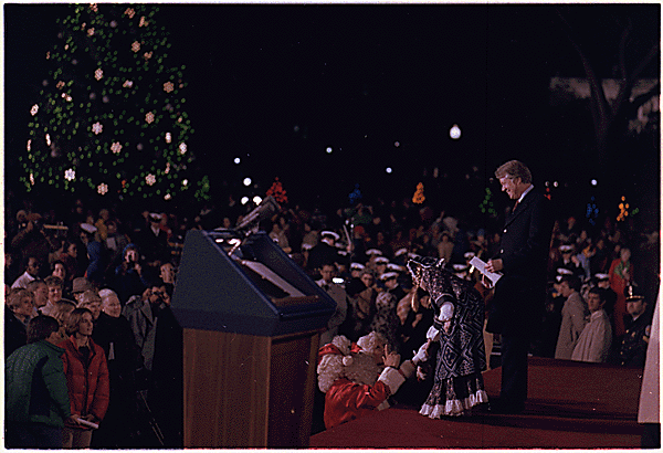
| Lighting of 1977 National Christmas Tree, which came from Nemadji State Forest. Photo courtesy of National Archives. |
Three-mile route
heads through
evergreen forest
Day hikers can enjoy a peaceful walk through a fragrant evergreen forest on the National Christmas Tree Trail in Minnesota’s Nemadji State Forest.
The three-mile (2.6 miles for loop plus 0.4 miles round trip for stem) trail sits in the northwest corner of the massive forest. In 1977, a white spruce cut from the Nemadji served as the National Christmas Tree in the nation’s capitol. Forestry officials created the trail in 1987, naming it in honor of that tree.
To reach the trailhead, from State Hwy. 23 north of Nickerson, take County Road 146 south. The county road angles east; when it veers northeast, continue going straight, turning right onto Net Lake Forest Road. The forest road heads though a wetlands. After crossing Net Lake River, turn left onto the State Forest B 41 Road heading to Gafvert Campground and Day-Use Area. When that road forks, go right. Parking is available at the day-use area for Pickerel Lake.
Dense red pine forest
The trailhead goes north from the looping road at the day-use area, near the restrooms. You’ll start on the stem of a lollipop trail. The stem heads through a dense red pine forest with tallgrass underbrush.
For thousands of years before loggers and pioneers arrived during the late 1800s, the red pines were much larger around. The red pines now there are young, growing on what once were farms, since abandoned because of the poor sandy soil.
Upon reaching the loop, go left/clockwise. Birch lines the trail’s left side while dark pines rule on the right side. About 0.75 miles into the trial, it enters a more open area.
During spring and summer, listen for the black-and-white warbler, which likes brush and decidious woodlands. Its song sounds like a squeaky wheel.
Other wildlife to watch for include white-tailed deer, raccoons, eagles and porcupine. The last usually can be spotted in treetops wherever you see falling bark.
At about 1.05 miles, the trail crosses a bridge of split logs over a creek that feeds Cranberry Lake. This is a low wetland area common to the northern part of the Nemadji.
National Christmas Tree Site
The forest is named for the Nemadji River, which in turn comes from the Indian word meaning “left hand.” It's so named because the river is on the left side of Lake Superior's St. Louis Bay.
At 1.25 miles, on the loop’s northeast side of loop, you can take a spur trial 0.2 miles to a picnic area overlooking the Net River. An old beaver dam is located here. This is what this part of Minnesota looked like before settlement – red pines so large that you can’t wrap arms around many of them.
Returning to the main loop, in about 0.5 miles you’ll come to the National Christmas Tree Site, where the 1977 tree was cut. Five white spruces were planted to replace it, and a sign commemorating the tree is located there.
From that waymark, the loop heads back to the lollipop trail’s stem, which you can use to return to your vehicle.
Find out about trail guidebooks available in the Hittin’ the Trail series.
