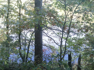
Day hikes amble alongside scenic river, through Northwoods forests
Here are some photos of great day hiking trails you’ll find in Washburn County.
 |
| Tuscobia State Trail, Birchwood segment |
Tuscobia State Trail, Birchwood segment
Wisconsin has nicely converted a number of abandoned railroad grades to hiking and multi-use trails. Among the more popular is the 74-mile Tuscobia State Trail running from Rice Lake to Park Falls. In the southeast corner of Washburn County, the trail passes through the village of Birchwood, the self-proclaimed Bluegill Capital of Wisconsin. A pleasant segment of the trail to day hike goes northeast from downtown Birchwood for a 4-mile round trip to County Road F and back.
 |
| Sawyer Brook Springs trails |
Sawyer Brook Springs trails
A set of three loops, primarily maintained as cross-country ski trails, begin behind the Shell Lake Arts Center in Shell Lake. The Yellow loop takes hikers twice across Sawyer Brook Springs.
 |
| Beaver Brook East Trail |
Beaver Brook East Trail
Day hikers can enjoy a pleasant walk along a classic trout stream on Beaver Brook Wildlife Area’s East Trail. Along the way, you may spot the impressive osprey or bald eagle. The wildlife area nicely preserves 1,964 acres of woods and wetlands between Shell Lake and Spooner. A number of loops run off the main trail so hikers can adjust the trail’s length to meet their time restrictions and energy levels.
 |
| Wild Rivers State Trail, Spooner segment |
Wild Rivers State Trail, Spooner segment
Day hikers can learn about railroading on an old rail line turned hiking trail in Spooner. The Wild Rivers State Trail runs for 104 miles across three counties on a former Omaha and Soo Line Railroads rail line. The trail connects Rice Lake in the south with Superior to the northwest. In Spooner, the trail marks the eastern edge of downtown. A 1.9-mile round trip segment of the trail makes for a pleasant urban hike.
 |
| College Street City Park Trail |
College Street City Park Trail
Several loops run through Spooner City Park at the end of College Street. One route encircles the park.
 |
| Trego Lake Trail |
Trego Lake Trail
A pretty hike through a Northwoods forest awaits hikers on the Trego Lake Trail. The 1.9-mile trail loops through the woods next to Trego Lake. Both the lake and the trail are part of the St. Croix National Scenic Riverway.
 |
| Trego Nature Trail |
Trego Nature Trail
A pleasant walk through the woods along a wild river await hikers on the Trego Nature Trail in the St. Croix National Scenic Riverway. The trail is best done during summer when the shaded walk keeps hikers cool. Early autumn is a good time for those who enjoy fall colors.
 |
| Wild Rivers State Trail, Trego segment |
Wild Rivers State Trail, Trego segment
A pleasant stroll through the woods with a bridge view of the Namekagon River awaits day hikers on a segment of the Wild Rivers State Trail in Trego. At a little under 2.2-miles round trip, the segment is just a small portion of a trail that runs for 104 miles across three counties on an old Omaha and Soo Line Railroads rail line.
 |
| Totagatic Ski Trail, Loop A |
Totagatic Ski Trail, Loop A
Multiple ski loop trails in winter serve as great day hiking paths in summer for those in the Minong area. Of the four Totagatic Ski Trail loops, try Loop A. At two miles round trip, it’s the shortest as well as the closest to the parking lot so is easy to locate.
Learn more about these and nearby trails in Day Hiking Trails of Washburn County.
